Hike Mount Holyoke Summit via Skinner State Park Loop

Let’s hike Mount Holyoke in Skinner State Park to incredible views at the summit and from the Summit House facing west over the Connecticut River Valley below!
In this post I tell you everything you need to know to do this lesser known (and quieter 🤫) loop taking you to the top of Mount Holyoke and the historic Mount Holyoke Summit House. Learn where to park, trail details, and turn-by-turn trail directions to help you find your way! ☺️
Living only a little over an hour away in Connecticut, this area of Massachusetts is one I’ll drive to when I want to hike somewhere new. There are so many trails along the Mount Holyoke Range, but I enjoy this less popular route and the amazing views at the top.

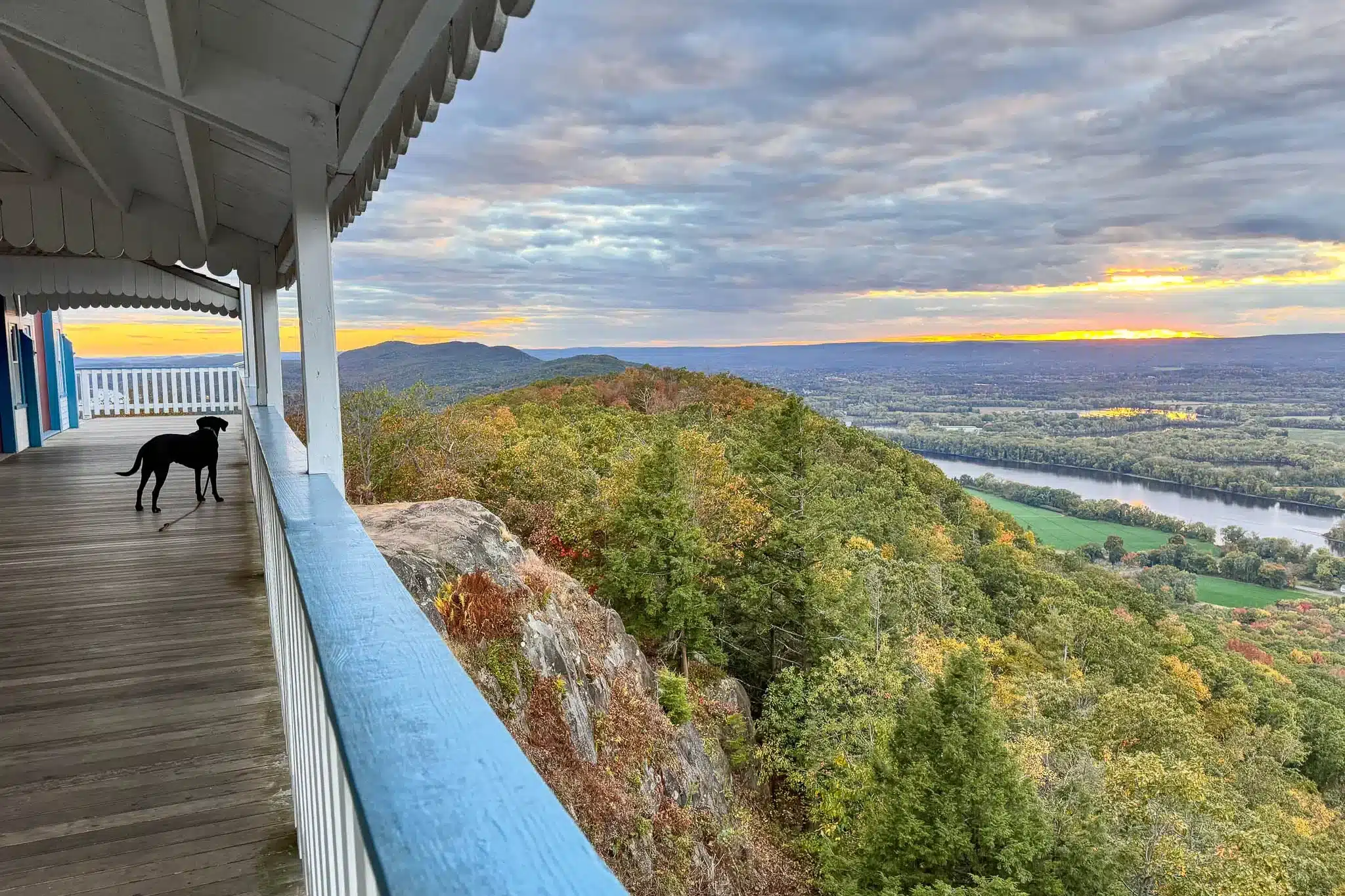
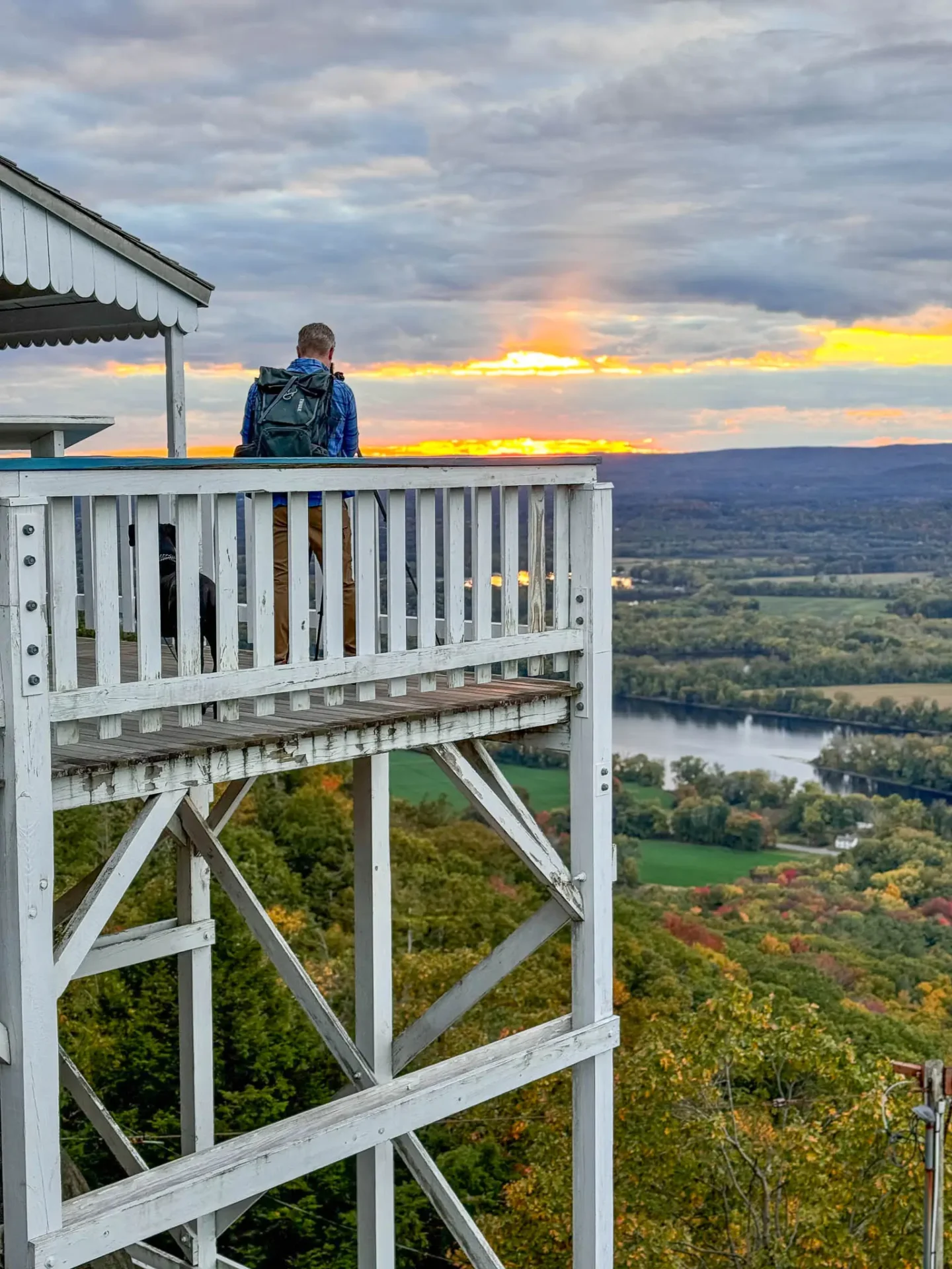
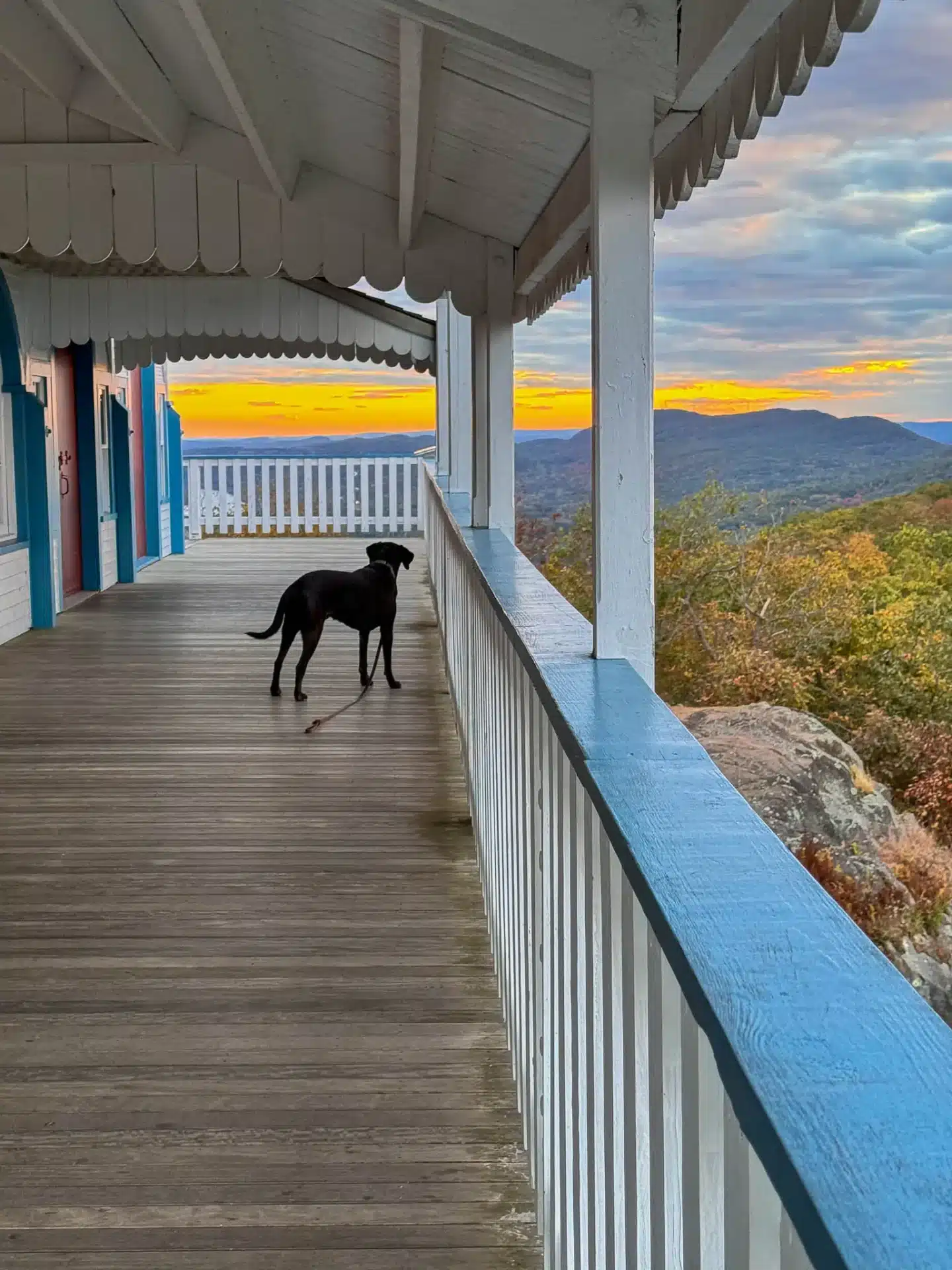
And if you go at sunset time like we did, the views of the valley, the river in the distance from the deck of the Summit House, the sun setting, and mountain range – really can’t be beat! 🌅
I went to Mount Holyoke College for my master’s degree and I love how driving to this trail takes me right by the scenic campus and reminds me of those days long before I even knew this hike existed!
This hike is a less popular and quieter loop to the top but you should note that there is a road leading to the top. So don’t be surprised if you don’t see anyone on the trail but arrive at the top with several other guests. We went for sunset time and got to enjoy the summit and views from the deck of the old hotel all to ourselves as most of the people cleared out by then.
Mount Holyoke Summit Location📍
Skinner State Park is located in the towns of South Hadley and Hadley in the Connecticut River Valley of Massachusetts. At over 800 acres, the park surrounds Mount Holyoke, the westernmost peak of the Holyoke Mountain Range.
Mount Holyoke Summit House History 🏰
The Summit House, also known as the Prospect House, was an old hotel that first opened in 1851 with 44 guest rooms and a 200-person dining room. Instead of guests hiking to the top with their luggage – they would take a tram to the top. It was so badly damaged by the Great Hurricane of 1938 that Joseph Skinner, part owner of the property, offered to donate the hotel and surrounding land to the Commonwealth of Massachusetts as long as it became a state park bearing his name.
Look for the plaque at the top that commemorates Joseph Skinner and reminds people what he wanted the park to represent – “a thing of beauty and a source of joy to the people of the Commonwealth.” 💜
Mount Holyoke Summit via Skinner State Park Loop Details
Let’s hike a less popular trail in Skinner State Park leading to expansive views at the top of Mount Holyoke with picnic tables, room to enjoy the view, and views from the Summit House, an old hotel from 1851.
- 🥾Miles: 3.64 miles
- Elevation: 797 ft elevation gain
- Level: Moderate
- Trail Type: Loop 🔁
- AllTrails trail link 🔗
- Average Time: 2 hours
- 🚘Parking: Click to navigate to 42.29098, -72.60005, parking along Old Mountain Rd.
- 🐶Dog-friendly: Yes, wide paths with short rocky section with steps, and then a little steep on the way down in a short section (no big jump ups or downs)
- Trail Highlights: Summit views (facing west) with lots of room to roam at the top, picnic tables to sit, and views from Summit House deck. Plus the Summit House itself is super cool! 😍🏰
Find the trailhead: Mount Holyoke College, head north on College St/Route 116. Turn left onto MA-47/Hadley St. After 2.8 miles, turn right onto Old Mountain Rd. After 0.3 miles you will arrive at a small pull off for the trailhead on the right side of the street across from residential houses.
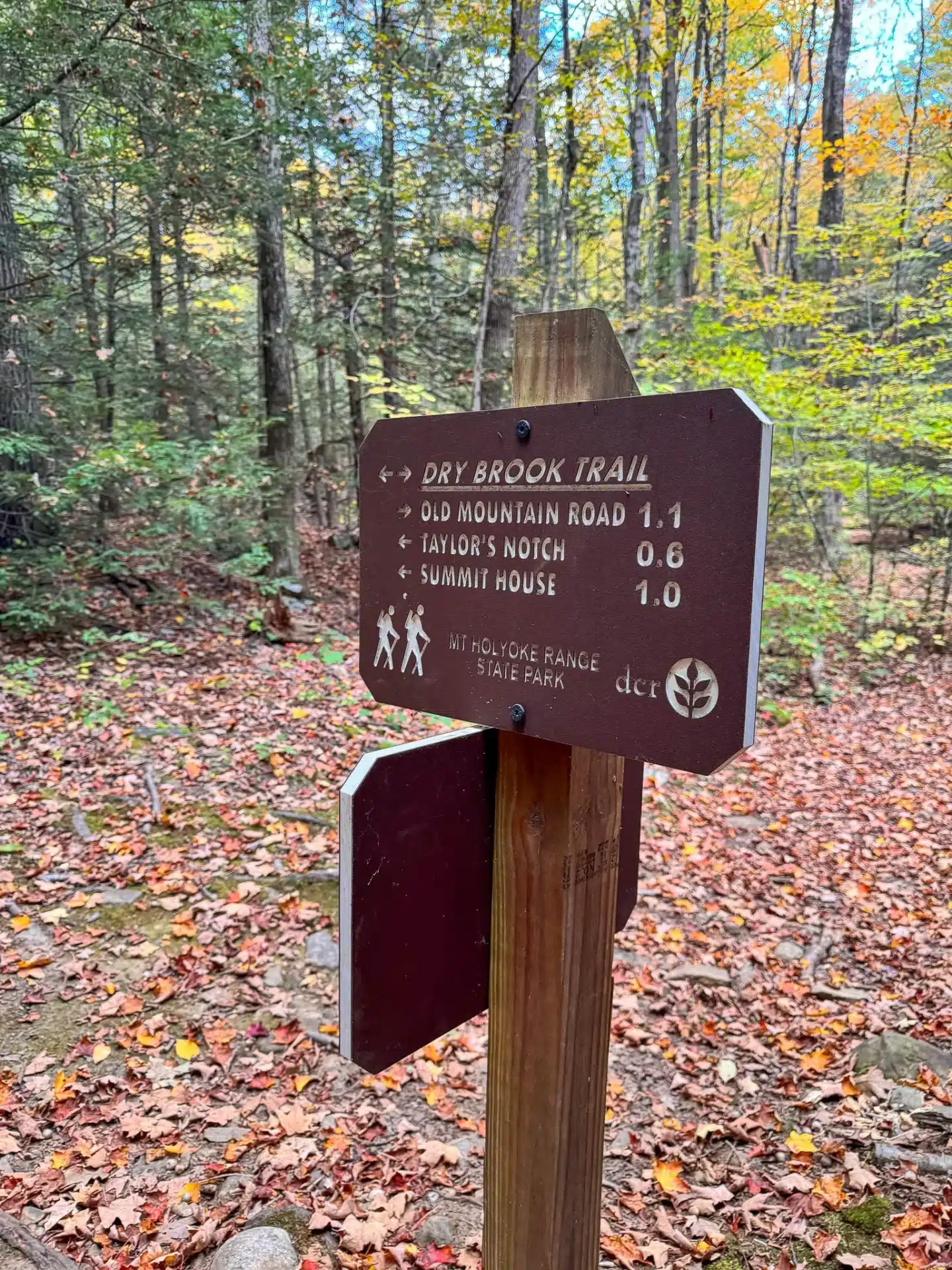
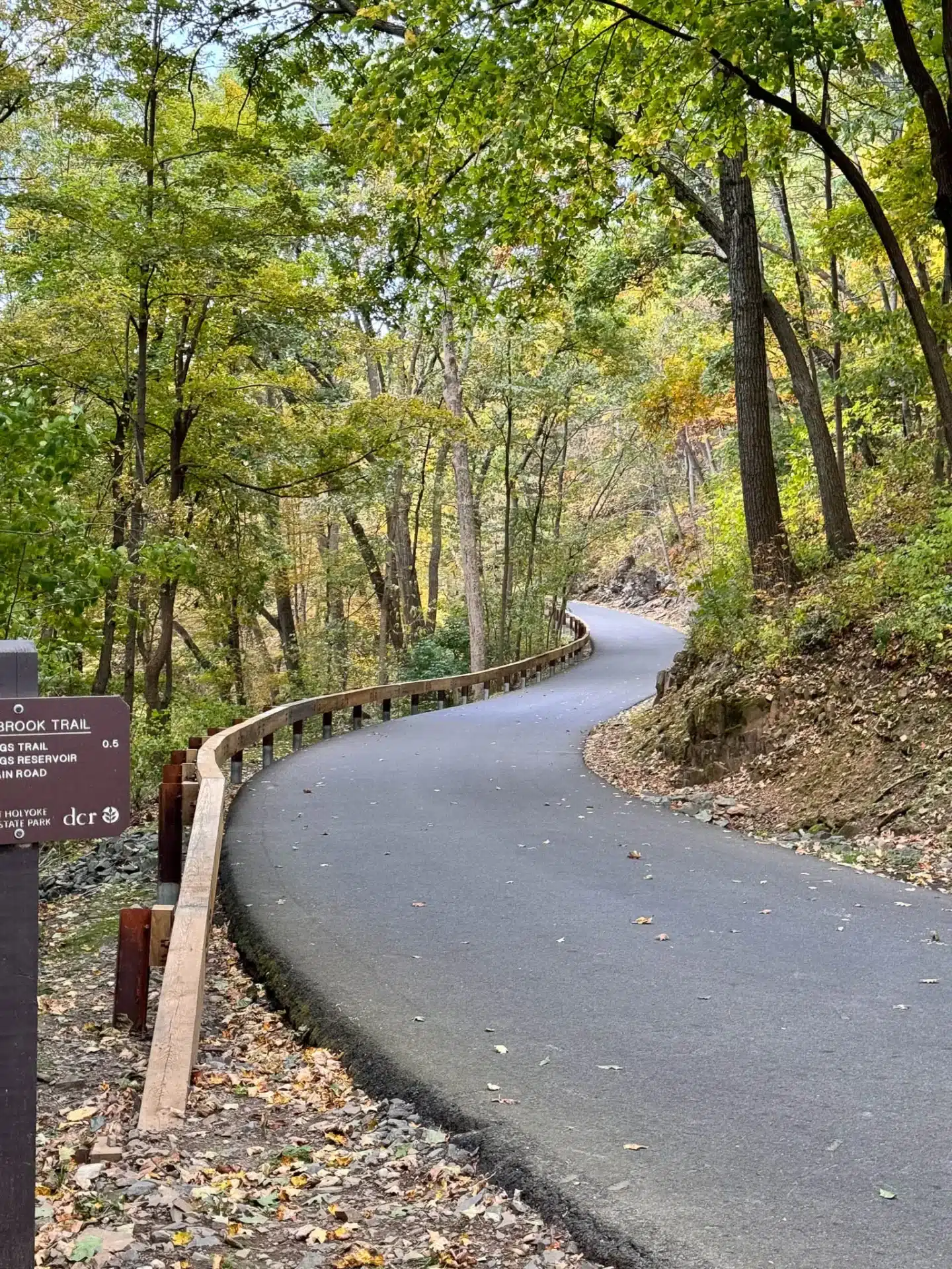
🚗 With parking for several cars on Mountain Rd., you’ll walk the loop counterclockwise, starting on the Dry Brook Trail which, after half a mile in, starts to run right alongside Dry Brook. After 1.2 miles, the trail bends to the left where the incline begins leading you up to Skinner State Park Rd.
You’ll walk directly across the road and pick up the white blazed New England Trail which takes you to the summit of Mount Holyoke and the Summit House.
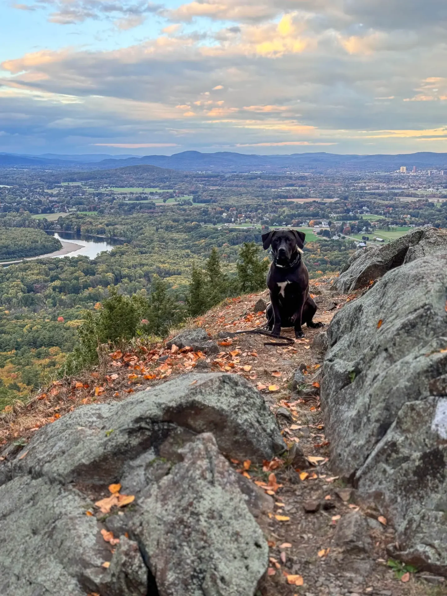
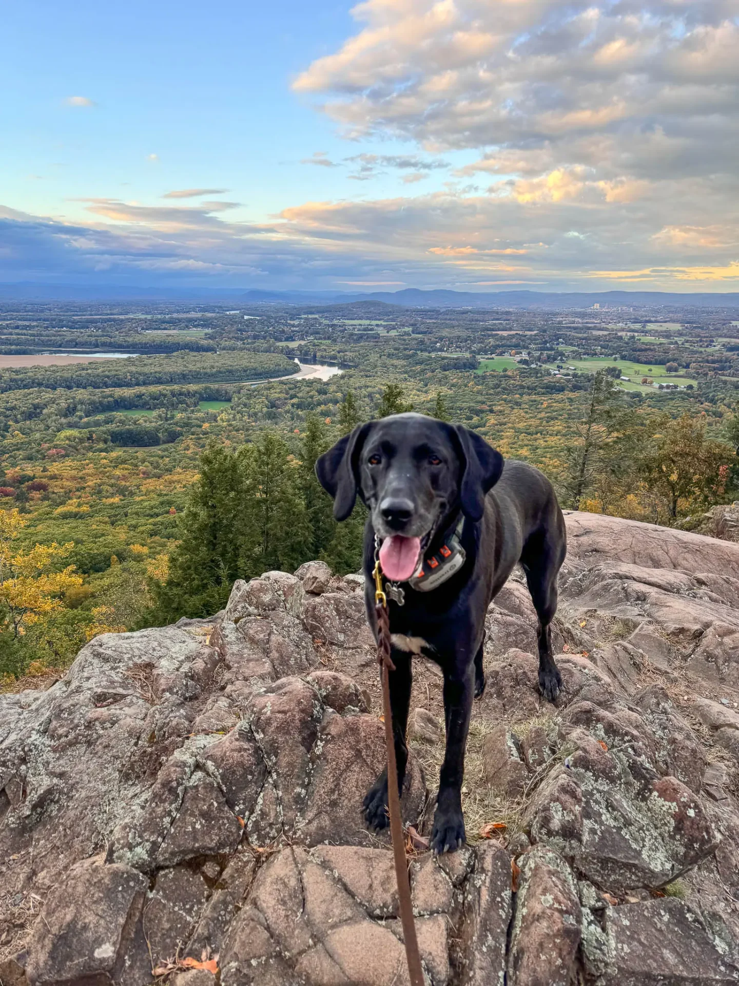
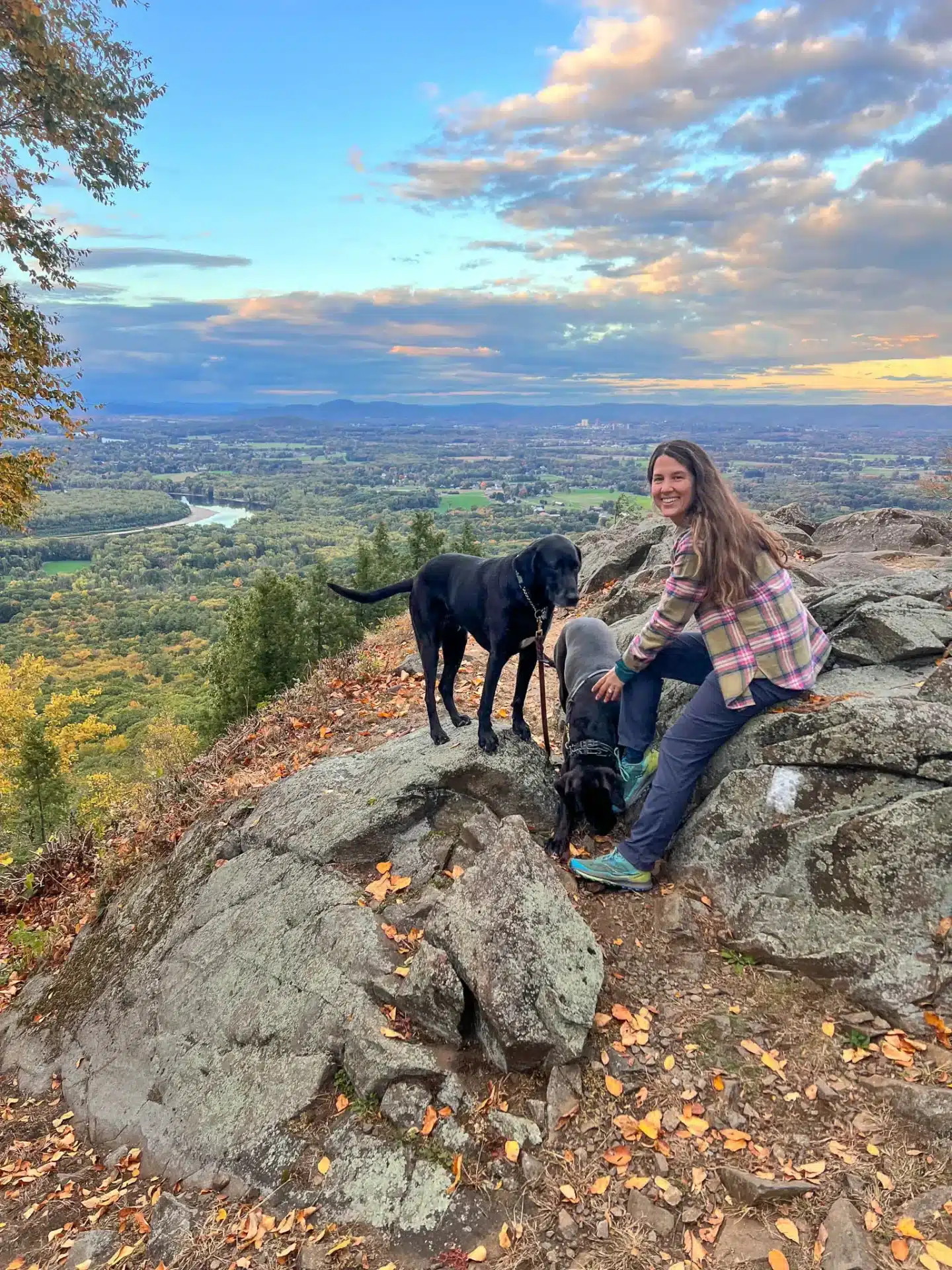
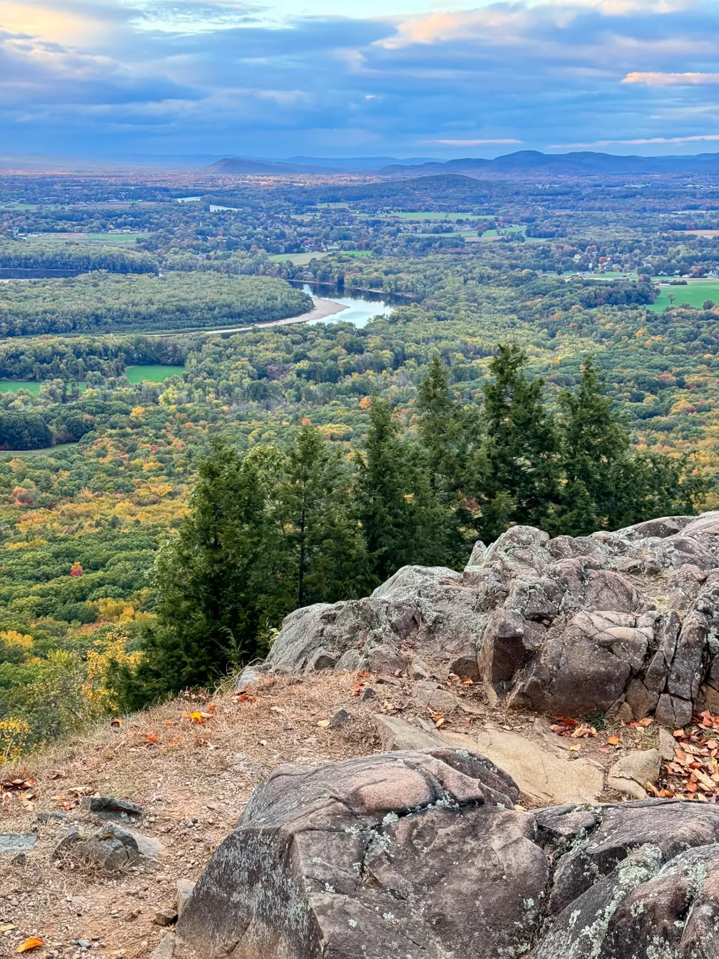
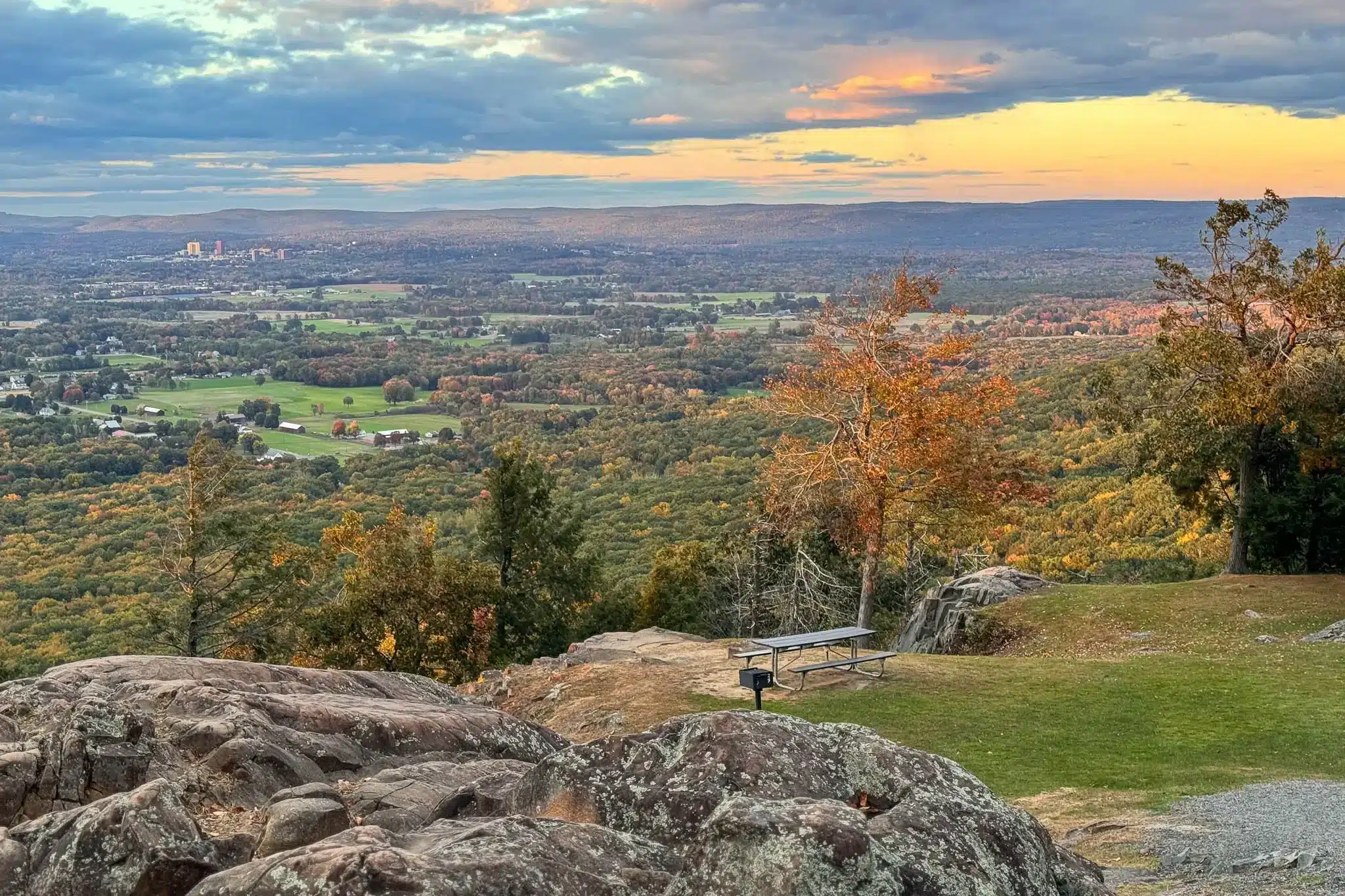
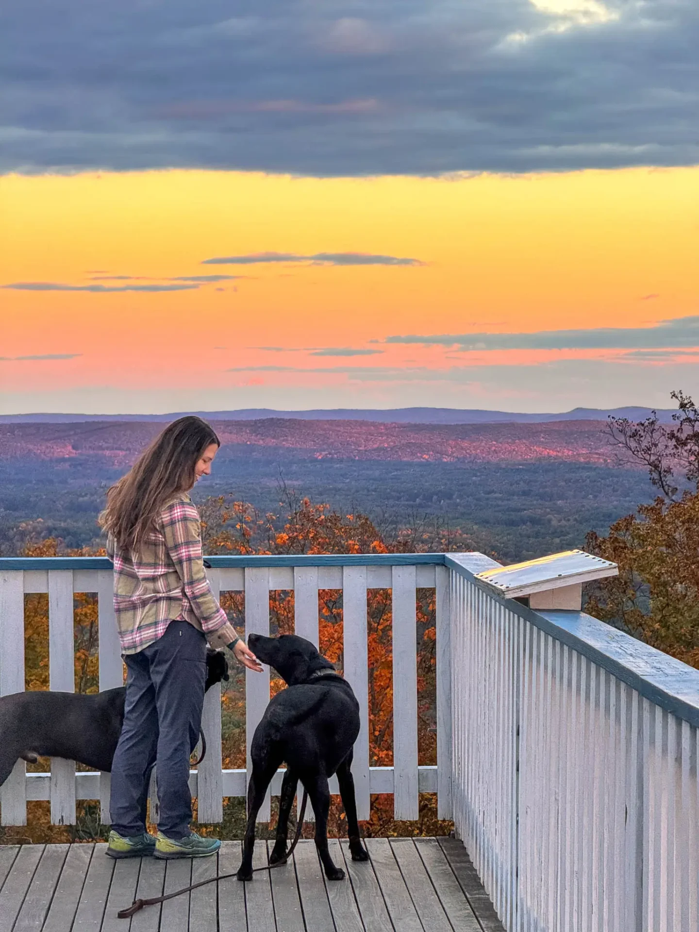
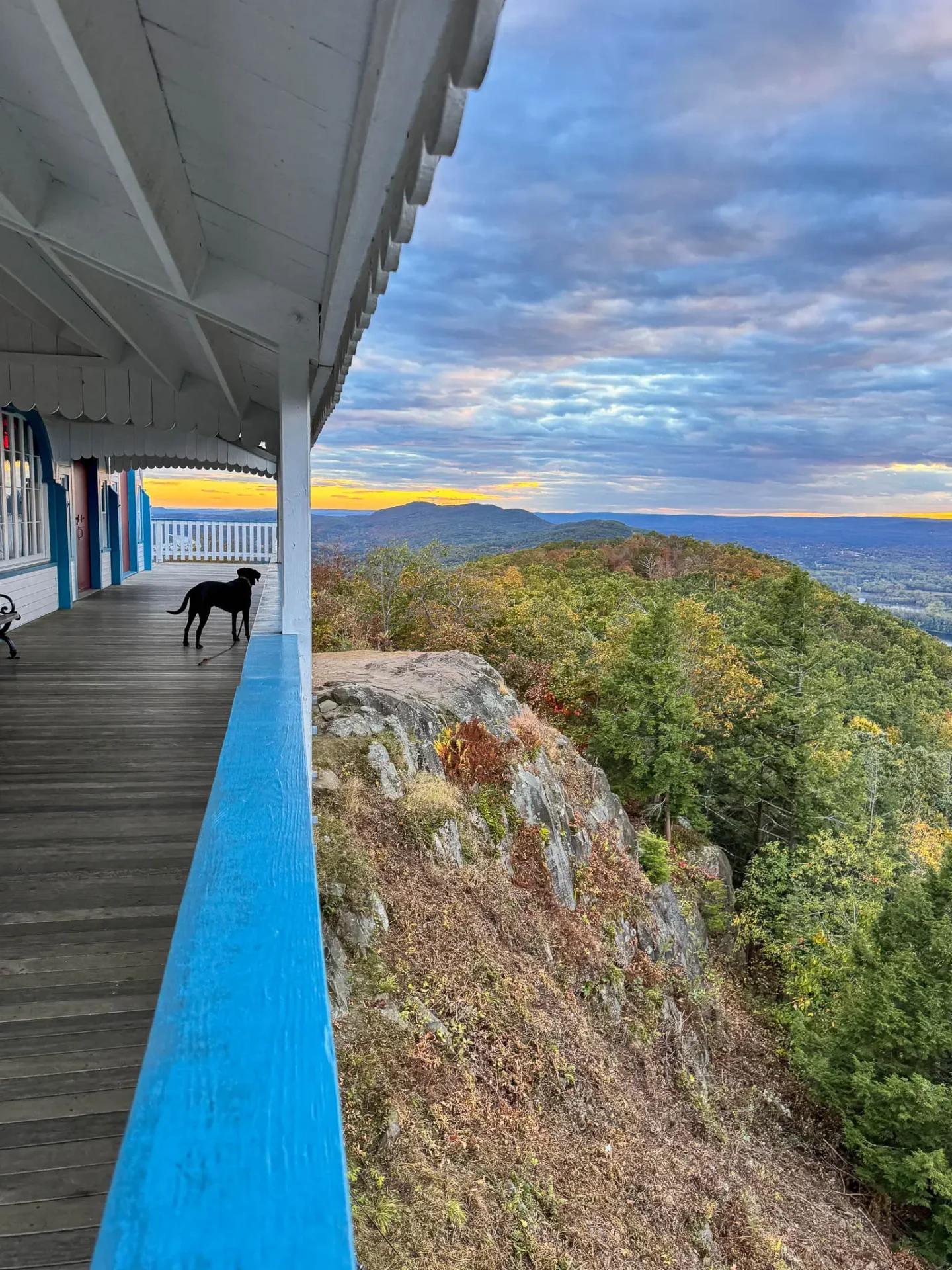
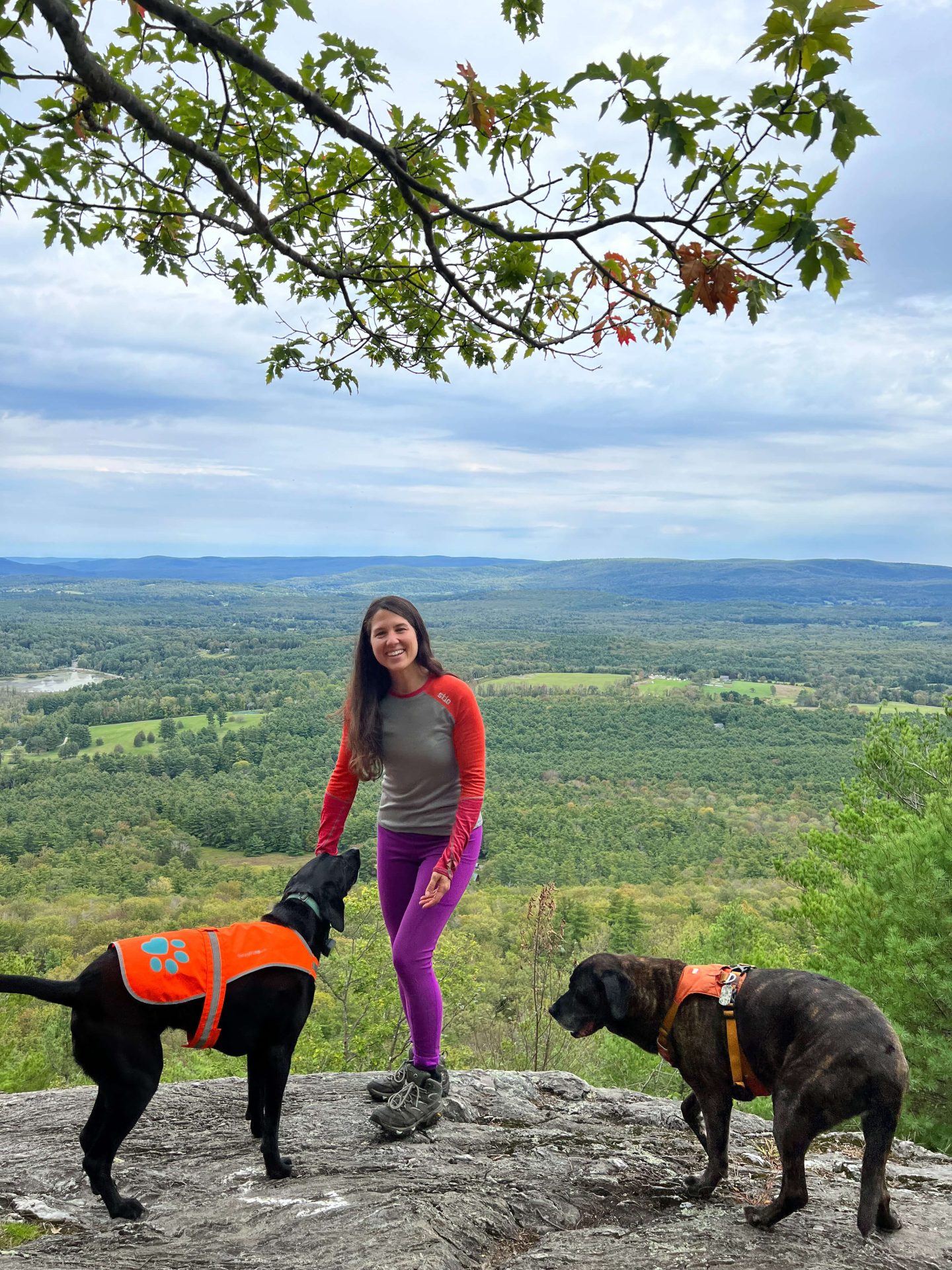
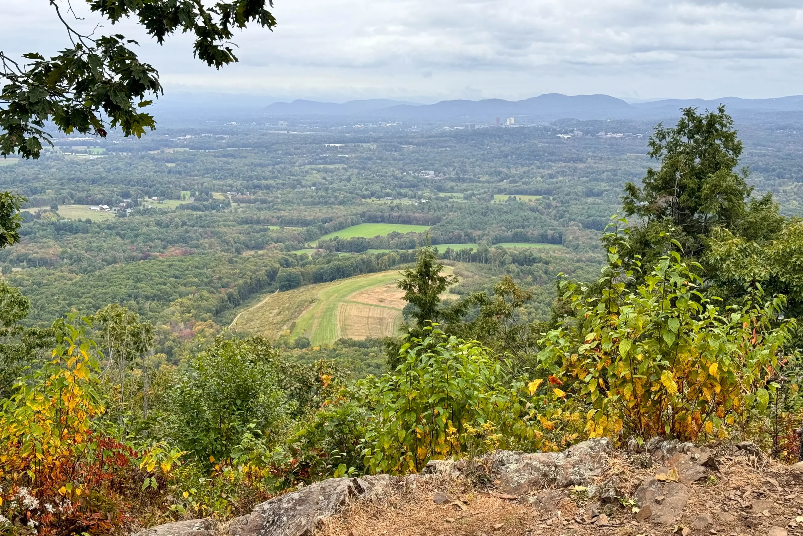
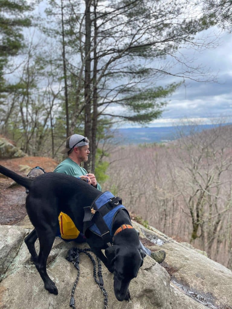
At the summit, you’ll find a spacious area to relax and take in the stunning views of rolling hills and Connecticut River Valley below, with several picnic tables scattered about. Walking about the wrap-around deck of the Summit House allows for another perspective and allows you to see what attracted people to this hotel over a century ago.
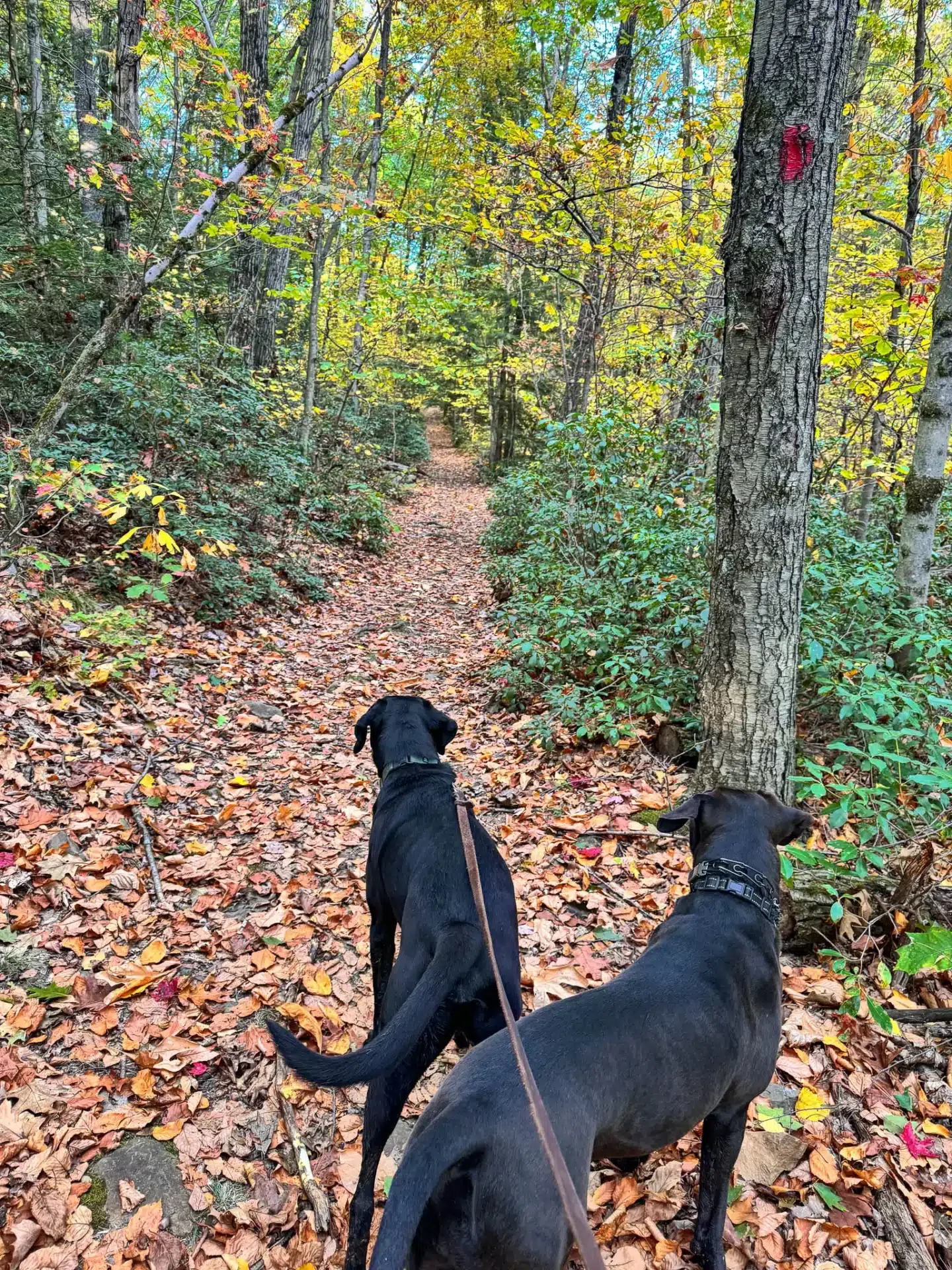
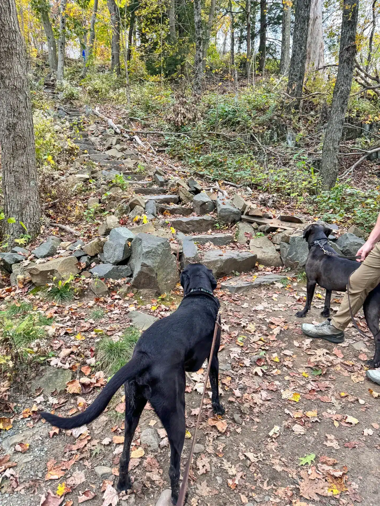
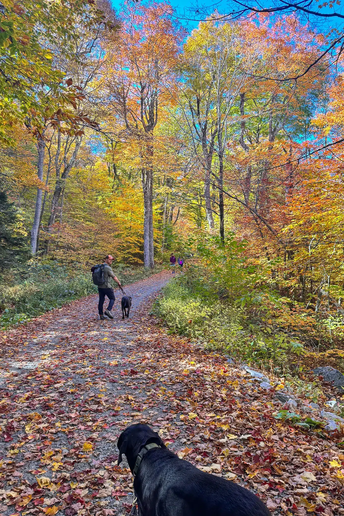
You’ll then follow the New England Trail for the last 1.6 miles back down to the car, catching glimpses of the river valley below through the trees as you go. Some spots can be a little steep here with larger rocks to step down or navigate around. Since we hiked here in October we had the added layer of leaves that made it difficult to find good footing on the way down. Sturdy boots are recommended and hiking poles may be useful but the dogs had no issue with the terrain.
🧭 TURN-BY-TURN TRAIL DIRECTIONS 🗺️
1.) From the parking area on Mountain Rd, find the ‘New England Scenic Trail Entrance’ sign and trail kiosk on the eastern side of Mountain Rd.
2.) After 0.2 miles, bear right to begin the loop counterclockwise following the sign to the Dry Brook Trail where you will begin to see red blazes on the trees. 🌲
3.) At 0.33 miles, you’ll see a large pond on the right, continue straight on the Dry Brook Trail.
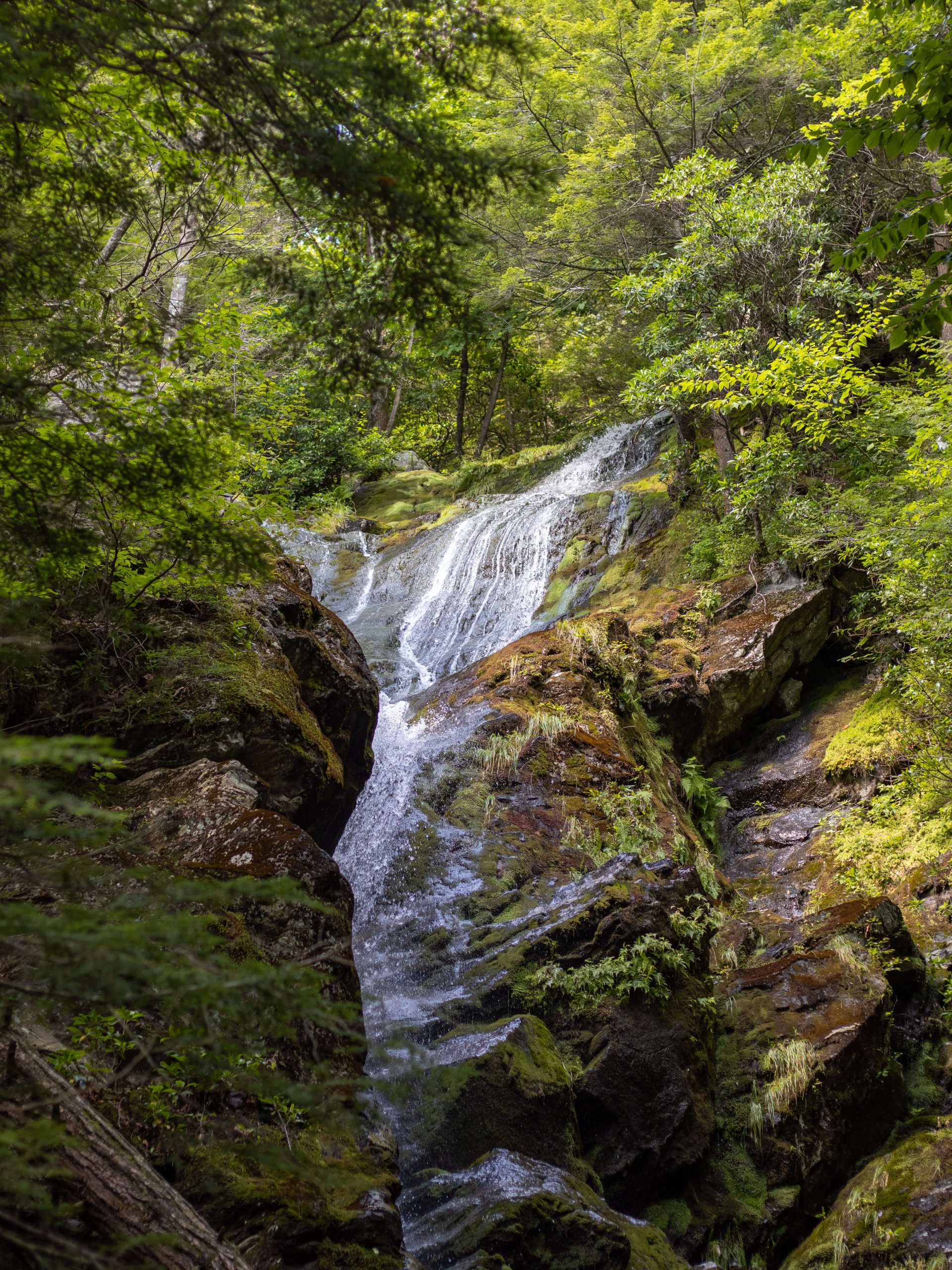
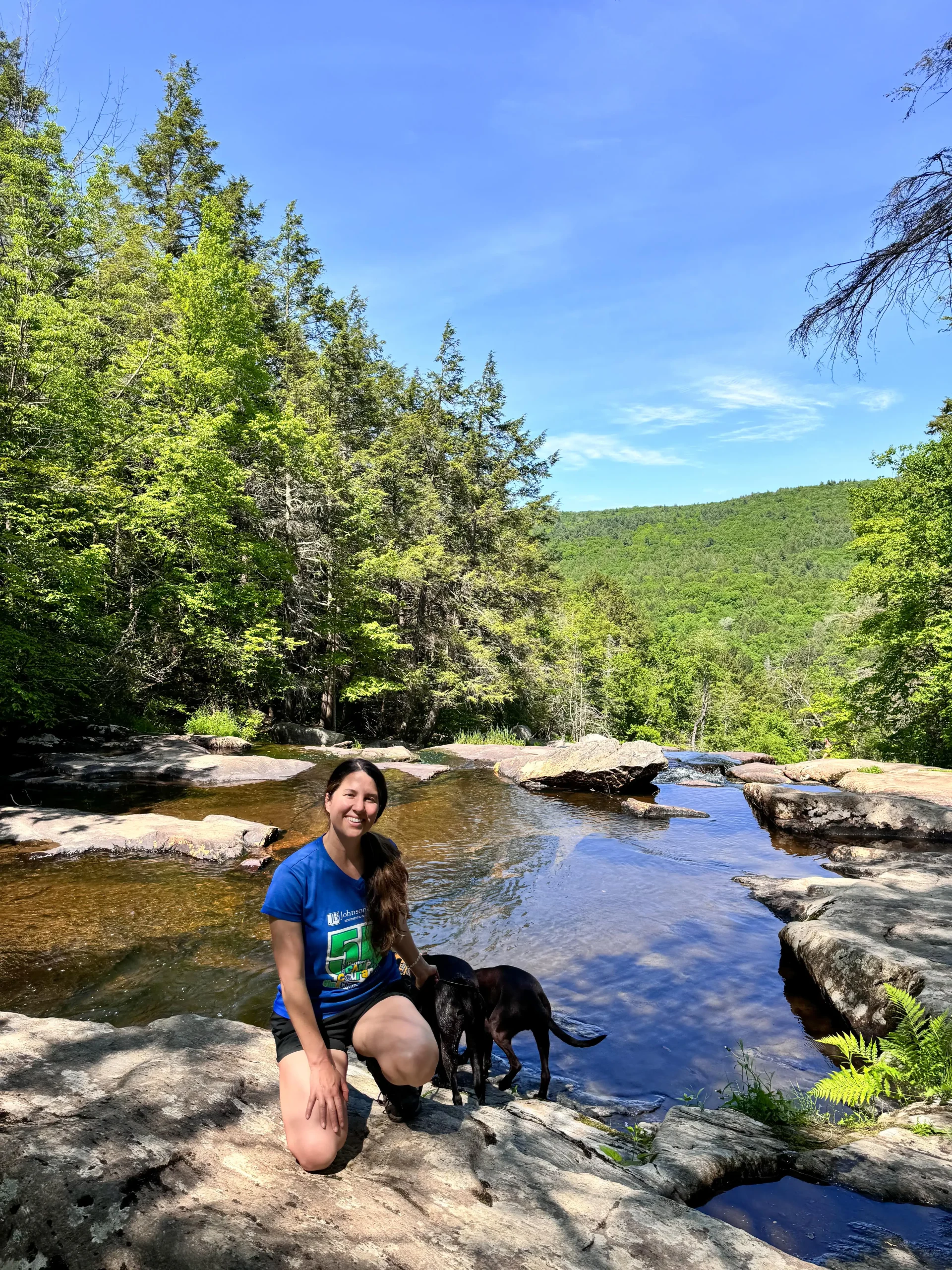
4.) At 1 mile in, the trail starts to run right alongside Dry Brook where the dogs can get water if the brook is running.
5.) At 1.2 miles, you’ll see an intersection with the yellow trail. Take a left to continue on the red trail, following the sign for the Dry Brook Trail.
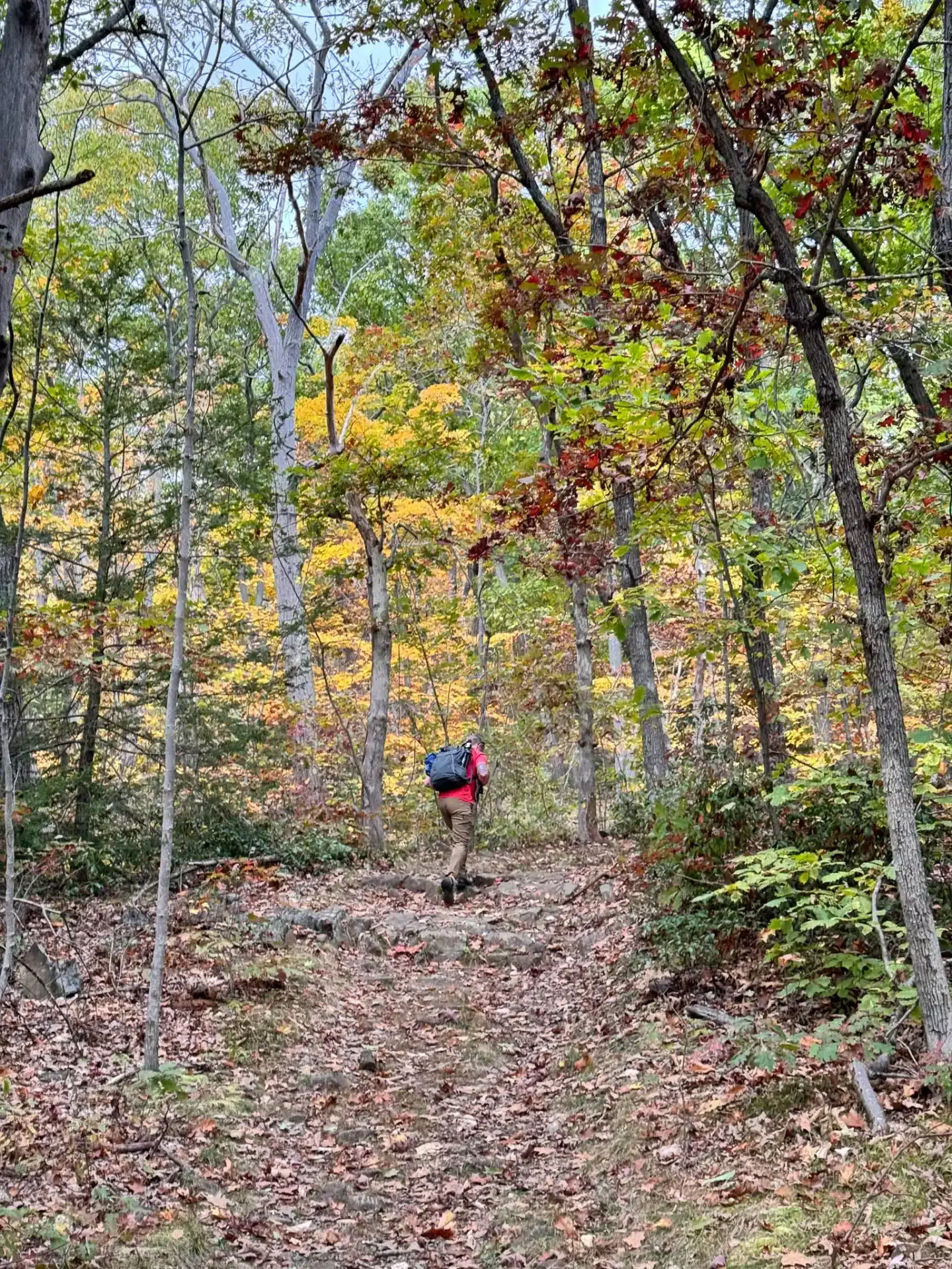
6.) At 1.35 miles, the incline begins.
7.) At 1.72 miles, you’ll come upon the paved Skinner State Park Rd. (People can drive up this road so keep dogs and kids close as you approach.) Cross the road to get to the New England Trail on the other side where you will see a New England Trail sign and steps leading up into the woods.
8.) At 1.97 miles, you’ll reach the top of Mount Holyoke where you will be greeted with 180-degree views. At the summit you’ll find Mt. Holyoke Summit House which has views facing west from its wrap-around deck.

9.) Walking along the deck of the house, head west down the flight of stairs into the woods where you will begin your descent on the white and blue blazed trail. Continue following the white blazed trail.
10.) At 2.5 miles, bear left to stay on the white trail.
11.) At 2.86 miles, the trail curves around to the right, continuing on the white trail.

12.) At 3.42 miles, you’ll arrive at the intersection of the Dry Brook Trail where you started. Turn right here to head back out to your car.
That’s it my friends. I hope you enjoyed this trail guide to hiking to the top of Mount Holyoke and discovering the beauty and history from the Mt Holyoke Summit House.
I hope the trail details and directions help you feel confident to navigate and take on this beautiful hike in western Massachusetts.
Comment below with your thoughts or any questions. I’d love to hear if you try this trail and if you like it!
➡️ For other scenic hikes in western Massachusetts check out my post… 13 Beautiful Hikes in the Berkshires! 🌟🥾

Great article.
Thank you so much!! 🥹glad you enjoyed it