A Detailed Guide for Hiking the Heublein Tower Trail
Want to hike to Heublein Tower?! This detailed Heublein Tower Trail guide will tell you everything you need to know including detailed turn-by-turn instructions that take you the most scenic way up to the tower and back down.
Hike up wide gravel paths and dirt trails through Talcott Mountain State Park to reach one of Connecticut’s most impressive landmarks, Heublein Tower!
This trail is for you if you want an easy, dog-friendly terrain (no big rocks or roots to step over) that’s not difficult to follow. This hike is one I would bring my mom on who isn’t a “hiker”. 🙂 You can do this walk in Sketcher type sneakers but I always wear my hiking boots for ankle support! 🥾🥾
Heublein Tower History
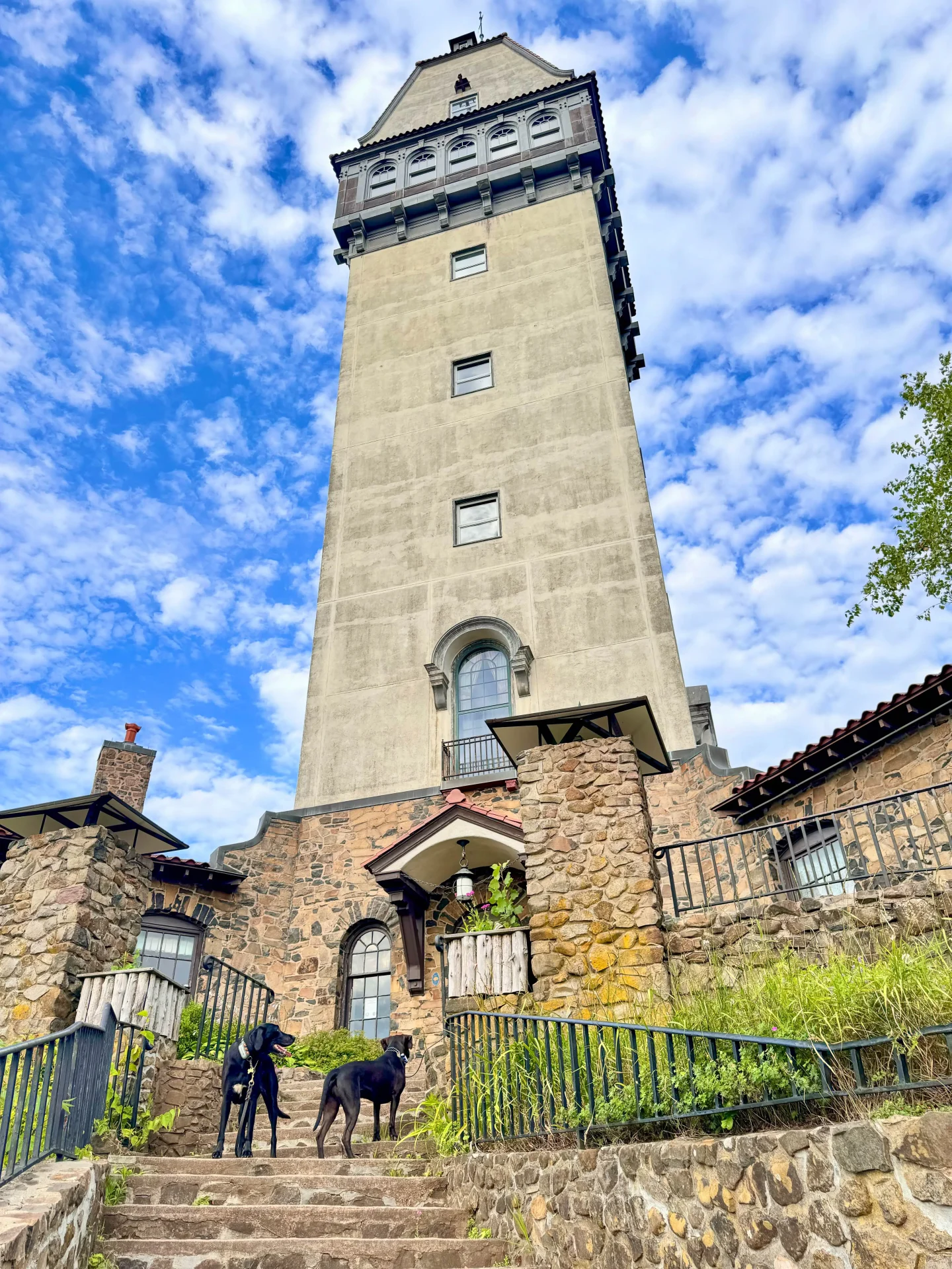
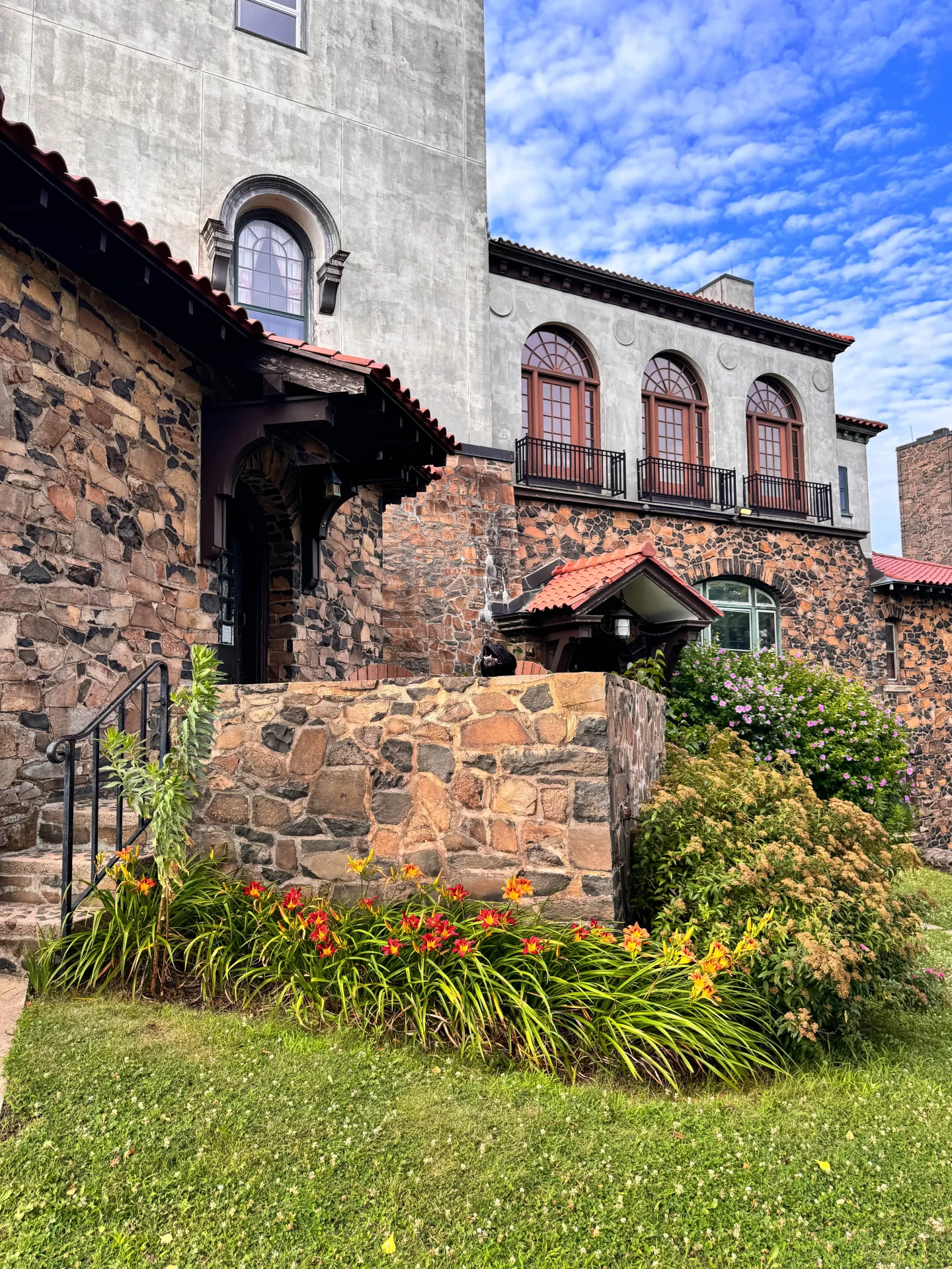
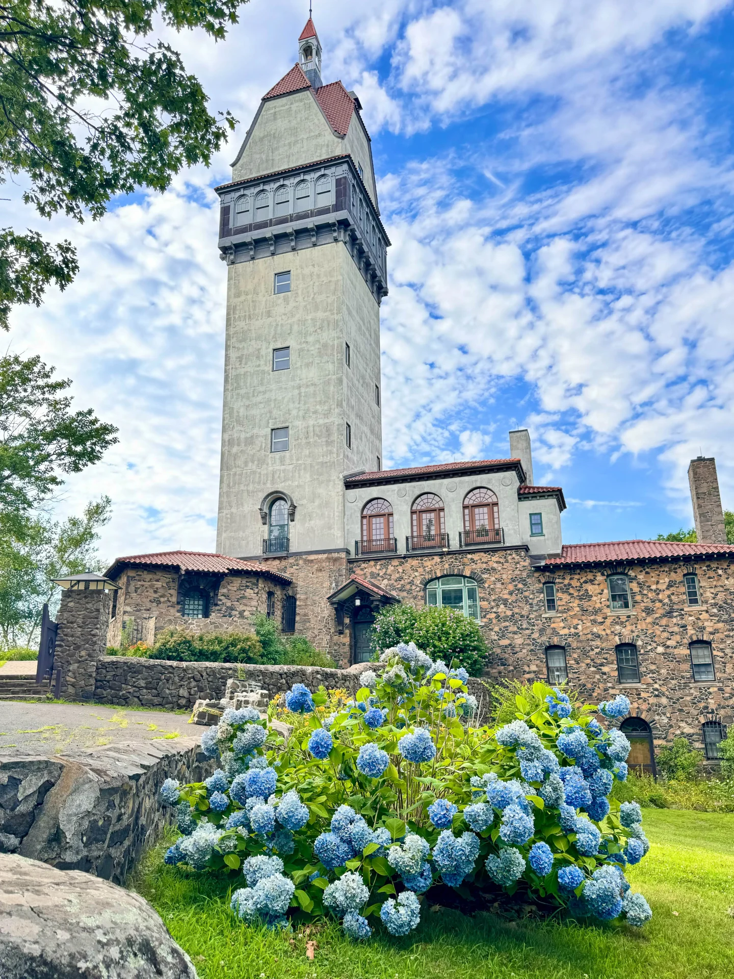
Heublein Tower, an iconic landmark in Connecticut, was built in 1914 by Gilbert F. Heublein, a wealthy member of Hartford’s elite. He made a promise to his fiance, Louise Gundlach, that he would build her “a castle on a mountain.” Today, the 165 foot, Bavarian inspired Heublein Tower stands high on the ridge and can be seen from a number of roads below as you make your way through Simsbury. The path leading up to the tower takes you by several lookouts all along the Talcott Mountain Ridge.
Heublein Trail Overview
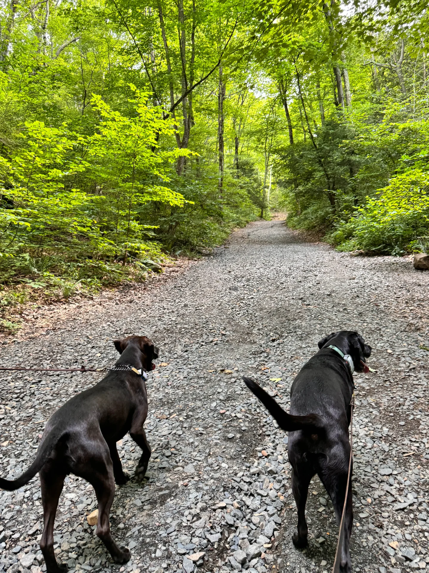
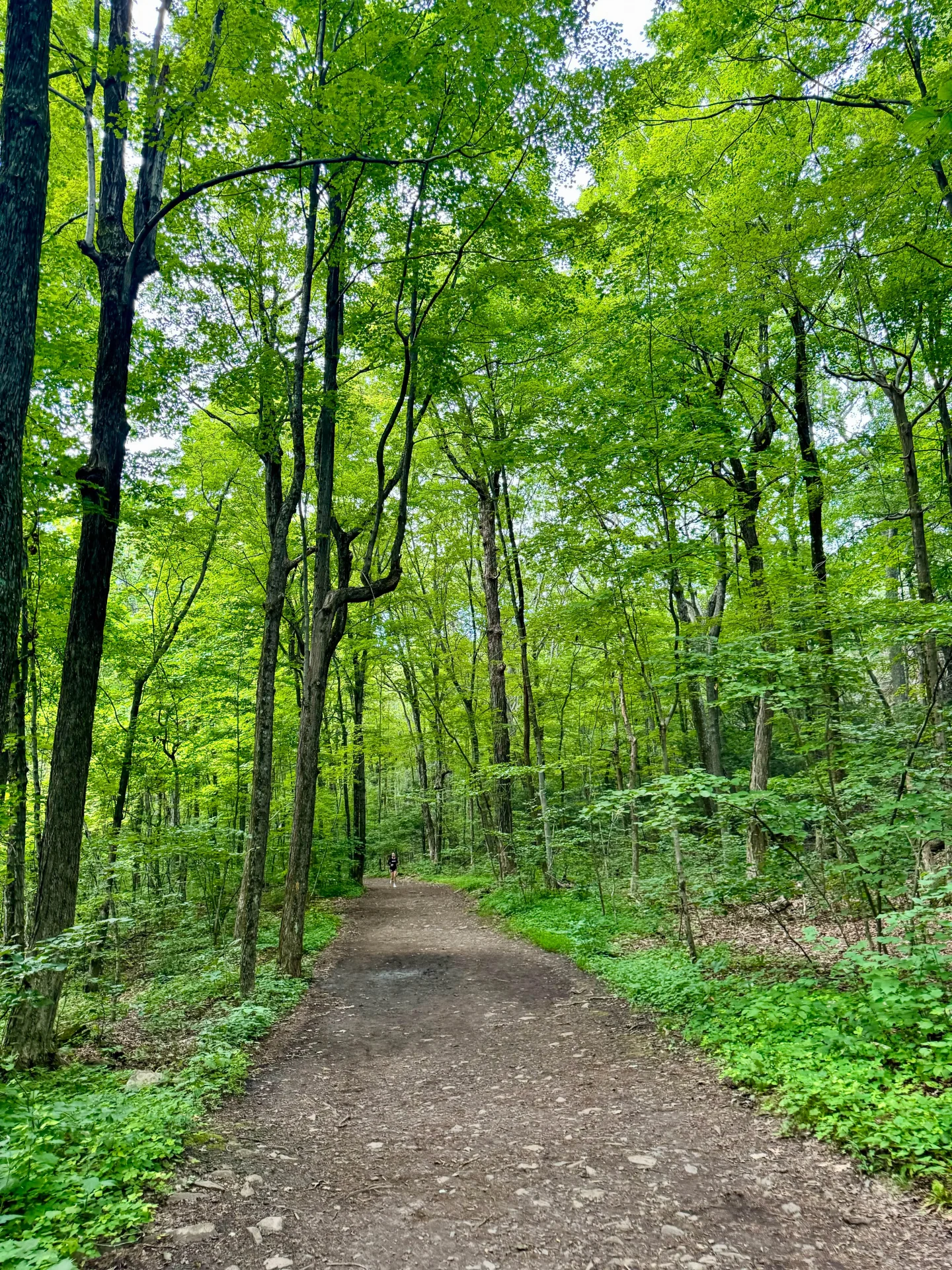
Starting on the yellow trail off Summit Ridge Road, you’ll begin a moderately steep climb on a wide gravel path lined with tall oak, birch, and maple trees. Designed to ensure you and your pup enjoy the adventure, you’ll find benches to give you a rest and pet waste stations along the way of this first steep section.
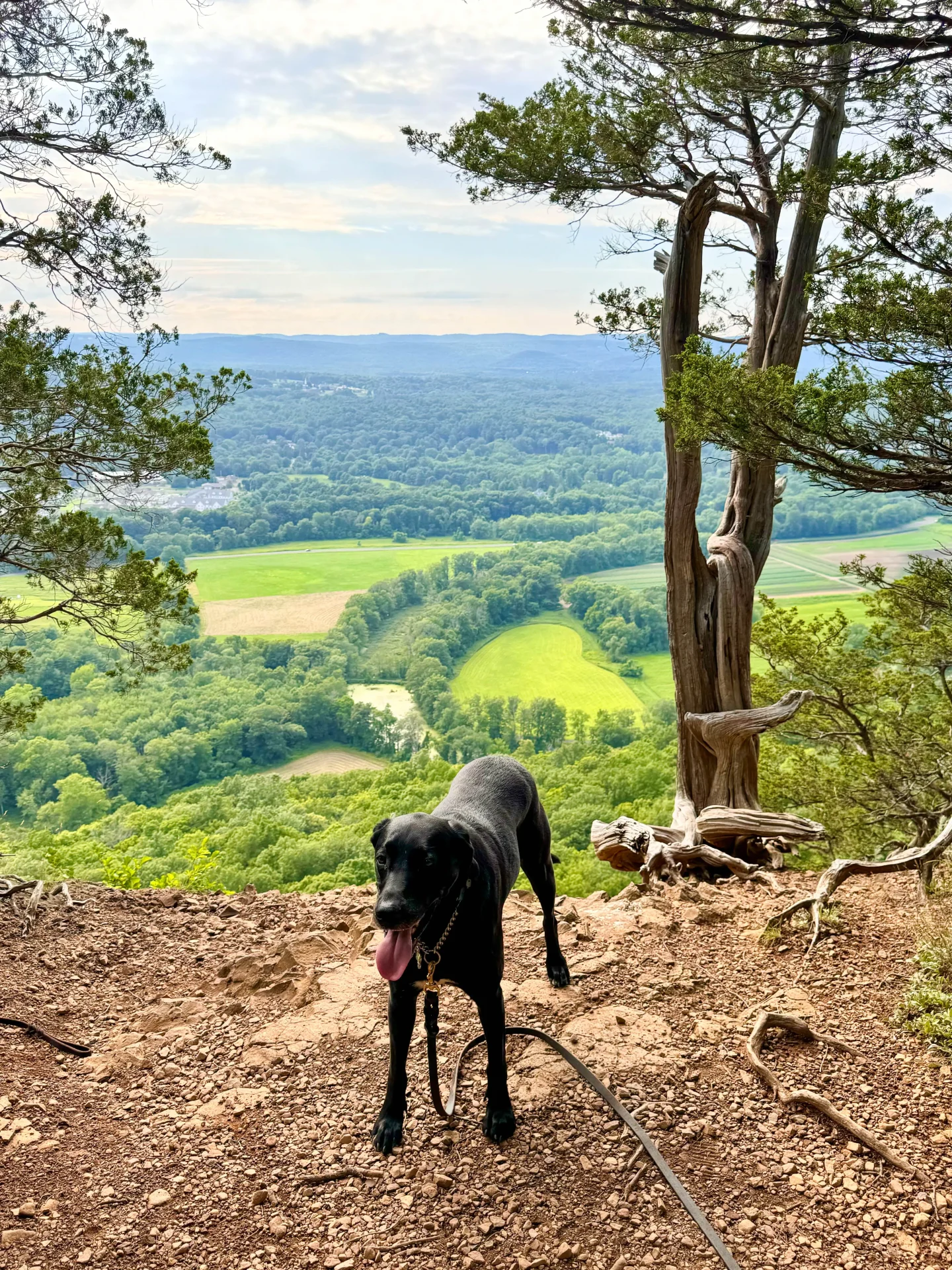
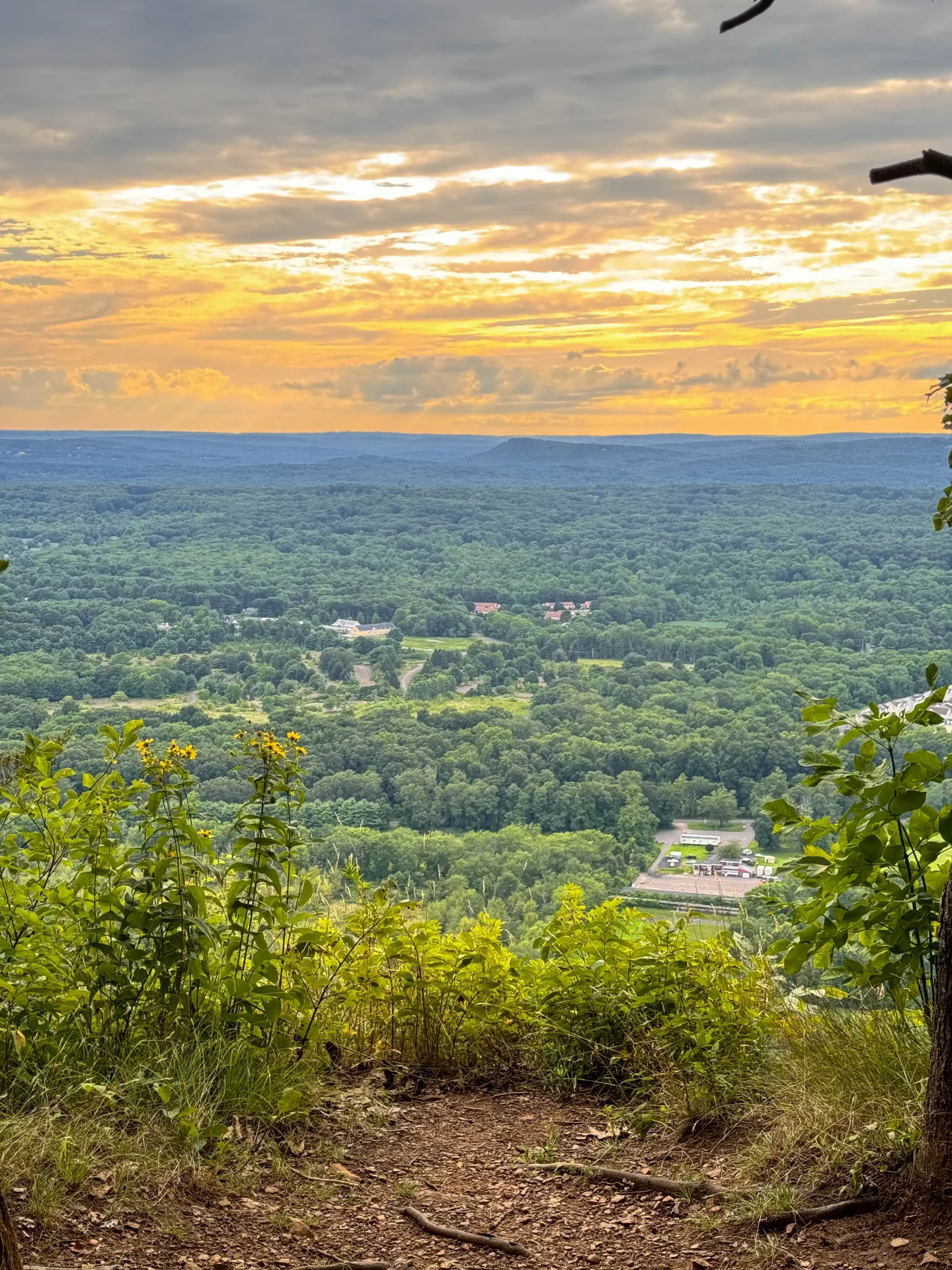
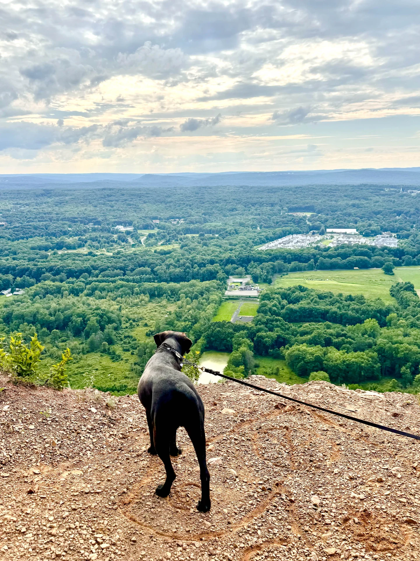
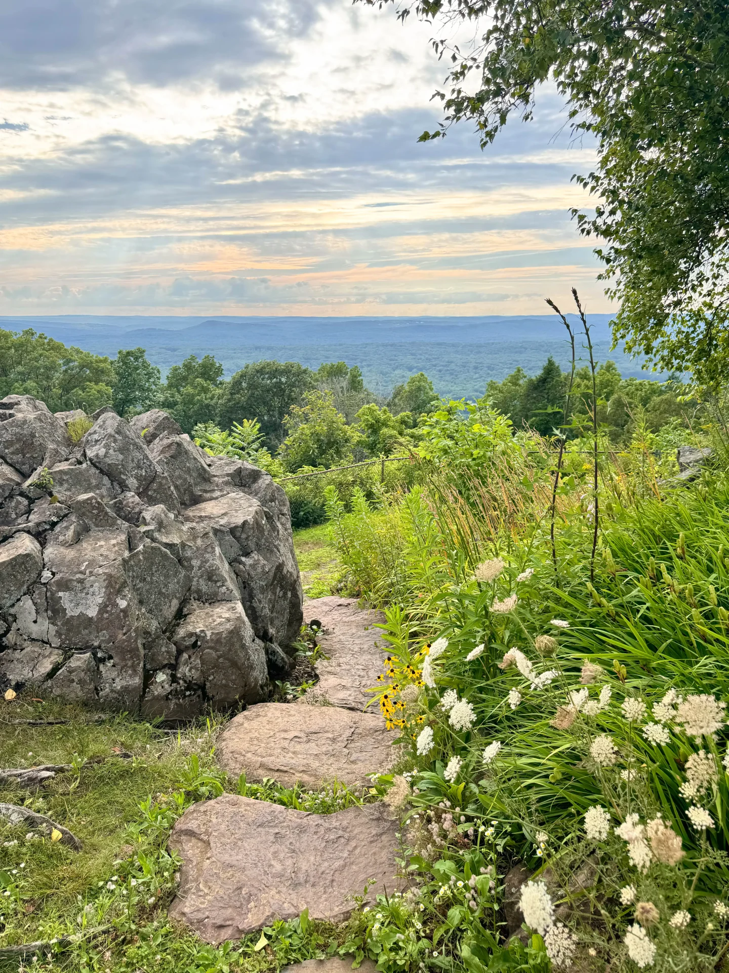
Once you reach the top of the ridge you’ll encounter your first western facing view with the towns of Simsbury and Avon below and the Farmington River Valley in the distance. The steep gravel path becomes a flat and narrow dirt trail that leads you all along the ridge. Here you will encounter too many lookouts to count, culminating with one wide open view before heading into the woods for the final stretch to the tower.
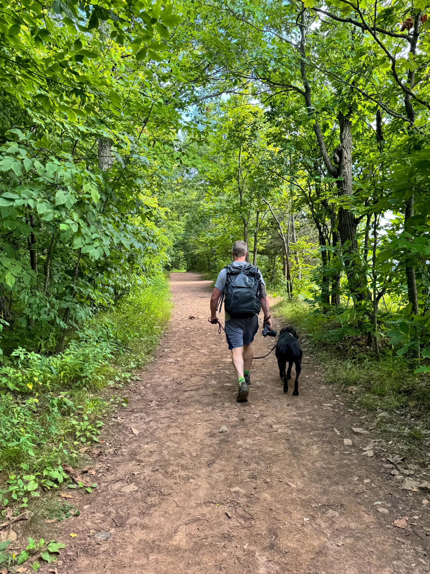
At the tower you’ll find picnic tables, bathrooms, and water available on the grounds. You’ll encounter wide open views here as well as views of this impressive CT tower. The tower is open Friday to Monday 10am to 4pm where, from the top, you can see into Massachusetts and New Hampshire. Dogs are unfortunately not allowed inside the tower. Once you’re done exploring around the tower you’ll take the yellow trail all the way back down to your car.
🥾Miles: 2.59 miles
📈Elevation: 427 feet
Level: Moderate
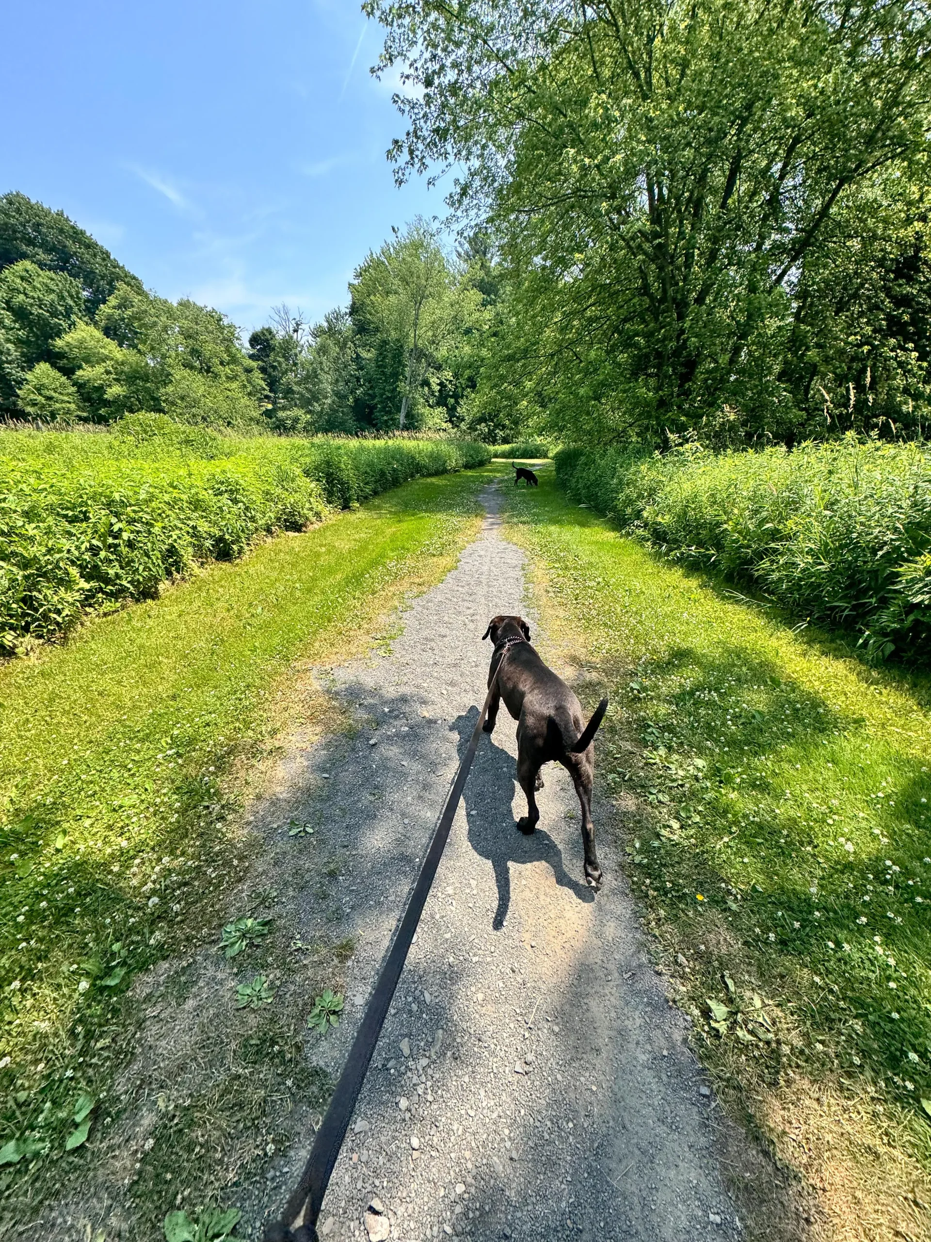
🐶Dog-friendly: Yes! Several pet-waste stations along the trail and water at the top by the tower. (Bring your own just in case though!)
Terrain: Wide gravel path for half the hike and a narrower dirt trail for other half.
🚗Parking: Click here to navigate to large parking lot on Summit Ridge Drive in Simsbury (GPS coordinates: 41.83969, -72.79257)
Detailed Trail Guide for Heublein Tower Trail
Turn-By-Turn Directions
1. From the parking lot, find the trailhead kiosk located on the south side of the parking lot toward the restrooms and start on the yellow trail which is the wide gravel path.
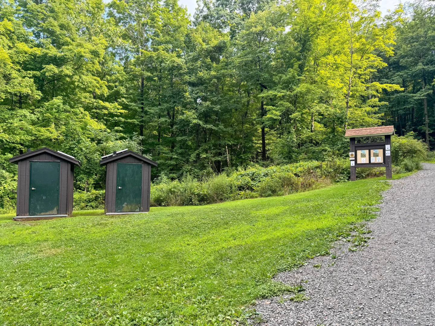
2. At 0.3 miles, you’ll find a pet waste station on your left and a bench on the right.
3. At 0.36 miles, you’ll come to a fork in the trail, stay to the right.
4. At 0.4 miles, you’ll come to another trail juncture, stay straight.
5. At 0.42 miles, you’ll reach the dirt path on the ridge and encounter your first lookout and continue walking left along the ridge.
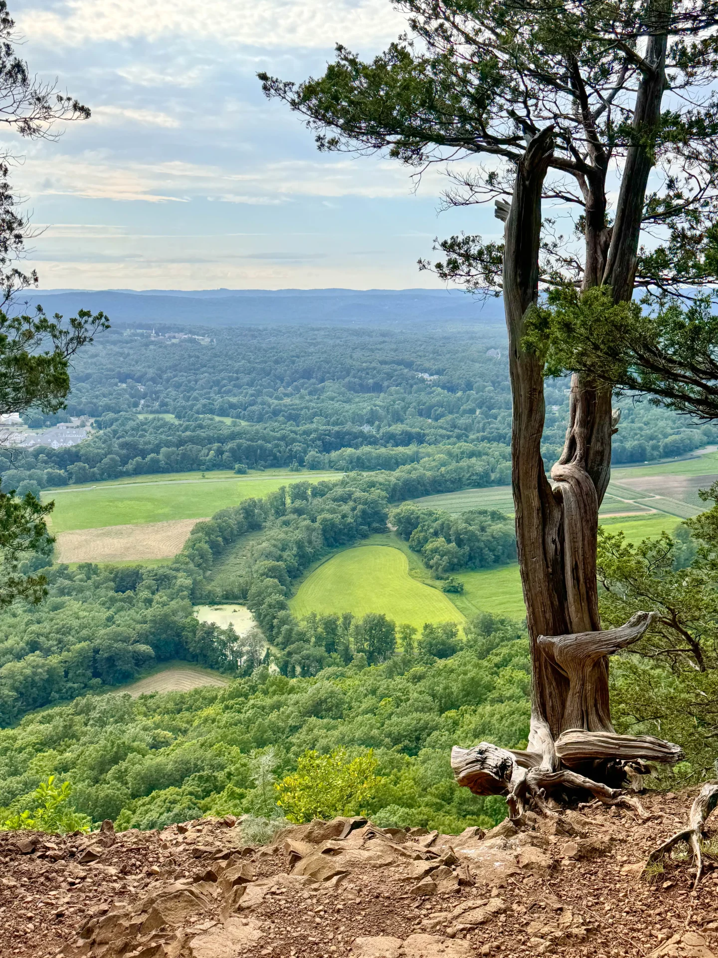
6. At 0.55 miles, you’ll reach a wide open view. From here look to the left and you’ll see a narrow path, heading back into the woods where you’ll continue walking along the ridge.

7. At 0.9 miles, there will be a path leading to the left, continue to stay straight on the ridge trail.
8. At 0.98 miles, you’ll meet up with the wide gravel path again. Head to the right to continue on this trail where you will start to see yellow blazes again.
9. At 1.2 miles, you’ll start to notice blue markers with the yellow. This is where the Metacomet Trail intersects with the yellow trail. Take a right towards the ridge to stay on the blue/yellow trail.
10. At 1.25 miles, you’ll arrive at the tower where you’ll find restrooms and a water fountain.
 See if you can find Captain here!! :)) 🐶💗
 My boy just loved his visit to the tower, can’t yoou tell??
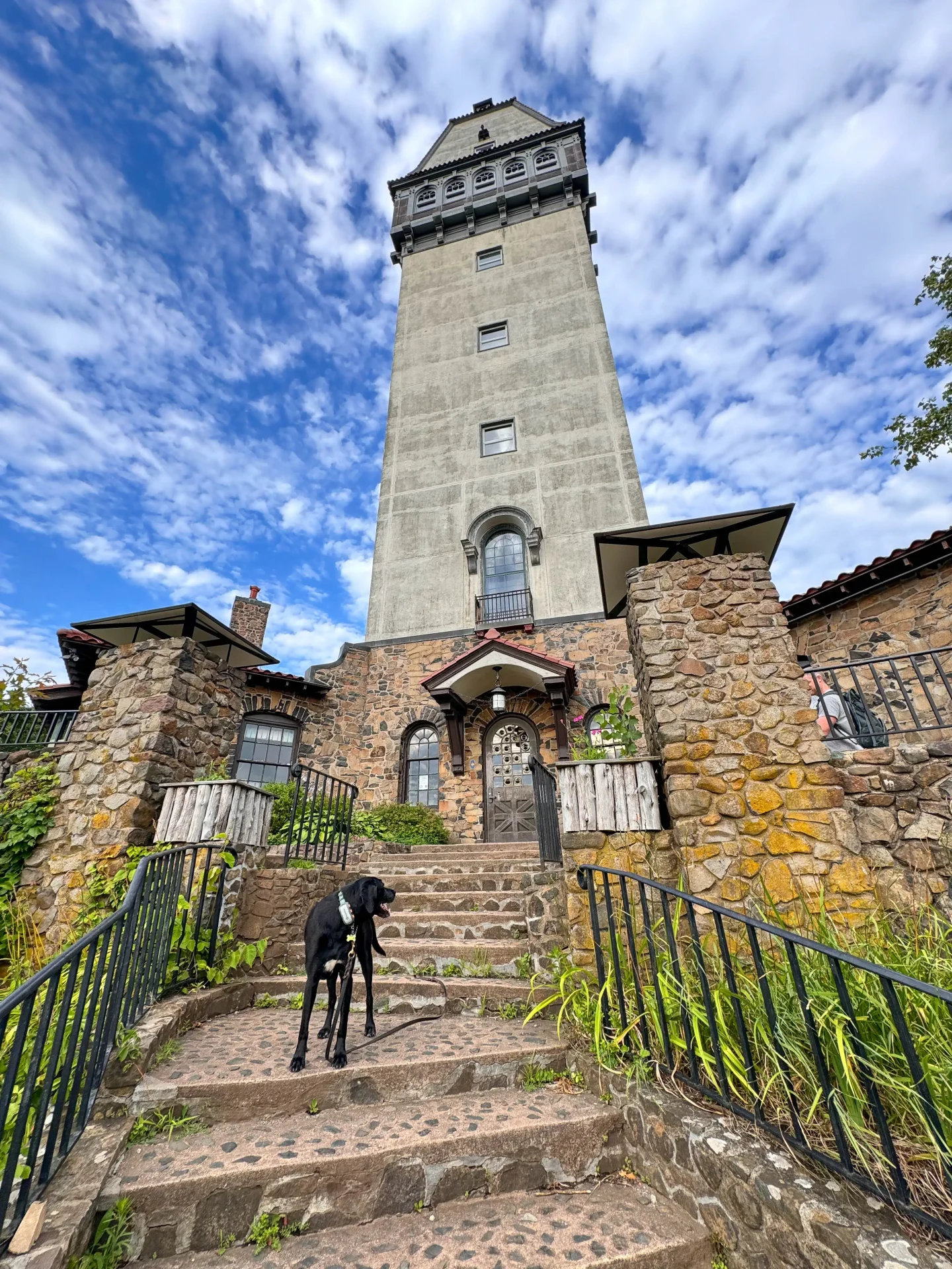 Captain looking up at the tower
11. At 1.3 miles, loop around the tower on the paved pathway and follow the yellow trail sign.
12. At 1.38 miles, you will encounter the wide gravel path (the yellow trail). Take this path all the way down to the parking lot.
The trail leading up to Heublein Tower at Talcott Mountain is a super scenic, peaceful, dog-friendly trail. Living only 20 minutes away it is a go-to for me and I even feel safe visiting here alone.
I hope you enjoyed this guide to hiking the Heublein Tower Trail!
If you are looking for other, less traveled, routes up to the tower check out my post:⬇️⬇️
🌟 4 Hikes up Talcott Mountain to Heublein Tower 🌟
Happy trails!! :)) 🥾🌿


Woah those hydrangeas 😍 I love a hike that is family friendly and not too hard! This looks so fantastic
Thanks, Lita!! Yes, love an easy hike sometimes especially after work during the week! :))