8 Tower Hikes in Connecticut; Amazing Views & History

What better way to see the leaves change in fall, green popping up in spring, or the snow coming down than from way above the trees! These 8 Connecticut tower hikes will give you gorgeous views and most of these are between 1 to 3 miles round trip.
This makes each one a great hike if you are a beginner or if you want to bring the family along. I doubt the kids will mind a short walk if they get to climb a super cool tower and pretend like they’re at the tower at the end of the level in Mario Brothers! (Anyone remember that?!🤔)
Some of the views from these tower hikes reach as far as Vermont, the Catskills, and the Berkshires in Massachusetts! With sweeping 360-degree views from several of these (I will note which ones) you can’t go wrong hiking up for sunrise or sunset.

If I’ve had a busy day and not enough time for a bigger hike, doing one of these at the end of the day an hour or two before sunset satisfies me and washes away the cares of the day! It’s amazing what time in nature and seeing such beautiful views can do.
Included in this guide to Connecticut’s lookout towers is interesting history about each one as several are featured in the National Register of Historic Places.
Some are also part of the Connecticut State Park system making the surrounding trails a beautiful place to walk around and extend the hike.
🗺️ Towers in Connectiut Map 🏰
These 8 towers are spread out across our state. Click on one of the pins below to see the tower associated with that location!
These towers are great if you’re looking for a short hike in CT leading to view. (And aren’t afraid of heights ;)) So let’s get to it!
🏰 8 Connecticut Tower Hikes 🏰
1. Mount Tom Tower Trail, Litchfield
- 🥾 1.3-mile loop, 340 ft elevation gain, rated ‘moderate’ on AllTrails
When visiting Litchfield, this is the perfect short hike to do! 🌅There are 360-degree views from the top of this stone tower making it ideal for sunrise or sunset!
At 0.6 miles in you’ll notice a trail to the right. It leads to a small cliff with beautiful views facing west. After this continue back on the trail for another 0.1 miles until you reach the tower.
📖History: This 230-acre state park is the oldest in the CT state park system and the tower is listed on the National Register of Historic Places! The 34-foot-high stone tower was built in 1888 by Columbia Professor and Litchfield resident H.S. Monroe after seeking donations from around the area.
📝Note: Though short, it is a rocky climb up so I suggest wearing hiking boots to protect your ankles. 🥾Sneakers may not be comfortable on the hike up or down with all the rocks.
2. Sleeping Giant Tower Trail, Hamden
- 🥾 3.1-mile loop, 600 ft elevation gain, rated ‘easy’ on AllTrails
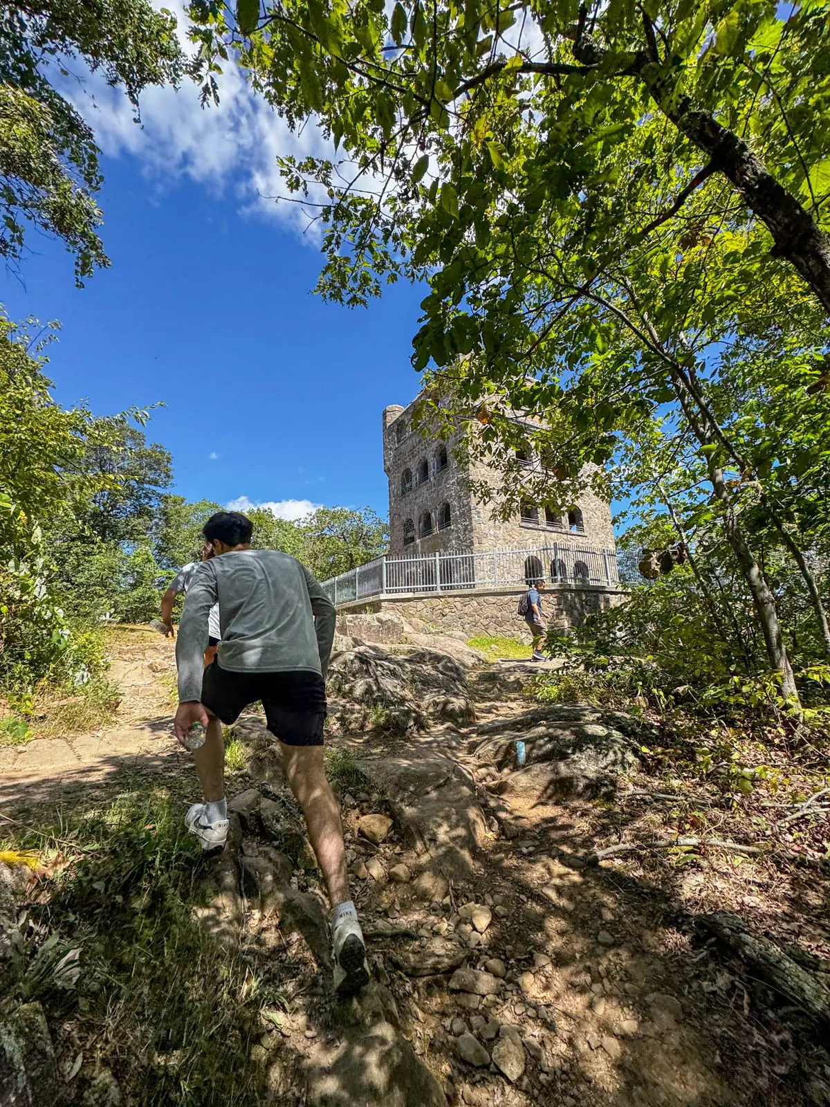
Sleeping Giant has many trails though the easiest path up to the tower is the wide gravel red blazed tower trail.
Take a look at my post ➡️ Trails at Sleeping Giant in Hamden to find a trail that works for you! The main tower trail is very popular trail and gets crowded on weekends with lots of people, kids, and dogs.

📖History: “The square four-story tower was built in the Romanesque-style between 1936 and 1939 by 60 workers through the Works Progress Administration as a Depression-era relief and recovery project.” (From the patch.com) Also from patch.com, “According to Julie Hulten, SGPA Outreach Chair and Assistant Archivist, “during World War II, the tower was ‘manned’ and there was a telephone installed to notify authorities in the event that any ‘enemy planes’ were spotted.”’ And in 1986, the tower was added to the National Register of Historic Places.
📝 Note: Sleeping Giant State Park charges an entrance fee for out-of-state registered vehicles which varies on weekends/holidays versus weekdays.
3. Orenaug Park Fire Tower, Woodbury
- 🥾 .9 miles, 209 feet elevation gain, rated ‘easy’ on AllTrails
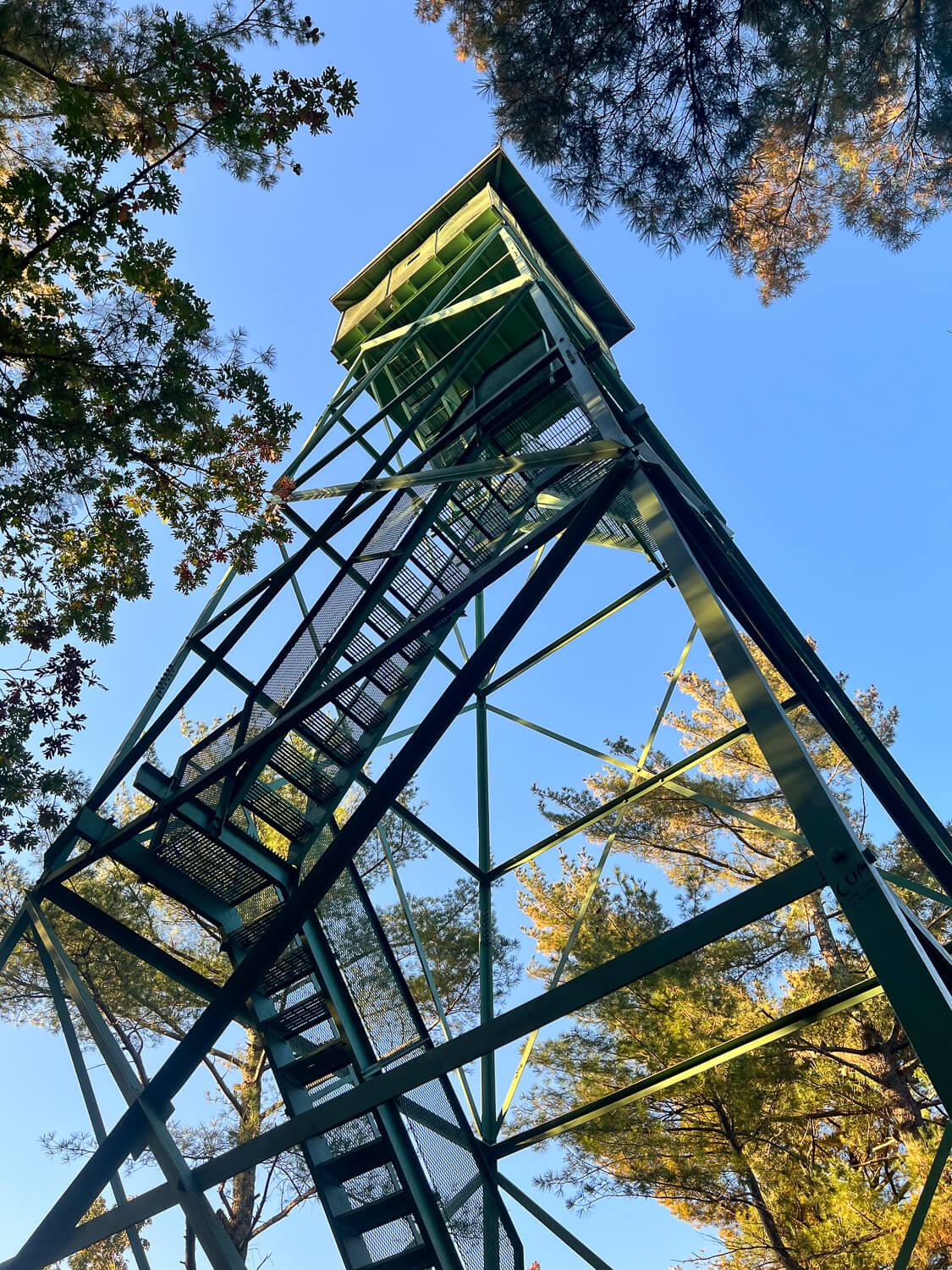
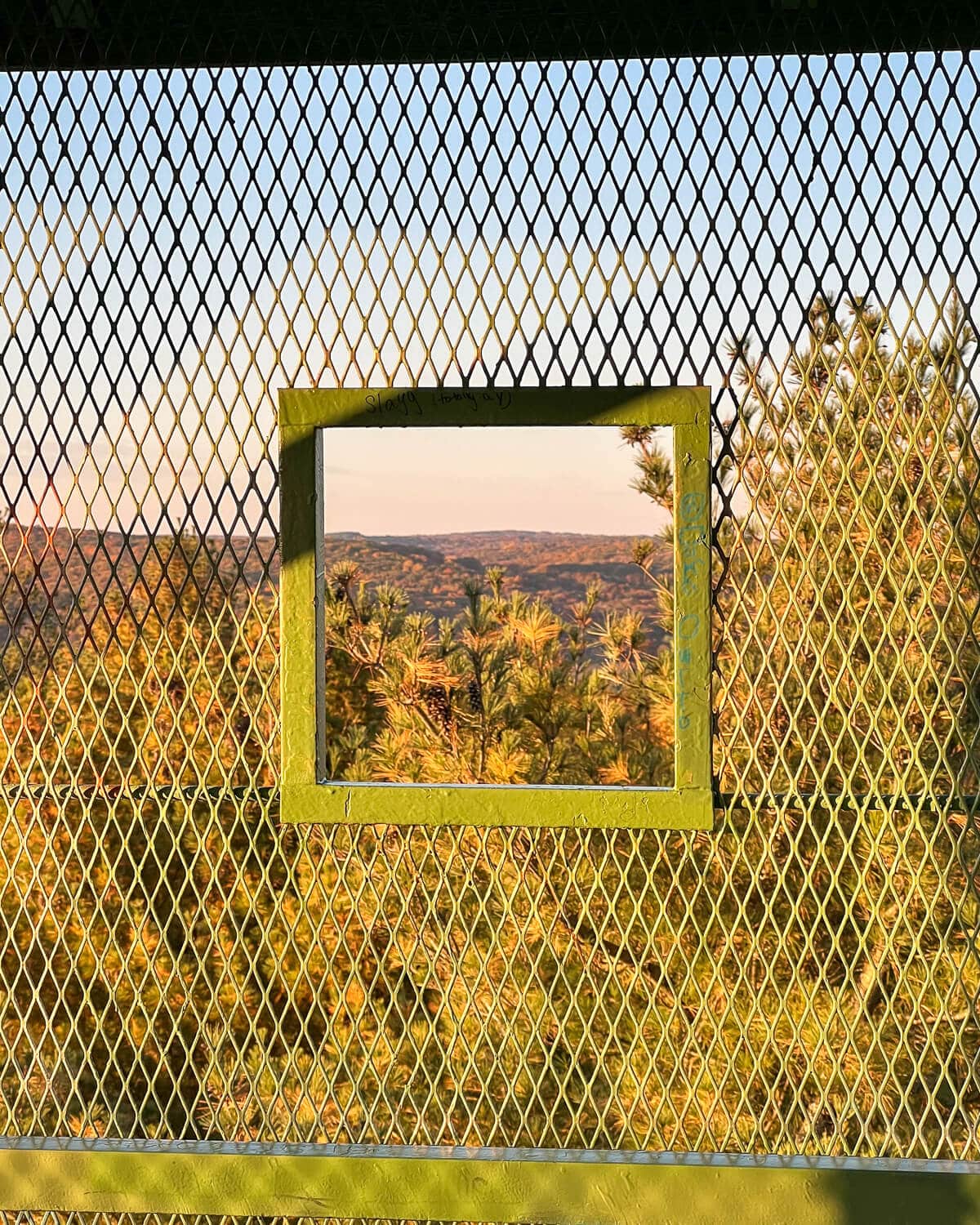
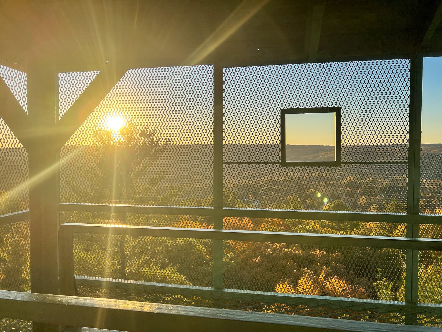
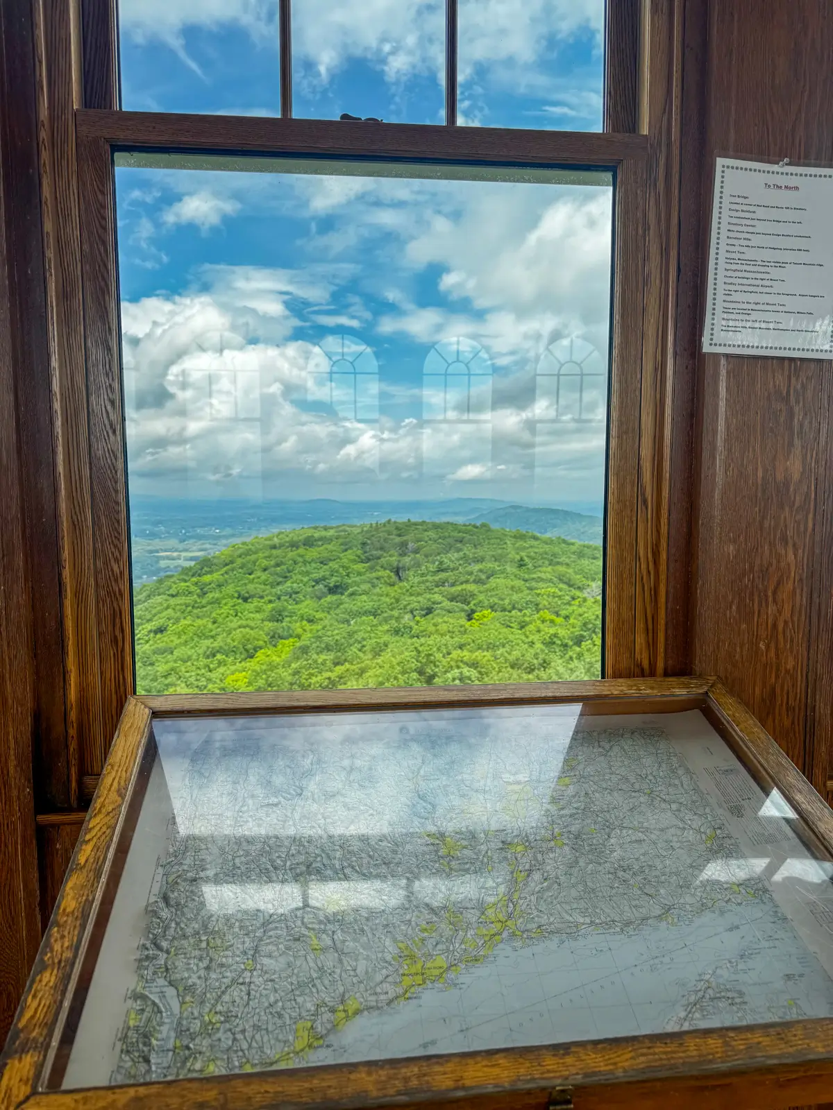
🌅With 360-degree views this is one of the top 3 views out of the towers listed here even though it is enclosed – you can peak out the windows!
This is a true fire tower so if you’re afraid of heights, it can be a little intimidating climbing up. There are several sets of stairs that are open on left and right but there are railings to use the whole way up!
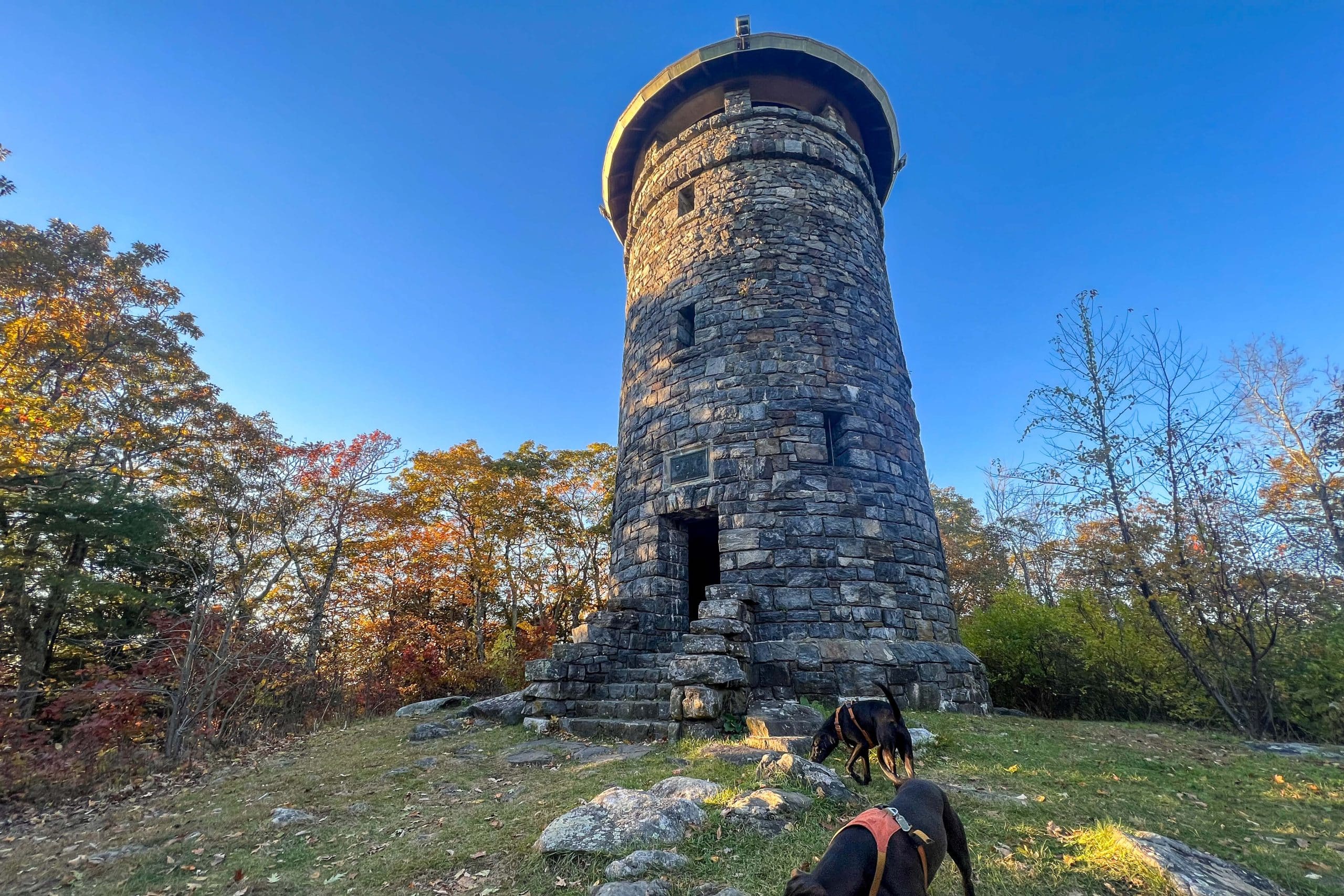
📖History: “The Orenaug Fire Tower was built in 1911. It was a lookout for fires within the Pomperaug River Valley. It stands 80 ft high from the base to roof, 260 ft above street level and 520 feet above sea level,” from woodburyct.org where there’s a trail map located as well.
📝 Note: There is another trail or a trail that continues beyond the tower but when we took it it looked like it wasn’t maintained very well and we ended up turning around.
Afterward, stop at one of the best independent and family-owned natural food stores in our state, New Morning Market in Woodbury. It has everything from prepared foods to go, local produce, a bulk section for all your trail mix needs, and of course multiple aisles of natural health and beauty products.
4. Talcott Mountain Yellow Trail to Heublein Tower, Simsbury
- 🥾 2.5 miles, 430 feet elevation gain, rated ‘moderate’
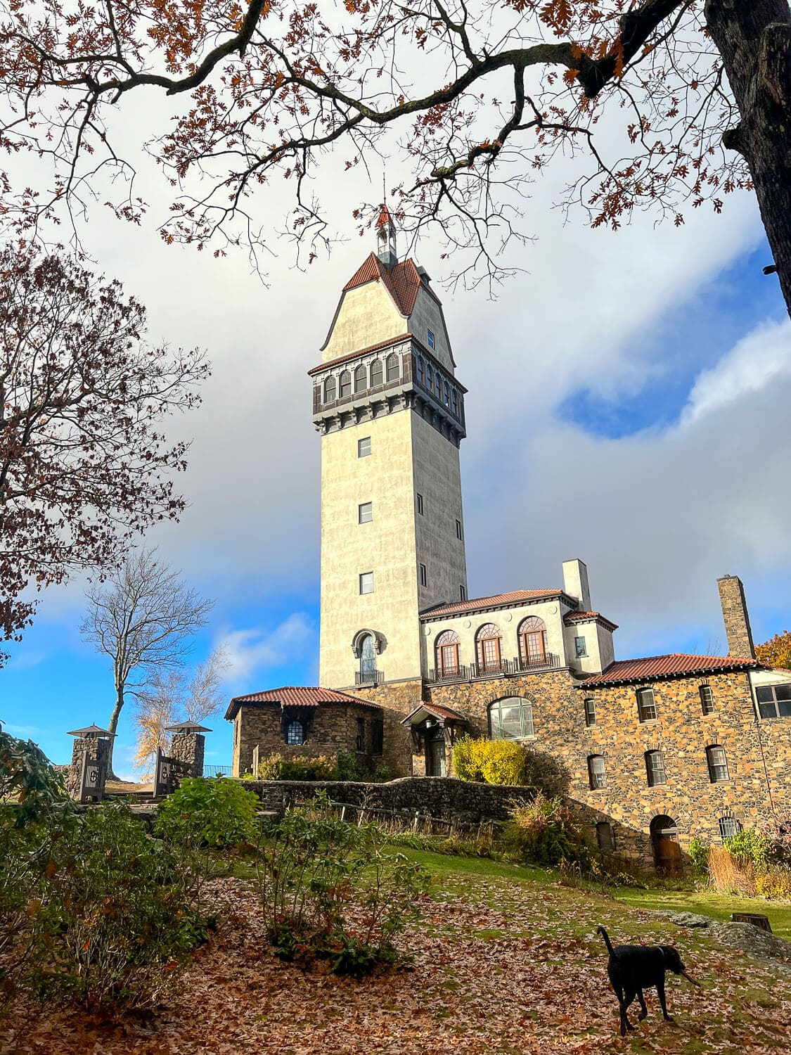
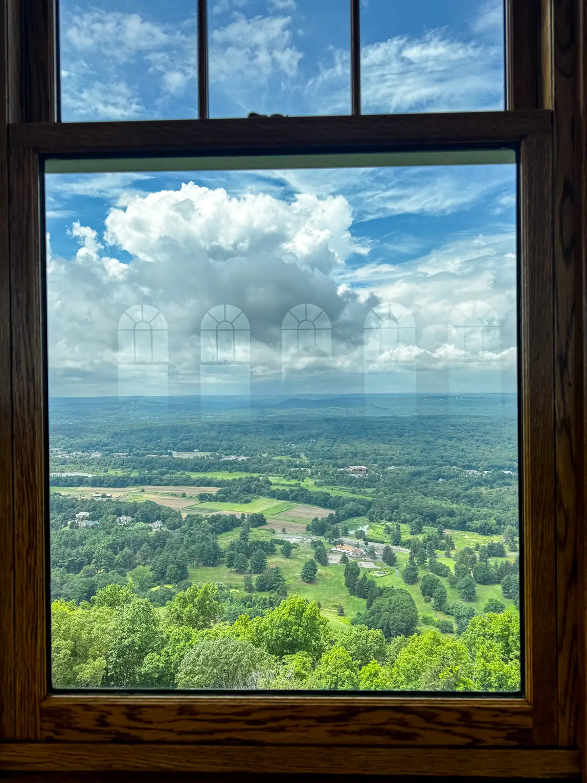
🌅 There are spectacular views on the way up to Heublein Tower which is great because the tower itself is not open often.
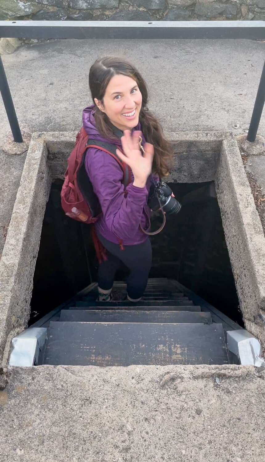
You can go inside the tower and walk flights of stairs to the top (a workout in itself!) when it is open. As of March 2026, the tower is open Friday to Monday, 10 am to 4 pm.

But again, even if you don’t make it into the tower the hike is 100% worth it as you’ll find beautiful western-facing views all along Talcott Mountain ridge.
I wrote a post about the different trails you can take to the tower so find the one that suits you best here ➡️ 4 Different Hikes Up to Heublein Tower 🌟
📖History: From FriendsofHeubleinTower.org, “The structure you see here today is the fourth tower built on this property. In 1810, Daniel Wadsworth built a tower at the top of this mountain, near his estate, which was called Montevideo. Wadsworth was the founder of the Wadsworth Atheneum in Hartford, Connecticut, and one of the very first Americans to be considered a patron of the arts.”
The 165-foot tower that is there today was built in 1914 by Gilbert Heublein after he promised his fiancé, Louise Gundlach, a ‘castle on the mountain’ when they were hiking on Talcott Mountain before their marriage. How romantic!
The tower was used as their summer retreat and you can read more about what took place from that time until the tower was restored and opened to the public in 1974 here.
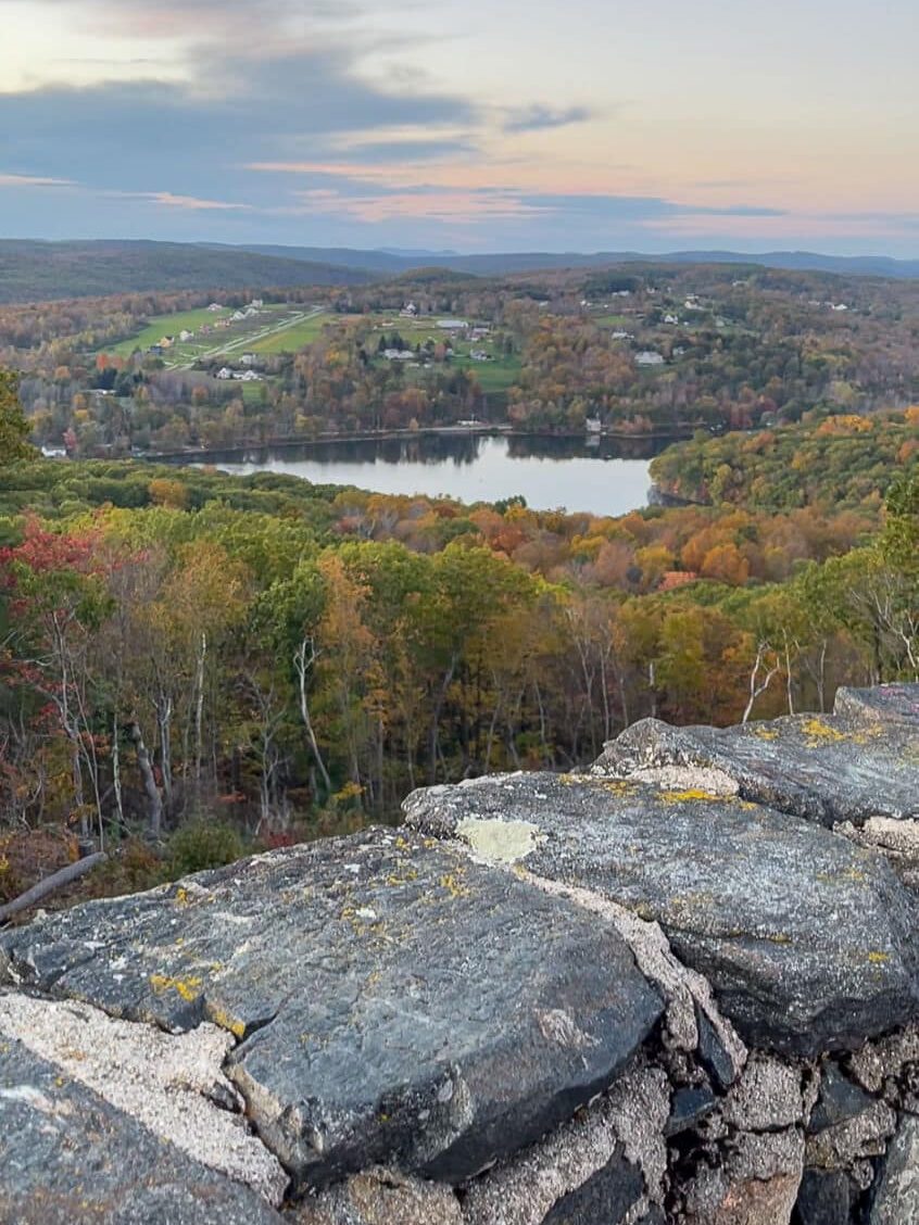
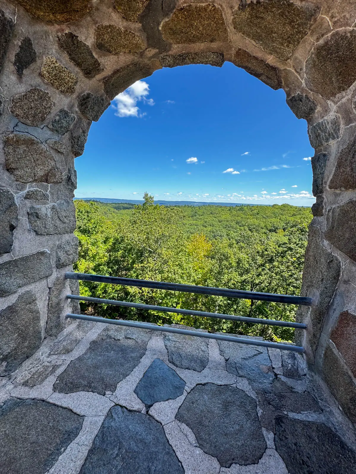
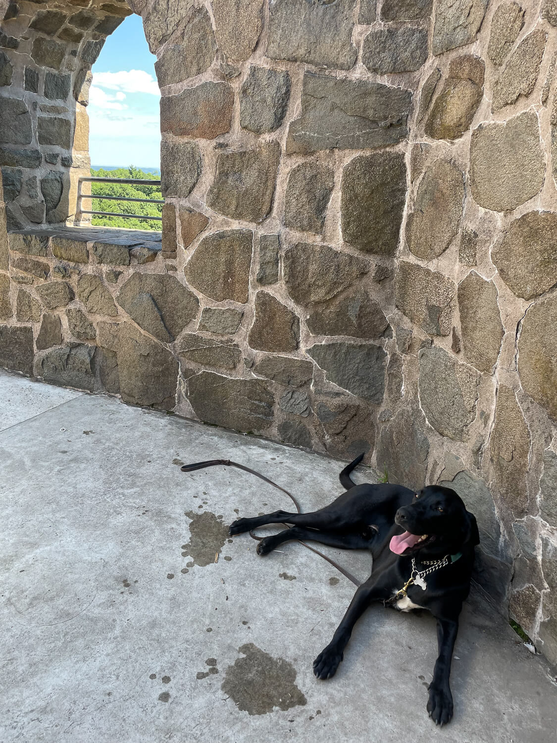
5. Castle Craig, Meriden/Southington, central CT
- 🥾 4.4 miles, 800 feet elevation gain, rated ‘moderate’
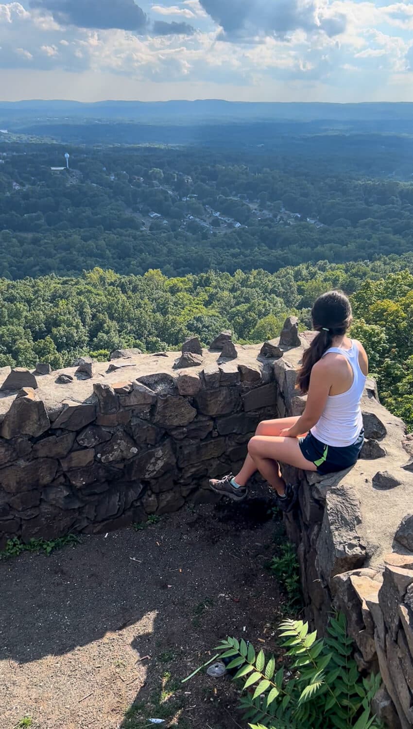
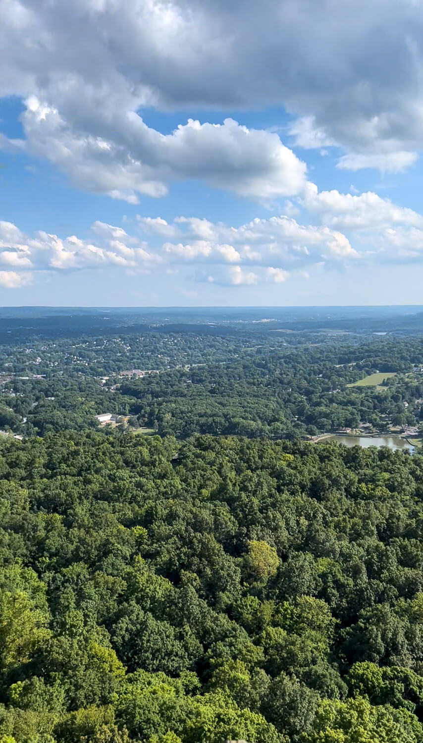
🌅 There is a 3-mile road that takes you up to the stone castle so because of its easy access the castle does close at 5:30 pm every day (as of 10/25/22) and opens at 10 am. From what I can see online the road to the tower is only open from May to October. You can walk up the road or hike up to the tower year-round though. Because of the road up it does make this a popular and crowded spot so it’s best to visit early or later in the day! From the tower, you can see south into New Haven and the Long Island Sound, west to the hills of the Berkshires, and north to Hartford.
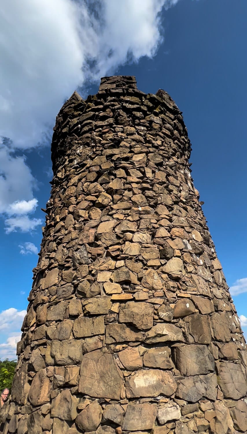
📖History: Castle Craig was dedicated to the people of Meriden by Walter Hubbard which is what the park it is located in (Hubbard Park) is named after. The 32-foot tall tower stands at an elevation of almost 1,000 feet and has the neat distinction of being the highest point within 25 miles of the coast from Maine to Florida.
If you’d like to visit a super close brewery that serves amazing pizza after the hike, check out my post featuring dog-friendly breweries in CT!🍕🍕

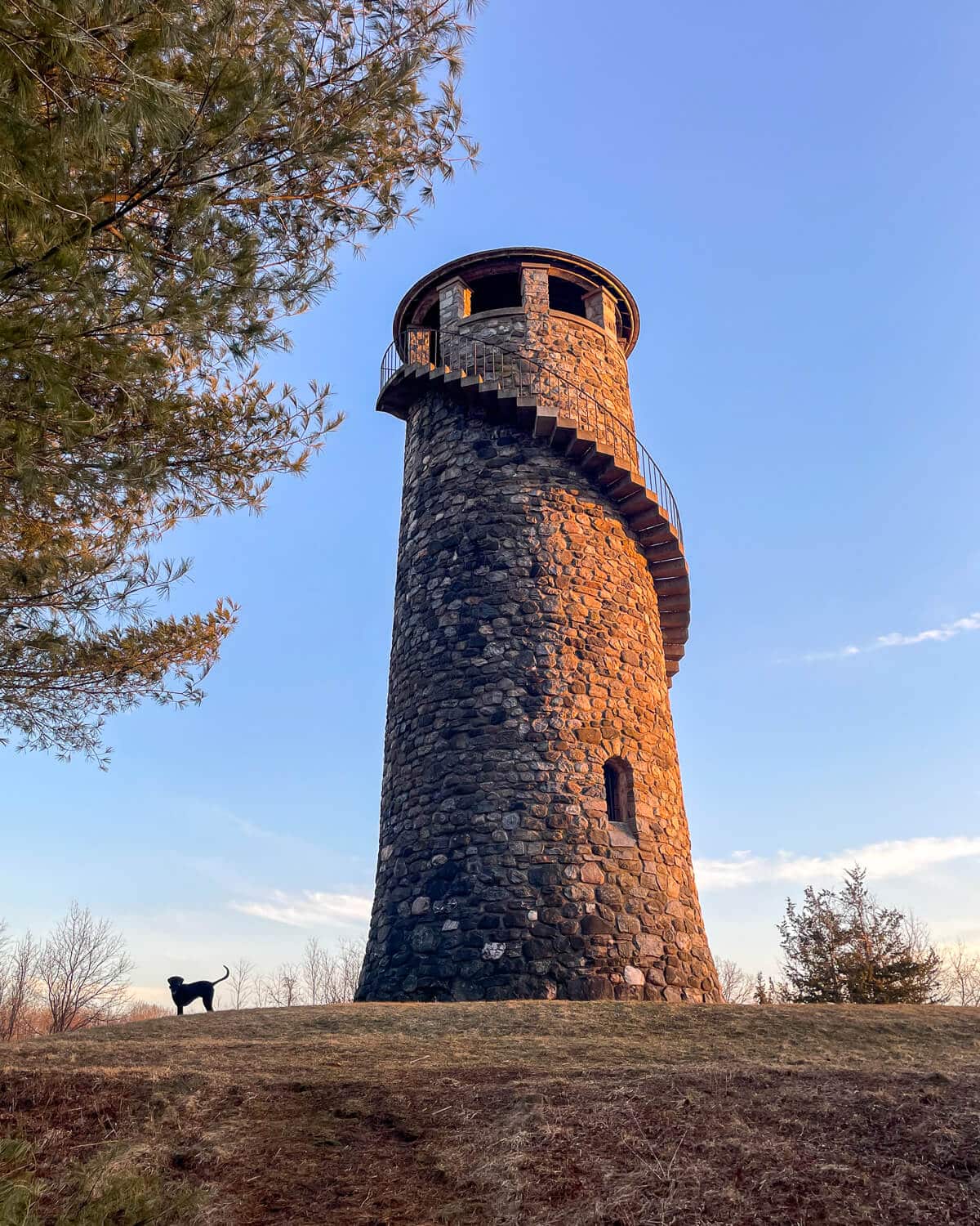
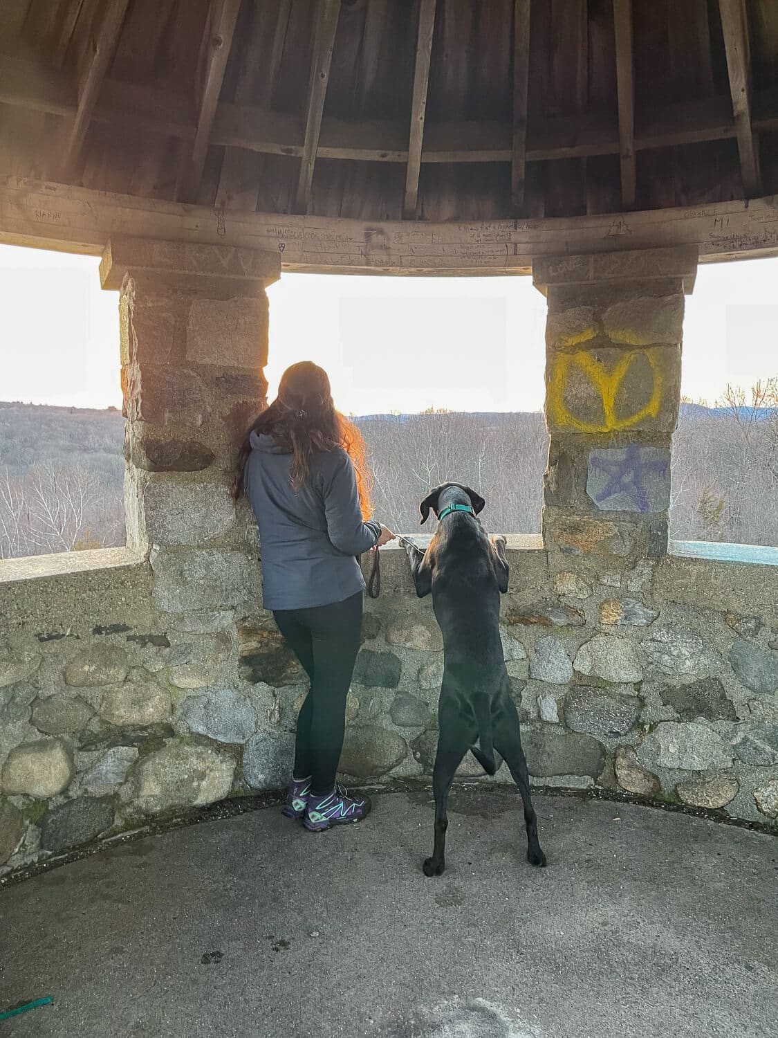
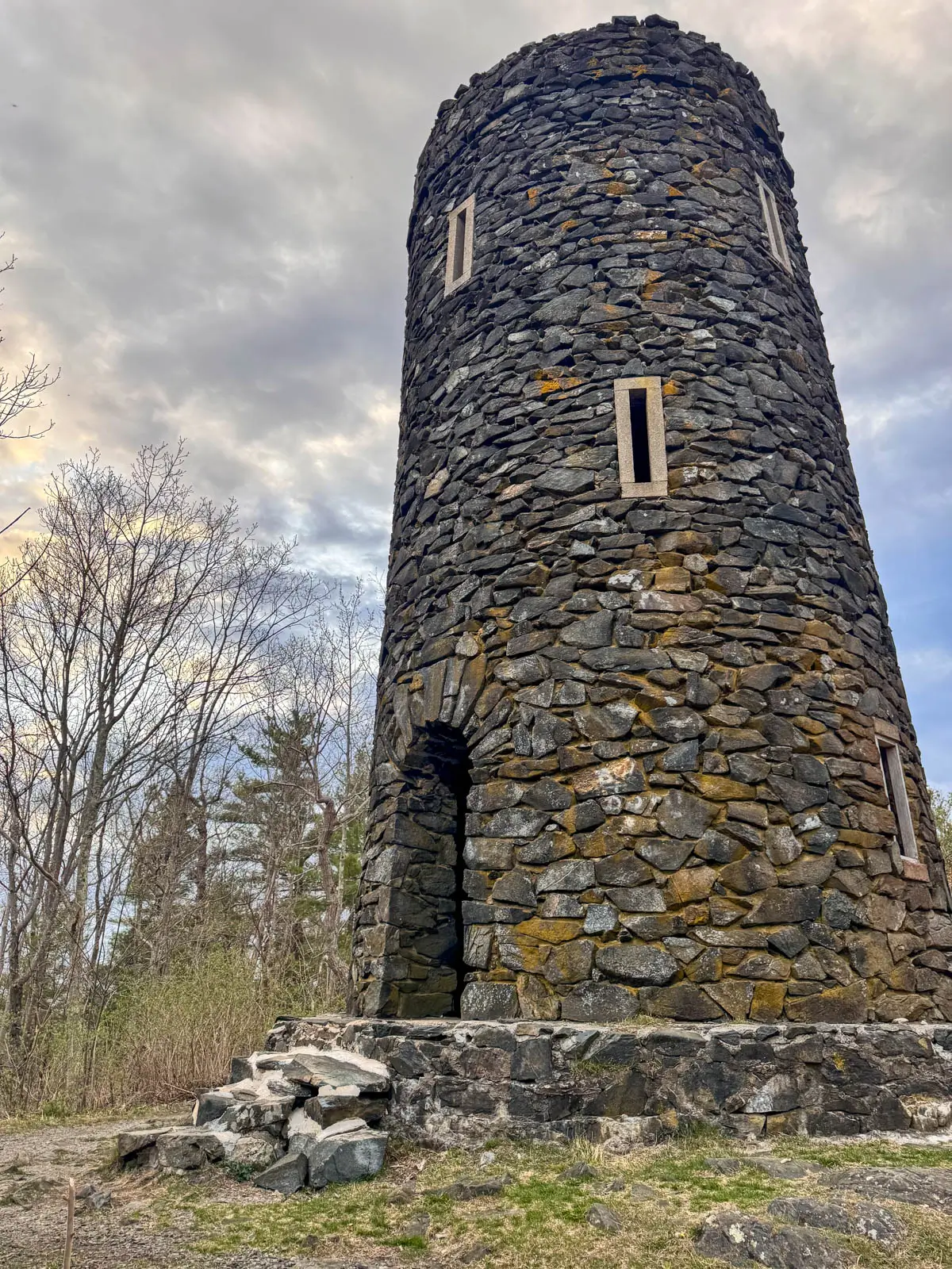
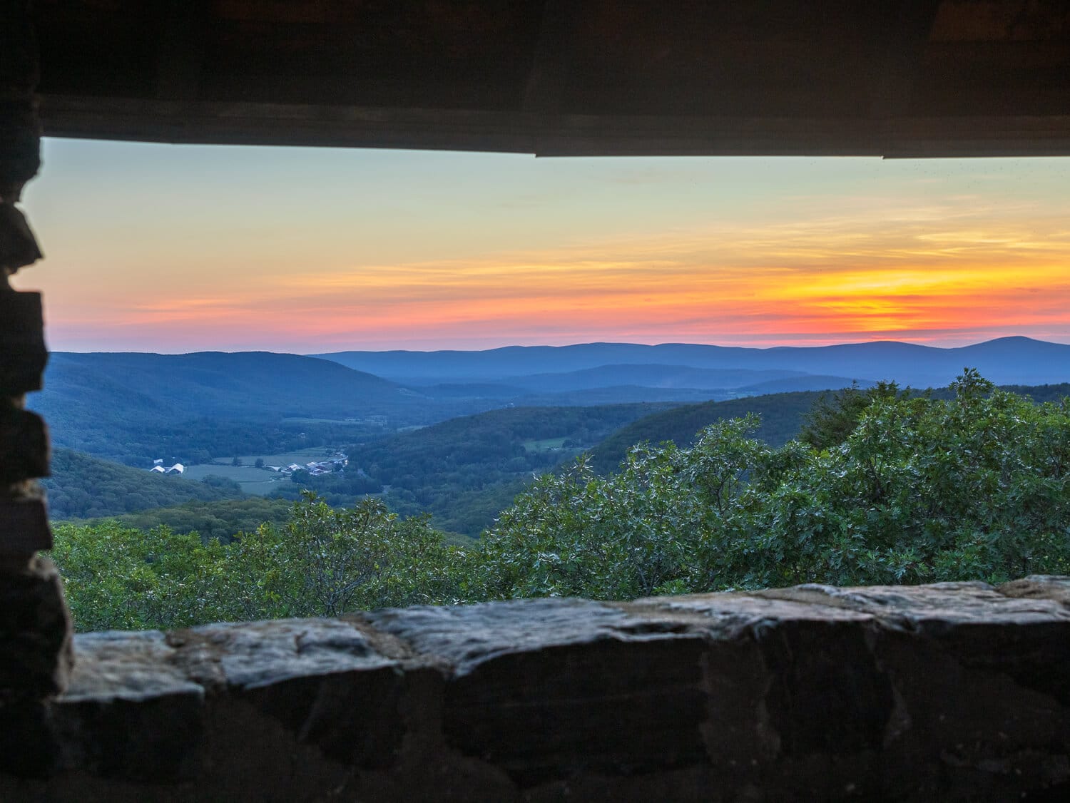
🌅Camp Columbia tower has 360-degree views at the top with openings on all sides but the clearest and longest view faces west making it perfect for sunset! If you’re visiting Litchfield, this hike is just minutes away in a small little town called Morris.
📖 History: There are almost 600 acres in Camp Columbia State Park. This park was used during the First World War where it served as a military combat training facility for Columbia students. According to Wikipedia, “During World War I, the property became the site of combat training for college students who sought officer commissions. Military exercises included simulated warfare with real gunfire and the digging of trenches. Remnants of the trenches dug during the training are still evident on the property.” You can read more about it here!
📝 Note: The stairs going up the tower is on the OUTSIDE and wind all around to the top. Check out the video I made of this hike here. This makes for a somewhat scary walk up and I would keep pets and children close on the way up or down. It definitely made me a little nervous and it’s best to not look down! There is a railing that you can hang onto. 🙂
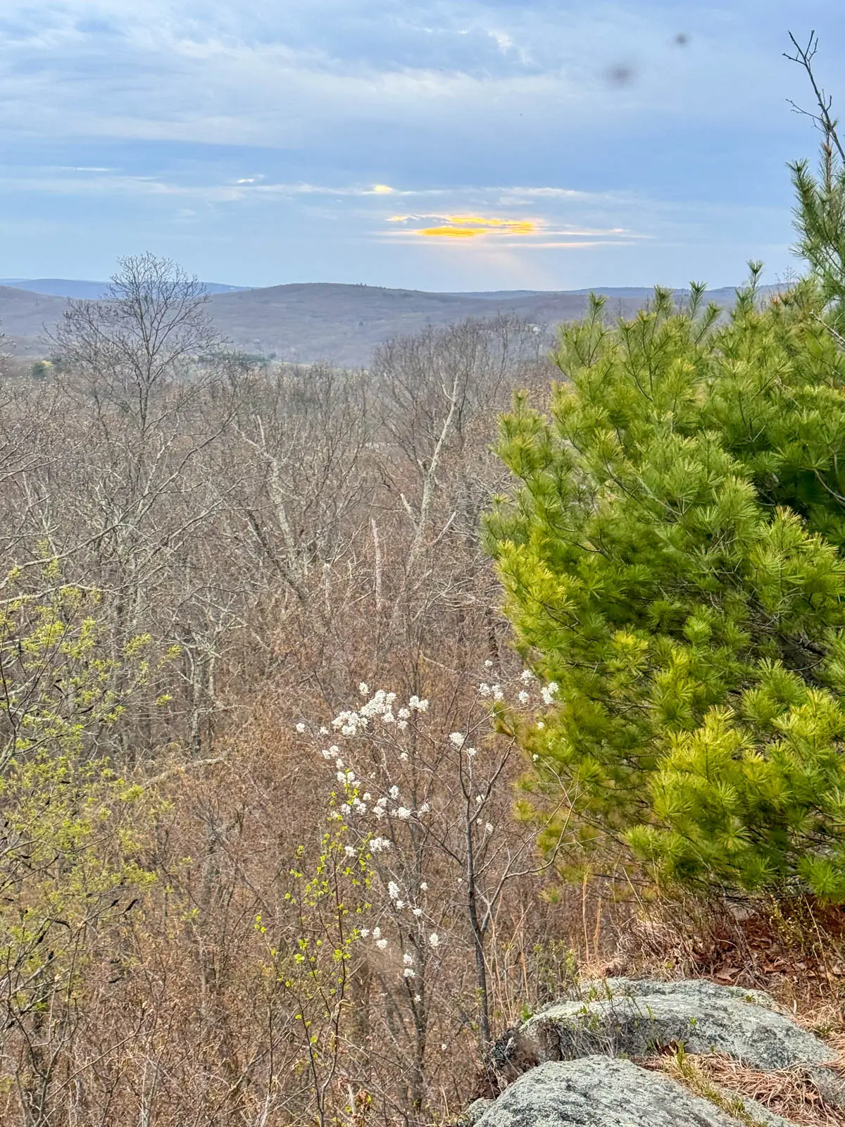
7. Haystack Mountain Tower Yellow Loop, Norfolk
- 🥾 1.8-mile loop on the yellow trail, 500 ft elevation gain
Check out the post I wrote about ➡️ 3 different routes to Haystack Mountain Tower to see all routes that lead to this amazing tower!

📖 History: Built in 1929, the tower and Haystack Mountain State Park were donated by Ellen Battell Stoeckel, a Norfolk resident, who donated the tower in memory of her husband. The tower is listed on the National Register of Historic Places and is a local example of medieval Tudor Revival architecture.
🌅 When clear you can see peaks in MA, NY, and even the Green Mountains of Vermont! This one is beautiful for sunrise or sunset and even for watching the full moon come up!
8. Soapstone Mountain Lookout Loop, Ellington
- 🥾2.9 miles loop on yellow trail, 500 ft elevation gain, ‘moderate’ on AllTrails
📖 History: The only public observation tower in Eastern Connecticut, yay! The lookout is located in Shenipsit State Forest which has over 40 miles of trails and 7,000 acres and 14 different hiking trails listed here on AllTrails for you to choose from.
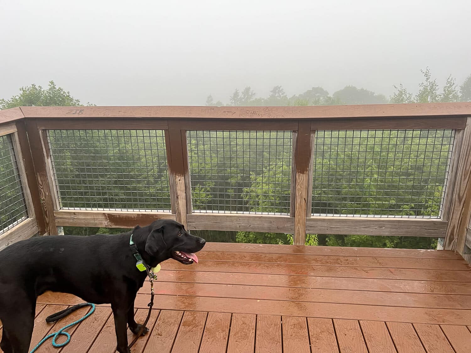
🌅 Unfortunately, when I was there for sunrise it was a very foggy morning but when clear you can see into the CT River Valley and Springfield skyline, so I hear. I will definitely be back and see what it looks like for myself!
📝 Note: There is a road that leads up to the lookout so if you are going for sunrise and down want to scramble up to the top (the hike up is a bit challenging!) I would suggest walking up along the road, especially in the dark, and then you can take the trail (or the road ;)) back down.
Conclusion🏰
Dear friends, that’s the end of our list! I believe I’ve covered every fire tower or tower that you can hike up to in the state of Connecticut! 😅
There is another stone tower on the shoreline in Guilford called Cranbrook Tower. Apparently you can climb up but it is on private property. :/ You can still walk by it on the street and snap a few pics! I plan to do that next time I’m in Guilford. 🙂
Other Connecticut Posts You Might Like!
Happy trails…🐾🥾🍂