18 of the Best Waterfalls in Connecticut
Did you know that there were so many waterfalls in CT?! Now of course they are not all as tall as Kent Falls (the tallest waterfall in Connecticut) but to me, they are all worth visiting and make for a great hike or walk!
For each waterfall I include what trail to take, how long the walk is, how tall the waterfall is, swimming access, parking, ease of accessibility, and anything else I think would be helpful for you to know.
The AllTrails map to each waterfall hike is linked in the title so all you have to do is click the title to get more details via AllTrails.
So what are the 18 most beautiful waterfalls in Connecticut to hike to?! Let’s see below…
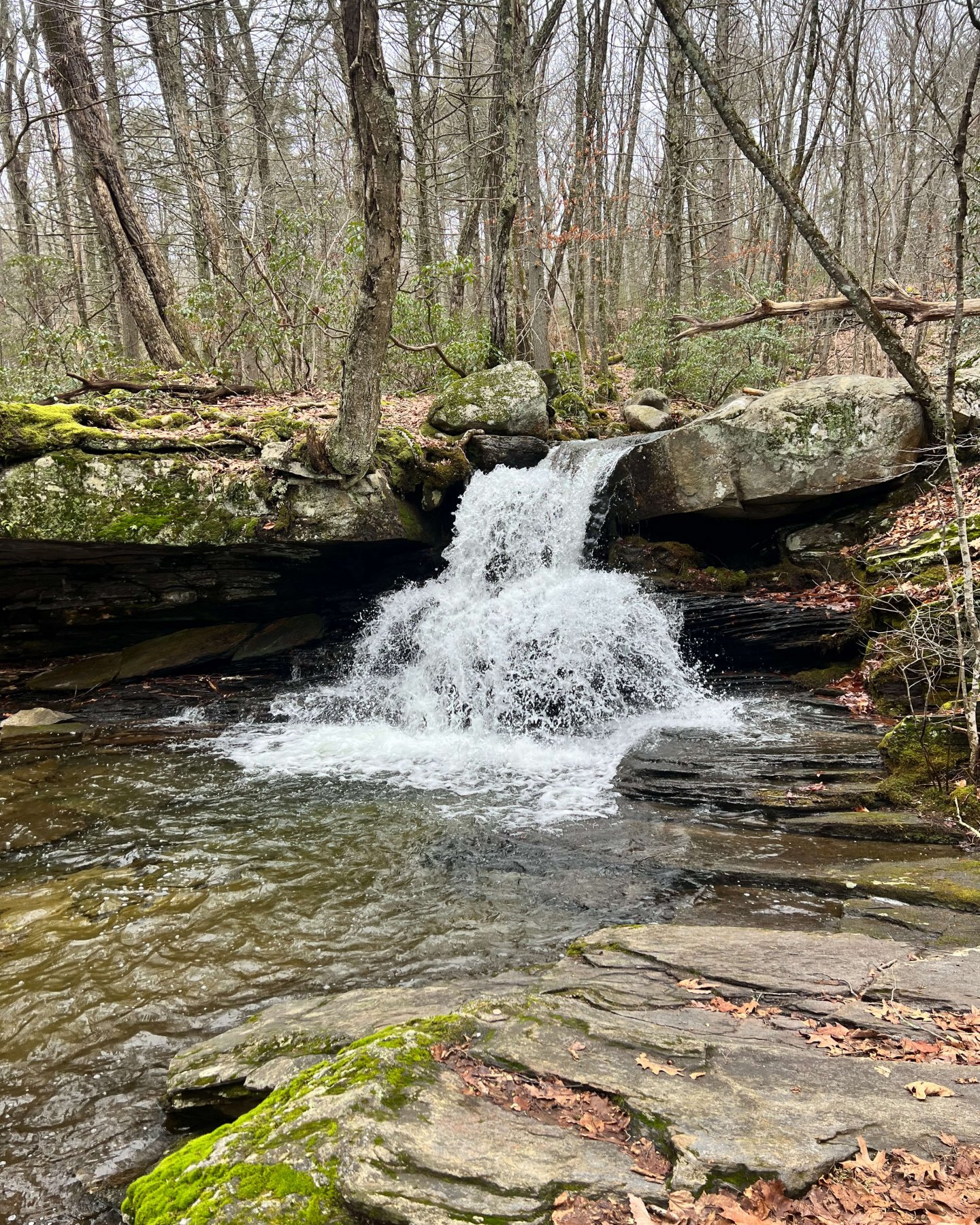
1. Nonnewaug Falls, Woodbury, Litchfield County
One of my favorite waterfalls in CT! To me, this one feels like a little oasis. 🌿You walk for a bit and then there’s a little steep dirt section to get down to the falls but once down there it feels very private. This is one I want to go back to again and again!
HIKE TO: Nonnewaug Falls
TRAIL: Nonnewaug Falls Trail
WATERFALL HEIGHT: 30 ft
SWIMMING: water only comes up knee height from bottom pool
MILES: 1 mile
ELEVATION GAIN: 134 ft
TIME: 30 min
DATE I WENT: 9/7/22
DIFFICULTY: easy
PARKING: large lot
PERSONAL RATING: 4 ⭐️'S
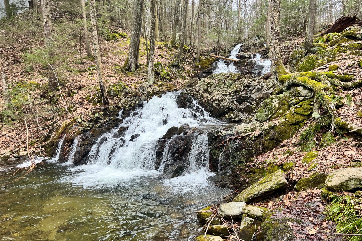
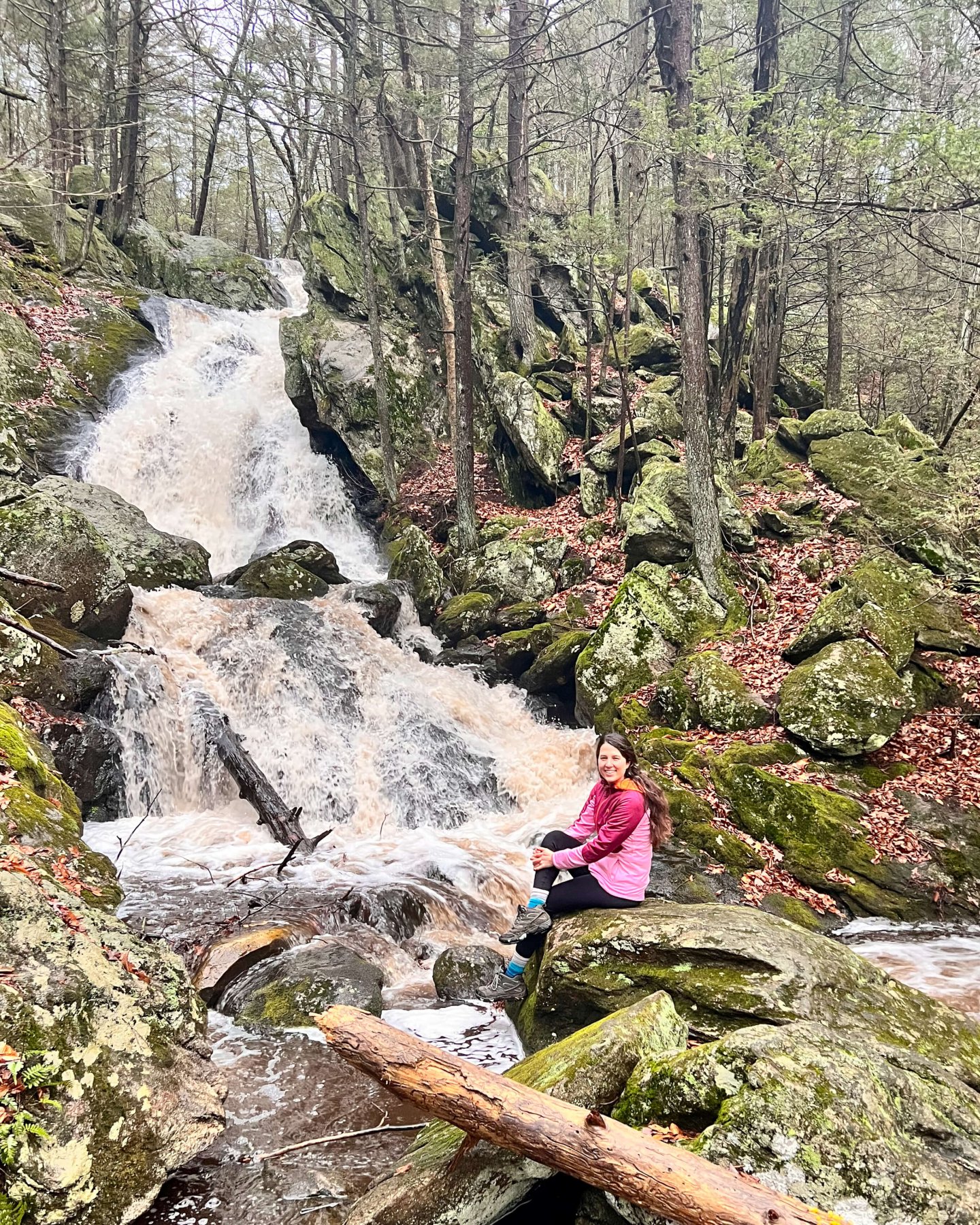
2. Enders Falls, Granby, northern Hartford County
Check out my hiking guide and more details on Enders Falls. Take a nice, easy stroll down to Enders Falls where there are multiple waterfall drops along the way. I love Enders but it can be tricky to get good pictures of as there is fencing along the way to keep people from getting too close to the falls, with the exception of the very bottom waterfall drop which is the tallest. Once you get to the bottom of the trail (or paved staircase which makes up half of it) then you come to a large pool of water and the 30ft fall area that is much safe to walk around and even wade in a little bit.
HIKE TO: Enders Falls
TRAIL: Enders Brook Falls
WATERFALL HEIGHT: 30 ft
SWIMMING: no swimming allowed here (and super dangerous slippery rocks!)
MILES: 1 mile
ELEVATION GAIN: 134 ft
TIME: 30 min
DATE I WENT: 5/11/22
DIFFICULTY: easy
PARKING: large lot
PERSONAL RATING: 4 ⭐️'S
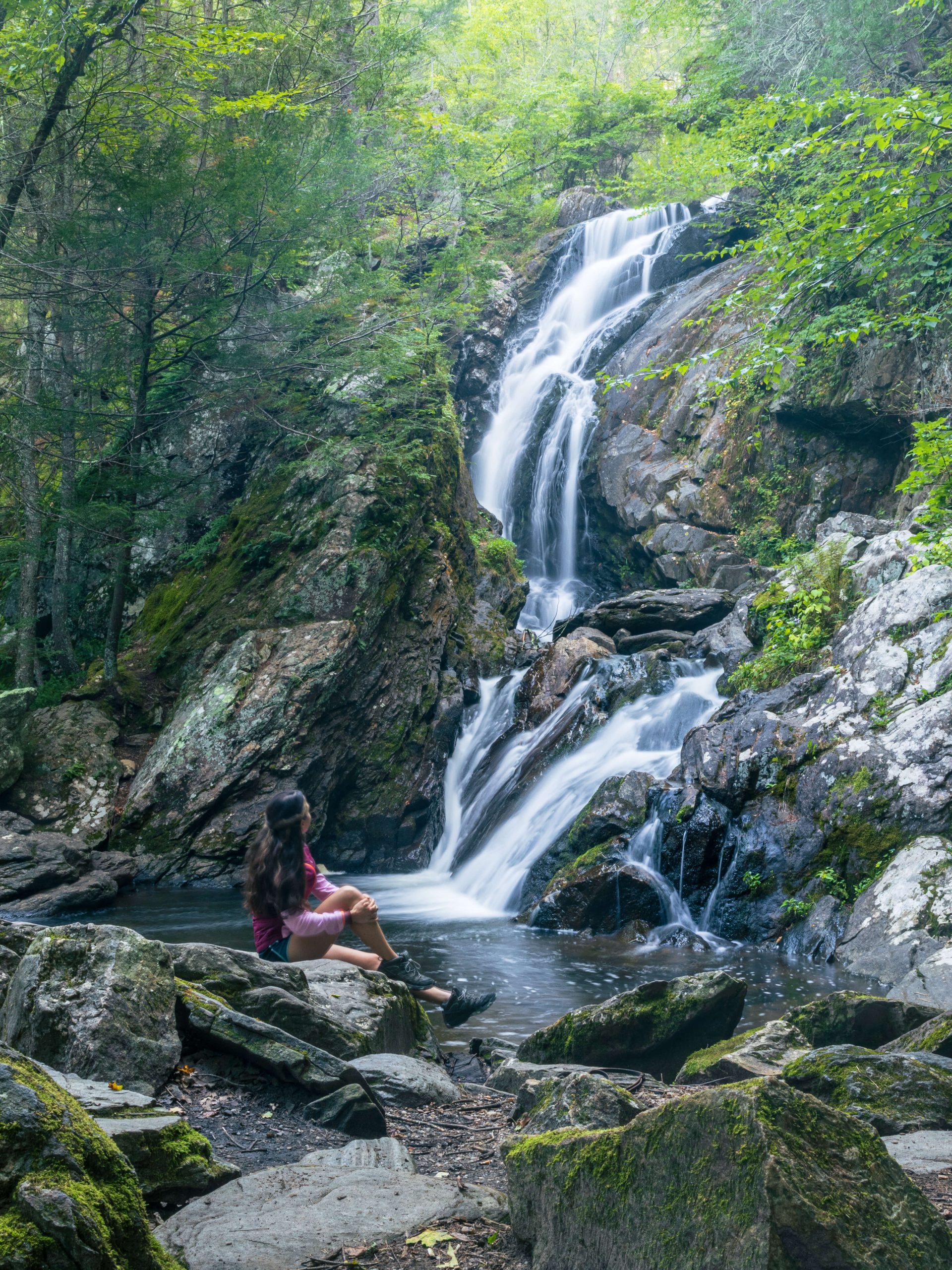
3. Campbell Falls, Campbell Falls State Park, Norfolk, Litchfield County
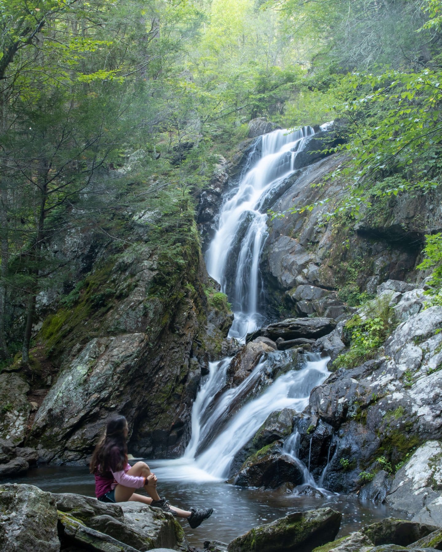
This is another favorite! In any season. Feels like a perfect mini hike, this waterfall is away from traffic and busy streets so it truly feels like an escape and a secret in the woods. A narrow path meandering through tall tall evergreens makes this an enchanting experience! The last part down to the falls is pretty steep (and can be muddy/slippery) so I always wear my tall hiking boots 🥾 here for stability.
HIKE TO: Campbell Falls
TRAIL: Campbell Falls
WATERFALL HEIGHT: 50 ft
SWIMMING: not allowed
MILES: 1.4 miles
ELEVATION GAIN: 187 ft
TIME: 36 min
DATE I WENT: 9/10/22
DIFFICULTY: easy
PARKING: small lot
PERSONAL RATING: 5 ⭐️'S
4. Great Falls, Falls Village, Litchfield County
Listen carefully for the correct directions to this one! You can either Google “Great Falls, CT” and navigate that way or click on the trail linked above in the title just to navigate to the correct parking lot. Navigate here and instead of crossing the street to start the Mount Prospect trail simply follow the trail/path along the water (water on your left), you shouldn’t miss it! After a few minutes, you’ll find an elevated view of the falls along a fence. There are good views and pictures spots here and down on the rocks or you can continue to follow the path further down.
HIKE TO: Great Falls
TRAIL: Mount Prospect and Raccoon Hill
WATERFALL HEIGHT: 50 ft
SWIMMING: not possible/prohibited
MILES: .25 miles
ELEVATION GAIN: ~50 ft
TIME: 10 min
DATE I WENT: 5/14/22
DIFFICULTY: easy
PARKING: large lot
PERSONAL RATING: 4 ⭐️'S
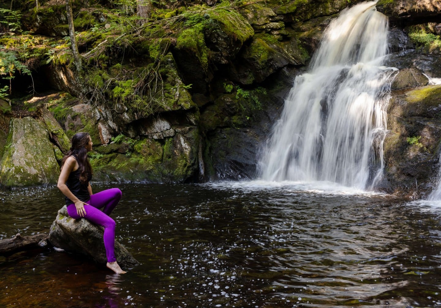
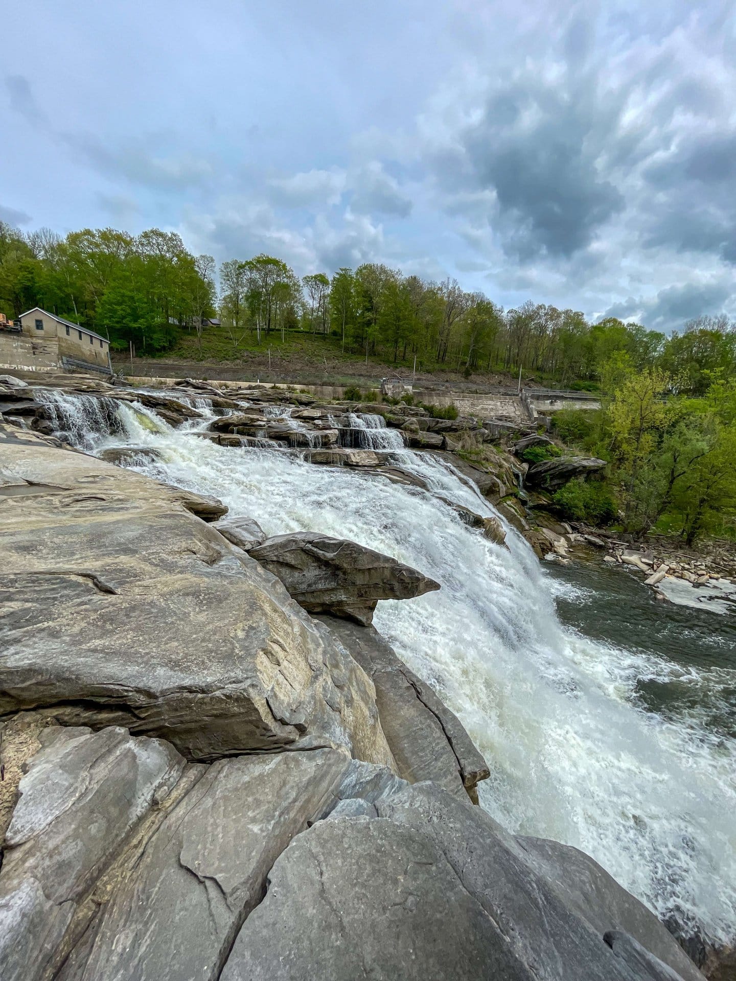
5. Kent Falls, Kent, Litchfield County
Come see Connecticut’s tallest waterfall! Kent Falls has multiple cascades and drops making the walk up alongside it a sight at the viewing platform. The trail is very kid friendly and accessible as it is part trail (natural ground) and part stairs, making the walk up non-technical. What is linked above is the red and yellow loop but I like just taking the red up on the right side of the falls until the top and then just coming back down that same way, finding new views of the falls that I want to stop and take photos at along each way.
HIKE TO: Kent Falls
TRAIL: Kent Falls Red Trail
WATERFALL HEIGHT: 250 ft total drop
SWIMMING: not possible/prohibited
MILES: .5 miles
ELEVATION GAIN: 125 ft
TIME: 30 min
DATE I WENT: 7/10/21
DIFFICULTY: easy
PARKING: very large lot, can be entrance fee for out of state vehicles
PERSONAL RATING: 5 ⭐️'S
6. Wadsworth Falls, Middletown, Middlesex County

The trail I linked above is the shortest way to the falls, it takes you right to a main parking lot where you have a super short walk to the falls. You can also choose to park at Wadsworth Falls State Park and take this 4-mile trail here but it is very hard to find the falls from this trail unless you are good at using AllTrails and following maps. 🙂 So, take your pick! You can even go to falls first with the shortcut I made and then go for the longer hike or vice versa. Depends on how much time you have.
HIKE TO: Wadsworth Falls
TRAIL: from parking lot
WATERFALL HEIGHT: 25 ft
SWIMMING: not possible/prohibited
MILES: .16 miles
ELEVATION GAIN: 16 ft
TIME: 10 min
DATE I WENT: 12/27/22
DIFFICULTY: very easy
PARKING: large lot
PERSONAL RATING: 4 ⭐️'S
7. Dean’s Ravine Falls, Falls Village, Litchfield County
This is a fun one that seems hidden in the woods yet right off of a somewhat busy road. The walk down to the falls (yes you will be walking down and then have a little climb on your way back!) can be a little rugged so I would wear boots that you don’t mind getting muddy and that have ankle support, AKA hiking boots! 🙂 There are some trees that have fallen in front of the main fall which makes it tricky to get close or get a good angle for photos but there’s lots to explore here and even some mini falls if you continue down the trail along Reed Brook.
HIKE TO: Dean's Ravine
TRAIL: Dean's Ravine Falls
WATERFALL HEIGHT: 50 ft
SWIMMING: not possible/prohibited
MILES: 1.2 miles
ELEVATION GAIN: 196 ft
TIME: 35 min
DATE I WENT: 11/12/22
DIFFICULTY: easy but rocky, wear boots
PARKING: just a couple spots along Music Mtn Rd
PERSONAL RATING: 3.5 ⭐️'S
8. Roaring Brook Falls, Cheshire, New Haven County
While this waterfall can be tricky to get pictures of (from top to bottom) but I gave it 4 stars because I really enjoyed the hike up and especially the little waterfall at the very top of this trail (make sure you keep going past the main falls!) called Upper Roaring Brook Falls. I enjoyed this upper, though smaller, waterfall even better than the main fall! If you wanted to get down closer to the base of Roaring Brook Falls be prepared for a slick and steep descent (not part of the trail). I didn’t chance it this time! Would love to come back here in the fall. 🙂
HIKE TO: Roaring Brook Falls
TRAIL: Roaring Brook Falls via Roaring Brook Road
WATERFALL HEIGHT: 80 ft
SWIMMING: not possible/prohibited
MILES: 1.2 miles
ELEVATION GAIN: 377 ft
TIME: 45 min
DATE I WENT: 1/4/23
DIFFICULTY: moderate
PARKING: spots along road at end of cul-de-sac
PERSONAL RATING: 4 ⭐️'S
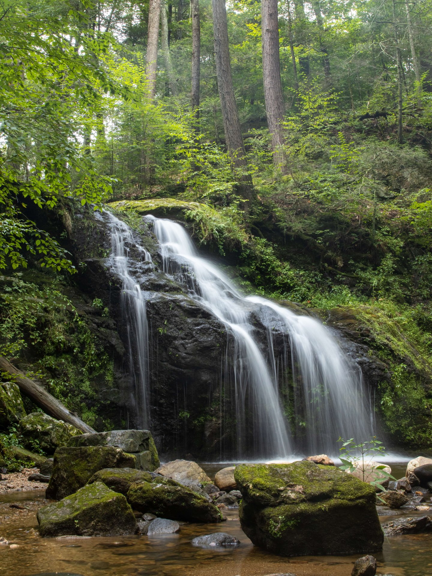
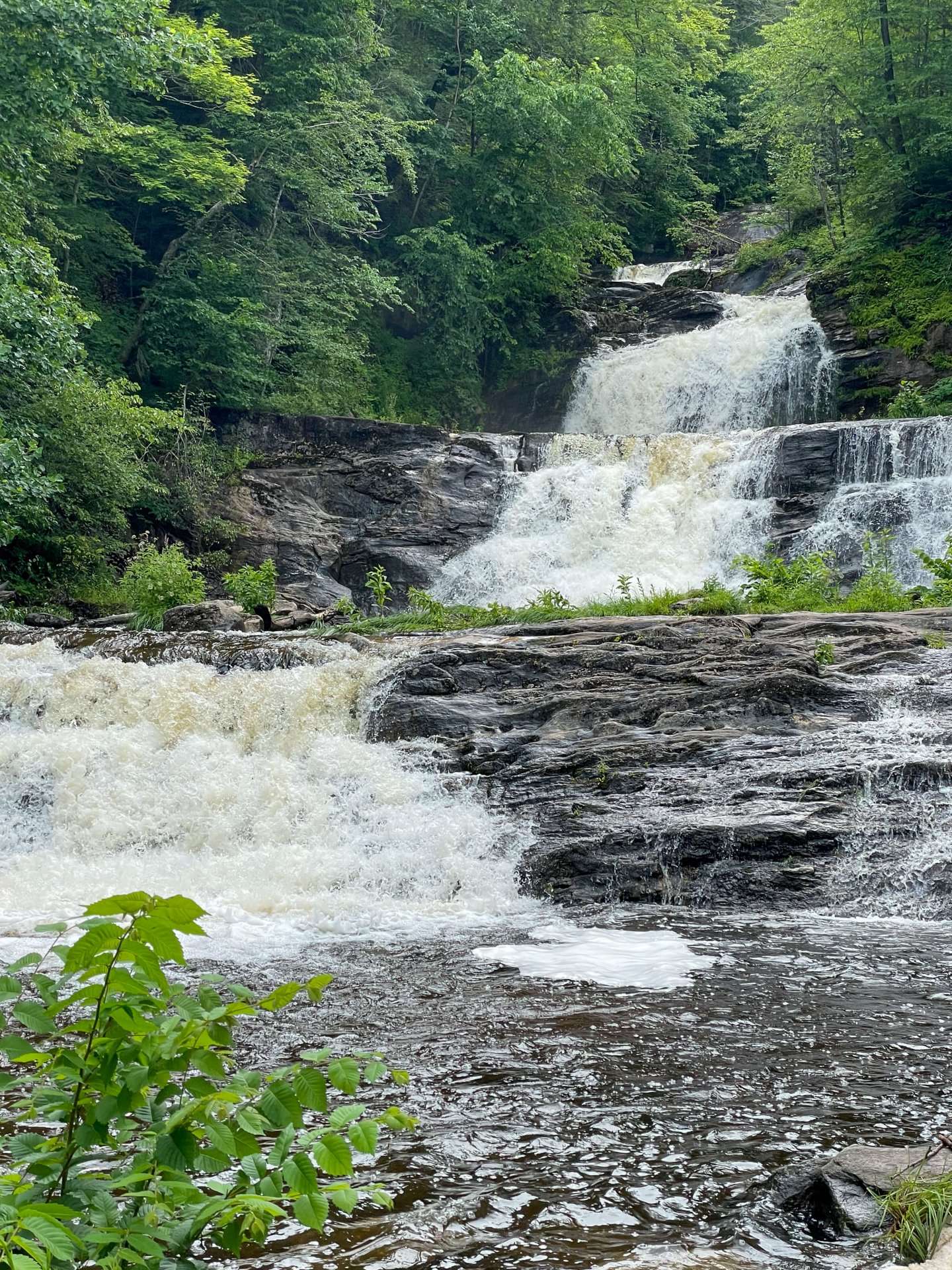
9. Chapman Falls, East Haddam, Middlesex County

This is a really pretty waterfall located in Devil’s Hopyard State Park on the eastern side of our state which I feel like I rarely venture out to! There are several other trails here in this park if you wanted to make a longer hike or day of it. As soon as you step out of your car it’s a beautiful setting with a covered bridge and brook. Picture opportunities abound in here!
HIKE TO: Chapman Falls
TRAIL: Chapman Falls Loop
WATERFALL HEIGHT: 60 ft
SWIMMING: not possible/prohibited
MILES: .4 miles
ELEVATION GAIN: 52 ft
TIME: 10 min
DATE I WENT: 5/8/22
DIFFICULTY: easy
PARKING: large lot
PERSONAL RATING: 4 ⭐️'S
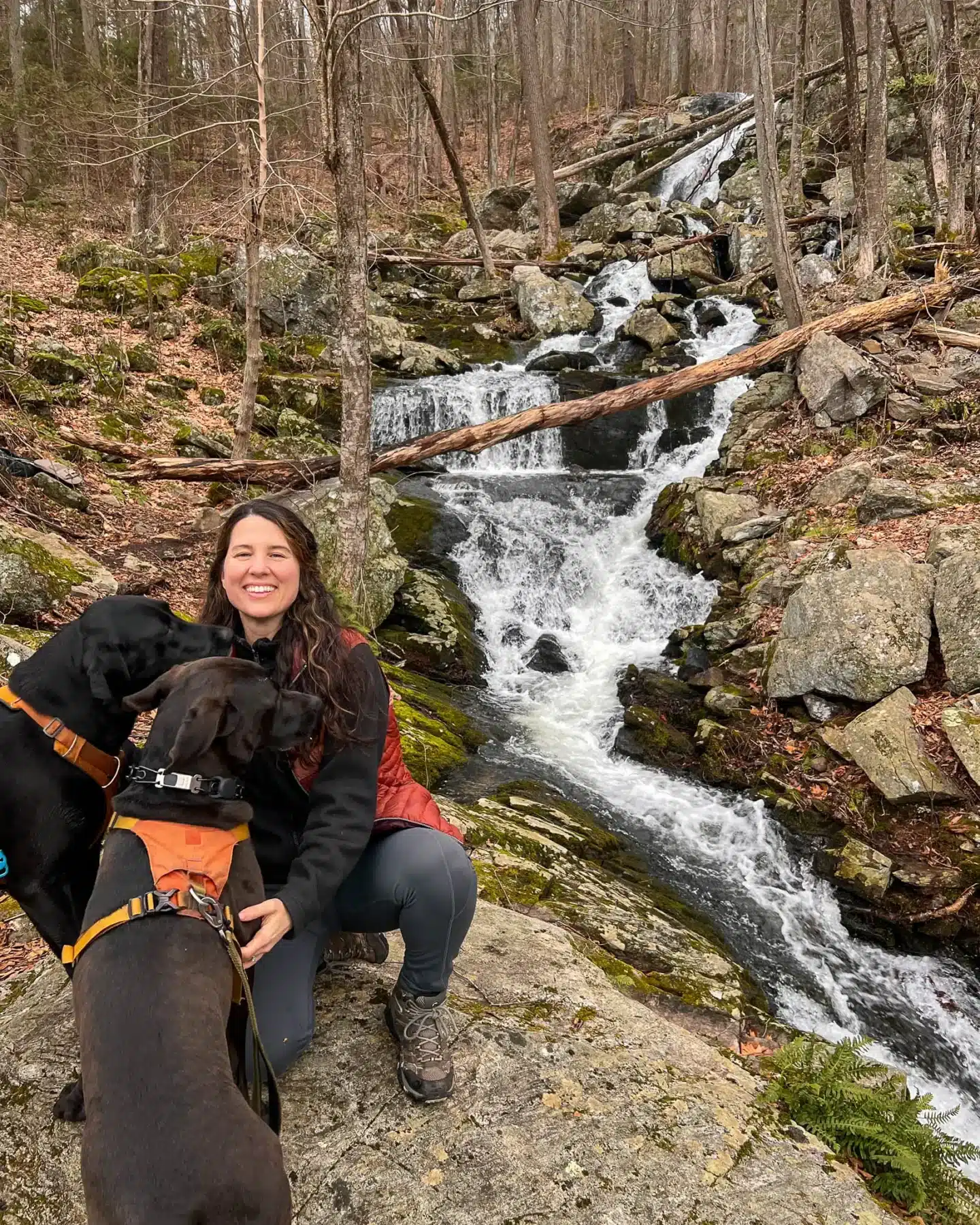
10. Westledge Trail Cascades, Simsbury, Hartford County
The hike to this magical little waterfall is only .25 miles but if you click the trail linked above in the title, you can hike for 3.4 miles total and see Pilfershire which is an abandoned town known as “the Lost Village” in Simsbury. I think the whole hike is worth it as you can find the abandoned foundations of the town once there and it can be fun to explore. I love the ledge that sticks out here by the waterfall that you can walk under! And be sure to check out Northgate Falls while you’re there, the description below in waterfall #11.
HIKE TO: Westledge Cascades
TRAIL: Pilfershire Abandoned Town Trail
WATERFALL HEIGHT: 8 ft
SWIMMING: possible
MILES: .25 miles
ELEVATION GAIN: 100 ft
TIME: 30 min
DATE I WENT: 1/21/23
DIFFICULTY: easy
PARKING: small pull off on Firetown Rd
PERSONAL RATING: 4 ⭐️'S
11. Northgate Falls, Simsbury, Hartford County
From the pull-off on Firetown Road walk directly across the street where you’ll see a trail into the woods. You’ll walk down a small but somewhat steep section to the base of the falls. I liked this waterfall but I probably wouldn’t make the trip just for this one and would tie it into the waterfall and hike linked in #10 above. 🙂
HIKE TO: Northgate Falls
TRAIL: small trail off of Firetown Rd
WATERFALL HEIGHT: 30 ft
SWIMMING: at base of falls only
MILES: .1 miles
ELEVATION GAIN: 50 ft
TIME: 10 min
DATE I WENT: 1/21/23
DIFFICULTY: easy
PARKING: small pull off on Firetown Rd
PERSONAL RATING: 3 ⭐️'S
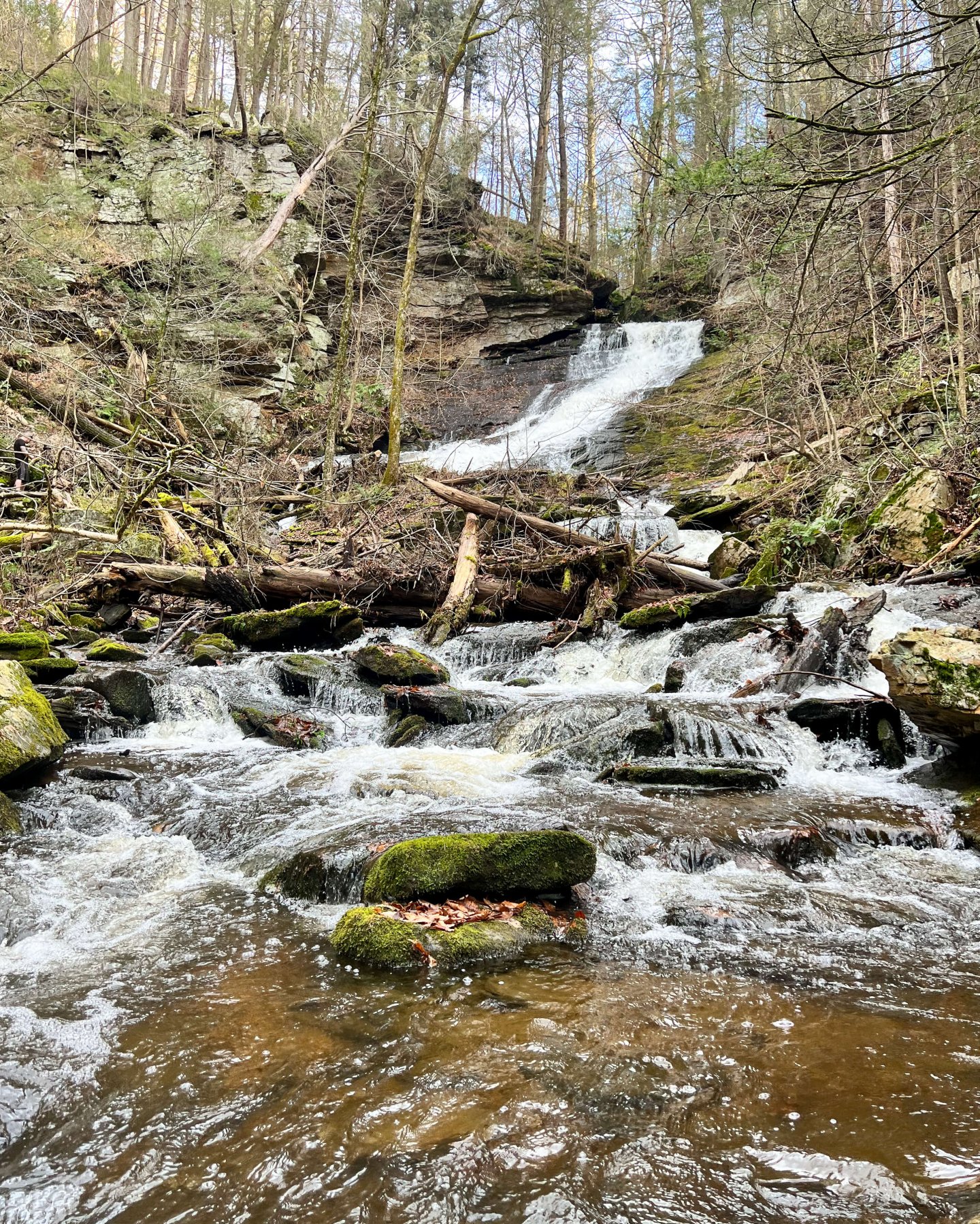
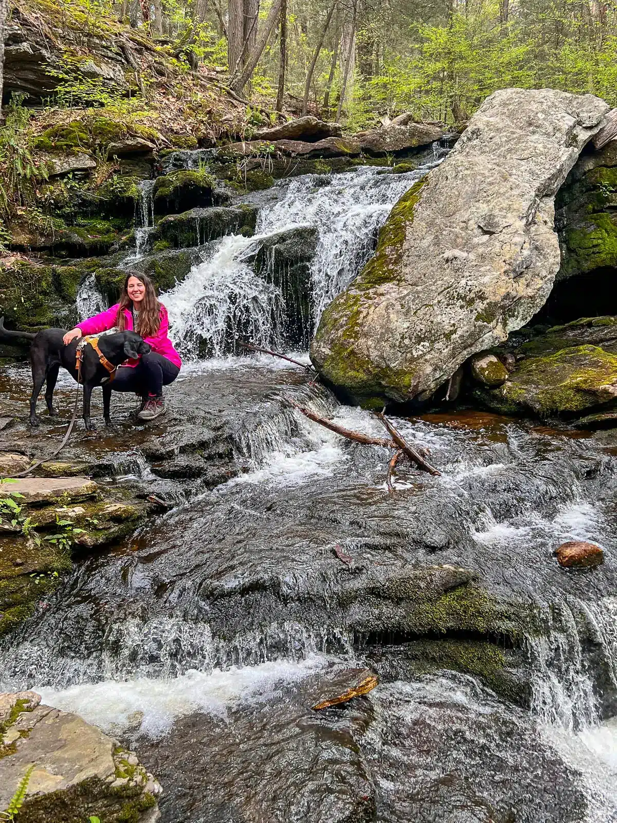
12. Carpenter Falls, McLean Game Refuge, West Granby Historic
Though tiny, I love this waterfall as it feels like a secret oasis in the middle of the woods. You would never know it’s back there! There’s a little walk to get to it but after some rain, it’s a beautiful little fall that’s worth the walk. Not to mention, McLean Refuge, where it’s located, has beautiful trails and is worth a visit even without a waterfall here! I loved the tunnel of trees during the hike on the way in along the trail. It can be tricky to get down to the base of this waterfall for pictures so bring some waterproof and nonslip boots if you want to adventure around! 📸
HIKE TO: Carpenter Falls
TRAIL: Carpenter Falls via Broad Hill Rd
WATERFALL HEIGHT: 18 ft
SWIMMING: not possible
MILES: 1.5 miles
ELEVATION GAIN: 242 ft
TIME: 45 min
DATE I WENT: 10/25/22
DIFFICULTY: easy
PARKING: large lot
PERSONAL RATING: 4 ⭐️'S
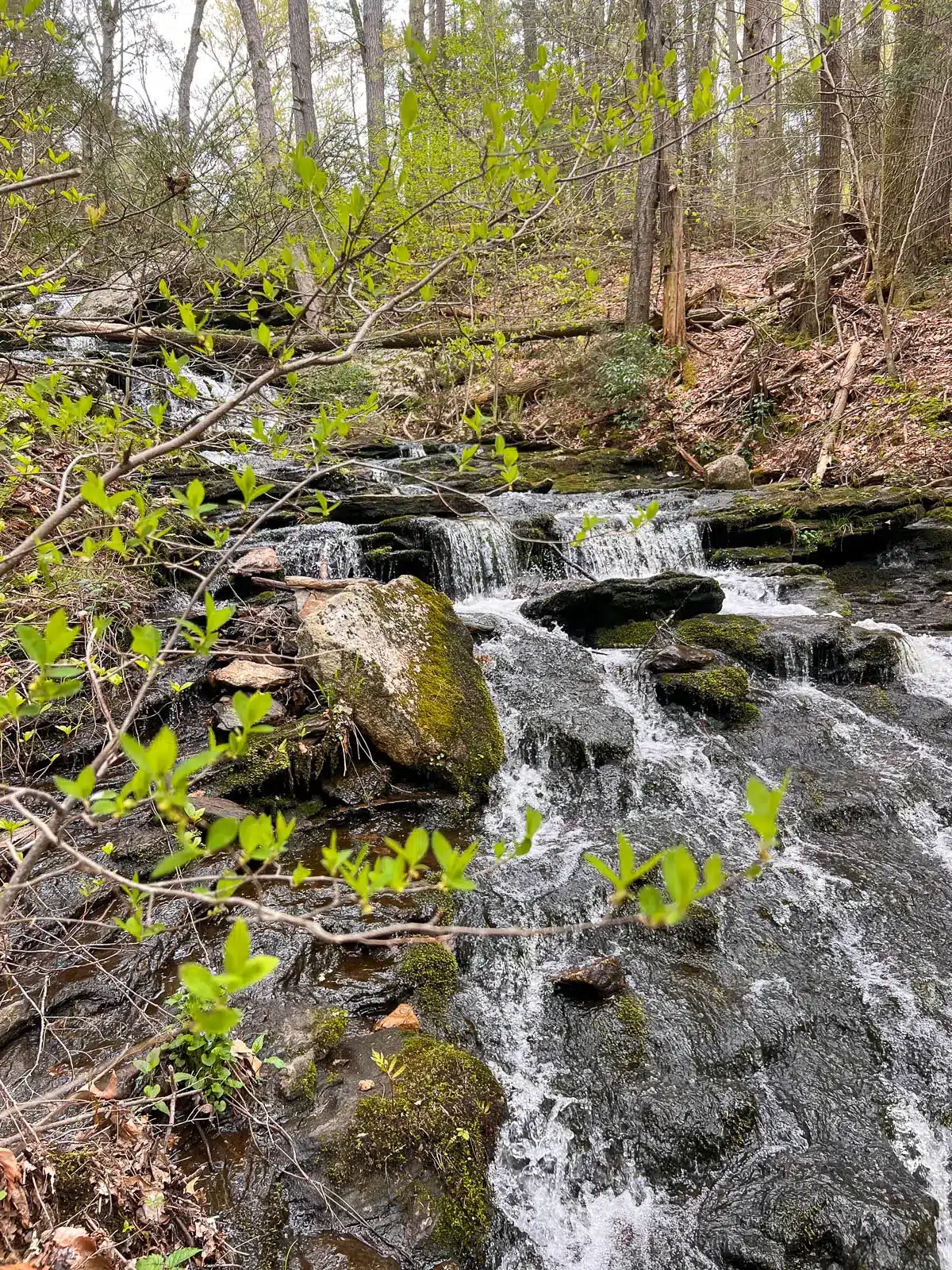
13. Cathles Trail Falls, West Simsbury, Hartford County
Note, the trail linked above is if you want to see the falls and do a full hike (3.5 miles total) with views along a ridge. If you want a shortcut trail to these falls (in under 1 mile) check out the second hike listed in my post here! These are really pretty after some rain and it’s a beautiful setting and hike if you decide to continue on.
HIKE TO: Cathles Trail Falls
TRAIL: Simsbury Land Trust Cathles South
WATERFALL HEIGHT: 60 ft
SWIMMING: not possible
MILES: .6 miles
ELEVATION GAIN: 100 ft
TIME: 20 min

DATE I WENT: 1/18/21
DIFFICULTY: easy
PARKING: parking along street at end of cut-de-sac
PERSONAL RATING: 4 ⭐️'S
14. Bull’s Bridge Falls, Kent, Litchfield County

Once again, the trail you click on in the title above is longer than it needs to be if you just want to hike in and see the falls and go back. Now, I guess I would call these cascades more than a single-drop waterfall but there are multiple options here. One; just after Bull’s Bridge (covered bridge) there is a little trail to the right that offers a view of part of Bull’s Bridge Falls. You can check it out and then continue on the trail linked above which will have you walking along a beautiful path with the Housatonic River and cascades all along your left. As you hike in (particularly during winter or early spring when there are no leaves) you will have a beautiful view of several small cascades alongside you. I like to walk up until the bridge (1 mile in) that goes over the river which at that point I turn back! It makes for a beautiful little hike.
HIKE TO: Bull's Bridge Falls
TRAIL: Appalachian Trail
WATERFALL HEIGHT: 15 ft
SWIMMING: not possible/prohibited
MILES: as long as you want it to be!
ELEVATION GAIN: open
TIME: open
DATE I WENT: 4/10/22
DIFFICULTY: easy
PARKING: medium lot
PERSONAL RATING: 4 ⭐️'S for the setting
15. Buttermilk Falls, Plymouth, Litchfield County
I like this one, it’s a beautiful waterfall, I just don’t really like how you have to access it. 🤔The parking is along a steep neighborhood road and then there is a trail into the forest that you follow to the thundering Buttermilk Falls. You can get some great photos here I would just prefer to go with a friend rather than alone though I’m sure it’s a safe location. Unlike Carpenter Falls in Norfolk, it’s not where I would come to find some peace on my own given the proximity of the neighboring houses! But that’s just me. 🙂 It’s definitely worth a visit though and I’d love to come back for some better pictures of it!
HIKE TO: Buttermilk Falls
TRAIL: Buttermilk Falls Trail
WATERFALL HEIGHT: 55 ft
SWIMMING: not possible
MILES: .6 miles
ELEVATION GAIN: 114 ft
TIME: 25 min
DATE I WENT: 12/3/22
DIFFICULTY: easy
PARKING: pull off alongside road
PERSONAL RATING: 3 ⭐️'S
16. Blackledge Falls, East Glastonbury, Tolland County

What a pretty set of falls! Blackledge Falls is located alongside the 1,500+ acres of Gay City State Park. If you’d like to explore more of this park check out this 5+ mile loop in Gay City State Park that takes you by the falls and the ruins and Gay City Pond. There are actually three different 25-foot drops of water here but depending on recent rainfall you might just see the middle, most prominent one. There are plenty of spots in the lot and arriving here on a Saturday morning aroound 9am we only saw two other people. There’s a tiny bit of uphill walking to get to the falls but it is a very easy and non technical trail. You’ll drop down into a little ravine where the waterfall which feels very private, surrounded by trees.
HIKE TO: Blackledge Falls
TRAIL: Blue and White Trails Loop in Gay City State Park
WATERFALL HEIGHT: 25 ft
SWIMMING: not possible
MILES: 1.1 miles
ELEVATION GAIN: 177 ft
TIME: 40 min
DATE I WENT: 9/16/23
DIFFICULTY: easy
PARKING: parking lot off Rt 94 Hebron Ave
PERSONAL RATING: 3.5 ⭐️'S
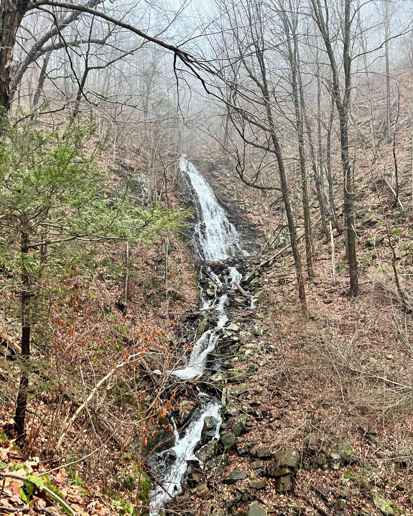
17. Prydden Brook Falls, Newtown, Fairfield County
A true waterfall hike! I loved this 3.3 mile round trip walk to Prydden Brook Falls. You’ll hike the popular Zoar Trail which runs right alongside the Housatonic River the whole time. A bonus about going in the spring is you can still see through all the trees with the leaves and have views of the river almost the whole time as you hike. This is definitely a lesser-known waterfall in CT. It’s a worthwhile and beautiful hike as it is and the waterfall at the end is like a big bonus!
HIKE TO: Prydden Brook Falls
TRAIL: Zoar River Trail in Paugussett State Forest
WATERFALL HEIGHT: 40 feet of cascades down to Housatonic River
SWIMMING: no
MILES: 3.3 miles
ELEVATION GAIN: 403 ft
TIME: 1 hr and 30 min
DATE I WENT: 3/9/24
DIFFICULTY: moderate
PARKING: parking lot at end of Great Quarter Rd in Stevenson, CT (neighborhood of Newtown)
PERSONAL RATING: 4 ⭐️'S
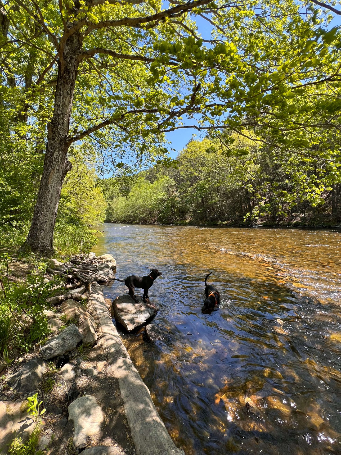
18. Day Pond Falls, East Hampton, Middlesex County
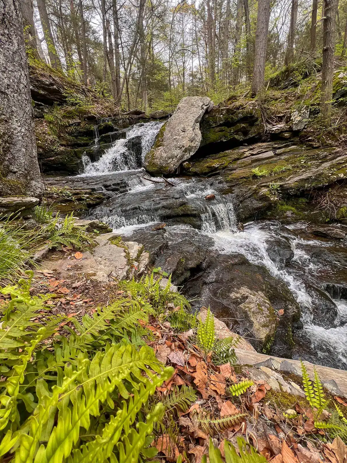
Nestled within the serene Day Pond State Park, adjacent to Salmon River State Forest, Day Pond Brook Falls offers a true hike as it’s 2 miles in and 2 miles out.
I love that there are plenty of water spots for the dogs as you walk along Day Pond Brook and then the Salmon River!
The falls meander through a forested landscape, featuring a mix of plunges, cascades, and horsetails, creating a picturesque setting that’s especially vibrant during the spring and fall seasons. A notable feature is a large boulder leaning against one of the middle falls, adding a unique touch to the scenery.
HIKE TO: Day Pond Brook Falls
TRAIL: Day Pond to Salmon River Trail
WATERFALL HEIGHT: 40 feet of cascades, tallest drop ~10 ft
SWIMMING: no
MILES: 4 miles
ELEVATION GAIN: 613 ft
TIME: 2 hrs
DATE I WENT: 5/5/24
DIFFICULTY: moderate
PARKING: large parking lot on Day Pond Rd
PERSONAL RATING: 4 ⭐️'S
🩷I hope you enjoyed this list of 18 waterfalls in CT! I am in the process of collecting more so bookmark this page for future reference.
And be sure to wear a pair of sturdy waterproof hiking boots when you visit so you can explore freely!
💗Thanks for reading this far! 🙂 As a bonus – here’s a link to FIVE secret (lesser-known) waterfalls in Connecticut! 💗

Other posts you might enjoy! ⬇️❤️
9 Best Hikes in Connecticut with Water Views
Top 21 Best Waterfall Hikes in New England and New York


First of all love your website and curosity. You forgot to add the Indian Well waterfall. This waterfall falls into the most enticing Well that I have seen of any waterfall in Connecticut
Thanks so much, Bradley!! I’m so glad you enjoyed this CT waterfall post and I will have to put Indian Well on the list! Thanks for giving me a new idea! 🙂
Nice article
Wow, thank you so much!! 🥹👏
Thank you so much! Glad you enjoyed it 😍👏
Good post
Wow, thank you so much!! 🙂 Let me know if you have any questions along the way and happy fall hiking! 😊🥾🐿
I could not resist commenting. Perfectly written!
Look at my web site; https://Telegra.ph/Playson-and-its-gaming-machines-12-25
Hi,
We’ve built an AI-powered chatbot based on your website content. Can we send it over?
Best,
Cliff Simon
(516) 518-4680
P.S: We can also turn your website into a robust lead gen machine by sharing 2 more tools that you can install yourself.
Just wanted to say that I love your content. Keep up the good work.
My friend Jordan from Thailand Nomads recommended your website to me.
Cheers,
Virginia
That is so kind!! Thank you, Virginia :))) Means a lot!!
I saw something wrong with your Google Map listing, is this a good place to send a report of the issues I found?
Hello! What Google Map are you referring to?
Good content
That’s very kind!! Thank you so much for the comment & encouragement :))