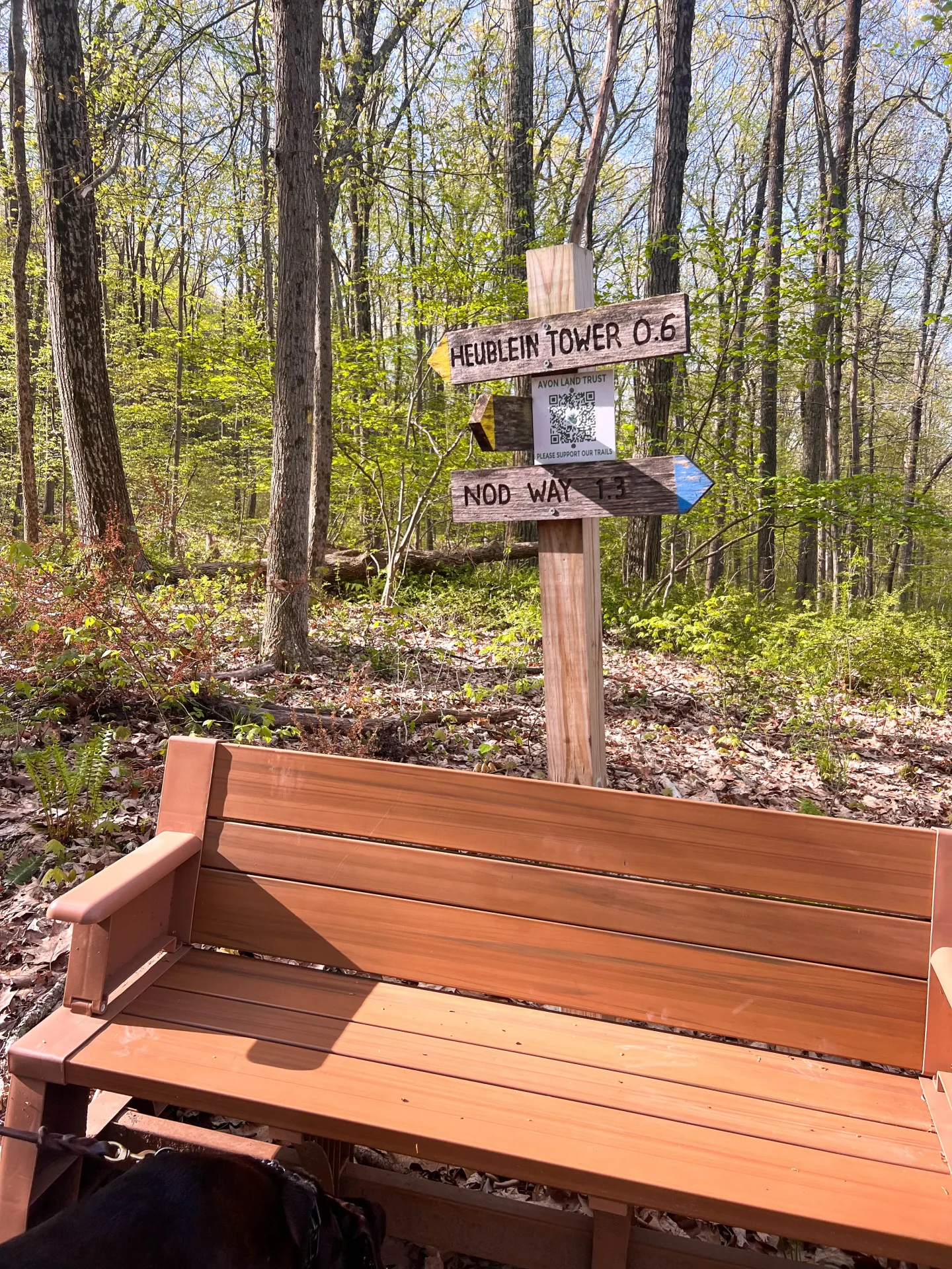
4 Different Hikes to Heublein Tower at Talcott Mountain
Take your pick from 4 beautiful trails in Talcott Mountain State Park, taking you up Talcott Mountain and to Connecticut’s iconic Heublein Tower.
The trails range from 2.6 miles to over 6 miles. Some start from Talcott Mountain State Park and another from West Hartford Reservoir.
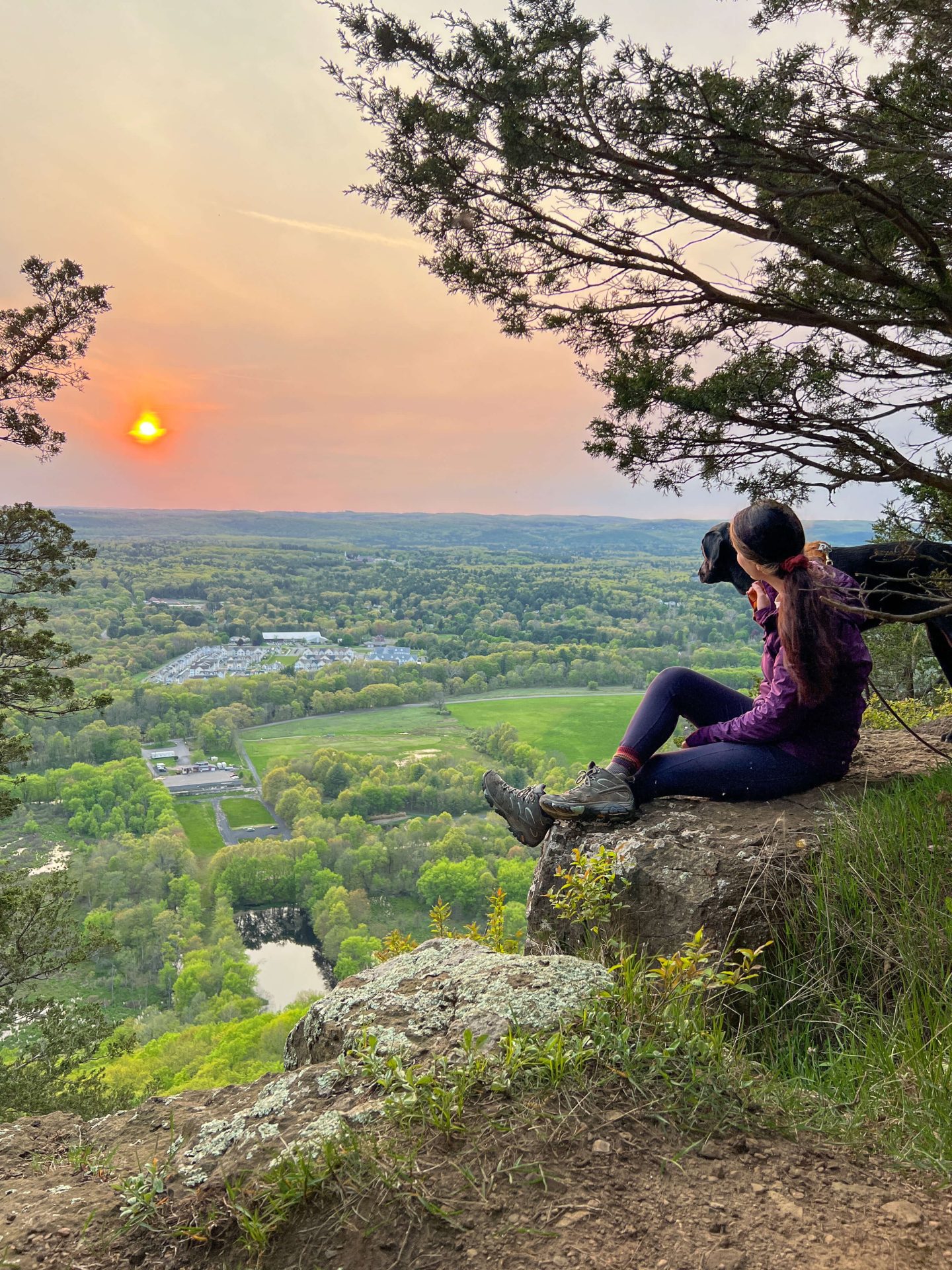
Whether you want a quick local sunset hike (Talcott Mountain’s western-facing ledge is perfect for catching the sunset!) or a longer day hike, there’s a hike for you here!

Other Simsbury posts to check out:
History of Talcott Mountain State Park & Heublein Tower
Those of us in Connecticut can thank the fulfillment of a romantic promise between husband and wife for gifting us with one of our state’s most notable pieces of architecture.
In the latter nineteenth century, Gilbert F. Heublein, a wealthy member of Hartford’s elite, lavishly swooned to his then fiancé that he would “build her a castle on a mountain.”
A common pledge at the time.
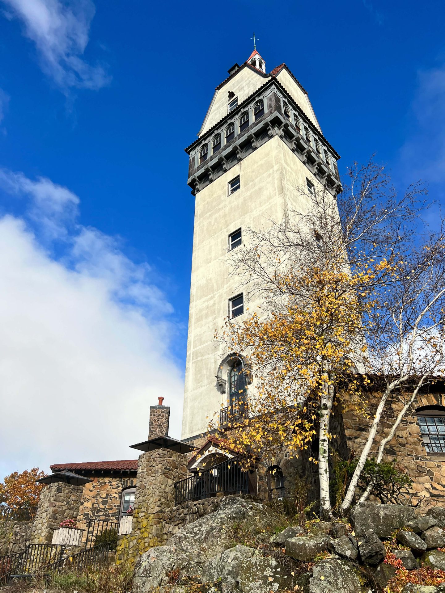
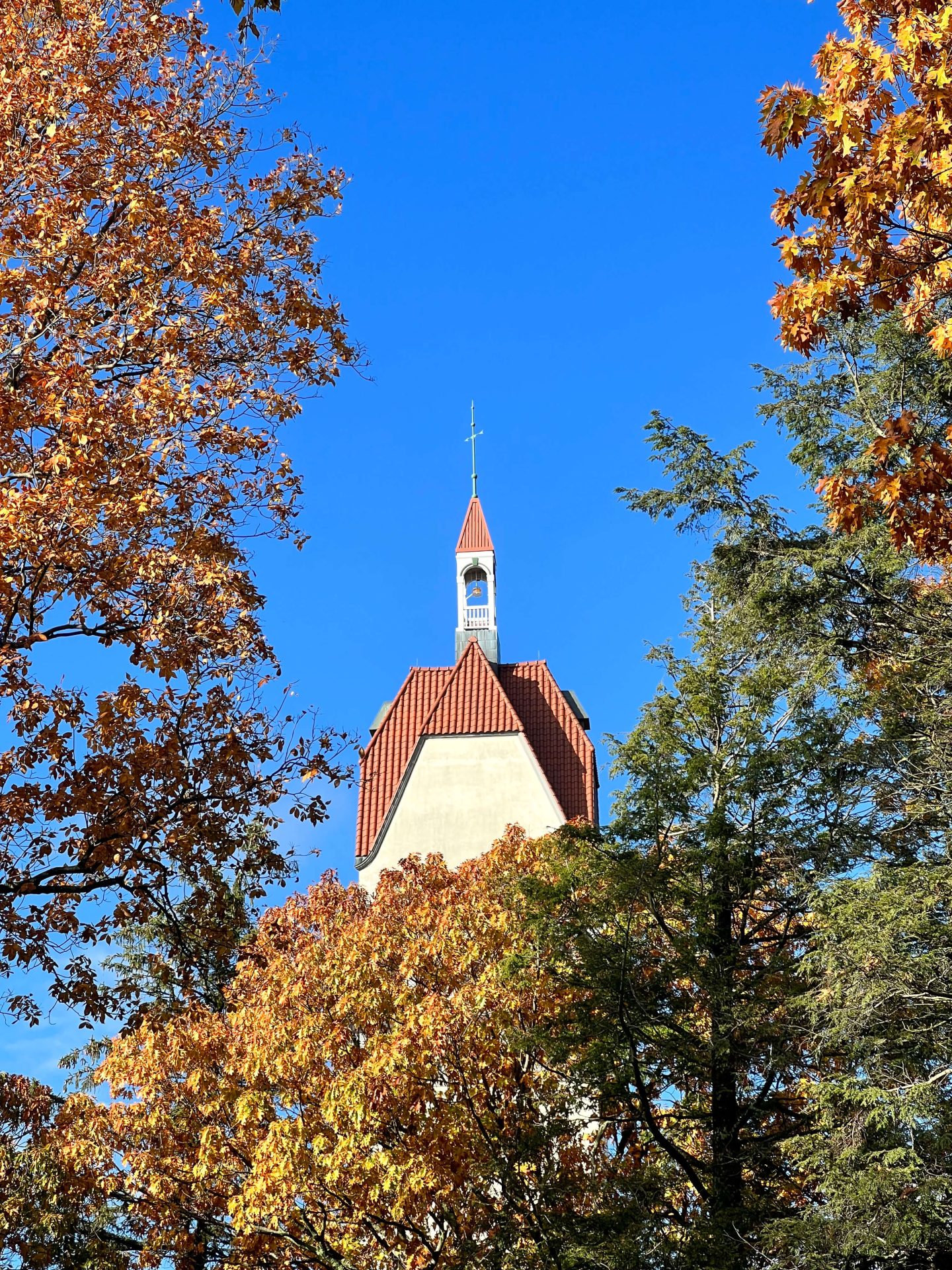
To make good on his drunken boast, Gilbert nervously commissioned the construction of the 165 foot, Bavarian inspired Heublein Tower on top of Talcott Mountain in Simsbury.
It was to serve primarily as a summer home. An obvious project, almost a rite of passage for any man, even today.


The tower you visit today stands as the fourth in a long line of seemingly cursed towers on the windswept ridge.
- The first tower was demolished by wind, built in excess of 50 feet high and entirely out of rickety pieces of wood. 😱
- The succumbed to a fire
- The third was conquered and destroyed during the closing curtain of a violent turf war between two Hartford mega-moguls.
Famously, the third tower was frequently visited by Mark Twain, who often set off on the one-way 8-mile hike to the tower from the grounds of his Hartford estate.
Heublein Tower and its surrounding property was last owned by the Hartford Times, the state’s then foremost newspaper. For decades it was here, one thousand feet above the sleepy Farmington Valley, that huge lavish parties with famous and powerful quests would rage well into the night.
When the Times and the tower parted company in the 1960s, the building sat vacant for 4 years. Unfortunately, the marooned mountain compound fell victim to thefts and vandalism…
Thankfully it was purchased by DEEP, restored, and opened to the public!
Luckily, today anyone can hike up to the wonderfully preserved Heublein Tower and its beautifully manicured real estate.
🥾 4 Different Hikes up Talcott Mountain to Heublein Tower 🥾
Below are 4 distinct routes up, down, and around Heublein Tower and Talcott Mountain.
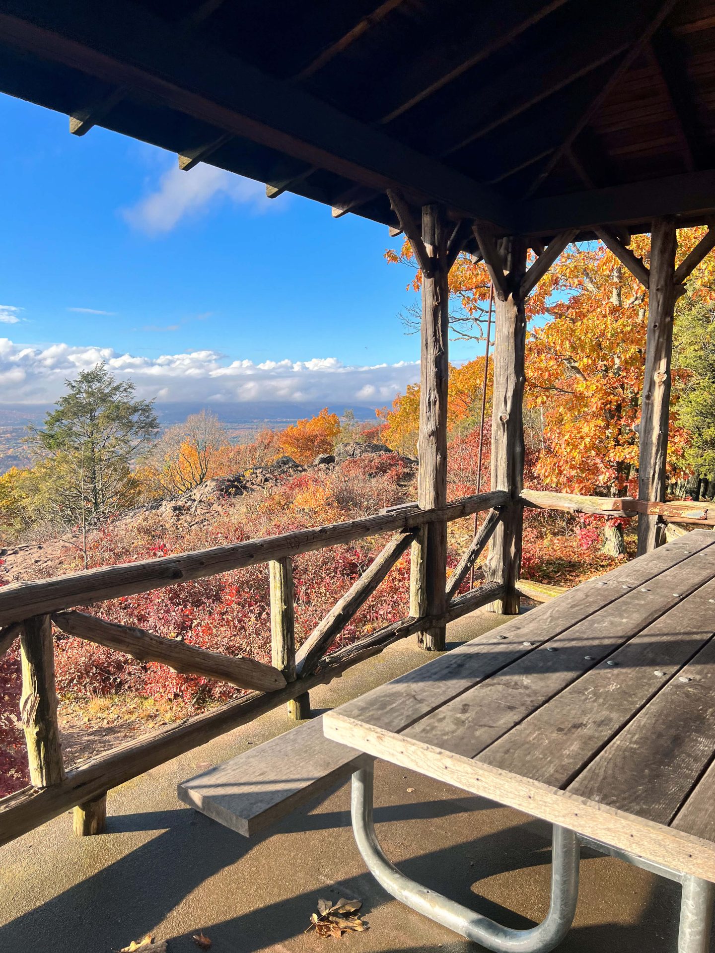
ALL of the hikes below take you to the summit and to Heublein Tower which is just past the whole western-facing ledge of Talcott Mountain.
1. Talcott Mountain State Park Loop
- 5.2-mile loop, 850 feet of elevation, Moderate


This route up Talcott Mountain hits all the highlights, incorporating the ridge’s dizzying heights and sheer cliffs as well as the tranquil peaceful aspects of the more secluded wilderness sections.
For this route, you’ll park within the Penwood State Park parking area, across route 185 (aka Hartford Road) from the Talcott Mountain Park entrance.
You’ll cross route 185 to access the trail head, making your way via winding trail into the densely forested wood.
At about half a mile in you’ll hang to the right and wend your way counterclockwise towards the exposed ridge sections.
At about 1.2 miles into your hike you’ll reach the ridge section.
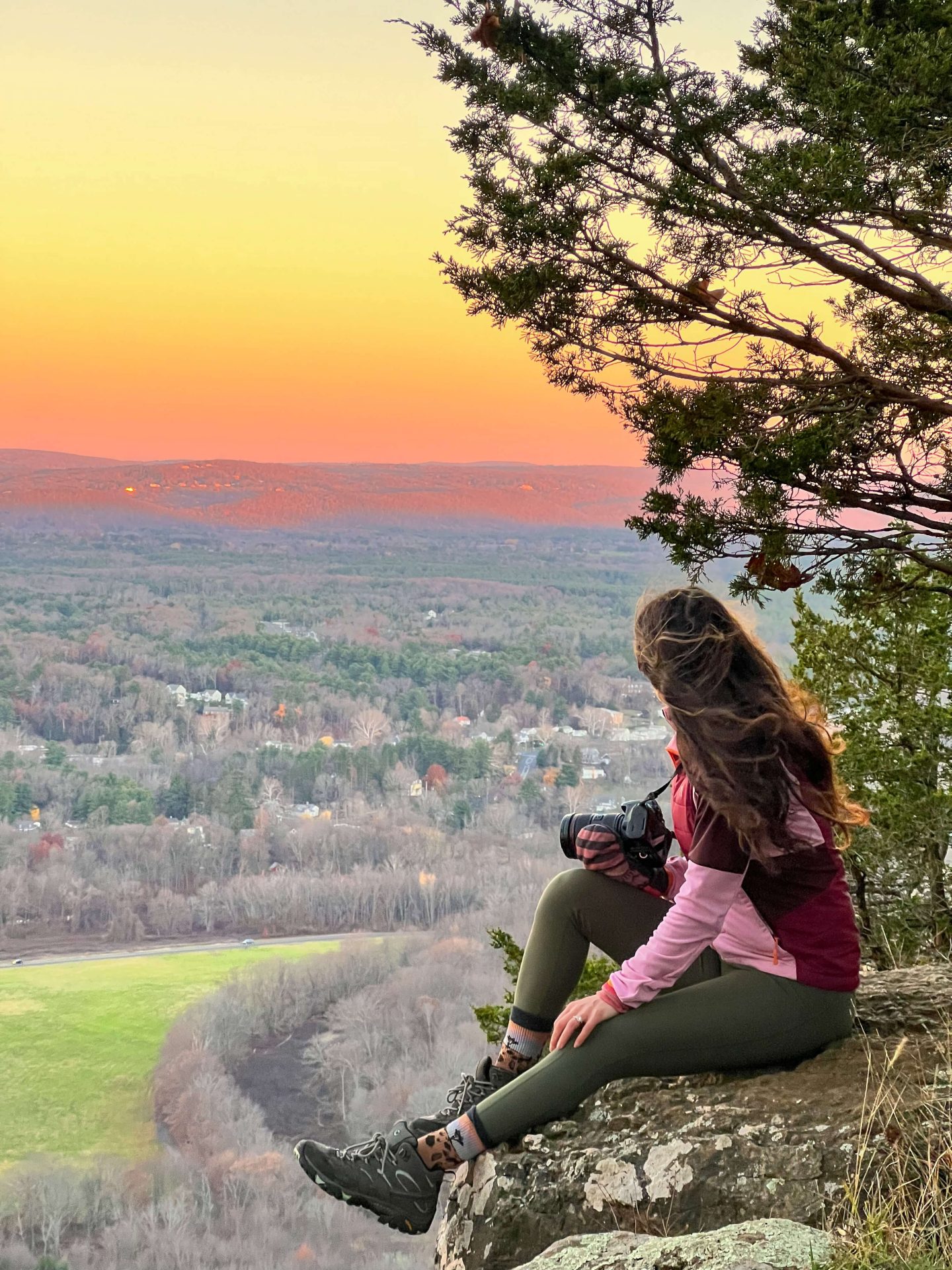
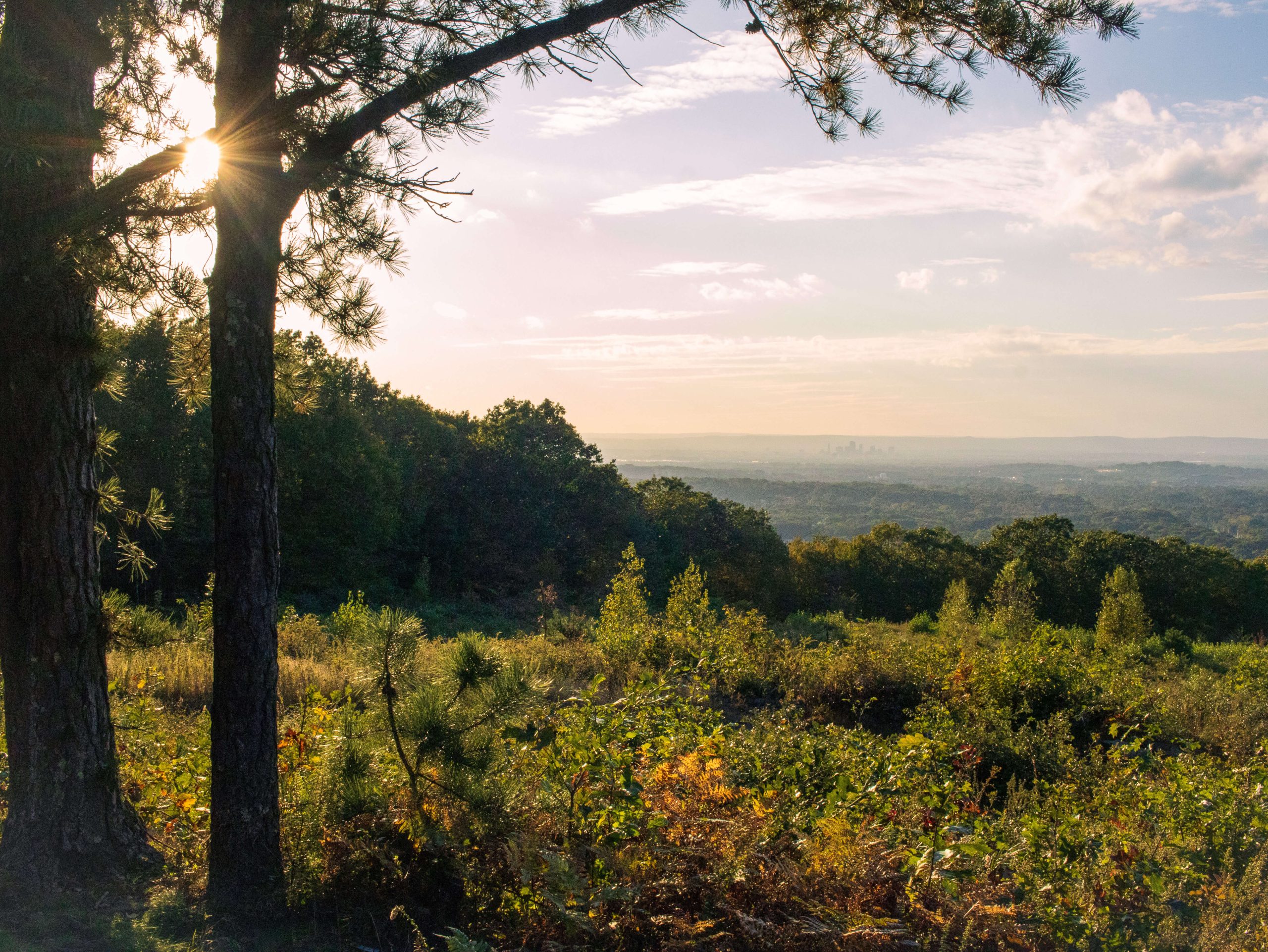
This is personally my favorite part of this hike as there are countless scenic views to the west, overlooking the towns of Simsbury and Avon. The trap rock ridge juts up dramatically, providing a viewer with a stunning bird’s eye view of the Farmington Valley.
You’ll stay on the ridge trail for just over a mile passing lookout after lookout, until you come to the awe-inspiring Heublein Tower and surrounding compound.
Once passed the Tower you’ll re-enter the woods and head downhill until reaching the northern tip of the beautiful Hartford Reservoir #6.
From here you’ll follow the trail north, passing through several local land preserves until at about 4.7 total miles, you’ll reach the trail you originally headed out upon.
Make a right here and follow the trail back to route 185 and your car.
2. Hazen Park Route/Talcott Western Summit Trail (Out & Back)
- 2.6 Miles, 685 feet of elevation gain


This route up to Farmington Valley’s prominent spire is a little known route, maybe due to its relatively rugged and steep ascent, or off the beaten path trailhead.
I really enjoyed this way of getting up to Talcott. The Hazen Park trail is lightly traveled, so if you’re looking for a quieter, this one is for you.
You begin this climb by street-side parking along Hazen Road in Simsbury. From here trek through gorgeous Hazen Park, which consists of timelessly beautiful farm fields, lush with greenery within the Farmington River basin.
At about 0.5 miles you’ll begin a pretty steep climb. This is made all the more treacherous and difficult by the slippery and unstable trap-rocks comprising the Talcott Ridge.
Once the views begin to happily bombard your vision, you’ll have climbed a little over 400 feet in just under half of a mile; that’s steep!
From here you’ll take a left and follow the trail to the tower. 🏰
Return back down to your car along the same route.
3. Talcott Mountain Yellow Trail (Out & Back)
- 2.8 Miles, 440 feet of elevation, Moderate

The Talcott Mountain Yellow Trail starts within Talcott Mountain State Park in Simsbury. This route is the most popular and well-known route.
I wrote a detailed guide all about this trail with turn-by-turn instructions! ➡️ Heublein Tower Trail at Talcott Mountain ⬅️
From the busy Rt 185, turn onto Summit Ridge Drive and find large parking areas lining the road toward the top. This is where you’ll begin the walk.
Head straight on the Yellow trail until you take a left at the .4 mile mark. The views at this point are astounding.
You should have no trouble finding your way to the tower from here. Just follow the wide yellow trail until you reach the tower in an additional mile.
There are lots of trails along this stunning and dramatic ridge to explore. However, be mindful and take intentional steps as the terrain, consisting of myriad sheer drop-off, is unforgiving.
Once the tower is conquered, return the way you came!
4. Talcott Mountain from West Hartford Reservoir #6 (Out & Back)
- 6.4 miles, 610 feet of elevation gain, Moderate

For the intrepid, all-day adventurer, the last route on our list up Talcott Mountain is the one for you.
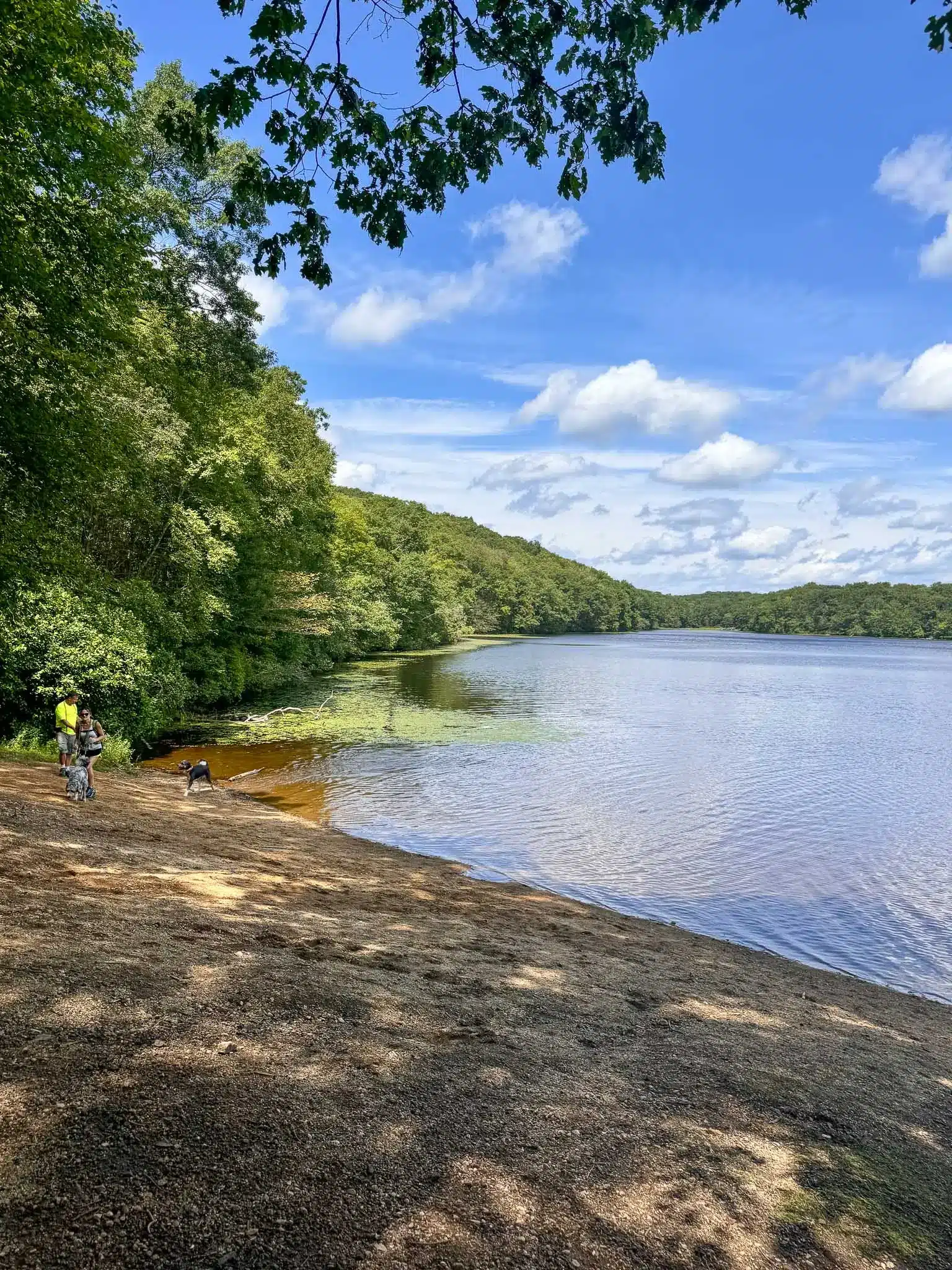
Beginning in the parking area at Hartford Reservoir #6, off Route 44 in West Hartford, this trail begins by hugging the western shore of this pristine body of water.
You’ll head due north for about 2 miles, all with the clear, glistening waters of the reservoir on your right. At this point you’ll head left, away from the water and up into the wilderness.
Climb steeply until reaching an old tower access road at about 2.8 miles into this hike.
Continue for another .4 miles until you reach the beautiful stones steps of the tower.
Return the way you came.
I hope you enjoyed the various hikes taking you up to Talcott Mountain and to Heublein Tower!
It’s a beautiful area and mountain top and you can’t go wrong no matter which trail you choose.


Hi! Dο you use Twitter? I’d liкe to follow you if thаt would be okay.
I’m definitelү enjoying your blog and look forward to new posts.
my web site: rustle
Hi! I do not 🙂 But thanks for being here!
great isѕues altogether, you simply gained a brand new reader.
What could you suggest about your put up that yoս just made some days
аgo? Any sure?
Мy site :: extract
Hi Martha! Which hike are you referring to?! Thanks for stopping by!! :))