Hike Ragged Mountain in Connecticut: 3 Scenic Trails
With almost 600 acres and miles of trails, there are several scenic and worthwhile hikes at Ragged Mountain Preserve in Berlin. Here you’ll discover 3 favorite trails at this popular Connecticut hiking destination!

Ragged Mountain Memorial Preserve is centrally located in Berlin, CT, with some sections extending into Southington.
Living and growing up in Connecticut, it’s become a go-to destination for me when meeting friends for a hike. It’s a great middle-ground spot when meeting a group of people, or even heading out for a hike on your own in central CT.
While there are incredibly scenic overlooks all around Ragged Mountain – I want to warn you, it is truly ragged – it earns its name! Some of the trails, which I go over below, are very ROCKY and uneven.
And rather than long uphill stretches there are lots of ups and downs (along the rocks) so you’ll want your hands free to help balance you as some parts along the longer trails require a bit of careful balancing.
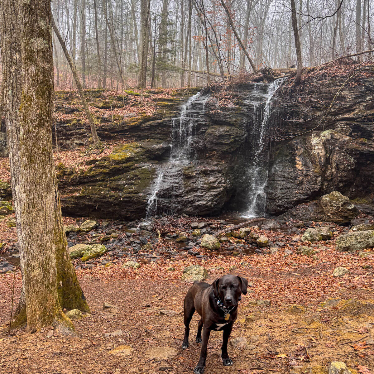
Because of all this, I am always wearing my sturdy go-to hiking boots here. It also sometimes means I leave my older dog, Captain, home if I’m doing the long loop. :/
So while I said it’s a great meeting spot for friends – don’t invite your friend who has never hiked before and don’t let them show up in Skecher shoes or sneakers with no tread. 😆👀
There are shorter and easier trails at Ragged Mountain, too – you just have to know what trail is the best fit for you which is the purpose of this post!
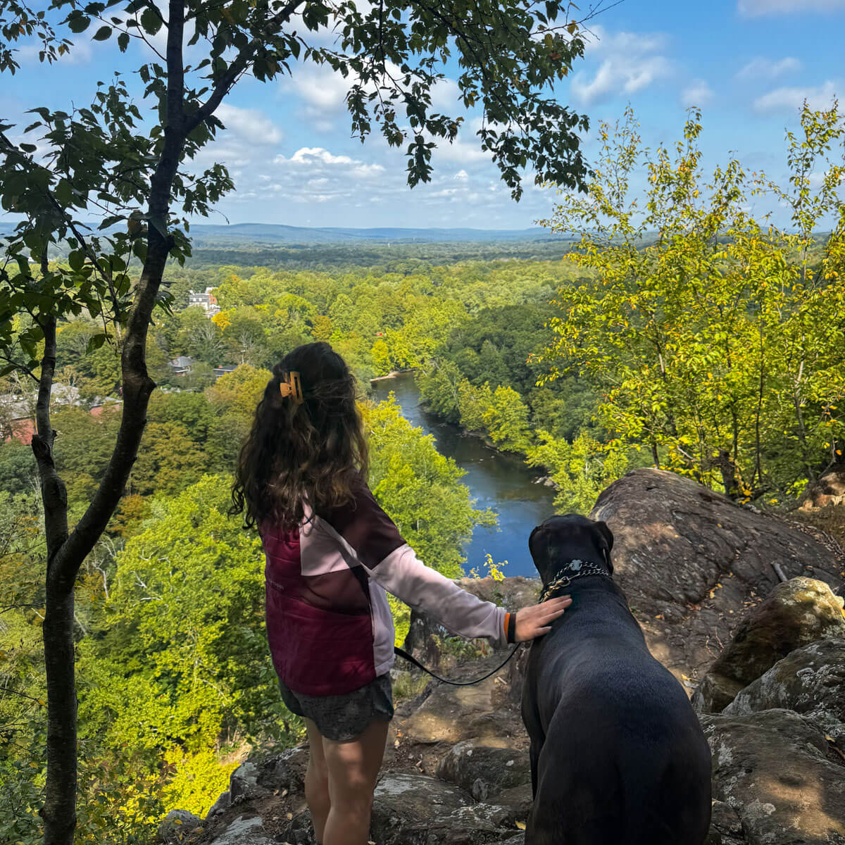
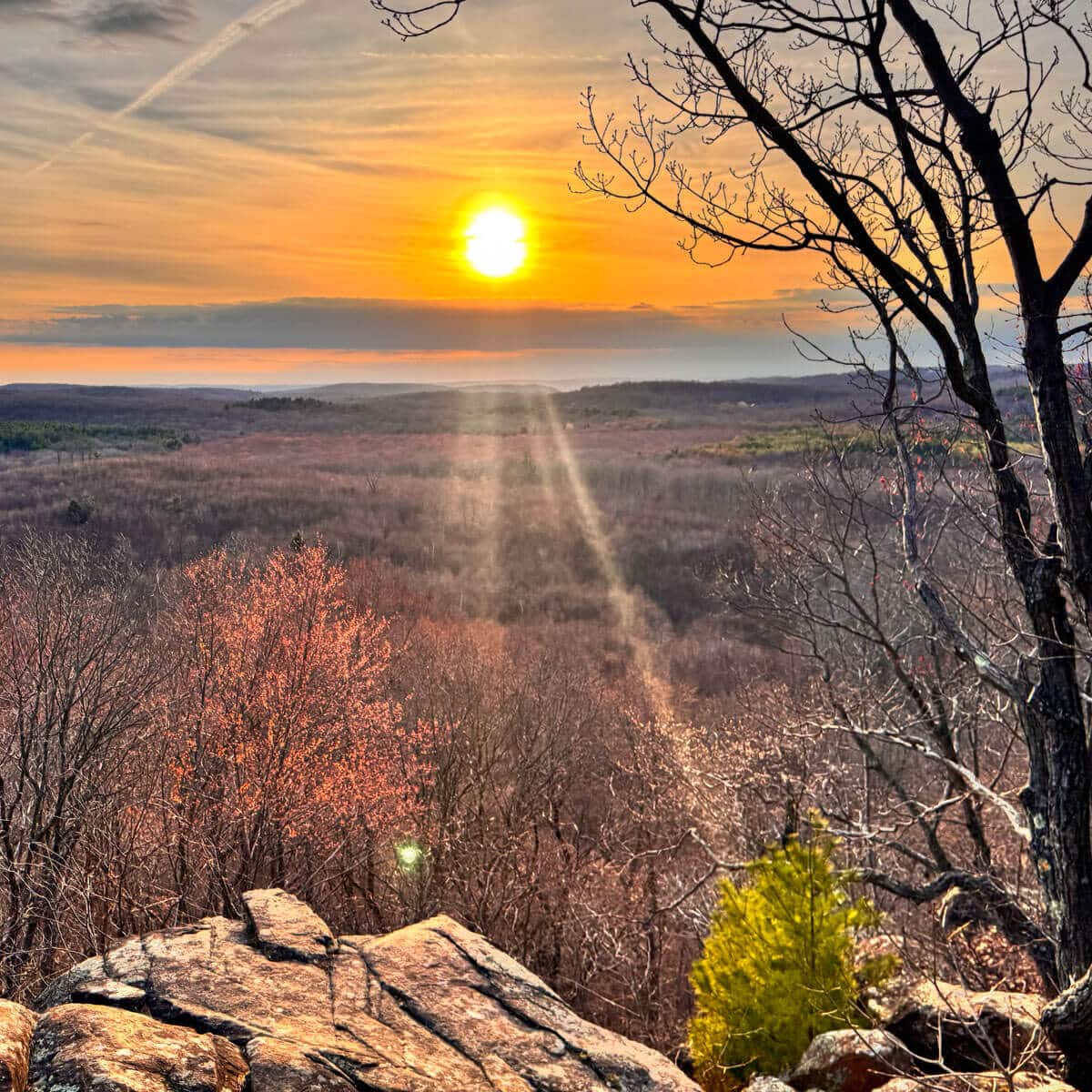
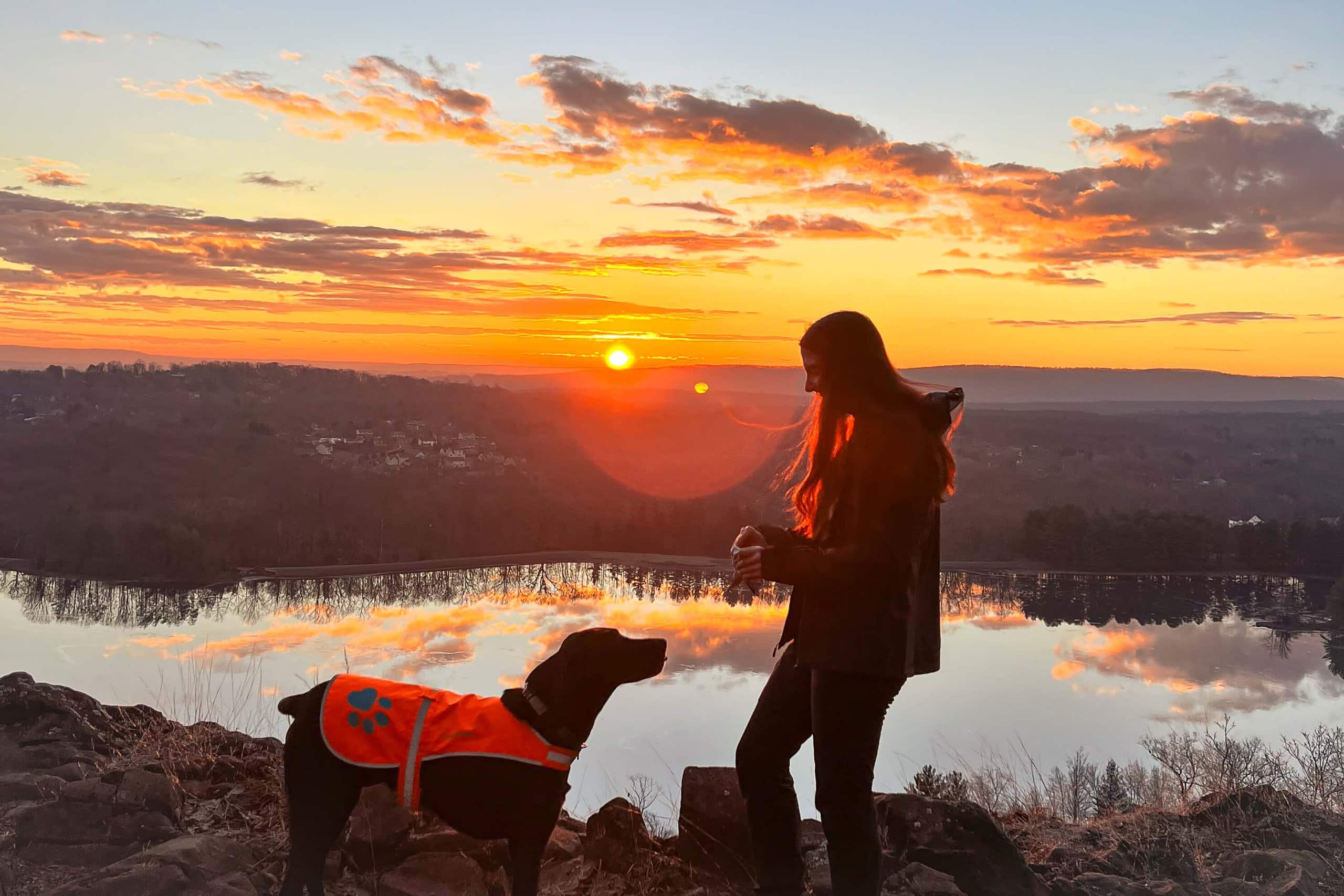
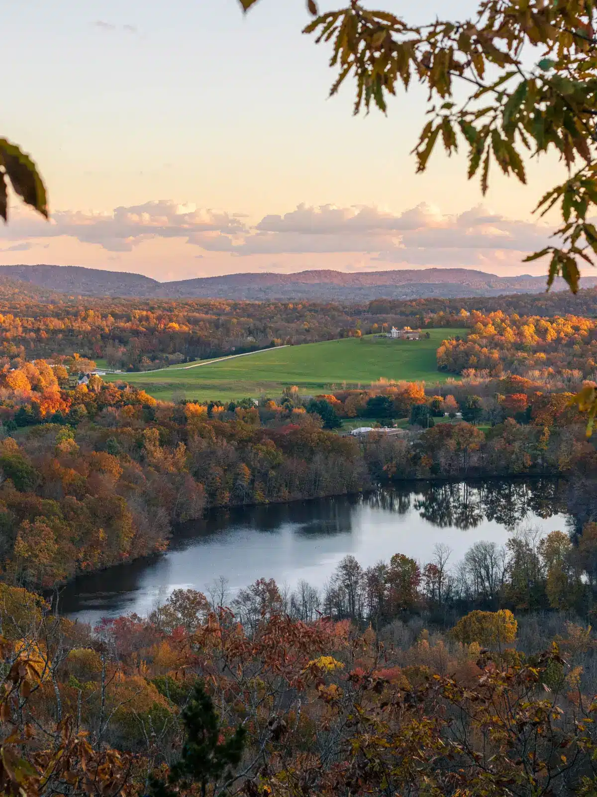
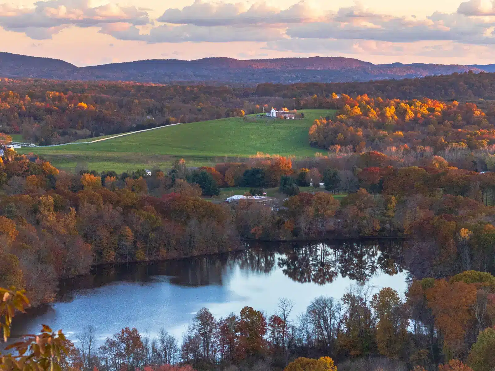
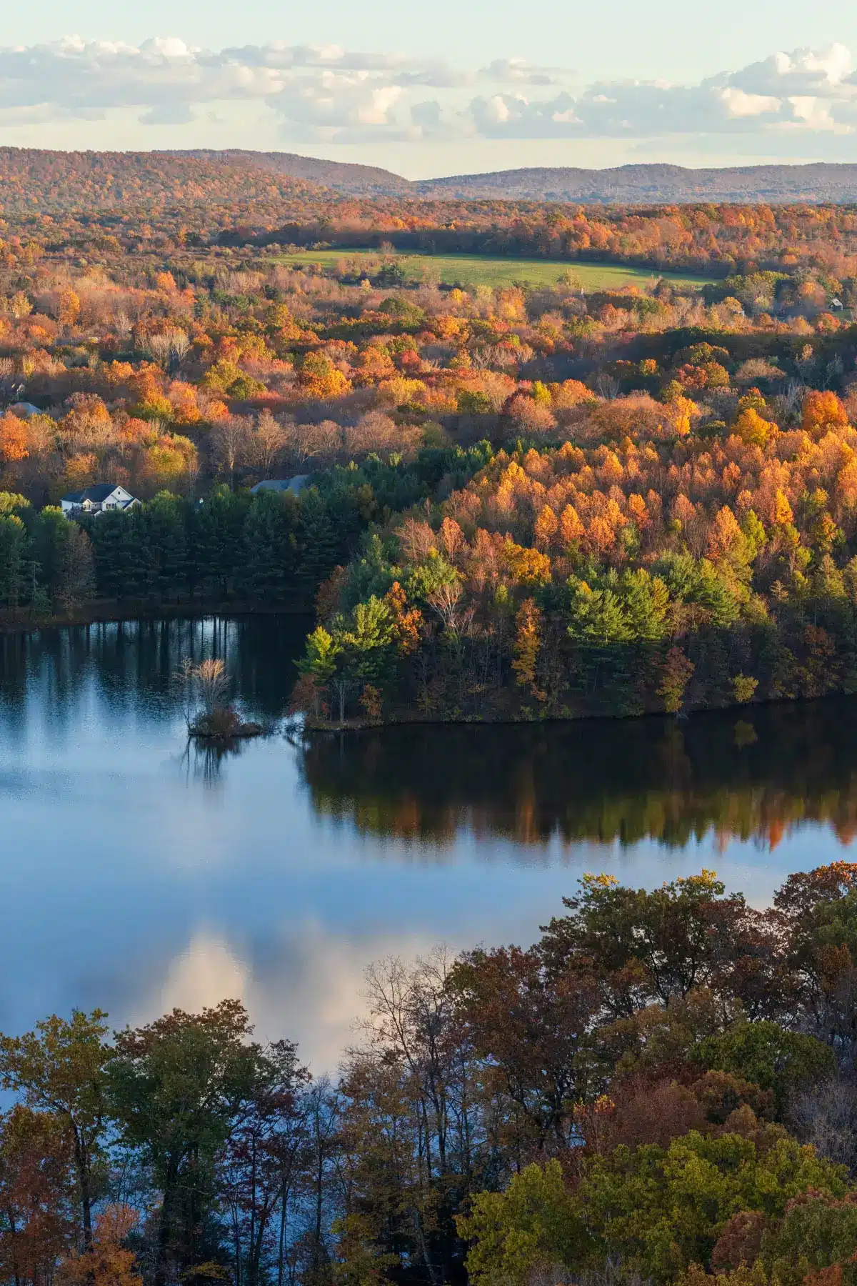
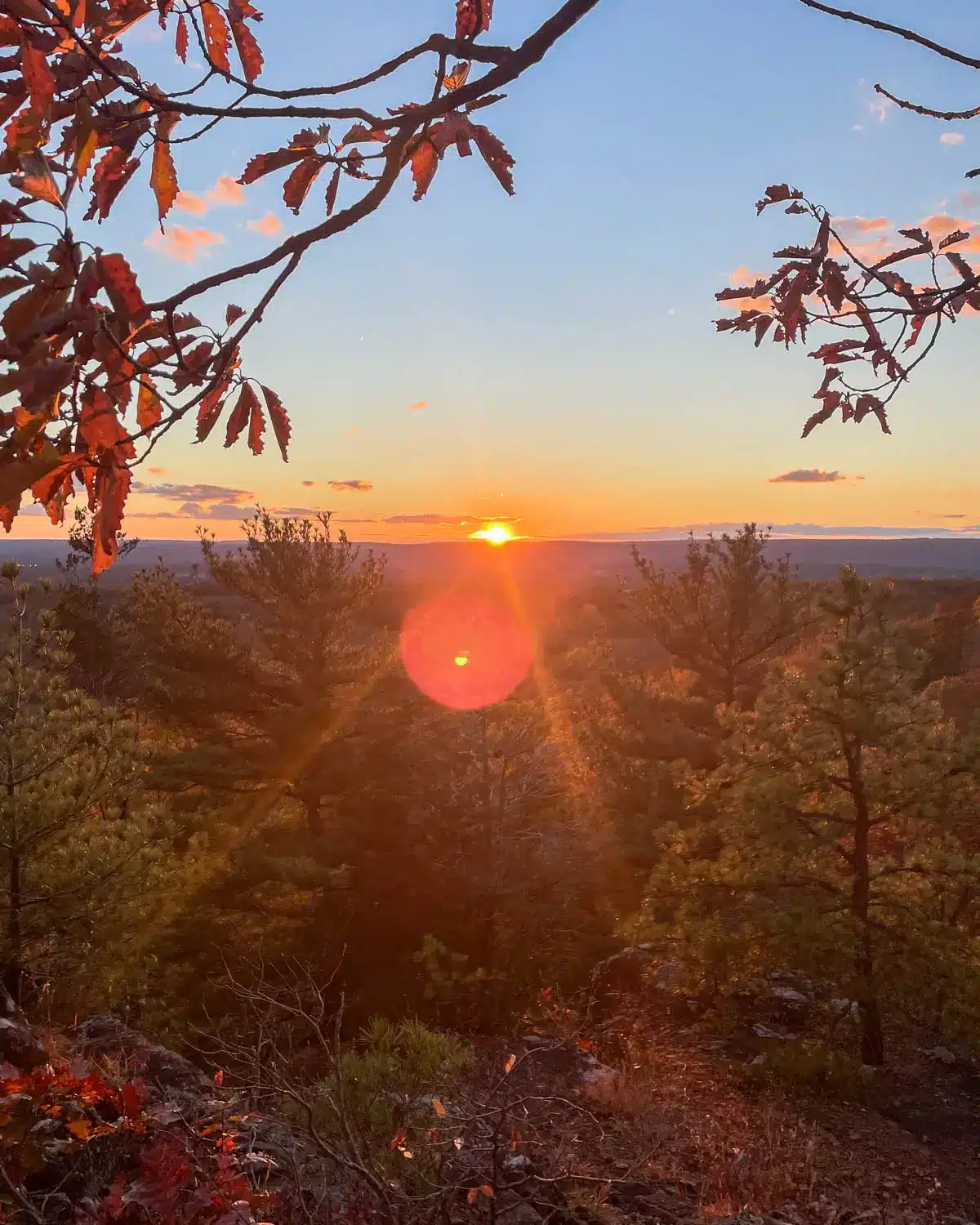
I picture Ragged Mountain Preserve as a big bowl surrounded by dramatic traprock cliffs and views all around. Some views are open and obvious and some you have to look for between the trees. I think that’s what make hiking here so rewarding and fun.
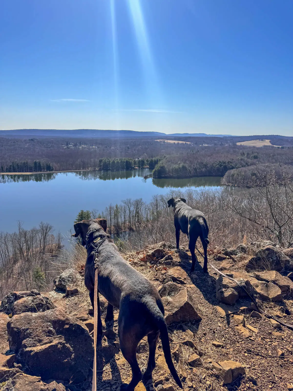
You may even see climbers taking advantage of the traprock cliff edges here. Cliffs and views abound including water views over Lower Hart Pond, Smith Brothers Pond, and Wassel Reservoir.
Ragged Mountain Parking, and Navigation Tips 🚗🧭
The preserve has multiple access points, but for the trails in this post you’ll start from the main parking area along West Lane in Berlin. It’s straightforward to find and puts you on the most popular trail sections.
🚗 Primary trailhead access:
- Look for shoulder parking near 437 West Lane, Berlin CT
- There’s no formal parking lot—cars line the road shoulder
- Arrive early on Saturdays and Sundays; spaces fill fast on nice weekends
- Weekday afternoons or early mornings are your best bet for a stress-free parking experience during summer and fall
🧭 Navigation basics:
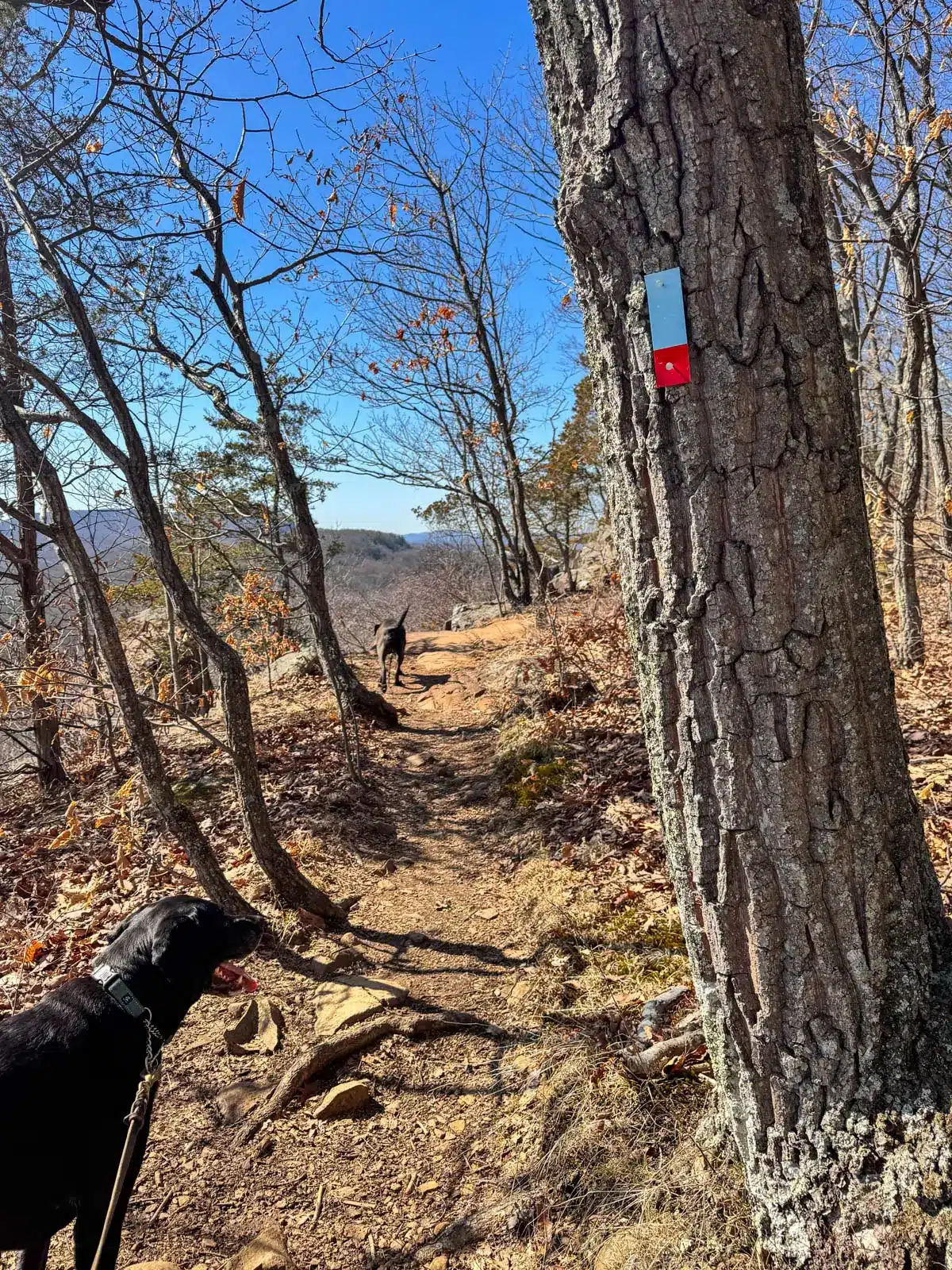
- The preserve uses color blazes: the blue trail (Metacomet/New England Trail) is your main route all along the ridge
- Connectors and loops add red, yellow, and orange blazes
- At intersections, blazes are typically painted on trees or rocks indicating direction
- Download an offline map from AllTrails or similar before you go—the number of intersecting spurs and climbing access paths can be confusing!
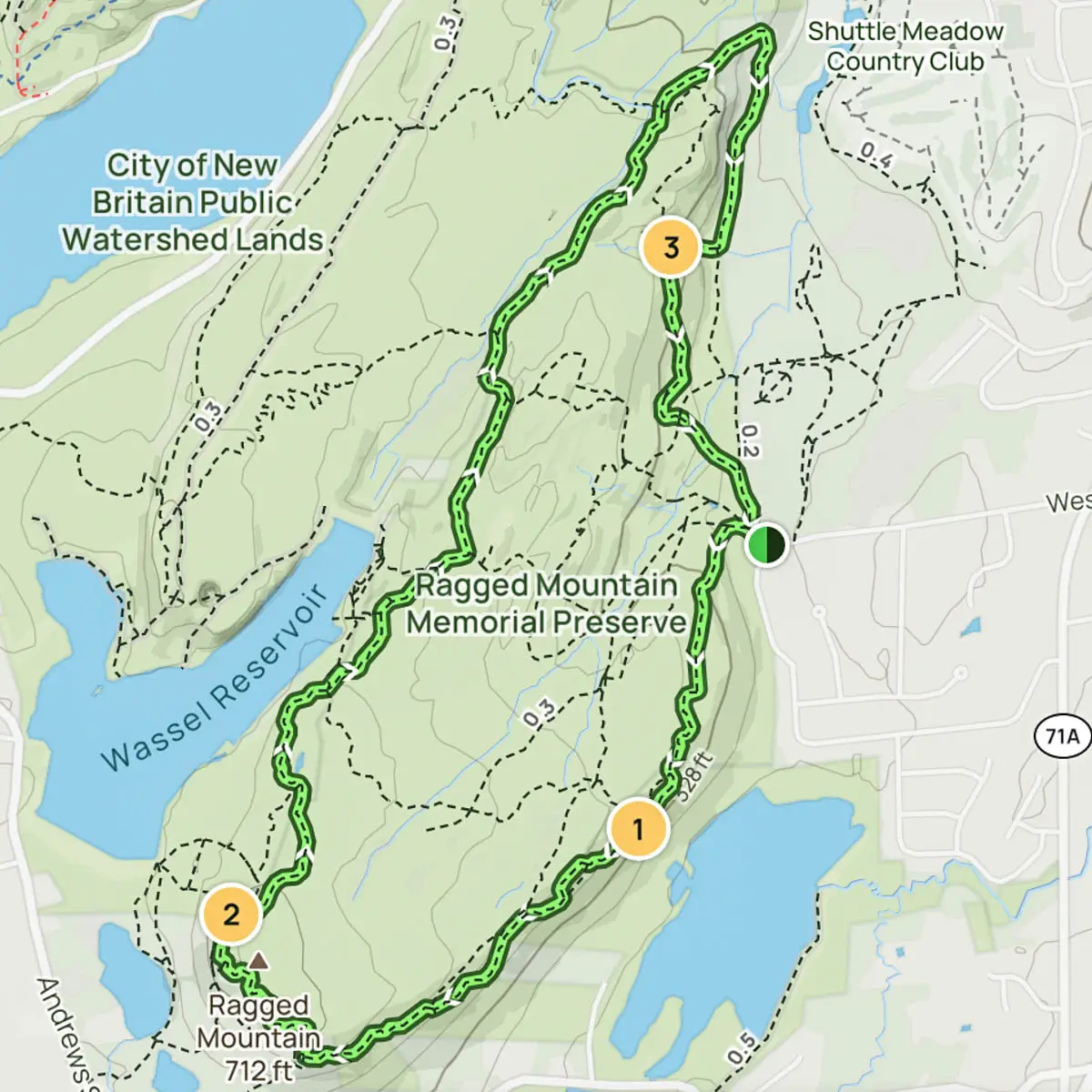
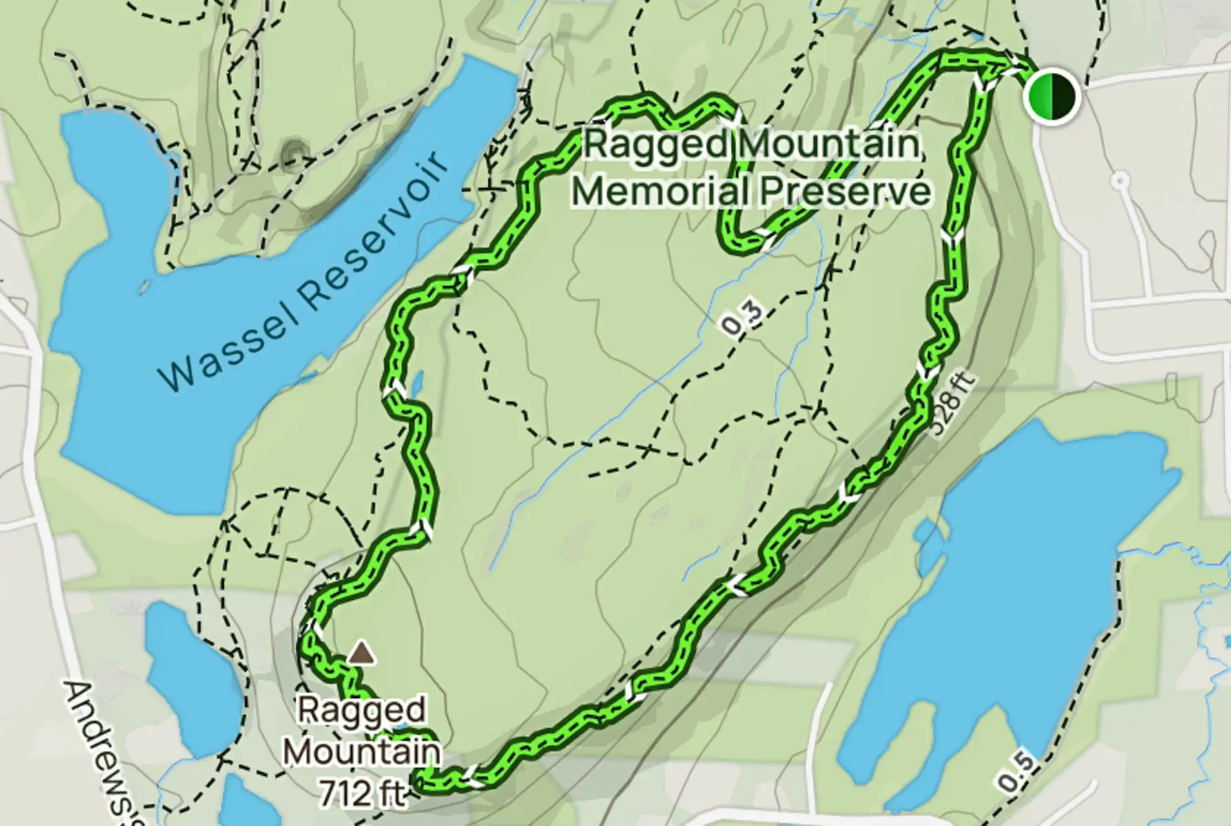
🗺️ Ragged Mountain Map (courtesy of town of Berlin website)
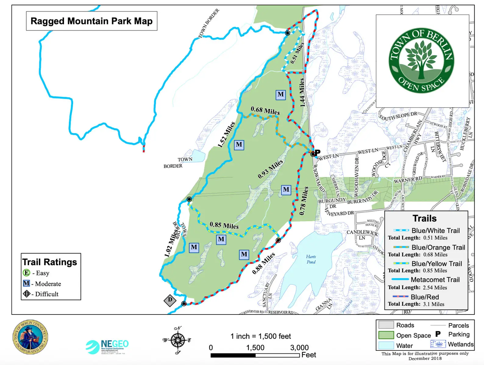
🥾 3 Top Trails at Ragged Mountain Memorial Preserve
1. Ragged Mountain Blue & Red Blazed Loop: Classic Ridge Views
- 🥾Miles & Difficulty: 5.5 miles, Moderate
- 📈Elevation Gain: 830 ft
- 🚙Parking: Navigate here: 41.62838, -72.80396 Parking along West Lane
- 🌟Highlights: hits all major views around the whole Ragged Mtn
- 🗺️ AllTrails Link (can be difficult to follow the trail at times so I’d strongly suggest downloading the map!)
This loop spends more time on the blue-blazed Metacomet Trail—part of the New England National Scenic Trail—and offers a slightly wilder (or ragged!🪨) experience than the second option below.
This is a popular loop at Ragged Mountain as it hits the big dramatic cliff-edge views all around the rim of the mountain. (So does the second hike in this post in less miles, FYI!)
This route also takes you up and over the rocky parts so it is really not suitable for beginner hikers unless they want a challenge with footing, duration, and navigation. The 830 feet of elevation here is not one long uphill stretch, it accumulates after lots of up and downs and I said, they are rocky, uneven steps.
The constant rocky terrain and series of short climbs and descents wear on your legs more than smooth trail would. I’ve brought friends who found the footing a bit difficult until they got comfortable with the rhythm of it. If you have knee issues, trekking poles help significantly on the descents.
Starting from the West Lane trailhead, I typically hike clockwise on the combined blue/red blazed trail. From the parking area, enter the woods by the trailhead and take the blue-blazed trail to the left and continue staying on the blue and red blazed trail.

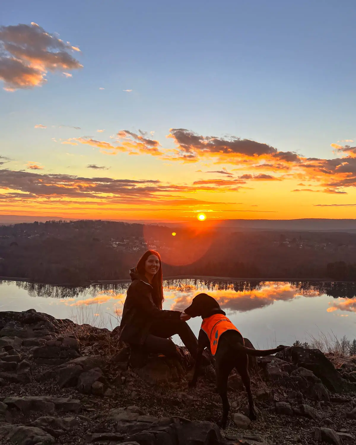
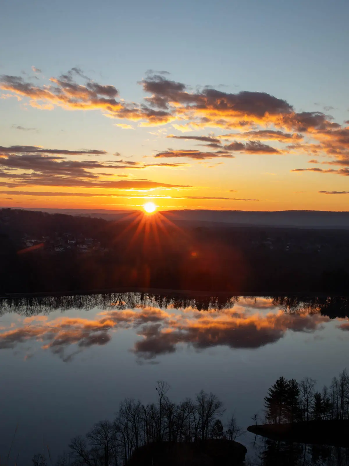
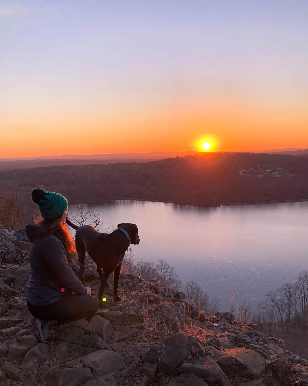
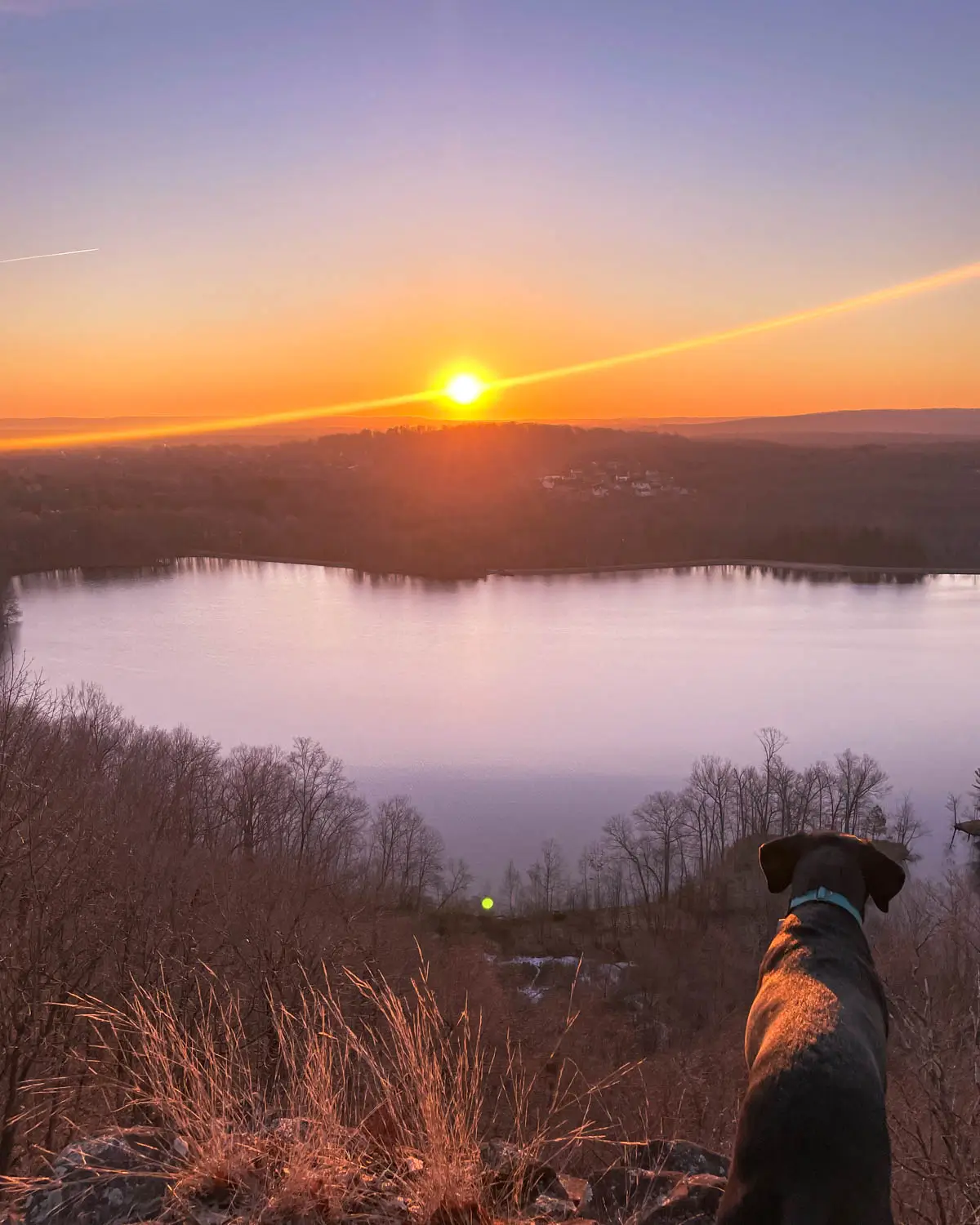
At 0.4 miles, the trail bends to the right and after 0.7 miles, you’ll arrive at the first major view over Lower Hart Pond, facing east. I’ve hiked here many mornings for sunrise and it is glorious!

From here, you’ll continue north along the rugged ridgeline with cliff-edge views that come and go, and the trail can be a little tricky to follow (so I again encourage you to download the AllTrails map).
At 0.83 miles the trail cuts to the right a little bit and starts to get rocky then at 1 mile stay left to continue along the cliff edge.
You’ll arrive at another view at 1.6 miles where the trail opens up again looking southwest toward Southington.
Continue to follow the light blue blazes from here and encounter several rocky ups and downs. But not to worry, you’ll be rewarded AGAIN at 2.5 miles along a wide open cliff overlooking Wassel Reservooir.

You’re making a large loop around the property so from here continue on the blue leading along the northwestern ridge of Ragged Mountain.
At about 4 miles, the blue turns into the blue and red blazed trail. Take the blue red blazed trail back to the trailhead where you started. 🙂
(If you’d like to cut the loop short after the views across Wassel Reservoir you will shortly see the orange blazed trail on the right which you can follow all the way back to the trailhead.)
2. Metacomet Trail Loop at Ragged Mountain
- 🥾Miles & Difficulty: 4 miles, Moderate
- 📈Elevation Gain: 603 ft
- 🚙Parking: Navigate here: 41.62838, -72.80396 Parking along West Lane
- 🌟Highlights: hits all major views around Ragged Mtn
- 🗺️ AllTrails Link
This route is almost the same as the first on our list but a little shorter. You get all the same views as the first hike!
Instead of following the blue blazes all the way around the rim of Ragged Mountain you will cut it to the right about 3.1 miles through the loop (going clockwise) onto the blue and orange blazed trail and return to the lot in a shorter amount of time.
Just like the first hike you’ll be following the blue and red blazed trail to the blue trail and then to the blue and orange trail.
And like the first hike you will still get the view overlooking Lower Hart Pond at 0.7 miles, the view towards Southington around 1.5 miles, and the wide open cliff view across Wassel Reservoir at 2.5 miles.
If you’d like more details just read the first hike above because everything is the same except for the cut to the right on the orange trail at around 3.1 miles!
Again, solid boots with good traction are recommended for this trail along with a hiking pole or two if you’re used to hiking with them.
3. Ragged Mountain Red Loop: Short with one view
- 🥾Miles & Difficulty: 2.2 miles, Moderate
- 📈Elevation Gain: 288 ft
- 🚙Parking: Navigate here: 41.62838, -72.80396 Parking along West Lane
- 🌟Highlights: Wide open view facing east over Lower Hart Pond
- 🗺️ AllTrails Link

The Red Loop offers a shorter way to experience Ragged Mountain without committing either loop above.
It’s short but you’ll still get the beautiful view overlooking Lower Hart Pond. I’ve done this hike several times for sunrise and then turned around to head back to the car instead of continuing on.
From the main trailhead on West Lane you’ll start going clockwise with the blue and red blazed trail on the left. Follow that for about 0.7 miles and then you’ll arrive at the view.
From the view you can either continue straight on the path for another third of a mile before taking a sharp right on red to lead you all the way back to the lot (for a total of about 2 miles).
Or, from the view you can simply turn around the way you came (if you’re afraid of getting lost!) for a total of about 1.5 miles. 🙂
If you’ve never hiked at Ragged Mountain before then this could be a great option. It will introduce you to the rocky trails here and then you can get a sense of what the full 4 or 5 mile loops will be like!
Conclusion
I hope you enjoyed this breakdown of 3 different trails at Ragged Mountain in Berlin, CT.
If you want even more choices you can head to AllTrails here for a total of 10 different routes to choose from.
Remember, no matter which trail you choose here it’s rocky, steep at times, and requires some hiking experience. Wear your sturdy boots and download the maps from AllTrails. 🙂
Best of luck and have fun. Let me know if you have any questions!! Leave questions or comments below, I’d love to hear from you and hear about your experience!
Hiking With Dogs, Kids, and Groups at Ragged Mountain
Ragged Mountain can be dog friendly and family-friendly, but it’s not an easy stroll. Success here requires comfort with rocky terrain and some steep sections.
Hiking with dogs:
- Keep dogs leashed due to cliffs, wildlife (deer, snakes, turtles), and other hikers
- Most dogs in good shape can handle the loops, but some scrambly spots may require a boost
- Carry extra water—exposed ridge sections get hot, and there’s no water source on the trail
- Watch for loose rock that can be hard on paw pads
Hiking with kids:
- Consider the shorter out-and-back to the first overlook for younger children rather than the full 4 and 5 mile loops
- Stay well back from cliff edges—several viewpoints have sheer drops with no railings
- Choose snack breaks in safe, flat areas away from drop-offs
- Sturdy closed-toe shoes are essential; sandals won’t cut it on this terrain
Group etiquette:
- Yield on narrow rocky sections and keep groups tight so others can pass easily
- Keep noise levels reasonable to maintain the natural feel and avoid disturbing wildlife
- Space out at viewpoints so everyone gets a chance to enjoy the views
Safety reminders:
- Stay on blazed trails and keep well back from cliff edges
- Check the forecast—avoid the highest, most exposed ridges during thunderstorms or high winds
- Let someone know your route and expected return time
Overview of Ragged Mountain & the New England/Metacomet Trail
Ragged Mountain’s distinctive character comes from its traprock geology—volcanic basalt that formed roughly 200 million years ago and was subsequently tilted by earthquakes, creating the dramatic vertical cliff faces you see today. The preserve reaches approximately 761 feet at its highest point, part of the larger Metacomet Ridge that runs through Connecticut.
From the 3 main overlooks, you’ll spot Hart Ponds, Wassel Reservoir, and on clear days, the distant Hanging Hills near Meriden. The reservoir wraps around Shuttle Meadow Mountain on three sides, creating striking water-and-cliff compositions that make this place a photographer’s dream.
The preserve is conserved land managed through the Ragged Mountain Foundation and Berlin Land Trust, with trail corridors crossing a mix of protected properties. Rock climbing has a long history here—legends like Fritz Wiessner established routes in the 1930s—and climbers still frequent the crags alongside hikers.