Mount Norwottuck Hike: A Guide & Turn-By-Turn Directions
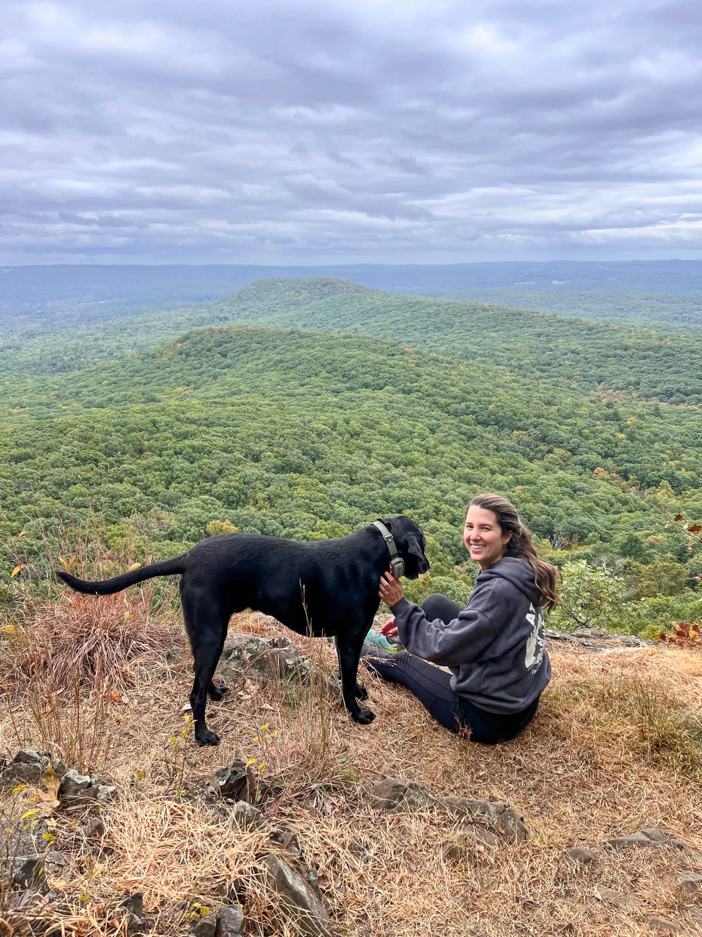
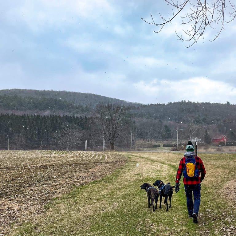
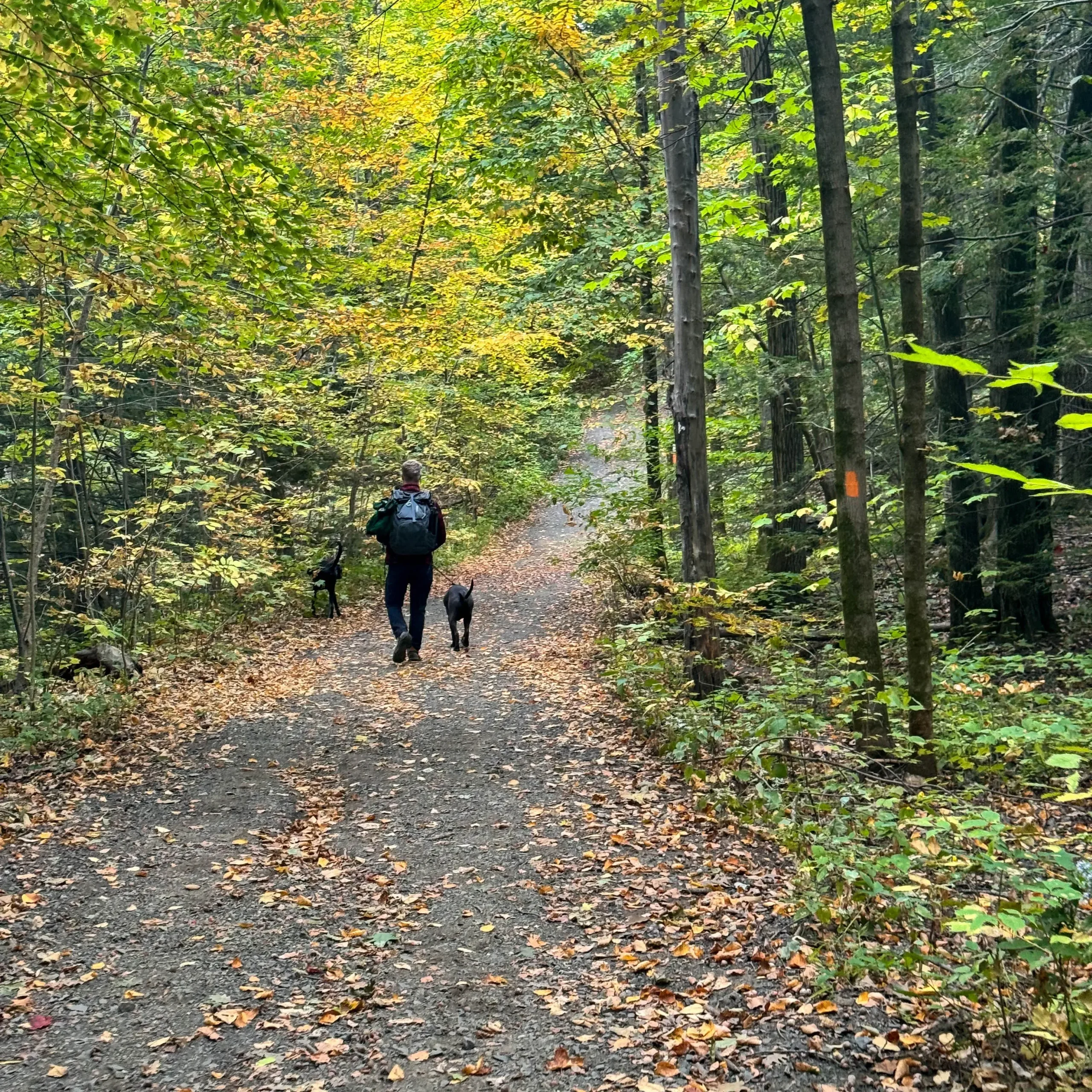
Nestled in the southern part of the Pioneer Valley of Massachusetts, Mount Norwottuck stands as the highest peak of the Holyoke Range at 1,106 feet. I’ve hiked Mount Norwottuck multiple times and the expansive views here (2 different lookouts!) & the thrill of finding the Horse Caves 😉 never gets old.
Here you’ll find all the details you need to know, including turn-by-turn trail directions for hiking Mount Norwottuck which may come in handy as there are several trails within the park!
The trail directions in this post will also help you find the coolest section of the Horse Caves which you will not find if you just follow the map on AllTrails! ⛔️🗺
Mount Norwottuck is part of Mount Holyoke Range State Park which encompasses 3,000 acres.
The Holyoke Range has a 7-mile mountain ridge line ⛰ and 30 miles of blazed trails! It’s a dream hiking land right in central Massachusetts and for me living in Connecticut it is only just over an hour away!
(And if you’re looking for more hikes in western MA check out my post about 13 amazing hikes in the Berkshires!)
The mountain’s name honors the Norwottuck tribe, a subgroup of the Pocumtuck Native Americans who once inhabited the region. “Norwottuck” translates to “in the midst of the river,” reflecting the tribe’s deep connection to the Connecticut River Valley which is where this hike is located.
With Mount Norwottuck being just one great hike in the Holyoke Range, let’s take a look at the other options within Mount Holyoke Range State Park…
⛰ Running west to east here are the peaks within Holyoke Range State Park:
- Mount Holyoke at 935 feet
- the Seven Sisters, a series of ridge line knobs with a high point of 945 feet
- Mount Hitchcock at 1,002 feet
- Bare Mountain at 1,014 feet
- ⛰ Mount Norwottuck at 1,106 feet (the tallest! ⛰)
- Rattlesnake Knob at 787 feet (240 m)
- Long Mountain at 920 feet (280 m)
- Harris Hill at 550 feet
✨ Trail Overview: Mount Norwottuck Loop ✨
- 🥾 Miles: 3.6 miles
- 📈 Elevation: 748 ft elevation gain
- 💪🏼 Level: Moderate
- 🔁 Trail Type: Loop
- ⏱ Average Time: 2 hours (took me 2.5 – 3 hours because we stop for photos & snacks! :))
- 🚙 Parking: Navigate here: 42.30495, -72.52802 There is a very large parking lot but it can fill up on weekends so go early or during the week!
- ✅ Restrooms & visitors center on site
- 🐶 Dog-friendly: Yes, on leash. (Also, see note below about dogs!)
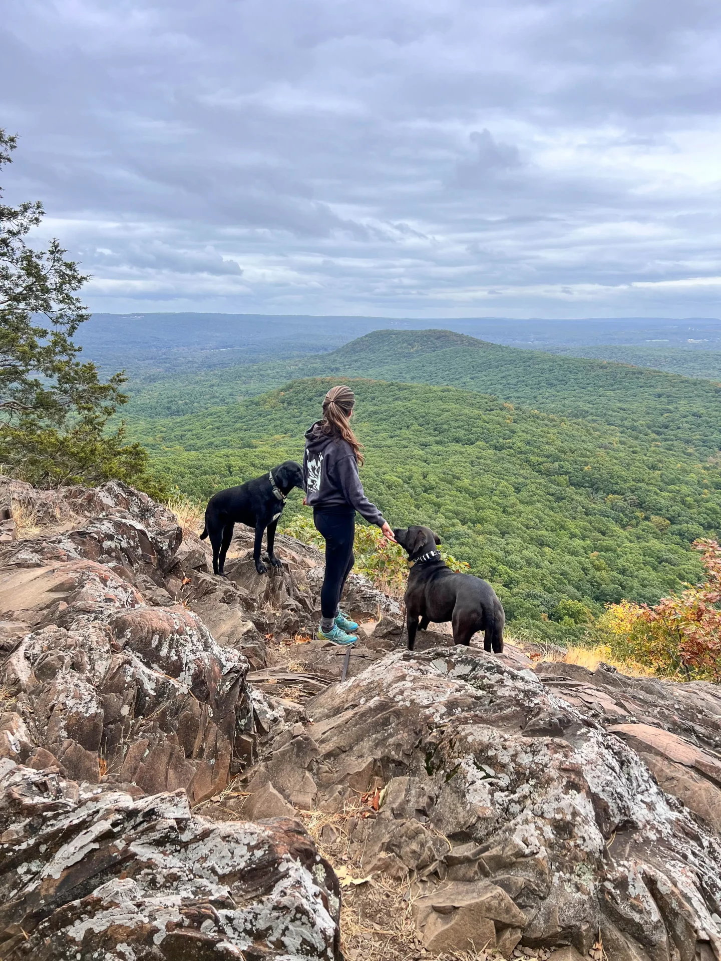
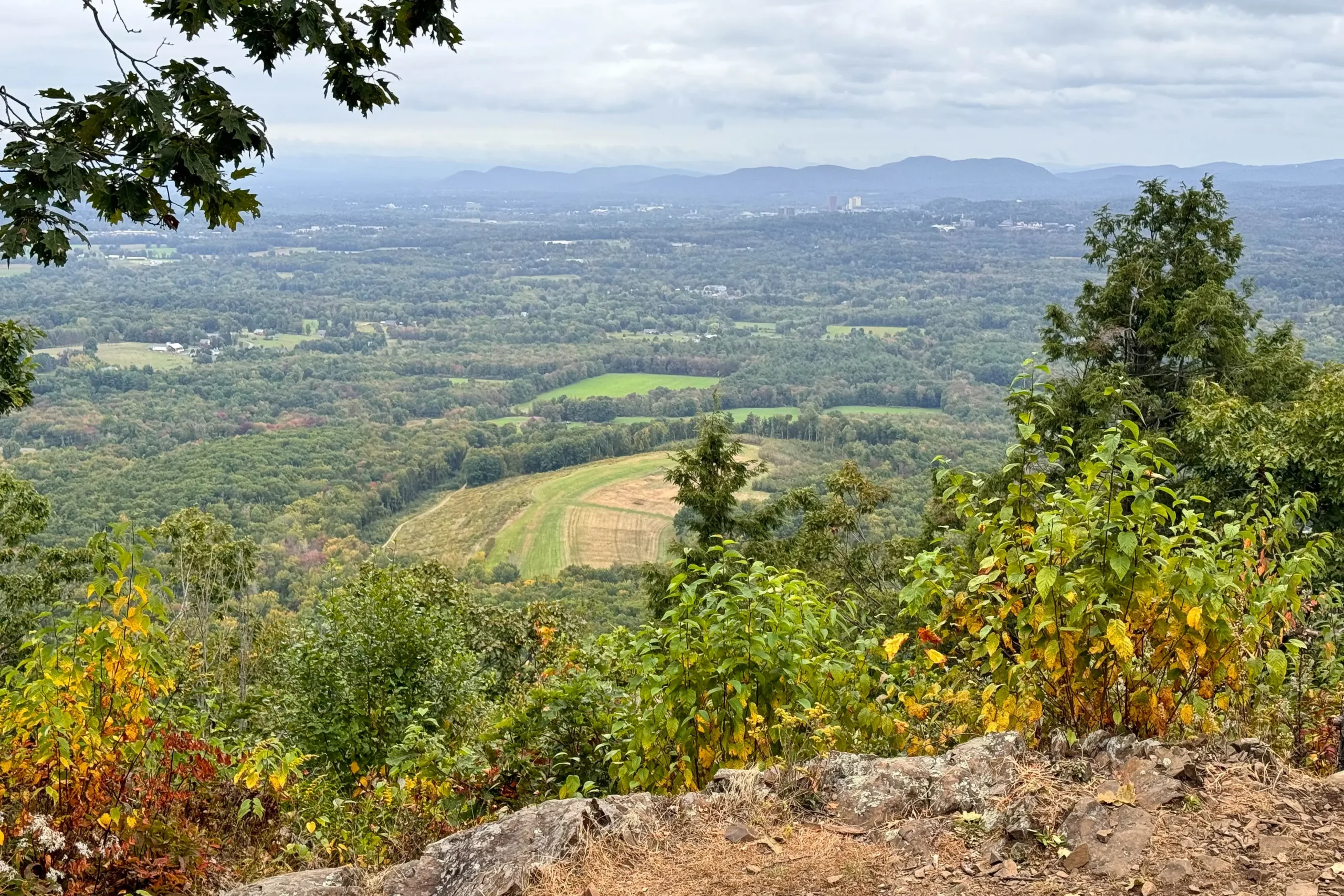
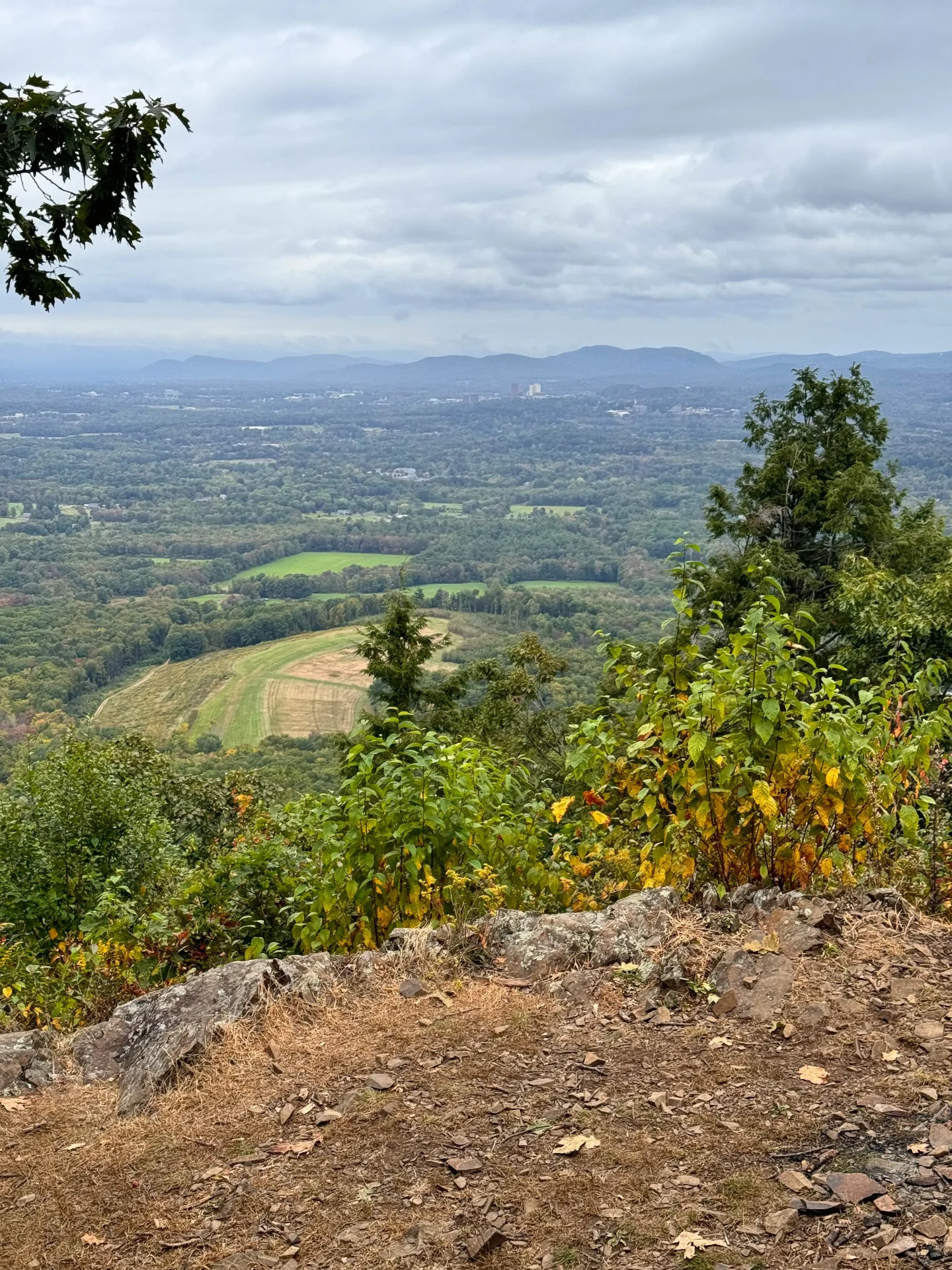
- 🌟 Trail Highlights: 2 different lookouts; one with sweeping views facing east over the Holyoke Range and the other (the official top of Mt Norwottuck) facing north. ALSO – the Horse Caves!! 🪨
🐶 Is Mount Norwottuck really dog-friendly?! A note about this! 🐶
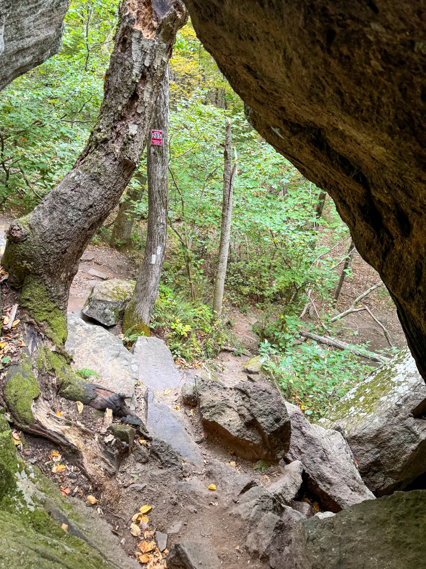
There is a section on your way up the Horse Caves where your dog will either have to do a bigger jump or you will have to pick them up.
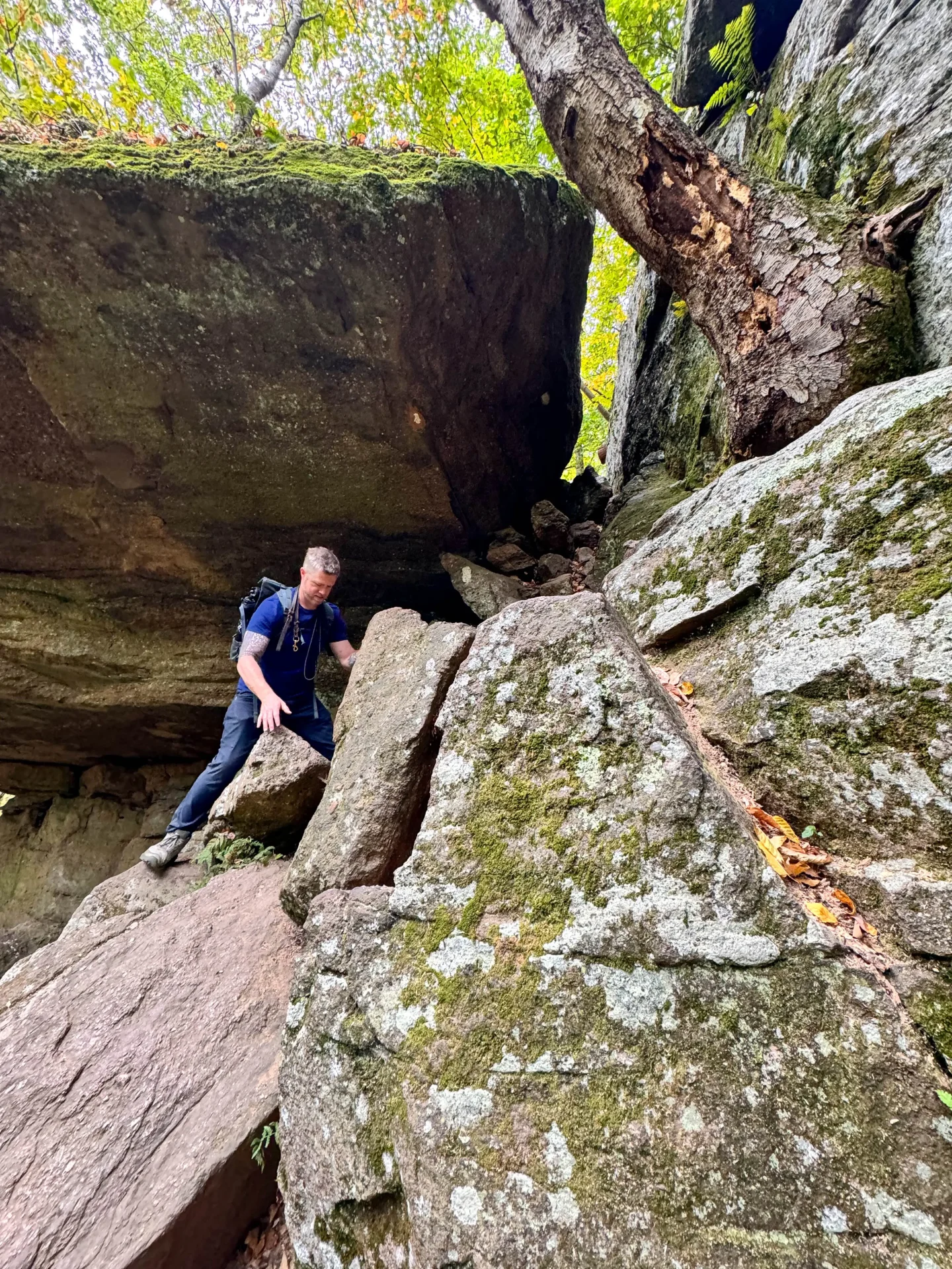
The rock they need to jump to get up is a few feet high and slanted (it’s not straight up which is good). My 6 year old dog Captain did it just fine but our younger dog (Bruin – who’s actually more agile!) was a little spooked by it…
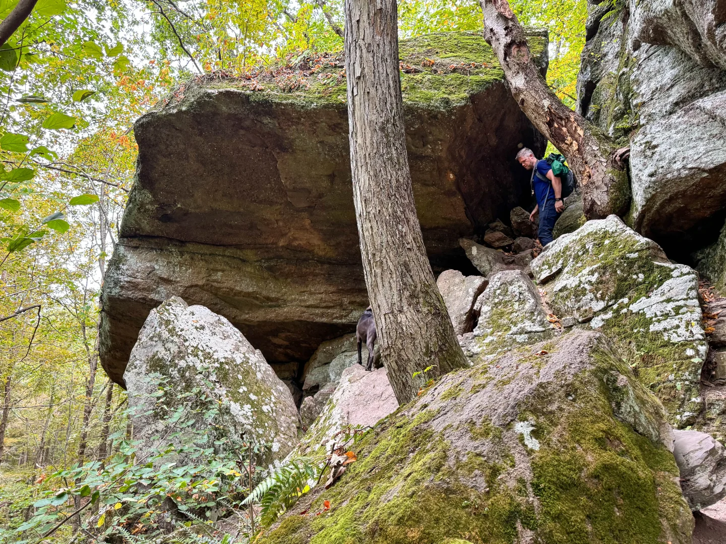
Since Bruin wouldn’t jump up on the rock we had to walk all along the ledge (all along the Horse Caves) until the ledge ended and we found a little trail to walk up.
So you at least have this as an option if your dog refuses to jump (or if you have an older dog that can’t jump) and you can’t lift them. Just head to the right and walk all along the wall, about 200 ft, until you see a trail up to the left.
📝Turn-by-Turn Trail Directions for Mount Norwottuck Loop
There are several trails in this park so it’s helpful to have the trail directions below (maybe take a screenshot!) when you are out there – especially if you don’t have the AllTrails app to navigate with. 🥾
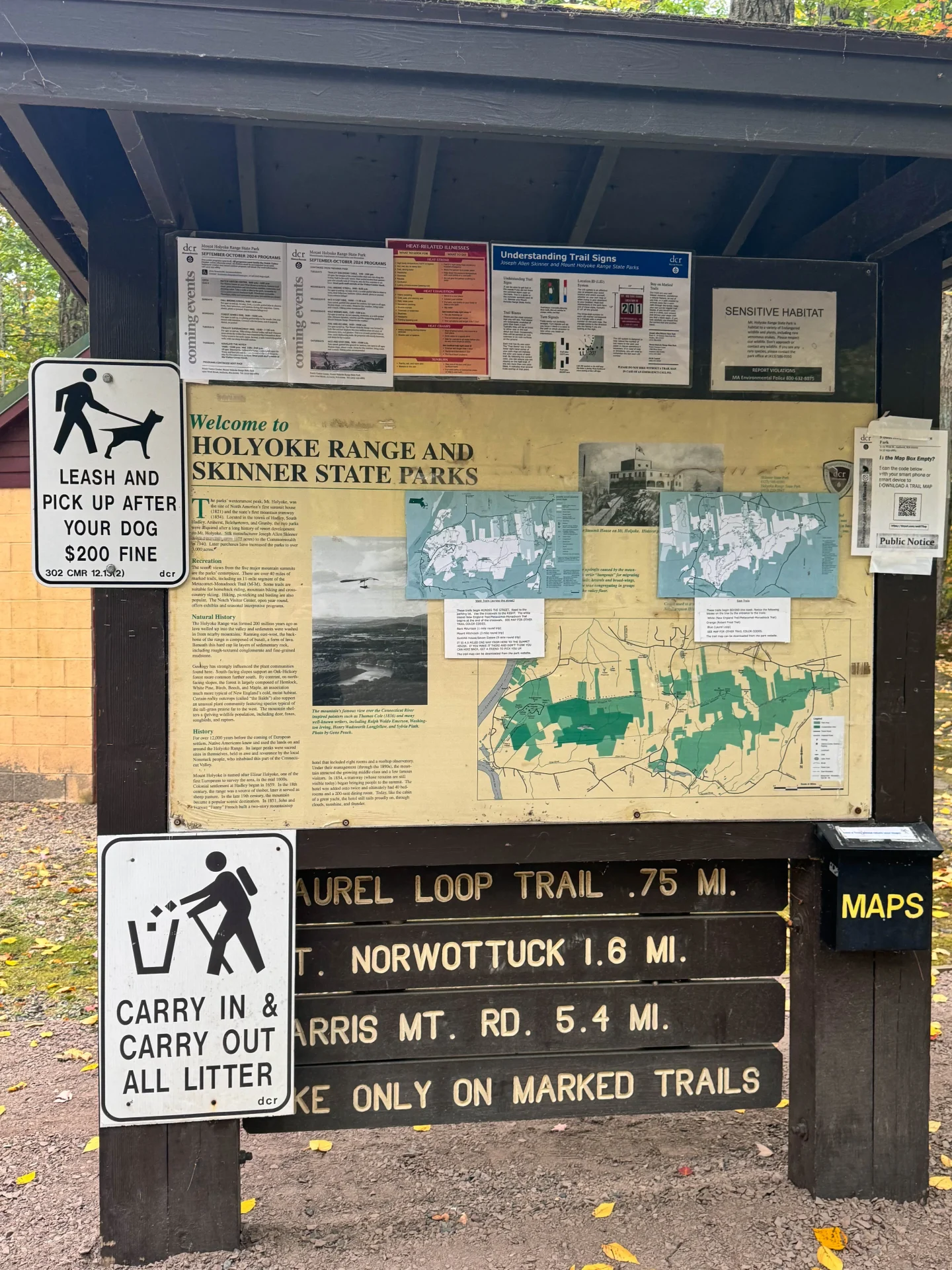
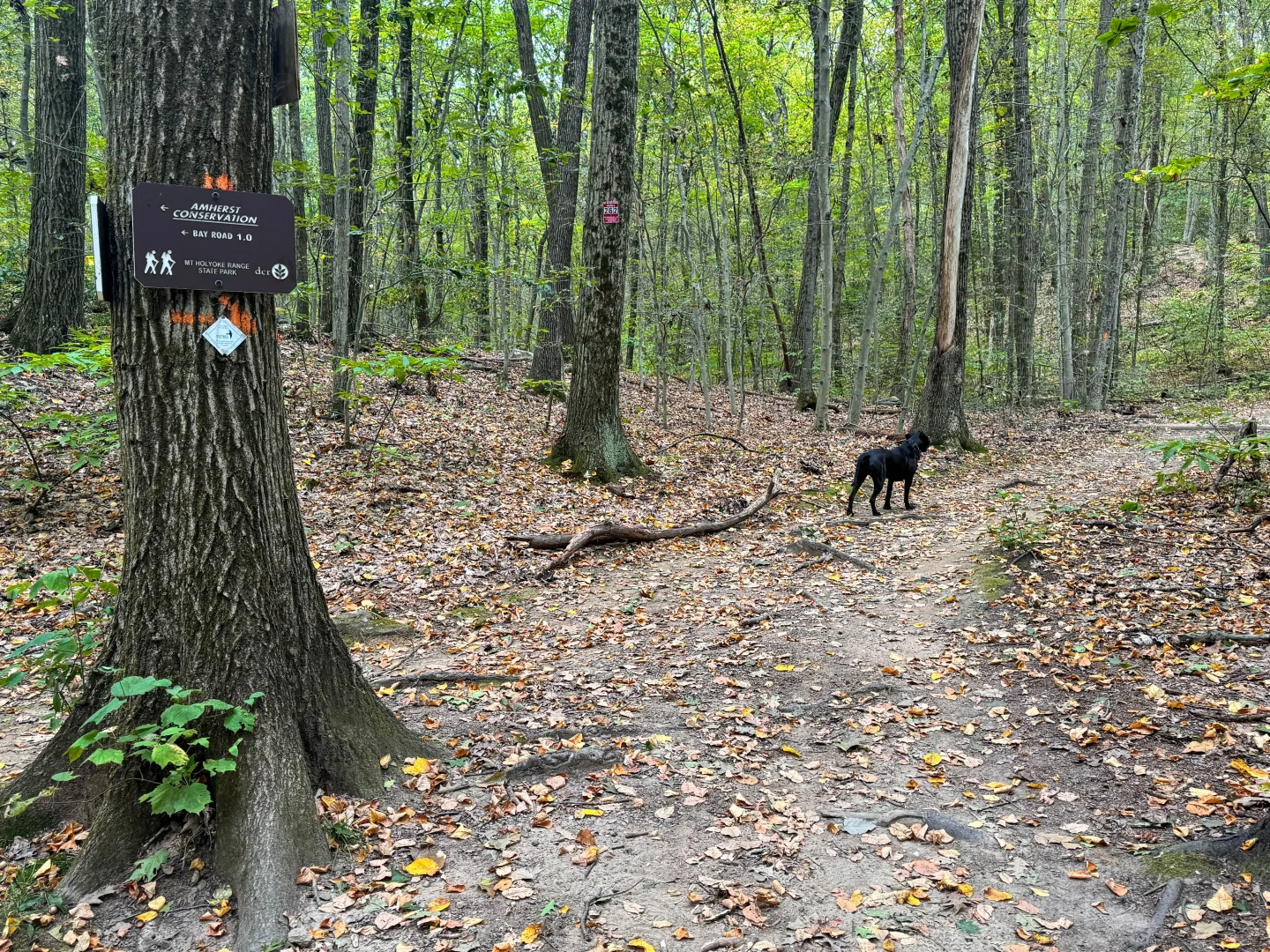
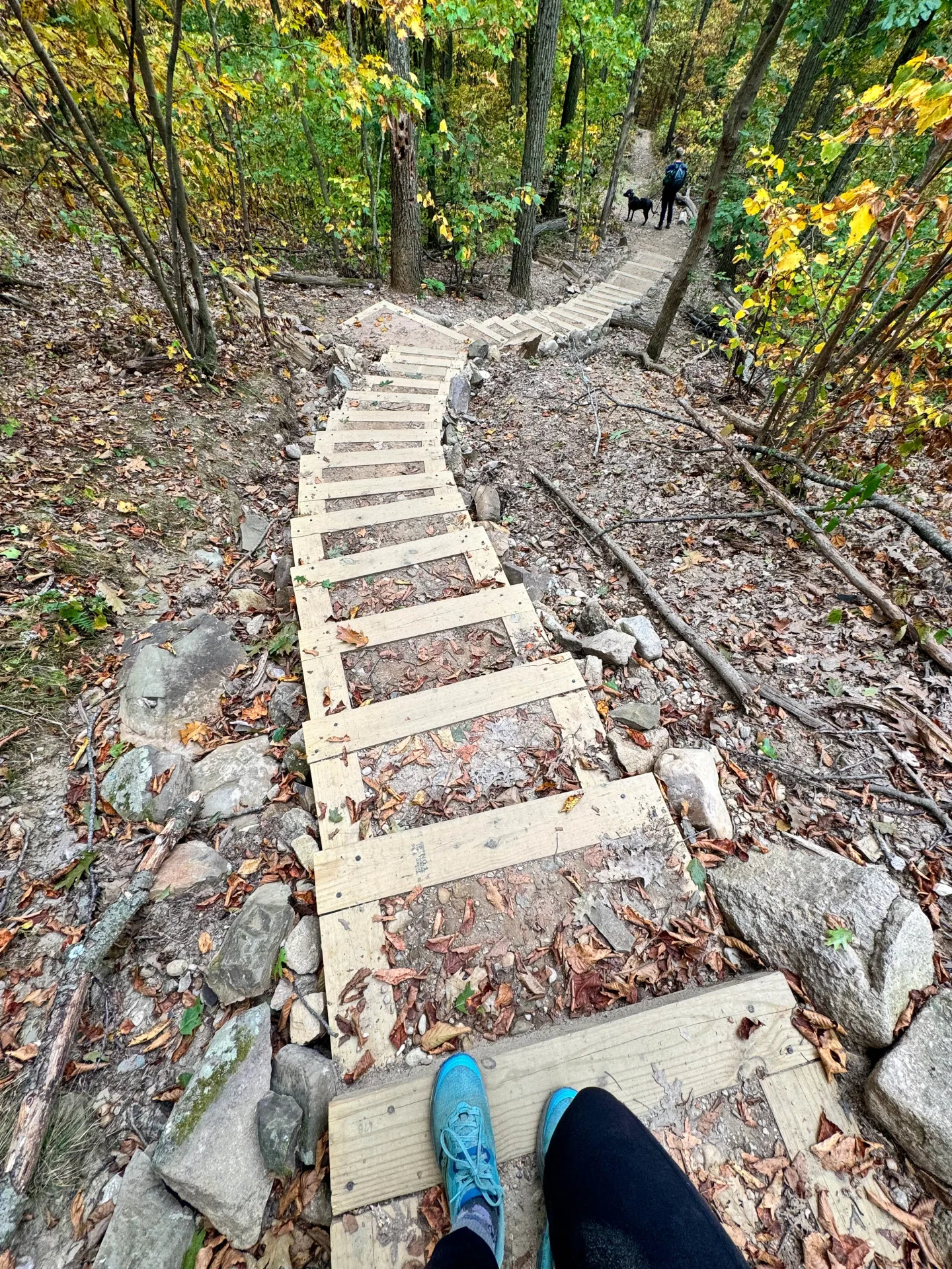
0 – 0.13 miles: From the parking lot, start on the orange that leads you up the stairs. Pass the visitor center on the left, which has park information, an exhibit and restrooms. 🙂 🟠
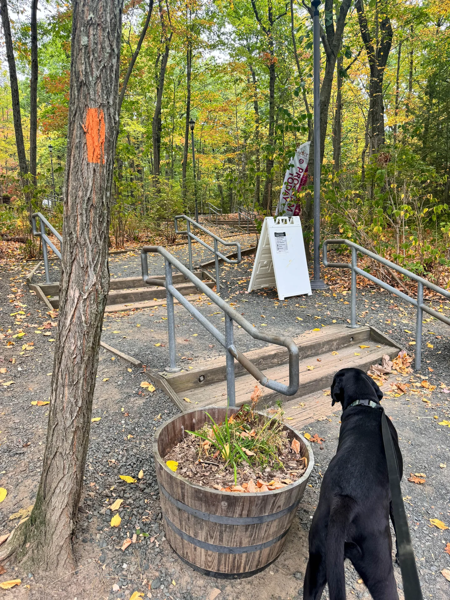
Pass the visitors center on the left and enter the forest where you will see the Robert Frost Trail sign and an orange trail marker. 🟠
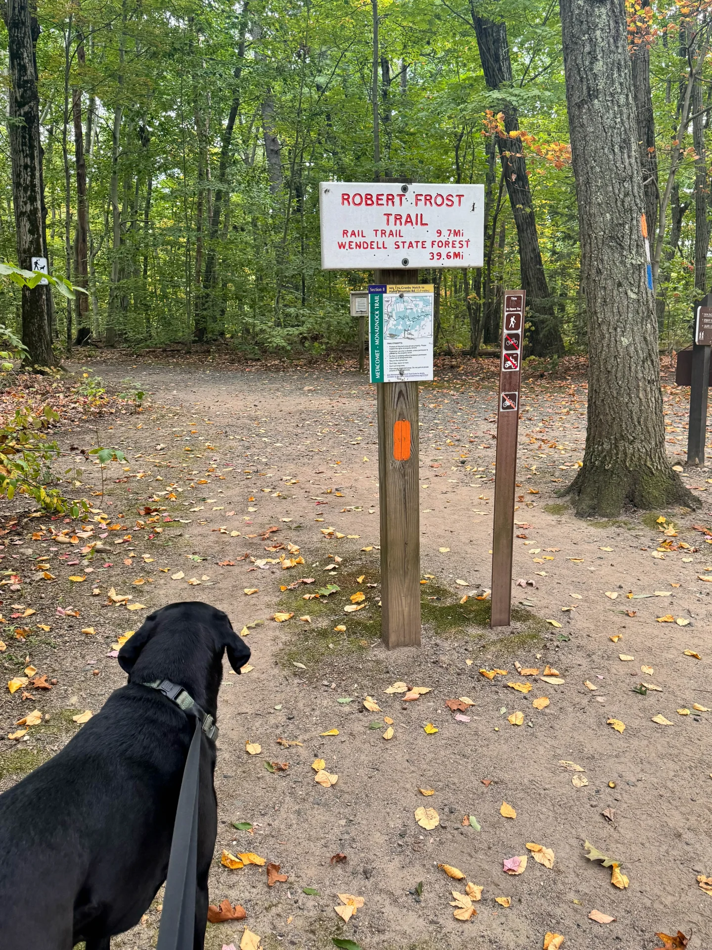
At 0.13 miles: Stay to the left along the orange trail. 🟠
0.18 miles: Stay to the right, you’ll see a trail leading to the left where power lines are, stay to the right on the main path where you will start to see a trio of blue, white, and orange trail markers. 🔵⚪️🟠
0.29 miles: Come to a 3-way intersection, stay straight ahead to continue on the Robert frost Trail marked orange and white. ⚪️🟠
At 0.32 miles: Turn left onto the orange trail, you will be on a wide gravel path now. 🟠
At 0.55 miles you’ll encounter the loop portion of this hike. I’ve done this loop both ways but I suggest going clockwise, I prefer a more gradual hike up rather than a short and very steep uphill with a very long downhill.
Stay straight to go on the orange trail and begin the loop clockwise. 🙂 🟠
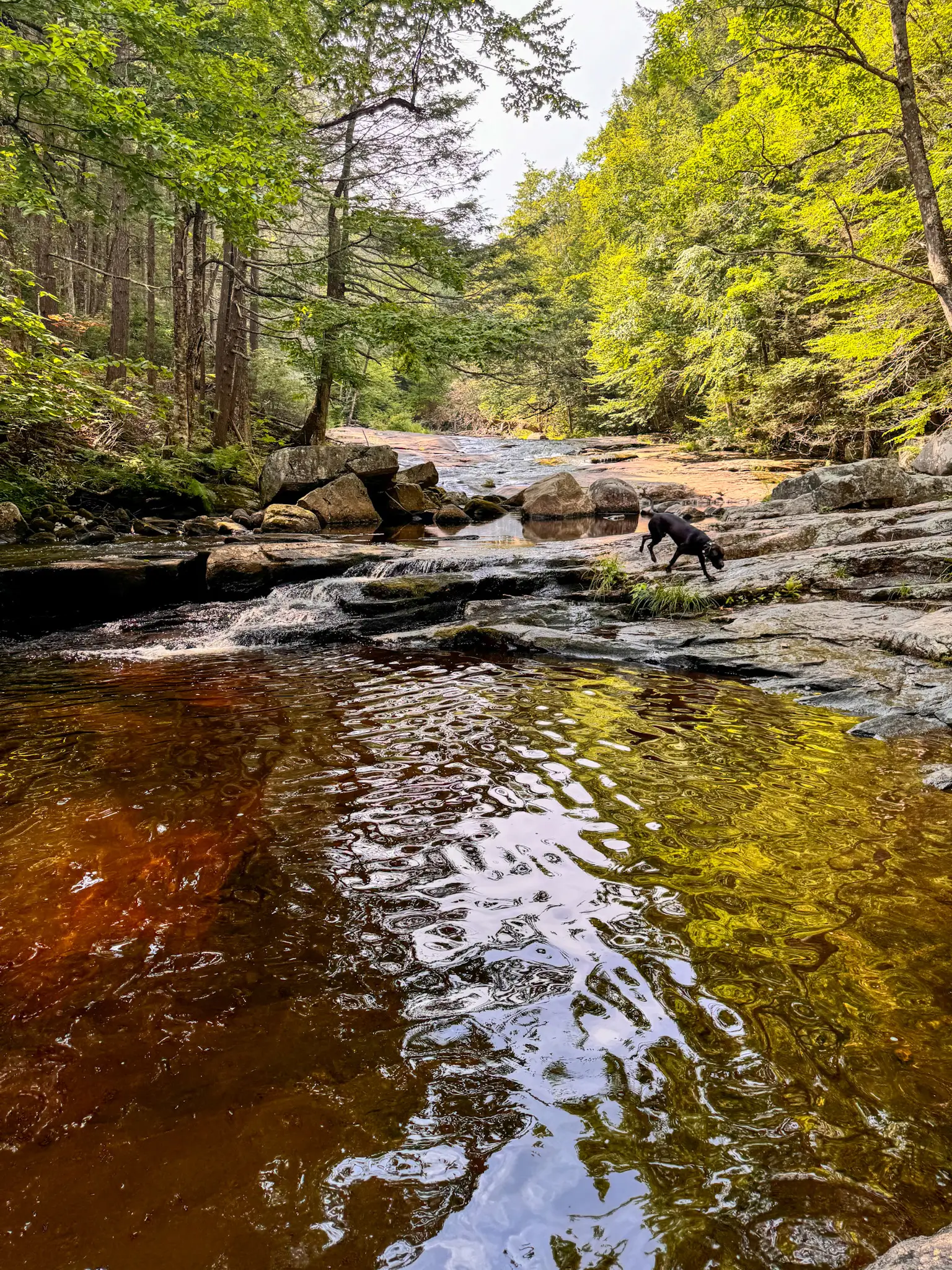
At 0.75 miles: bear right to stay on the orange marked trail. You’ll cross a wooden bridge that runs over a brook. (water for dogs!💦🐶)
1.65 miles: bear right to stay on the orange trail. This is where the incline begins! 🟠
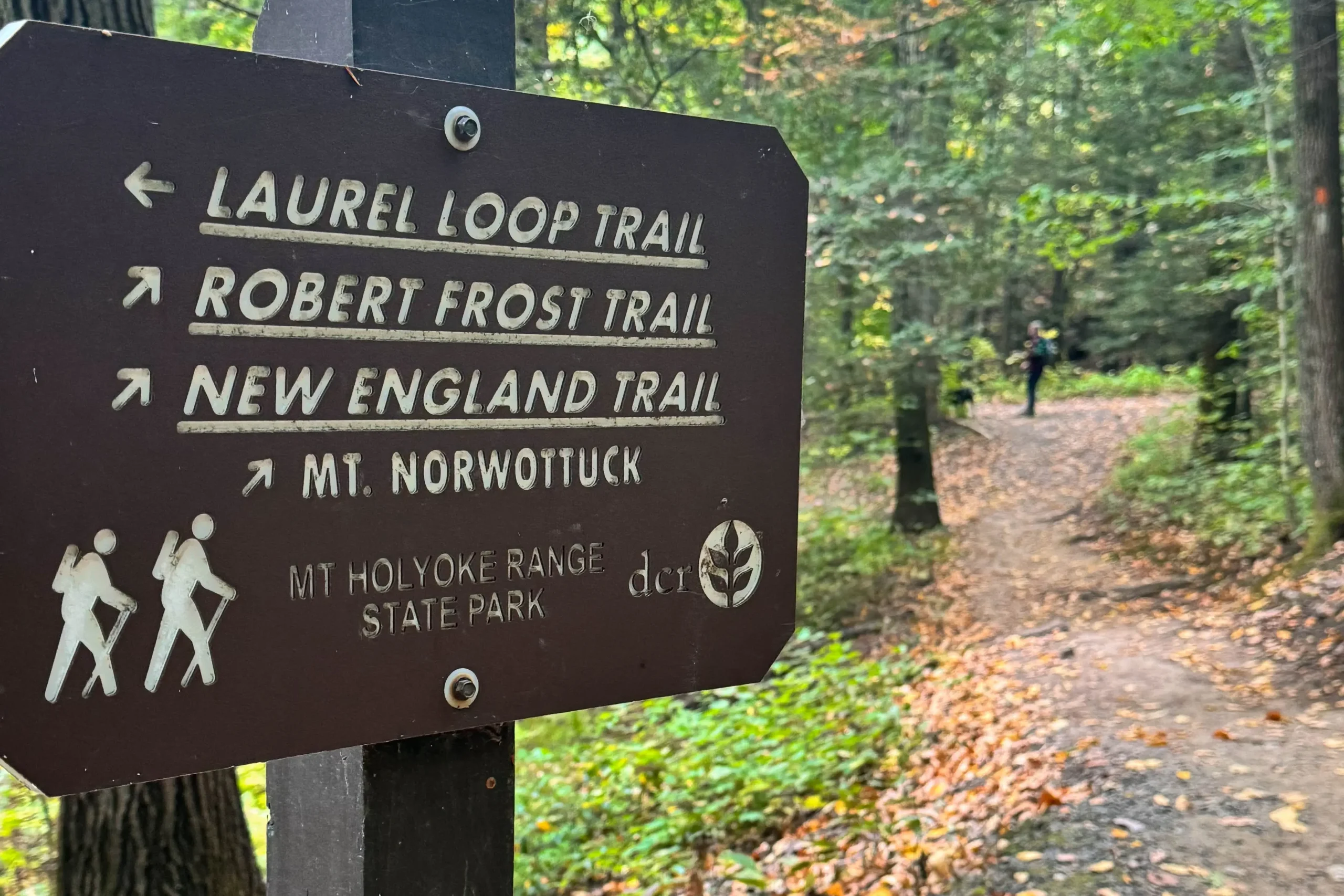
1.8 miles: stay straight onto the New England Trail, Following the sign to the New England trail and Mount Norwottuck. You are leaving the Orange Trail at this point and picking up the white trail. ⚪️
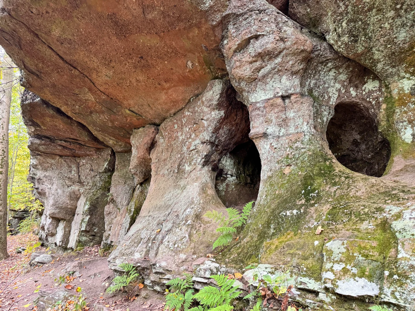
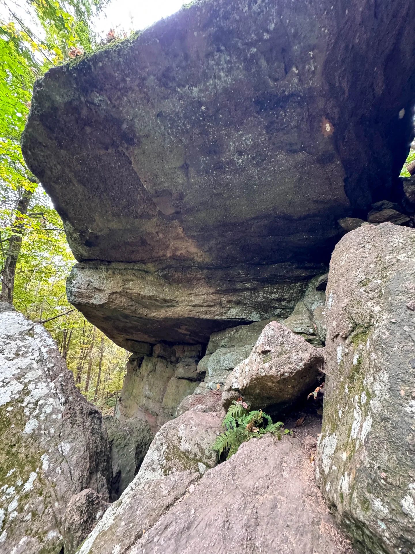
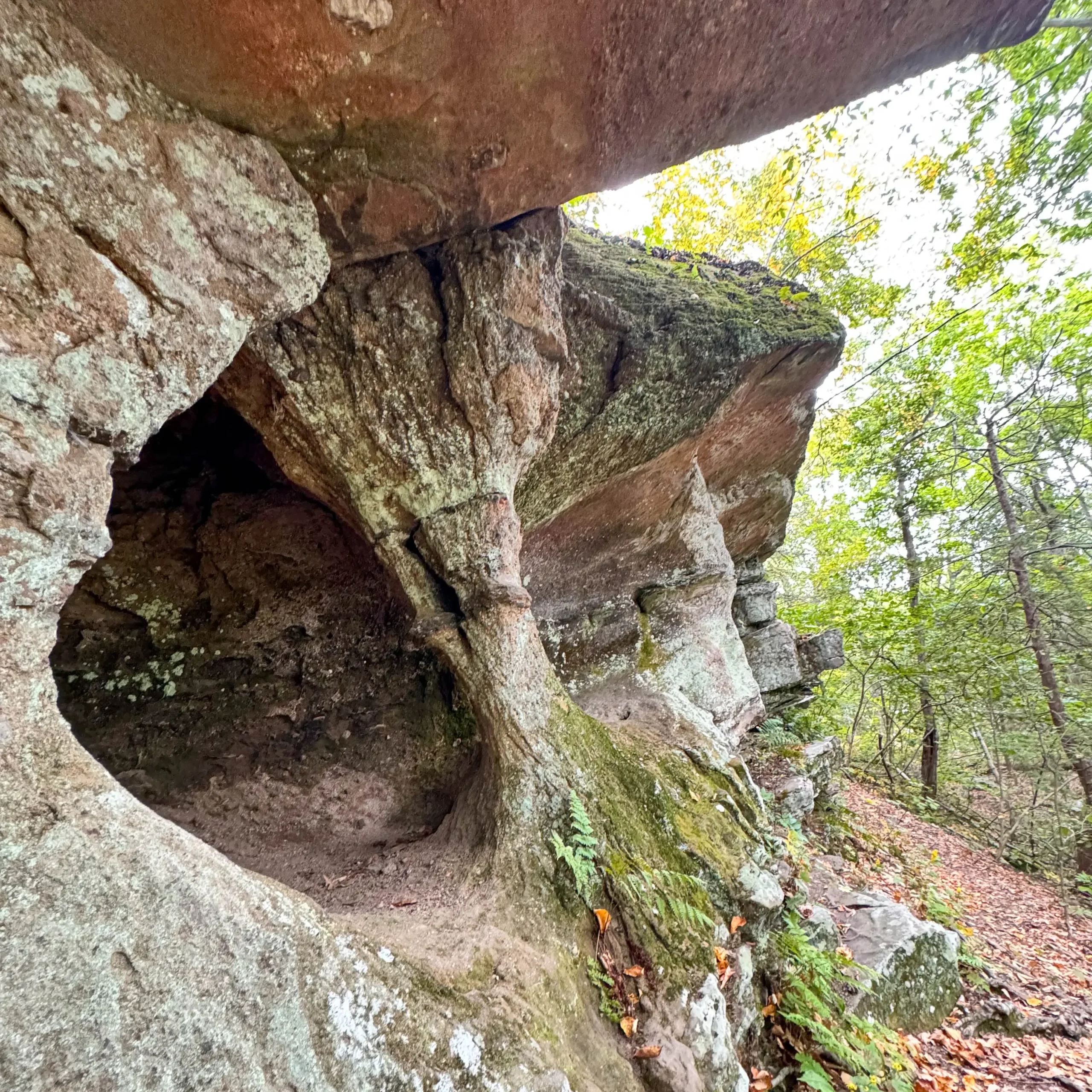
2.09 miles: Here is where you’ll encounter the Horse Caves and you will have a short scramble section over a few rocks. 🪨
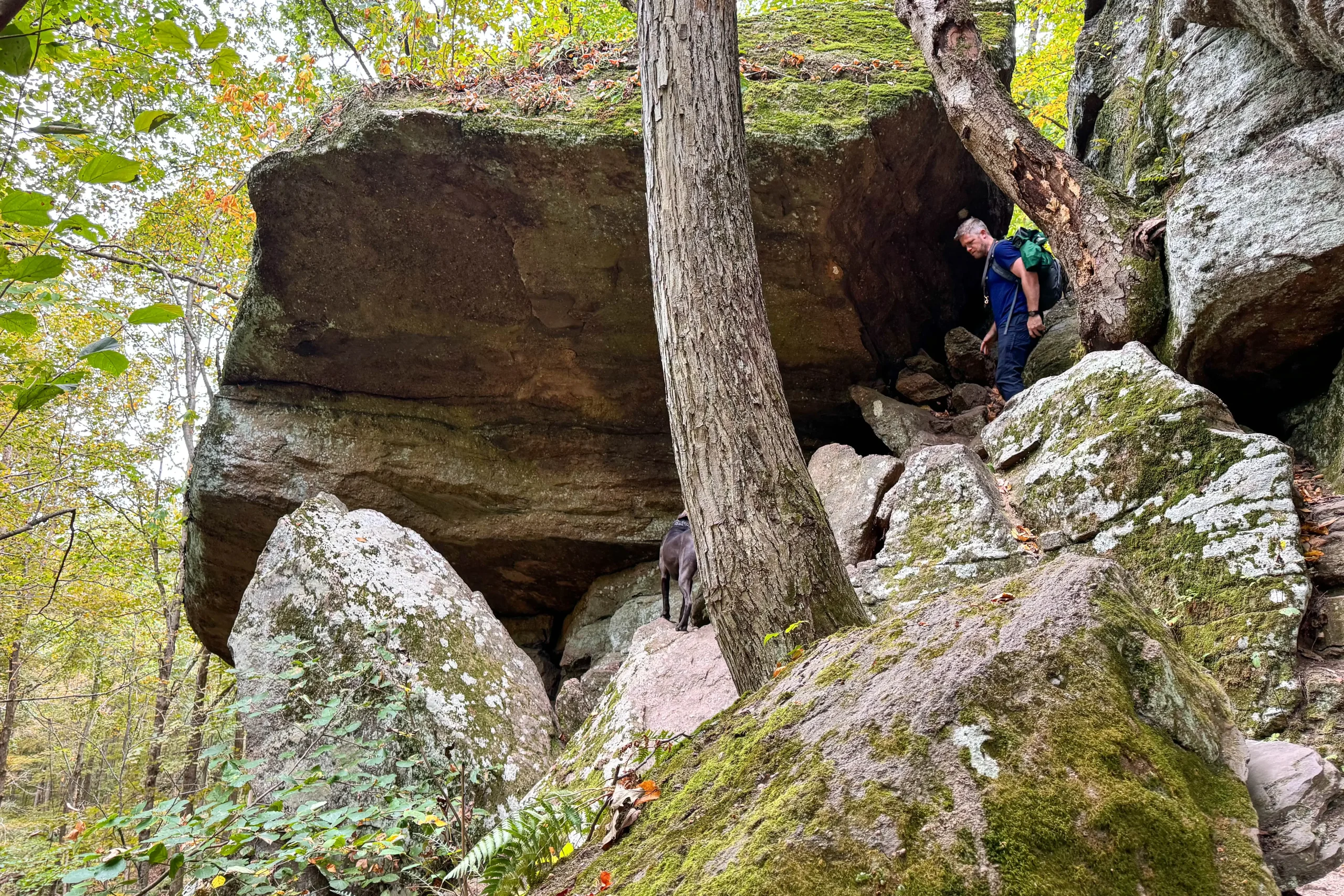
***If you want to get to the COOL part of the Horse Caves, the part you see in my photos here, then before doing the short scramble up the rocks head to the RIGHT and follow the rock wall for a couple hundred feet. Walk along the base until you reach the caves! Then you can return to the rock scramble to resume the rest of the hike.*** PAUSE your watch/GPS if wearing one otherwise the mileage below will be very off! :))
2.4 miles: bear right on white, follow white blazes up to summit. ⚪️⚪️
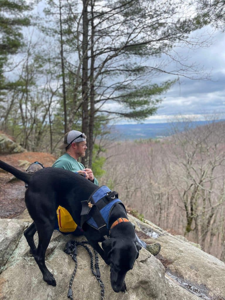
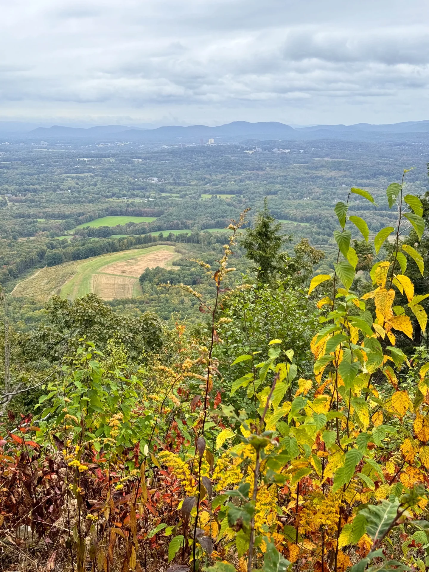
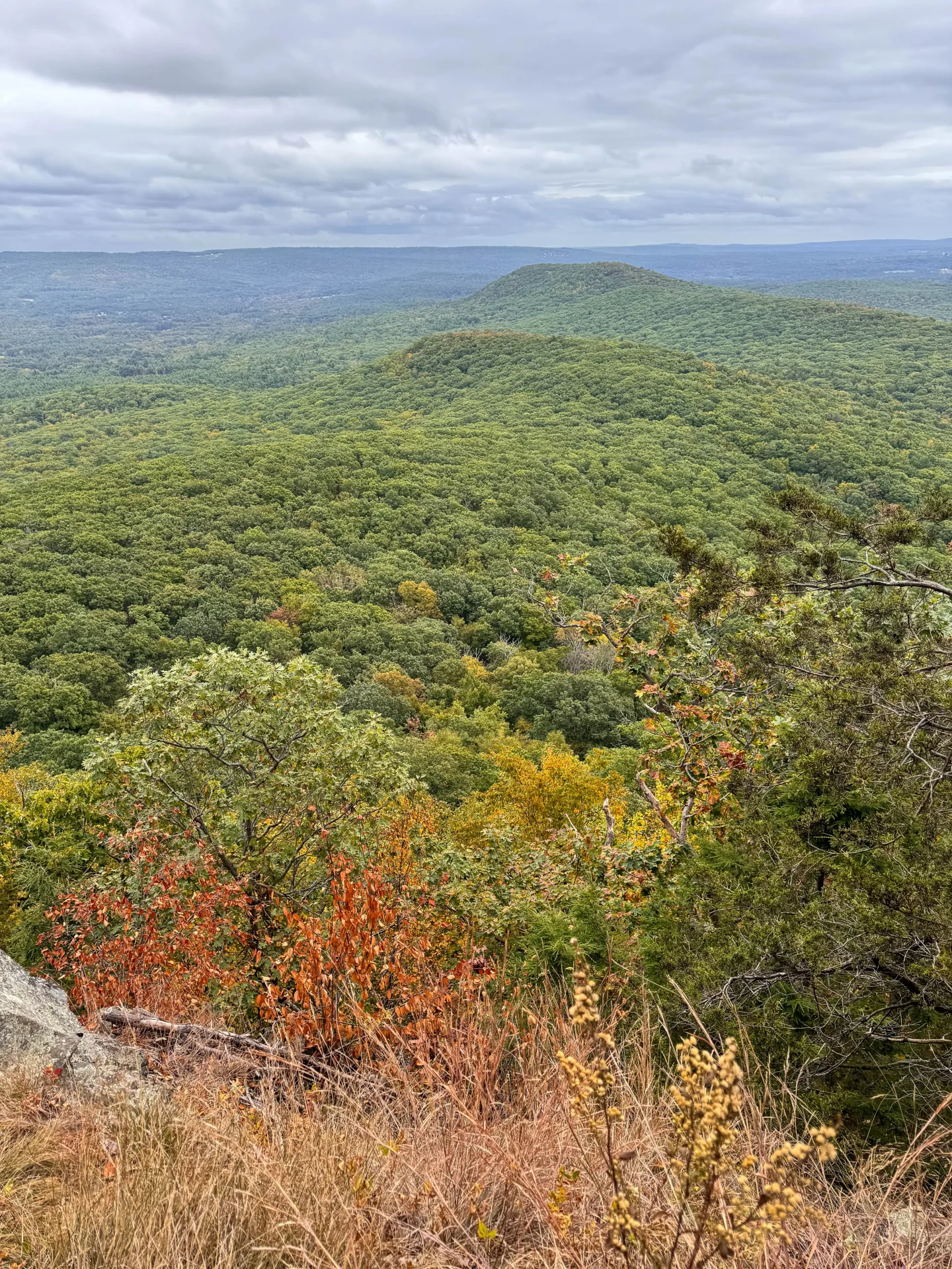
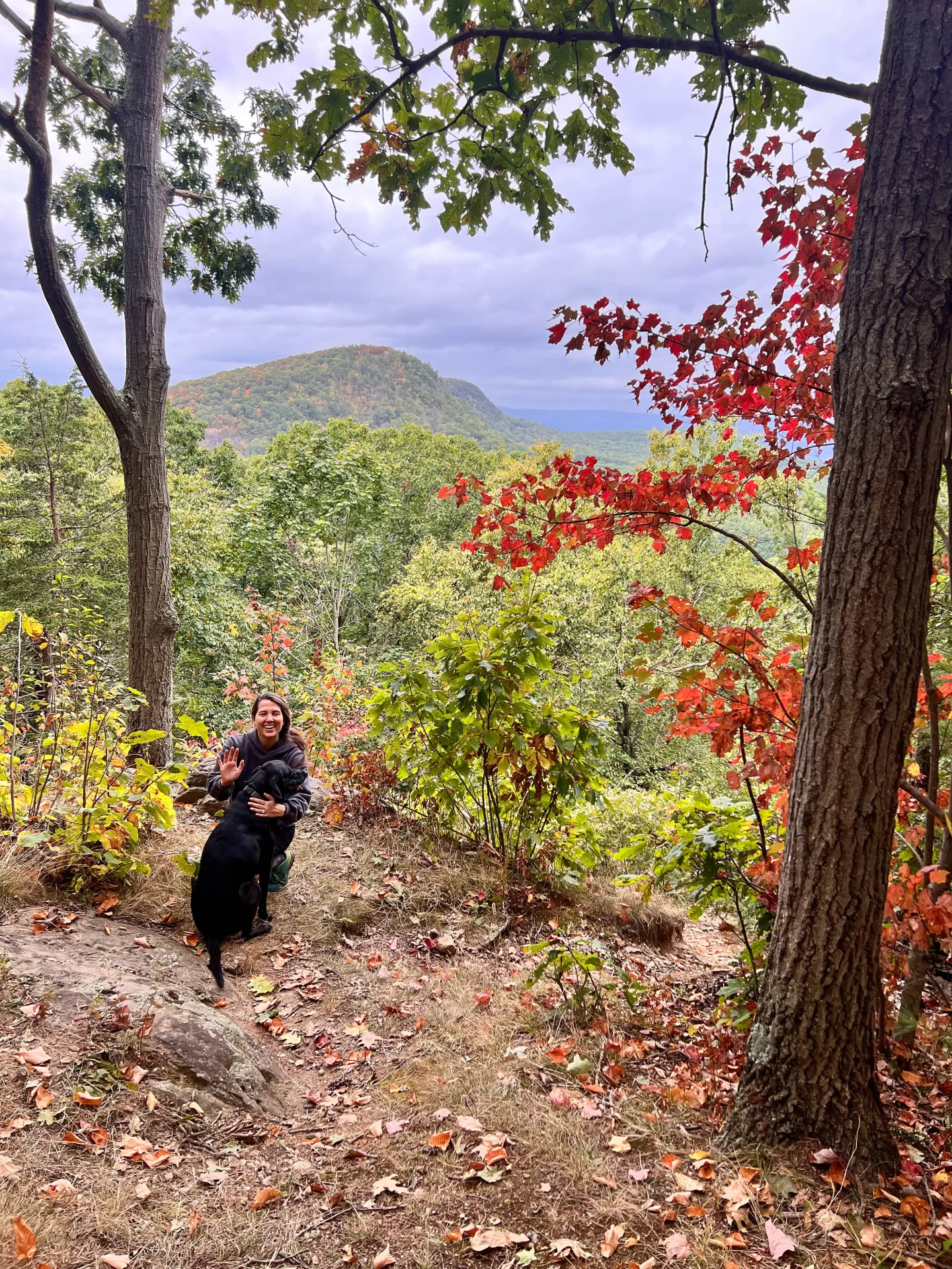
2.5 miles: arrive at the first view! This sweeping view faces east. Be careful as you explore along the rocks & ledges here!
After taking in this view, get back on trail and continue uphill on the white. ⚪️
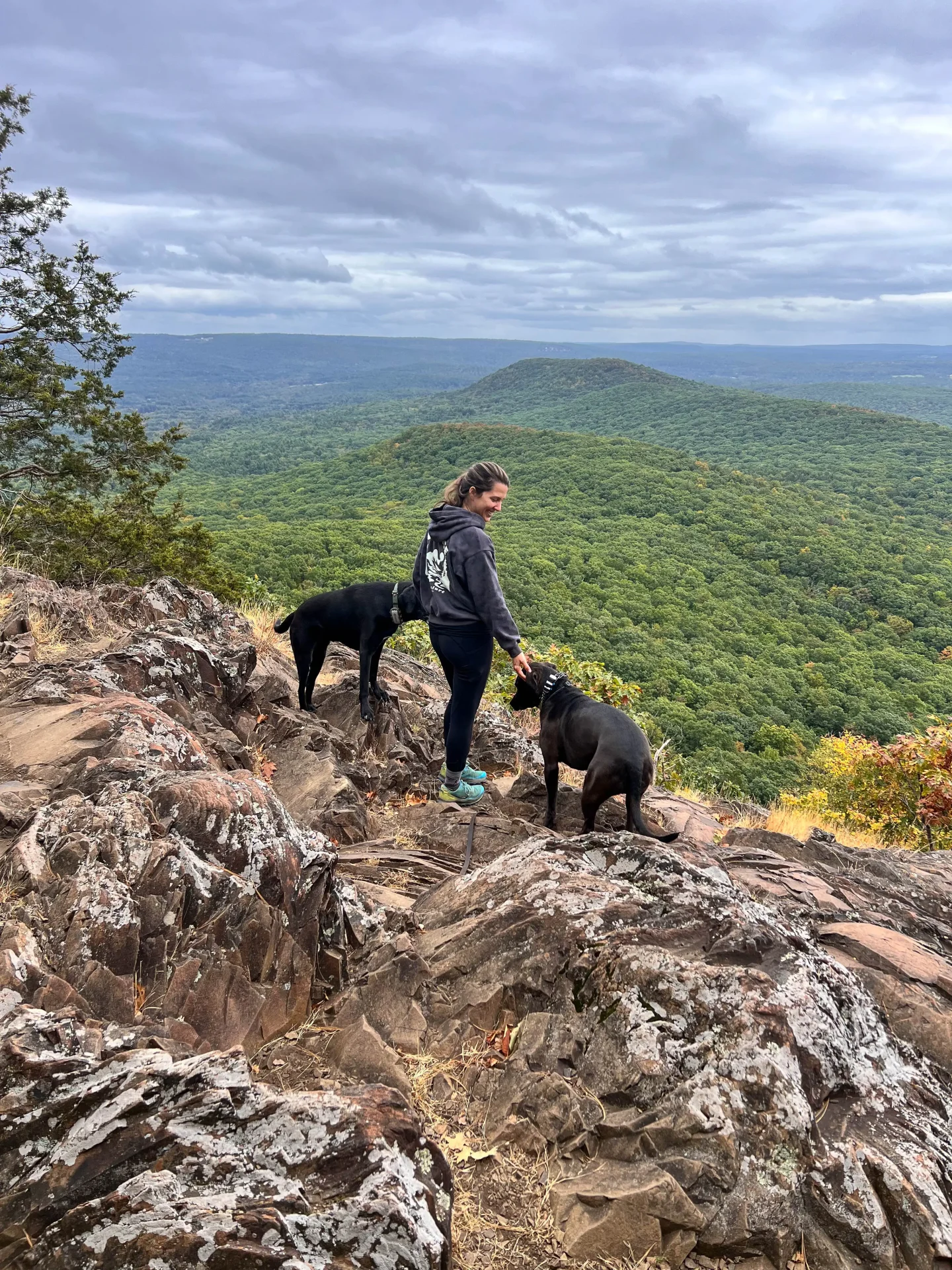
2.55 miles: arrive at the official summit of Mount Norwottuck ⛰👏⛰ (you will see a sign!)
After taking in the view here at the top of the mountain, get back on the white trail ⚪️ and start heading downhill.
3 miles: bear to the right to continue staying on the white trail. ⚪️
3.15 miles: continue to stay straight on the white blazed trail ⚪️
At 3.31 miles: you’ve now reached the beginning of the loop! Turn left onto the orange trail and exit the way you came in. 🙂 🟠
3.55 miles: Bear to the right to stay on the white and orange blaze trial, the same trail you walked in on.
Then stay straight to continue on the orange white and blue trail, which leads you back out to the parking area. 🚙👏
Where to eat after hiking Mount Norwottuck 😍👏
You made it, friends! And now is the fun part! (Well, another fun part ;))
Let’s eat! Or get a tea, a hot latte, or even a local beer – yup, this place has everything and anything you might want after a hike. Hike early enough so it’s still open when you’re done!
Atkins Farms in Amherst just minutes from the hike is THE place to stop before or after your hike. I got an apple cider donut, a salted caramel chocolate chip cookies and an egg and cheese for the top. 😉 (We went before the hike!)

And look at how fair the prices are?!
Where can you get an egg & cheese for under $5 these days 😱


Final Thoughts
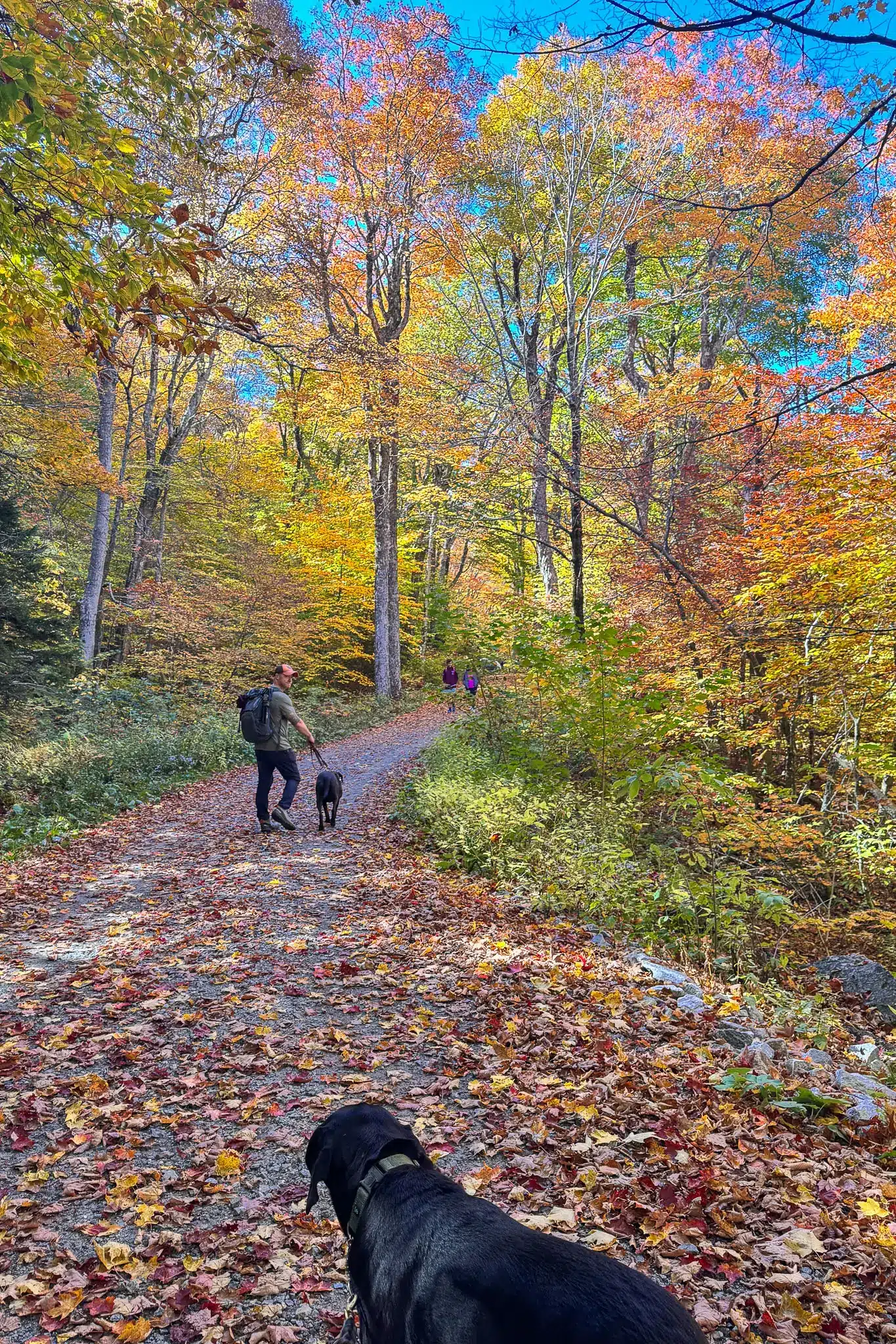
Hiking Mount Norwottuck is more than just a trek to a summit—it’s an opportunity to connect with the history and natural beauty of the Pioneer Valley. Whether you’re an experienced hiker or someone looking for a moderate day hike, this trail offers something for everyone. With its rich history, unique geological features, and stunning views, Mount Norwottuck is a must-do hike for anyone exploring this area of Massachusetts!