Hike Camel’s Hump in Vermont; 3 Scenic Trails

Tucked away in the heart of the state near Waterbury, Vermont’s third highest mountain and one of its five coveted 4,000 footers, Camel’s Hump stands as an iconic peak with its distinctive and eye-catching double-humped profile. In this post, we’ll explore 3 different trails you can take to hike up Camel’s Hump.
That’s right. We don’t know how many humps Sally the Camel had, but you can count on 3 different trails to hike your way up Camel’s Hump here! 👀 🐪🐫
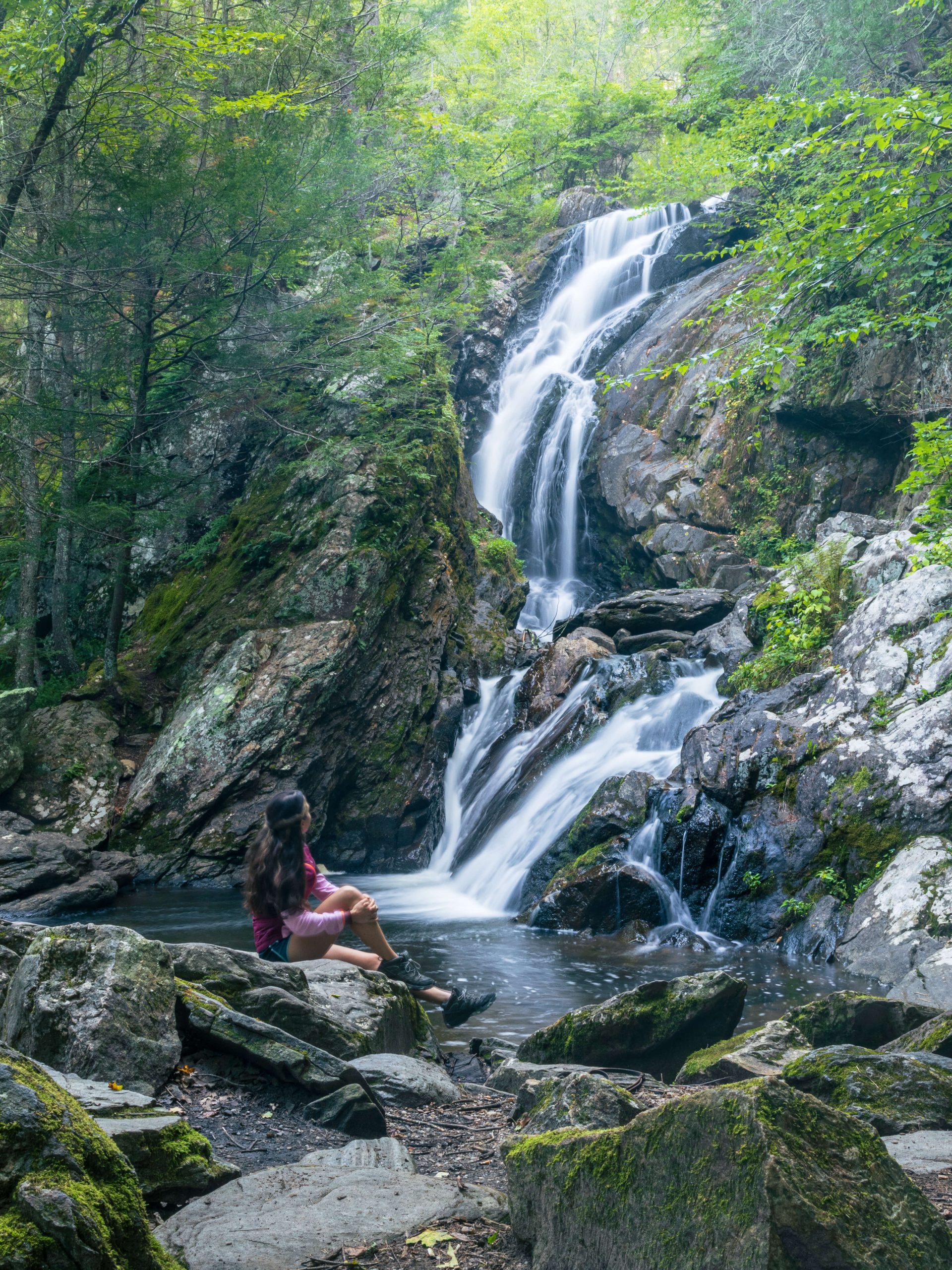
I’ve done this hike twice in the summer, one of those times for sunset which was beautiful! For sunset, we took the Burrow’s Trail (the shortest trail) up at 4.7 miles.
Each distinct route has its own highlights, challenges, and, of course, spectacular rewards – the views at the top of Camel’s Hump! We cover each route in detail below! ⬇️
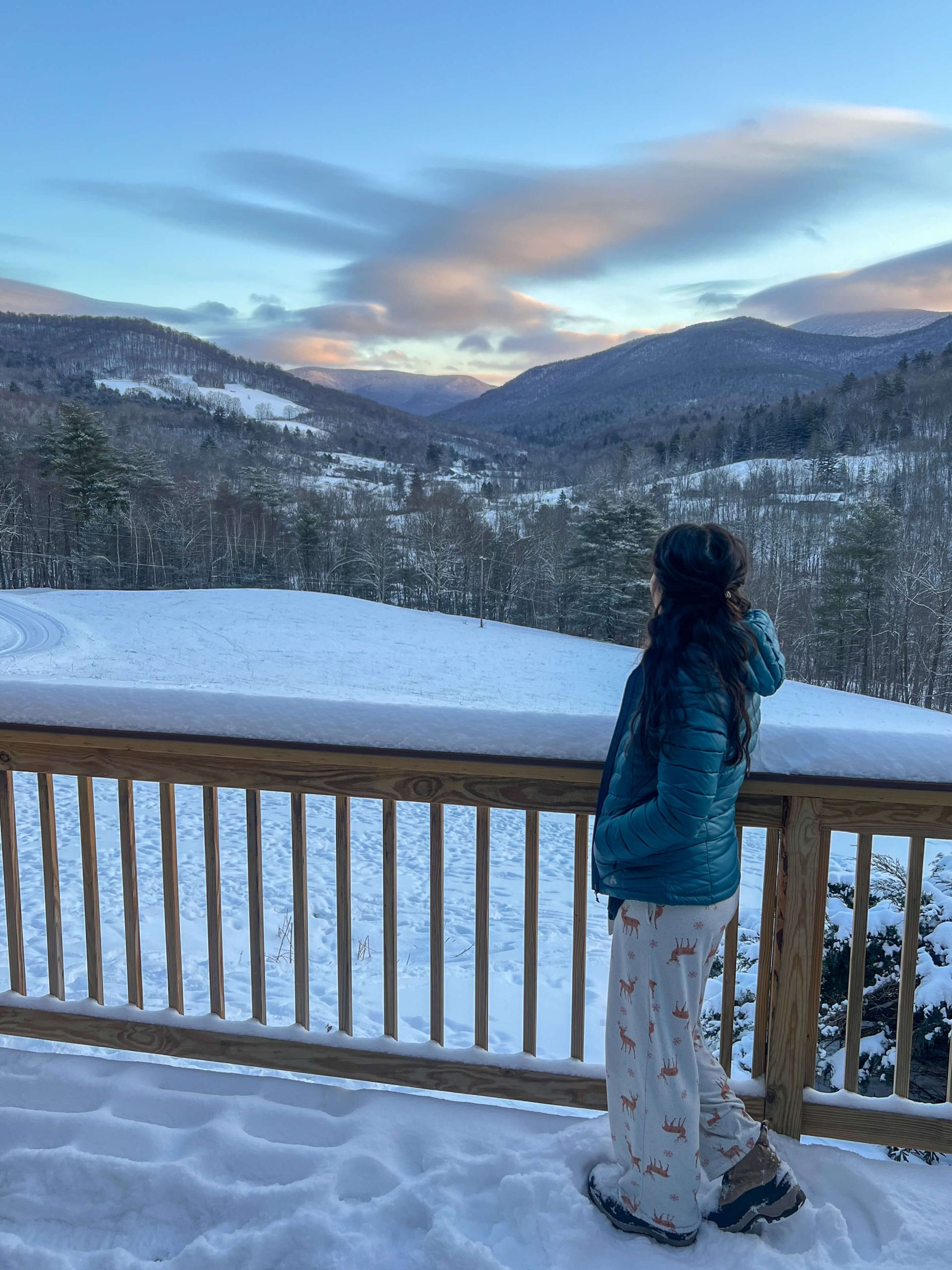
 View facing west toward NY!
- Admiring the views…


I’ve hiked all 5 of Vermont’s 4,000 footers but Camel’s Hump is the second that I’ve hiked more than once. And it’s a VT mountain I hope to return to again and again!
Quick breakdown of the 3 different trails to get to top of the Hump:
- Burrow’s Trail⛰
- 4.7 miles 🥾
- 2,280 ft elevation gain
- Forest City & Long Trail⛰
- 5.5 mile loop 🥾
- 2,414 ft elevation gain
- Camel’s Hump Trail⛰
- 6 miles 🥾
- 2,588 ft elevation gain

Camel’s Hump General Stats:
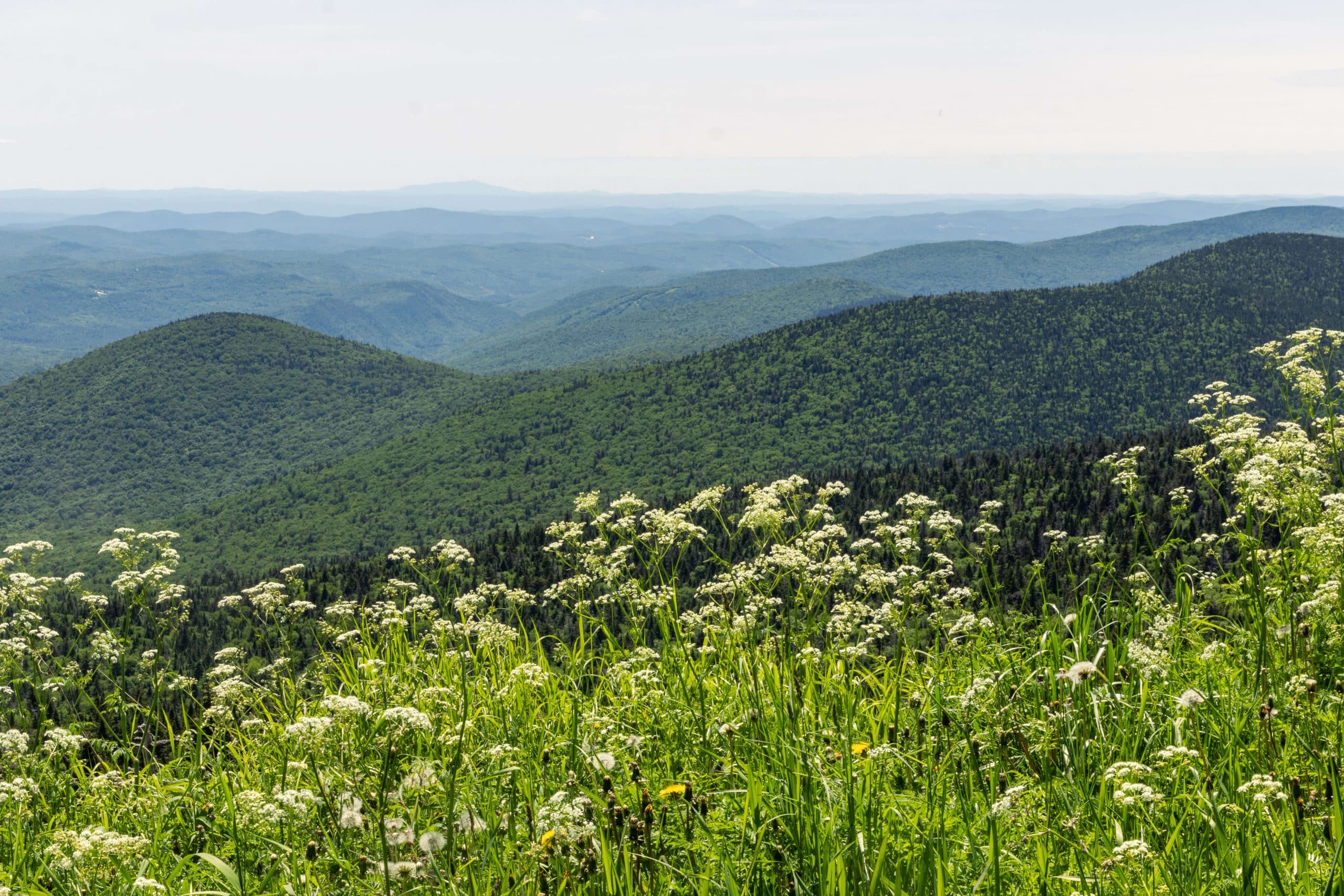
⛰Main Attraction: The views, of course! 🙂
And here’s what you can see from Camel’s Hump 360 views at the top:
- 🧭 North towards Vermont’s additional high peaks
- 🧭 South towards VT’s Killington Peak and Mount Abraham
- 🧭 East towards New Hampshire’s imposing White Mountains
- 🧭 West out over glistening Lake Champlain and New York’s Adirondack Mountain range
LEVEL & Terrain: Challenging & rocky
🗺CAMEL’S HUMP MAP:

🐶DOG-FRIENDLY: YES, on leash.
KID-FRIENDLY: Only tough kids need apply for these trails.
PEACE AND QUIET:
Depending on the time of year and time of day, you’ll likely encounter other like-minded hikers during your time on these routes. Early morning for sunrise, later afternoon for sunset, or during the winter months are all good times to avoid any crowding.
⚠️SAFETY:
Each route offers its own set of challenges and varying terrain. As with most outdoor adventures, there is the risk for injury. Watching your step and taking your time are they keys to this climbing puzzle.
🐫⛰3 Different Trails to Hike Camel’s Hump⛰🐫


1. Burrows Trail up to Camel’s Hump: A Classic Ascent, 4.7 miles, 2,280 ft elevation
- Miles: 4.7 miles
- Elevation Gain: 2,280 ft
- Trail Type: Out & back
- Level: Hard
- Time: ~4 hours
- Parking: Navigate here to lot at the end of Camel’s Hump Rd from Huntington Center (this is a rocky and uphill road!)
- Dog-friendly: Yes
- Helpful AllTrails Review: “Such a great trail. So well maintained, mix of roots and landscaped rocks makes for easy ascent. It’s a steady incline, but I’d call it more moderate than very challenging. The view at the summit is extraordinary. The rocks I could picture being slippery when wet, but I hiked during a dry spell. Highly HIGHLY recommend!” ~Katie Sullivan 9/21/23
The Burrows Trail is perhaps the most popular and quintessential route to the summit of Camel’s Hump. This trailhead is located at the terminus of Camel’s Hump Road in Huntington. The ascent trail is very well-marked and maintained, making for a pleasant, albeit challenging route.
This is the best trail to take if you are at all nervous about finding the correct trails and aren’t good at navigating with an app like AllTrails when you’re out there. That’s because this trail takes you up and back down the same way you came.
The Burrows Trail gets you up and over Camel’s Hump summit in a 4.7 round trip, gaining about 2,280 foot of elevation.
From the summit you can look north towards Vermont’s additional high peaks, westward out over glistening Lake Champlain and New York’s Adirondack Mountain range, east towards New Hampshire’s imposing White Mountains, and south towards VT’s Killington Peak and Mount Abraham, you return via the same route you hiked up.
Highlights Burrows Trail up to Camel’s Hump:
- Forested Bliss: This trail meanders through lush, dense forests, offering a mostly shaded and serene ascent.
- Peaceful Summit: Depending on the time of day, the wide open summit can provide a more tranquil atmosphere, allowing visitors to soak in the natural beauty undisturbed. I would plan to climb very early or during the golden hours of the day to help avoid any crowds.
- Alpine Zone Views: As you ascend, the forest often will give way to open rocky expanses, providing exquisite views of the surrounding landscape.
2. Camel’s Hump via Forest City, Long, and Burrows Trail (loop): A Less Traveled Path, 5.5 miles, 2,414 ft elevation
- Miles: 5.5 miles
- Elevation Gain: 2,414 ft
- Trail Type: Loop
- Level: Hard
- Time: ~4 hours
- Parking: Navigate here to lot at the end of Camel’s Hump Rd from Huntington Center (this is a rocky and uphill road!)
- Dog-friendly: Yes
- Helpful AllTrails Note: Hikers recommend doing the loop via Long Trail/Forest City in a counter-clockwise direction. Start at the Burrows trailhead, follow the Forest City Connector and Forest City to Long Trail, then go left on Long Trail up to the summit from the south. Heading in the opposite direction from the summit down Long Trail is treacherous in places.
For those seeking a quieter and less crowded route, this loop offers a more secluded experience compared to the first option which just goes up and down the Burrows Trail.
The disadvantage of this route up Camel’s Hump compared to the first is that other trails branch off from the top and along the Long Trail. So only take this trail if you are good at navigating with AllTrails. That also requires you to have cell service and a charged phone.
This trailhead is accessed via the Burrow’s Trailhead in the town of Huntington. Instead of bearing left for Burrow’s at the beginning of your climb, you’ll make a right at about 0.1 miles and set off on the Forest City Trail.
At around 1.5 miles you link up with Vermont’s legendary Long Trail, traversing this path all the way up to Camel’s Hump summit.
This approach is breathtakingly dramatic, rocky, and can be treacherous, so keep your wits about you and take your time.
After taking in the views at the top, about-face and descend the way you came. 🥾
Highlights of the Forest City and Long Trail
- Monroe Skyline: Hikers on this trail are treated to stunning views to the east, west, and south along the Monroe Skyline. Catch glimpses of the White Mountains, Adirondacks, and Green Mountains.
- Montclair Glen Lodge: Nearing the end point of this route, hikers will encounter Montclair Glen Lodge, a rustic shelter that serves as a great resting spot and over night camping area for Long Trail through hikers.
- A True Wilderness Experience: The Monroe Trail provides a true sense of New England wilderness, with few amenities and a more backcountry feel.
3. Camel’s Hump Trail: 6 miles, 2,588 ft elevation gain
- Miles: 6 miles
- Elevation Gain: 2,588 ft
- Trail Type: Out & back
- Level: Hard
- Time: ~4.5-5 hours
- Parking: Navigate here to lot at the end of Camel’s Hump Rd from North Duxbury
- Dog-friendly: Yes
- Helpful AllTrails Note: “It is a fairly relentless climb, but not unduly steep. Summit is windy and cold, so bring extra thermal layers, but the panoramic views are amazing!” Mark Thurston 10/27/23
- Note: During the winter months the closest lot is not always open, so expect to park a little further from the starting point.
The aptly named Camel’s Hump Trail is a direct route up Camel’s Hump that rambles along the Monroe Trail all the way up to the mountain’s 4,065 foot rocky summit.
The trailhead for this renowned route again begins at the end of Camel’s Hump Road, however, the parking area is in Duxbury, as opposed to Huntington.
From the parking lot in Duxbury, the Monroe Trail will be a steady climb for 2.3 miles and about 1,600 ft before reaching the Dean Trail intersection. (This trail is like a lollipop; straight for 2.3 miles then lollipop loop at the top AKA the Dean Trail intersection at which you can go left or right.)
At this point you have the option to turn left onto Dean Trail and then take the Long Trail up to the summit or continue straight on the Monroe Trail to the summit. (Don’t do a hard right turn as this will take you on the Alpine Trail and NOT to Camel’s Hump!)
If continuing straight on Monroe Trail, you’ll reach the hut clearing at which point the Monroe Trail ends and becomes the Long Trail. It is then a short climb to the summit.
Highlights: of the Camel’s Hump Trail
- Rugged Terrain: This trail takes you through some of the more rigorous and challenging terrain on Camel’s Hump so be sure to wear sturdy footwear! Towards the summit, the trail becomes very gnarly and narrow. Here you’ll want to focus, taking one deliberate step at a time until you reach more forgiving ground.
- Birch Forests: The trail winds its way through a variety of forested hallows, but notably through enchanting birch forests which give a picturesque and unique aesthetic to this trail!
- B-24J Bomber Aircraft Crash Site: As is common in the windy mountain-scapes of the northeastern United States, there is a downed aircraft memorial site. This particular one is right at the outset of this route. The crash occurred in October of 1944 and tragically claimed the lives of all 9 crew aboard. There is a plaque here memorizing these brave servicemen.


I hope you enjoyed this post about the 3 different hikes up Camel’s Hump! 🙂
Camels Hump Hiking FAQs
As listed in this post, there are 3 different trails you can take to get to the top of Camels Hump! The Burrow’s Trail route is 4.7 miles. The Forest City & Long Trail Loop is 5.5 miles. And the Camel’s Hump trail is 6 miles long.
The Burrow’s Trail route up Camel’s Hump is the shortest year-round hike at 4.7 miles.
Camel’s Hump is in the town of Huntington/North Duxbury, Vermont. The trails listed here start from either Huntington Center or Duxbury.
The tallest mountain in Vermont, at 4,393 feet, is Mount Mansfield in the town of Underhill, Vermont, in Chittenden County. Check out this post here on 3 different hikes up Mount Mansfield!
5 mountains in Vermont are above 4,000 feet! These include Mount Mansfield (the tallest), Camel’s Hump, Mount Ellen, Mount Abraham, and Killington Peak.
I provide links to park and navigate to each of the trails listed here to hike up Camel’s Hump. Most of the parking is along Camel’s Hump Road.
Whether you opt for the classic Burrows Trail, the tranquil Forest City Trail, or the challenging and iconic Camel’s Hump Trail, each route up this beloved Vermont staple promises a unique and memorable hiking experience.
⚠️Note: during the winter months, the small parking areas that are normally open and accessible throughout the year may be closed. That only means that you’ll need to park on the road or elsewhere. AllTrails always has updated info about the roads. So just click the AllTrails link in each title above to get there!
Want to hike Vermont’s TALLEST mountain?! Check out this post on 3 different hikes up Mount Mansfield in Vermont!


I loved your post on hiking Camel’s Hump! The trails you highlighted sound stunning, and your descriptions really painted a picture of the views. I can’t wait to try the Sunset Ridge Trail; the panoramic vistas must be incredible! Thanks for sharing your experiences and tips!
Thank you for checking it out! Camel’s Hump is a must-do hike in VT! Here for any questions!