Hike Gibbs Mountain in MA; Trail Guide to Views and Lake!
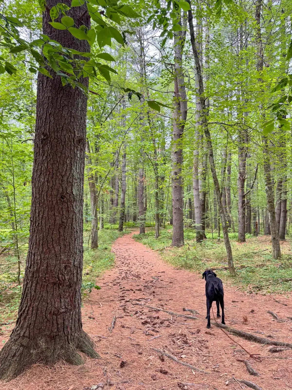
Soft pine trails, quiet forest groves, and a feeling of escape make the Gibbs Mountain Loop Trail a hidden gem for dogs and their people in eastern Massachusetts. Find meadow views, Beebe Pond, and wide pine paths that are easy to follow.
Find everything you need to know to hike this 3.8-mile loop, including trail details, where to park, and turn-by-turn directions! 🧭🥾
Located just 30 minutes east of Worcester and 38 minutes west of Boston within the beautiful 958-acre Callahan State Park, the Gibbs Mountain Loop offers a tranquil multi-mile walk through dense pine forest, gently rolling terrain, open meadows, and fern-filled undergrowth.
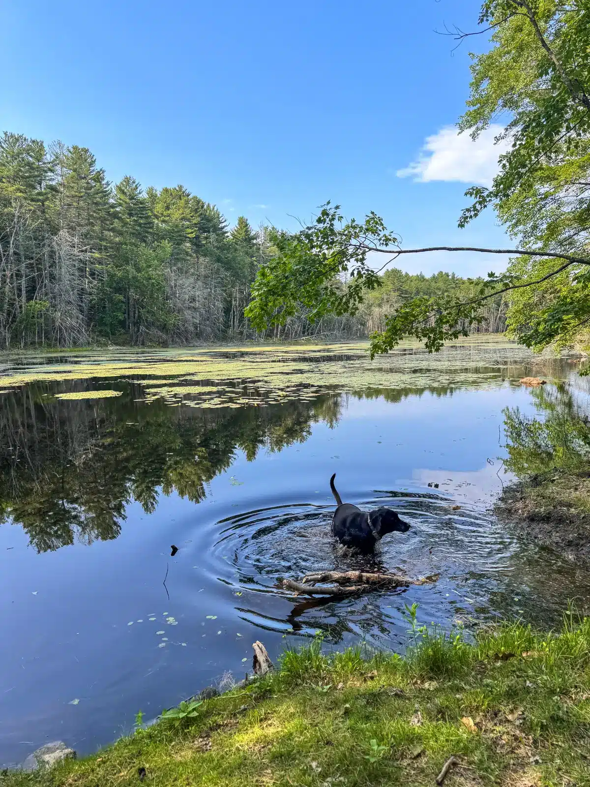
Though you won’t find sweeping summit views here, the peaceful woodland atmosphere and elevated feeling of walking along Gibbs Mountain create a sense of being far away from suburban life without driving too far. The dogs will enjoy the chance to swim at the picturesque Beebe Pond and the almost 4 mile loop provides enough challenge without any big inclines, making it a great option for dogs of all ages.

Living next door in Connecticut, I love taking day trips to hike new trails in Massachusetts. I usually opt for a hike in the Berkshires, but I was pleasantly surprised by this serene park and hike that’s not far from Boston!
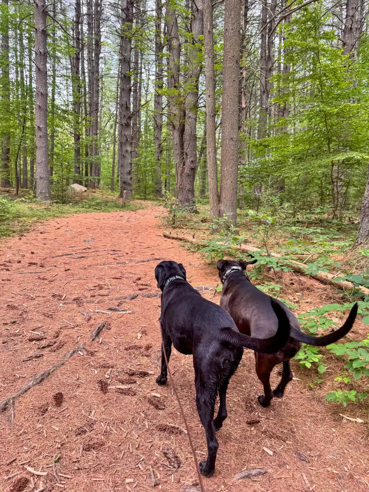
This hike is especially ideal for walking with dogs thanks to its natural pine-needle carpet and wide, forgiving paths. Pine cones scatter across the trail, and tall trees provide shade as you wind your way up and around the top of Gibbs Mountain.
There are lots of little trails here, including mountain biking trails, so I suggest you use the custom map I made on AllTrails and follow the turn-by-turn trail directions I include further down in the post.
So let’s get to it! ⬇️🌲🌲
🥾 Gibbs Mountain Loop Overview 🥾
- Location: Marlborough/Framingham, MA
- AllTrails Link: each number on the map corresponds to the turn-by-turn directions included below
- Miles: 3.88-mile loop 🔁
- Time: 1 hr 45 min
- Elevation Gain: 446 feet elevation gain
- Difficulty: Moderate
- Conditions: Wide pine paths, meadow, pond, stone wall
- Parking: large parking lot off Broadmeadow Road, click to navigate to 42.33899, -71.49944 🚗
- Highlights: Wide paths, meadow views, pond for swimming 💦🐶
- Dog-friendly: Yes. steady paths, no big ups or downs, soft trails 🐶
ESSENTIALS:
- Find the trailhead: From Marlborough Public Library, turn left on W Main Street, then make a quick right on Granger Blvd (US-20). After 0.9 miles, turn right onto E Main Street (US-20). After 1.8 miles, turn sharp right onto Farm Road. After 0.5 miles, turn left onto Broadmeadow Street, then after 0.8 miles parking will be on the left at 466 Broadmeadow Road.
- Land manager: Massachusetts State Park, Mass.gov. P.O. Box 248, Princeton, MA 01541. (978) 464-2987
🩷WHY YOU’LL LOVE IT💚
- Peaceful pine woods with a soft, dog-friendly trail
- Sea of ferns and tall trees create a lush, calming vibe
- A quiet escape that feels far from the city
Gibbs Mountain Details
From the large parking lot off Broadmeadow Road, find the trail kiosk and follow signs for the blue-blazed ‘Backpacker Trail’ to start the hike. This park is well-marked and well-maintained, but since there are mountain biking trails weaving through there are multiple turns and signs to follow as noted below in the turn-by-turn directions.


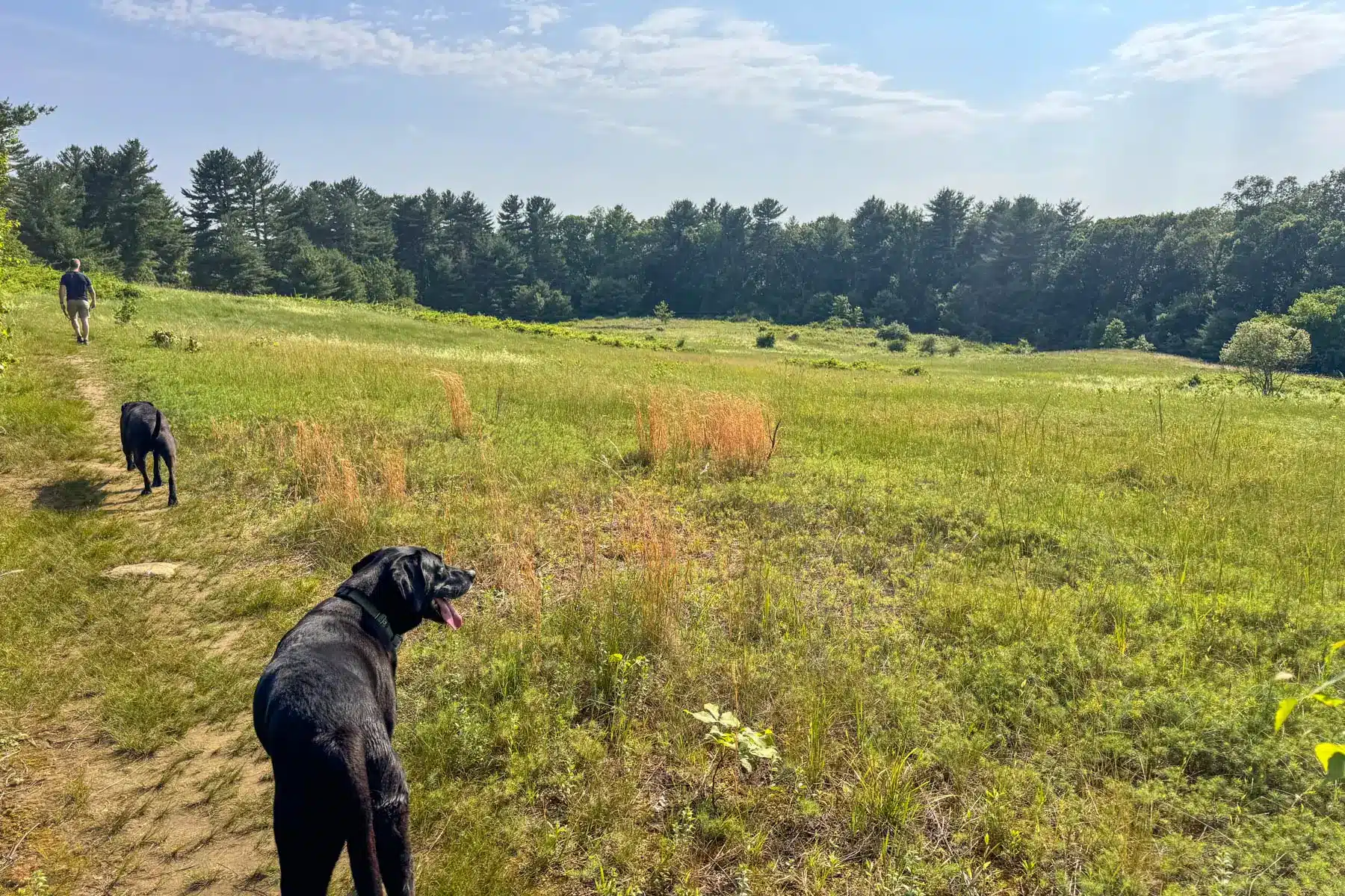
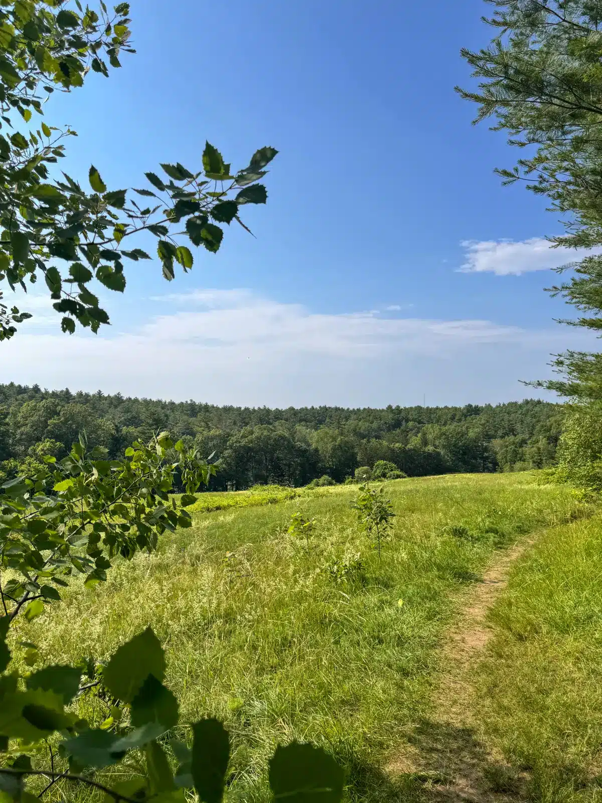
Continue following signs for the blue blazed ‘Backpacker Trail’ and ‘Backpacker Trail S’ which you remain on until about 2.15 miles where you pick up the Gibbs Summit Trail. Around 2.45 miles, the trail follows a high path above a sunlit meadow, giving the hike an airy, elevated feel.
At 2.85 miles, the dogs will be rewarded with a well deserved sip and swim at the expansive Beebe Pond. From here, the Bear Paw Trail will lead you back to the parking lot but not before passing through old stone walls and more open meadows for the dogs to explore.

🧭 TURN-BY-TURN DIRECTIONS 🧭
- Find trail kiosk and start here following signs for the blue-blazed Backpacker Trail.
- At 0.4 miles, continue straight following signs for the Backpacker Trail.
- At .46 miles turn right following the Backpacker Trail South sign.
- At 1 mile, left to follow the Backpacker Trail South sign.
- At 1.35 miles, bear right to follow sign to Northeast Loop Trail to leave the open field and head back into woods.
- At 1.56 miles turn right onto open field walking along the yellow gas pipeline markers (if you see the Callahan SP Northeast Loop sign you’ve gone too far!
- At 1.77 miles, at the bottom of the hill with the pipeline markers turn right. You will see ‘Sudbury Valley Trustees” marker on the trees. You’ll start walking on a thin trail between ferns.
- At 1.96 miles, turn left on the blue blazed trail to follow Backpacker/Bay Circuits sign, walking along the left side of the pond here.
- At 2.05 miles, turn left at top of hill to follow Backpacker Trail South sign and in 150 feet bear right to follow Backpacker Trail South sign.
- At 2.15 miles, bear right to start going uphill following Gibbs Mountain sign.
- At 2.28 miles near bear away from the cairns. See cairn on left bear right
- At 2.45 miles, turn left at bottom of hill at F29 Framingham Callahan state park sign following “Berne pond via meadow” sign.
- At 2.48 miles, turn left and follow “Berne Meadow” sign and after 100 feet, bear right to take the trail along the meadow.
- At 2.63 miles, bear left on the thin path at the fork at bottom of the meadow.
- At 2.75 miles, come to three-way intersection, turn left to start heading downhill toward the lake and continue walking along the left side of the lake.
- At 2.85 miles, stay straight to follow sign for “Bear Paw Trail” where you will see an old chimney, leaving the lake behind you.
- At 3 miles, turn left to walk between the stone walls at the top of the small hill where you’ll see “Bearpaw Trail” sign and in 100 feet continue staying left on the path along the open meadow.
- At 3.32 miles, turn left following Bearpaw Trail and then after 200 feet, keep right and begin heading downhill.
- At 3.75 miles, turn left onto Broadmeadow Road which will lead back to the parking lot.
Photos from the trail:
 Trail through the meadow
- Trail through the forest


- Short piece that goes through utility line trail, following gas pipeline markers (see #6 & 7 on trail directions above)


- stonewall that corresponds to direction #17 on turn-by-turn trail directions


That’s it, friends! I really hope you found a lot of value in this post, from the photos to the trail directions. And I hope you enjoy your hike here at Gibbs Mountain!
Feel free to leave a comment below or any questions you have. Or comment below to let me know how you enjoy the hike!
Happy Trails 🙂 🩷🥾🐾