13 Best Hikes in the Berkshires; Views, Waterfalls, & More!
Looking for the most scenic hikes in the Berkshires?! Check out this round-up of the best Berkshire hikes all with great views and/or waterfalls!
Located in western Massachusetts the Berkshires is a county that runs from the southern point of Egremont to the very top of the state in North Adams.
I’ve lived in New England all my life and was lucky enough to live in the Berkshires for 4 years. I loved my time living there from the small communities to the hiking and beautiful scenery.
While I live back in Connecticut now, I often make the 1-2 hour drive up to the Berkshires to hike and visit a favorite cafe along the way!
When I’ve had a rough work week or just feel the need to get away, the Berkshires is the first place I think to escape to. My fiance, Jared, likes to say – “does someone need a Berkshire weekend?” and usually I do! 👀
The Berkshires is a beautiful area with tons of hikes and trails to choose from so let’s get to our best of the Berkshires hiking list! ⬇️⬇️
Each hike includes several favorite places you can head to after for a latte, pastry, or lunch!
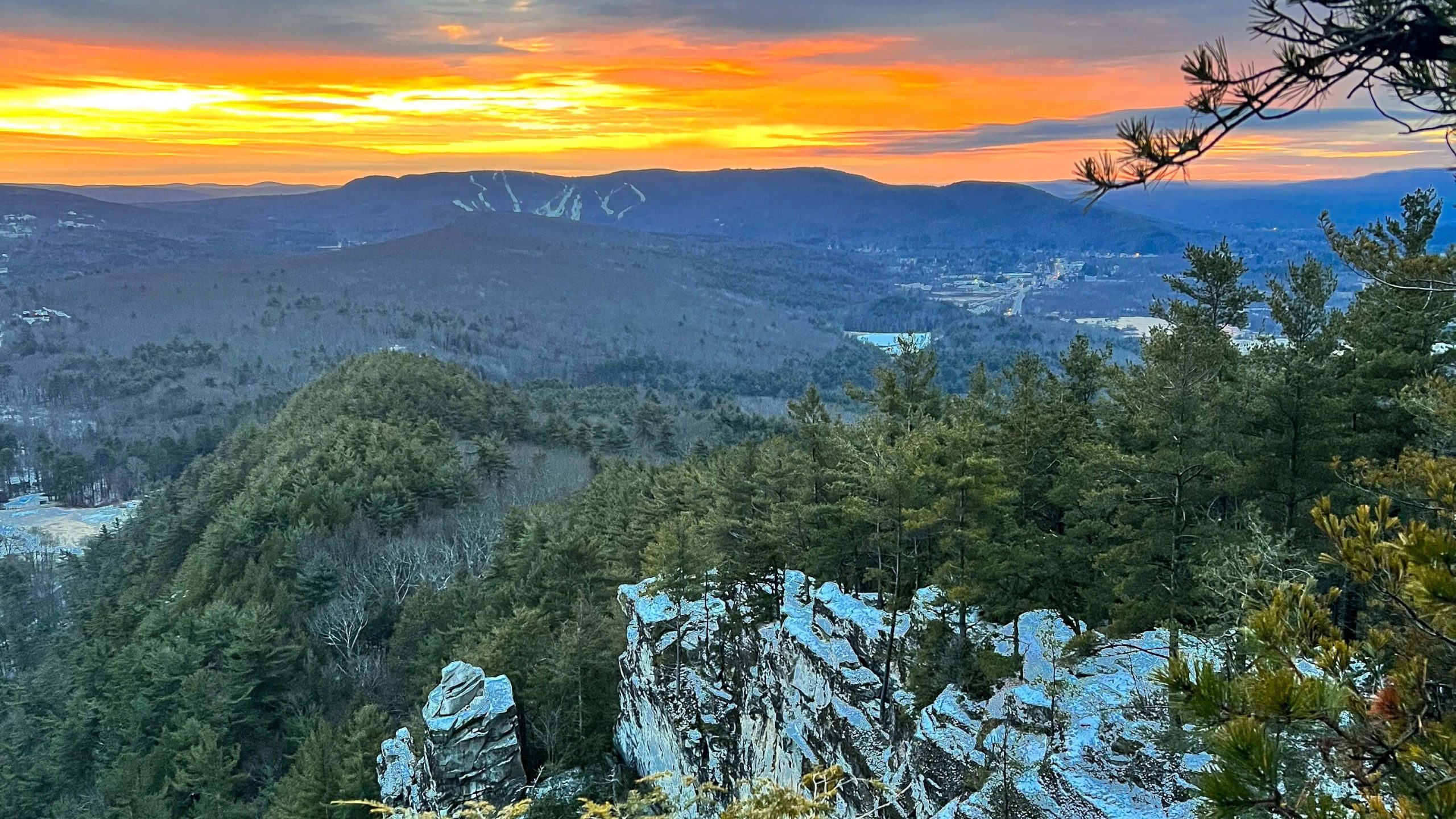
 Mount Race at sunrise
 The Patisserie in Great Barrington is a must-stop post hike!
 Monument Mtn at sunrise
For each hike you’ll find:
- a parking description & GPS coordinates 🚙
- a link to the hike on AllTrails 🔗
- mileage and difficulty 🥾
- special features of each trail 🌅
- and where to eat after! 🥐☕️
I plan to keep adding to this list so bookmark this page and return when you’re ready for a beautiful hike in the Berkshires!
🥾 List of 13 best hikes in the Berkshires 🥾
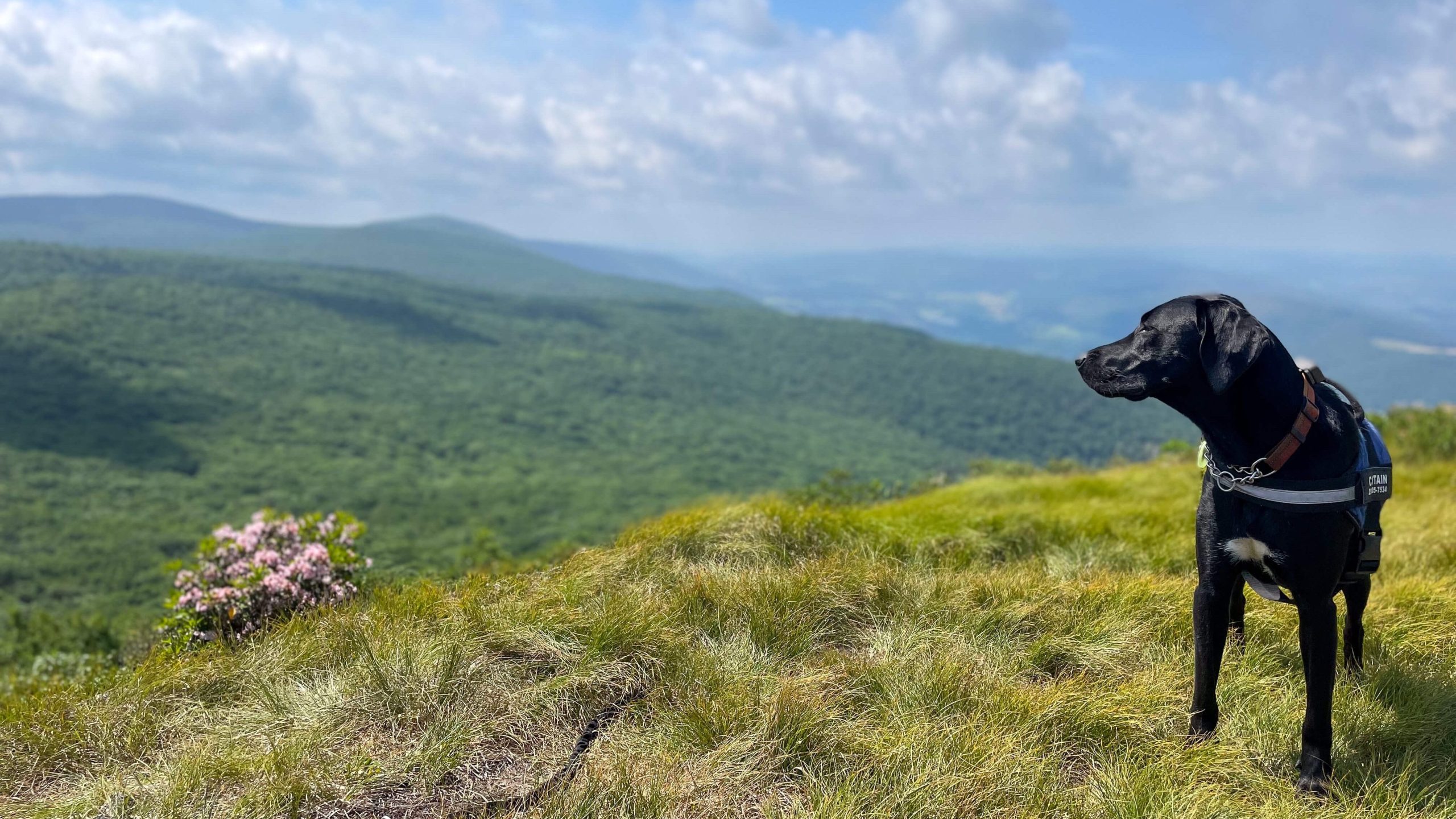
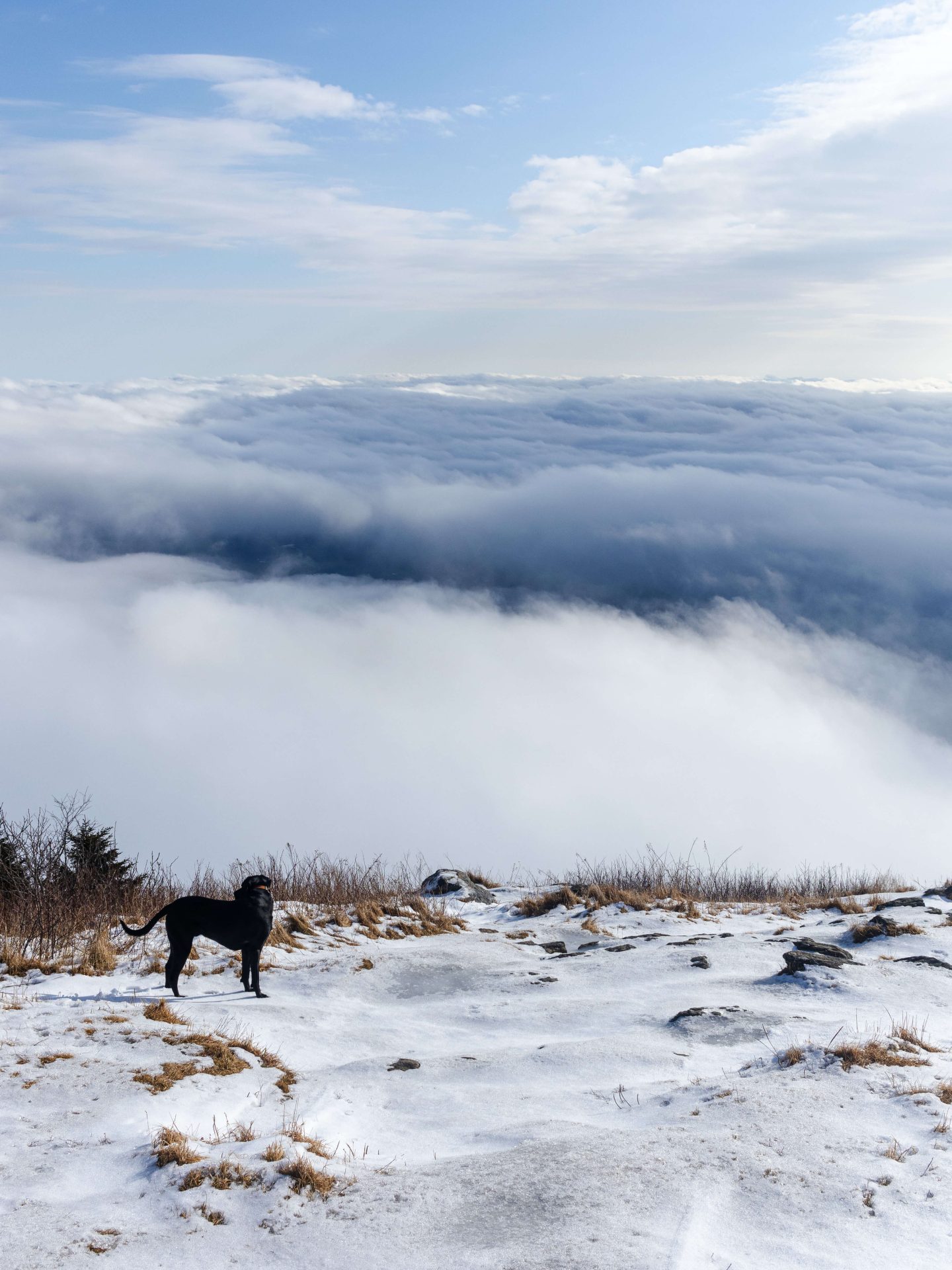
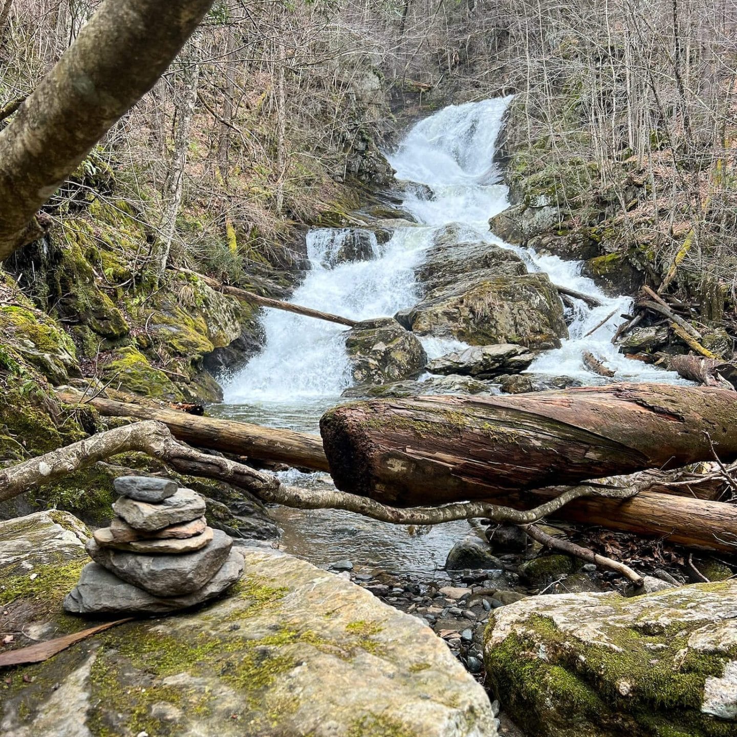
1. Mount Race and Race Brook Falls, Sheffield, 5.7 miles
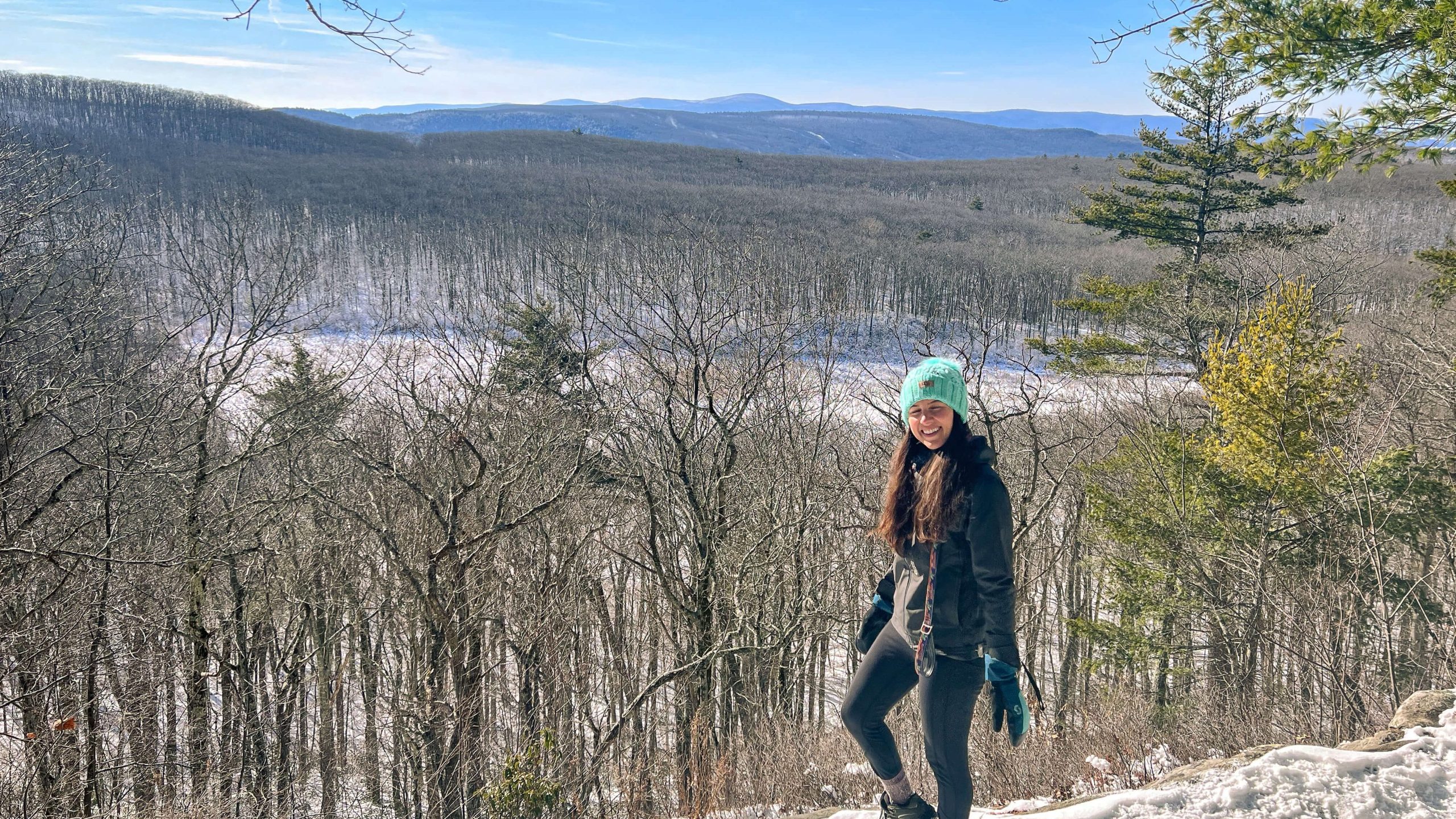
 Mount Race in summer
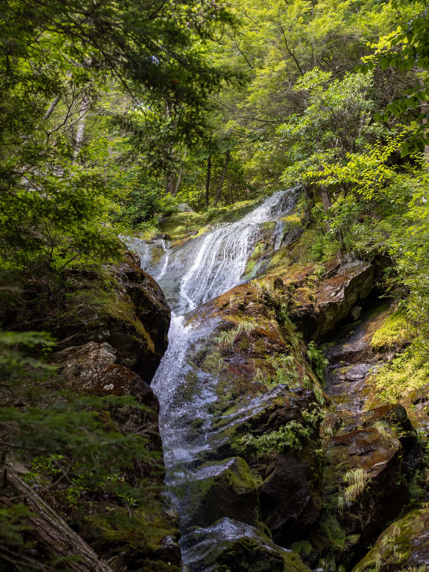 Race Brook Falls in summer
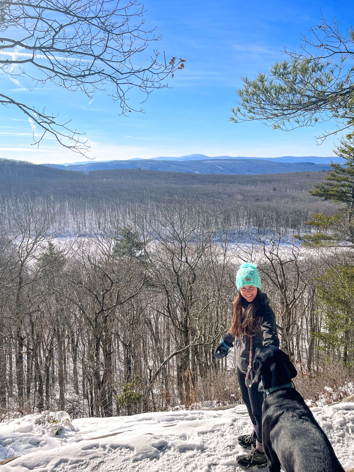
 Winter sunrise, Mount Race
- Miles: 5.7 miles 🥾
- Elevation Gain: 1,676 ft elevation gain 📈
- Level: Hard
- Parking: Pull off along Rt 41/S Undermountain Rd, on a busy day cars will be parked parallel to traffic all along the street here (GPS Coordinates 42.0895, -73.41122)
- Special Features: Wide open view facing east 🌅 and Race Brook Falls 💦
- Where to go after: I love stopping at the Marketplace Cafe ☕️ in Sheffield on way back to CT. Or stop by the amazing and historic Race Brook Lodge to check out the inn or eat at their 18th century tavern.
A big big view and waterfall, too, on this hike! It most certainly deserves a spot on this best hikes in the Berkshires list. Though tough, I’ve done this hike countless times from a winter sunrise or sweltering summer climb (see below) and each time it’s worth it!
Mount Race Details
While this hike is rated ‘Hard’ on AllTrails it’s mainly a non-technical uphill walk except for a short scramble section at the end where you may use your hands to help you up.
At just 0.9 miles in you’re rewarded with the (usually raging) Race Brook Falls. Though not the tallest waterfall in MA (that’s further on this list!) this is a tall fall I always stop to admire. It’s a great spot to take a break and reinvigorate yourself for the rest of the climb.
From Race Brook Falls you’ll continue with a steady incline, passing Race Brook Campsites and at 1.9 miles you’ll meet up with the Appalachian Trail (white blazes). Turn left onto the AT and continue with the final mile of the hike.
At the top, enjoy the sweeping, wide-open views looking east over Mount Everett State Reservation. It’s a great place for lunch and to spend some time. It will be hard to leave this summit but when you do, turn around and enjoy the no longer uphill steps, back down the way you came.
2. Mount Greylock, Adams, 5.9 miles


- Miles: 5.9 miles 🥾
- Elevation Gain: 2,244 ft elevation gain📈
- Level: Hard
- Parking: Parking lot off of Gould Rd (GPS Coordinates: 42.62714, -73.14522)
- Special Features: Tallest ⛰ in MA, 360-degree views at the top, Bascom Lodge, and tower/monument
- Where to go after: Click here for coffee shops, diners, and restaurants to stop at in Adams.
At 3,491 feet, Mount Greylock is not only the tallest mountain in Massachusetts but also the tallest in all of southern New England! A must-do hike in the Berkshires and top spot on our Berkshire hikes list.
It is the hike that’s the furthest north on this best of the Berkshires hiking list. So, unfortunately, I don’t make it up there as often since it is about 2 hours from me.
I’ve climbed Mount Greylock multiple times; in winter, summer, and fall!
🌟 Check out my post for hiking Mount Greylock and see the best routes for each season!🌟
Mount Greylock Details
“The 12,500-acre Mount Greylock Reservation is the oldest Massachusetts wilderness park. The park spans five towns with the Mount Greylock summit in Adams. The reservation includes the state’s only subalpine taiga-boreal forest. Old-growth forests including remarkable stands of red spruce up to 120′ can be seen.
From late May through November 1, you can drive to the summit on two recently restored roads (weather permitting). The views are spectacular from the summit and several other spots along the roads.” ~exploreadams.com
In addition to the noteworthy views atop Greylock, there are two other reasons to hike up. From the top of the Veterans War Memorial Tower (built 1932) you’ll enjoy a five-state view from the highest point in Massachusetts.
And then Bascom Lodge, built from stone and red spruce from Mount Greylock, is open seasonally for dining, lodging, and events. Bring cash up to buy treats at the lodge! :))
3. Alander Mountain, Mount Washington, 5.8 miles


- Miles: 5.8 miles 🥾
- Elevation Gain: 1,200 ft elevation gain📈
- Level: Moderate
- Parking: Parking lot just off of West Street (GPS Coordinates: 42.0863, -73.46205)
- Special Features: Wide open views 360 degrees mainly facing west toward New York
- Where to go after: There isn’t anywhere too close here so I would head into Millerton NY to check out Harney & Sons Tea & Cafe or another cafe there or head into South Egremont to Mom’s County Cafe! (check hours)
The epic views on this hike in the southern Berkshires earn this hike a permanent spot on this best hikes in the Berkshires list! For me in CT, it is conveniently located in the southeastern corner of Massachusetts almost on the border of New York.
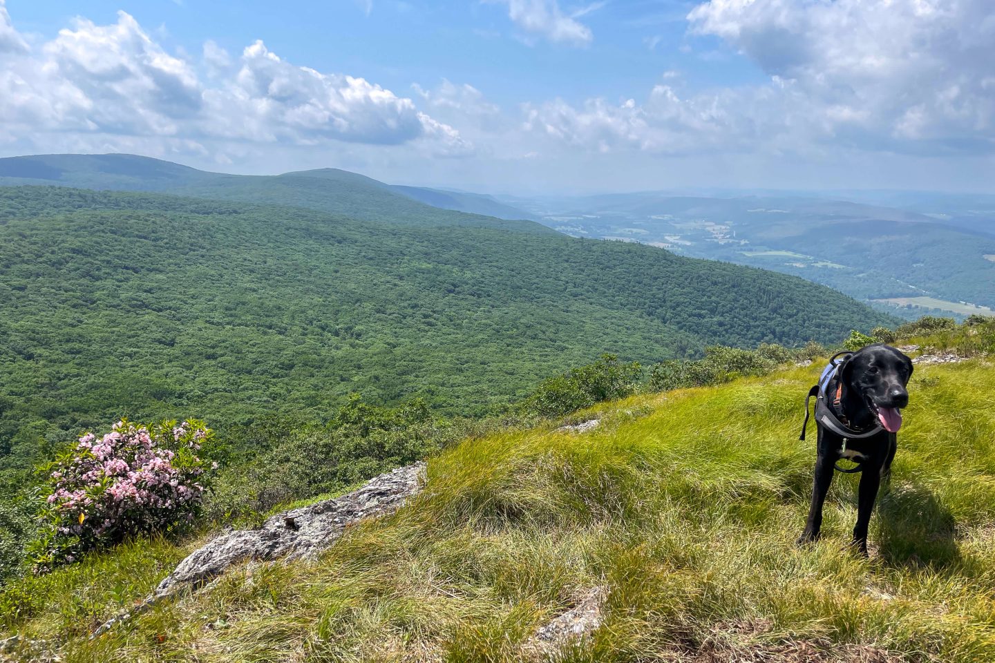
I’ve hiked Alander countless times and in every season. It’s a beauty when you catch the mountain laurel in bloom in early summer when the hills in the distance are blanketed in green. But it’s got breathtaking and wide wide-open views to the Catskills and is worth it in any season.
Alander Mountain Details
The summit of Alander Mountain is just east of the Massachusetts/New York border.
The trail is rolling for the first two miles before the more continuous climbing begins to the top.
For the first 1.9 miles it’s a mostly flat trail will just rolling elevation. You’ll cross a pretty stream at the beginning before the views start to open up the closer you get to the top.
After the 1.9 mile walk you’ll start the climb up with about 650 feet of elevation for the next 0.9 miles.
There will be a couple trails shooting off to the left so just stay straight all the way up to Alander Mountain.
In the late spring there are super pretty mountain laurel bushes along the top.
4. Appalachian Trail: Jug End Rd to Mount Bushnell, South Egremont, 3.6 miles

- Miles: 3.6 miles 🥾
- Elevation Gain: 1,102 ft elevation gain 📈
- Level: Moderate
- Parking: Several pull-off spots along Jug End Rd. (GPS coordinates: 42.14448, -73.43173)
- Special Features: Sweeping view and ledge facing east 🌅 from top of Mount Bushnell
- Where to go after: Mom’s Country Cafe 🍳 (open 7 am-3 pm every day) in South Egremont or Marketplace Cafe ☕️ in Sheffield if heading back to CT
One look at this view from the southern Berkshires and it’s no wonder this hike made the list of the Berkshire’s best hikes! That and the walk along the Appalachian Trail which is always a treat in itself!
I’ve done this hike a few times as it’s another conveniently located southern Berkshire hike just over an from me in CT.
This is a hike that always gets me. While it’s not very long there is quite a bit of elevation packed into a short distance.
Mount Bushnell Details
There is almost 900 feet of elevation in under a mile here and right at the start!
I like the way one AllTrails reviewer put it; “Steeper than the average moderate,” from Daniel Pianko who still gave this hike 5 stars. I guess he didn’t mind the steepness too much. 😉
There’s an amazing view at just 0.8 miles into this hike so if you want to shorten it you can turn around here.
While I haven’t done this hike for sunrise yet, the view at the top of Mount Bushnell would be perfect for it given its wide-open eastern-facing view at the top.
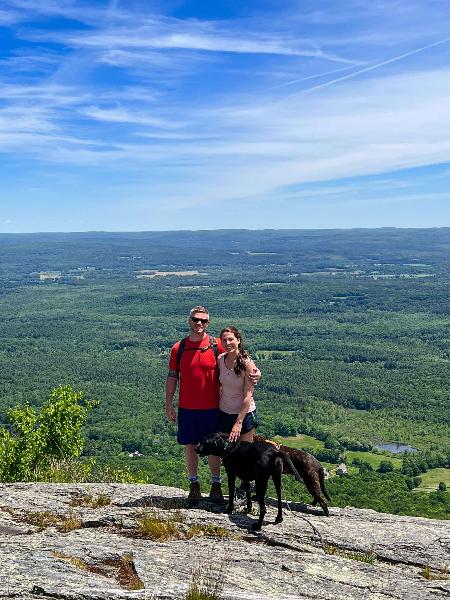
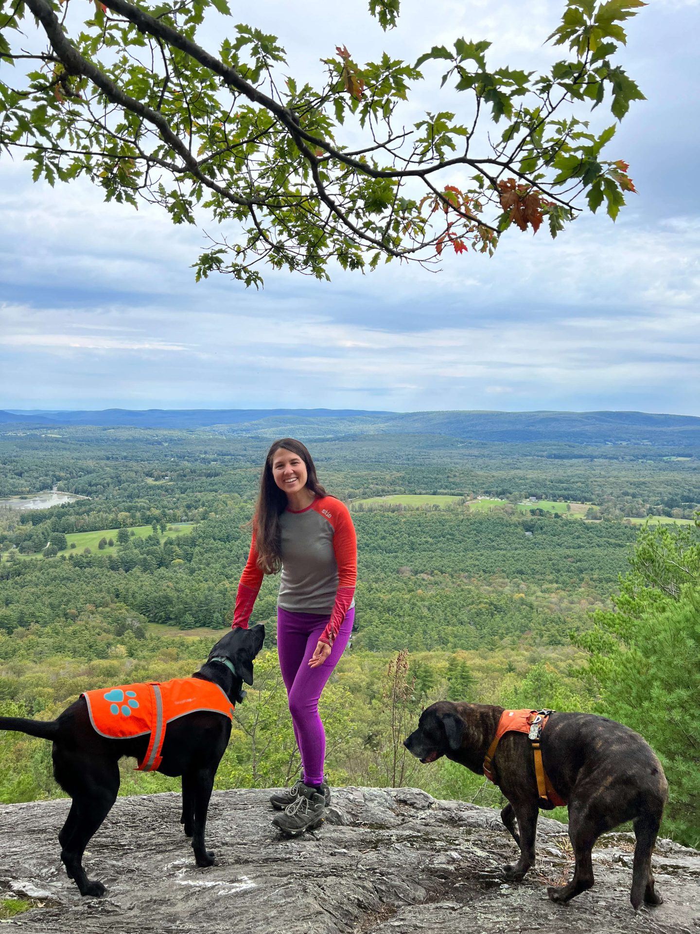
5. Monument Mountain via Hickey & Peeskawsa Peak Loop, Great Barrington, 2.4 miles
- Miles: 2.4 miles 🥾
- Elevation Gain: 669 ft elevation gain 📈
- Level: Moderate
- Parking: Large parking lot on Stockbridge Rd. (PARKING FEE ~$5, cards accepted) (GPS Coordinates 42.24325, -73.33522)
- Special Features: Spectacular view facing east 🌅 (great for sunrise!)
- Where to go after: Oh boy, so many places! Head right out of the parking lot and you’ll find yourself in downtown Great Barrington after a few miles. I love the Patisserie 🥐 and/or Fuel Bistro ☕️
A classic hike in the Berkshires! Monument Mountain is a favorite among locals and visitors alike. That might be because of the big payoff at the top for just a 1.2-mile walk up.
I can’t count the number of times I’ve done this hike. It is always ‘just right’. Even on the days when you have lots of time to spare, I always feel satisfied after this relatively short hike.
I’ve hiked here alone and have always felt safe but it can get very crowded on the weekends so plan accordingly! The only time I’ve never seen anyone else there was when we hiked it for sunrise in the winter. Wow, what a sight!
Monument Mountain Details
Given the popularity of this trail, I like to hike here early on weekends.
To start this loop you can head either clockwise or counterclockwise on the trail. I like to go to clockwise (head left into woods) where the trail runs parallel to Stockbridge Rd for half a mile. (Keep dogs leashed here with the road so close).
After that mainly flat half mile warm up, the trail curves right and you head away from the road and deeper into the woods where the sound of traffic disappears. This is also where you’ll start a gentle elevation whereas going counterclockwise is a little more steep right from the start.
You’ll walk for a mile up and then along Monument Mountain’s ridge. There are a couple of lookouts once at the top (Peeskawso Peak & Devil’s Pulpit) but be careful up here along the ridge.
From its description on AllTrails, “The overlook is on top of a cliff, so use caution near the edge. The area is very popular on the weekends, so an early start is recommended.”
The wide-open views along the top face east making it a perfect spot for a sunrise hike!
After taking in the views continue along the trail which will start to bring you down in elevation and into the forest away from the cliffs. Stay straight (there is a trail off to the left but don’t go that way!) and at 1.7 miles in the trail will hook right to lead you back down to the parking lot.
6. Laura’s Tower Trail, Stockbridge, 1.8 miles
- Miles: 1.8 miles 🥾
- Elevation Gain: 649 ft elevation gain 📈
- Level: Moderate (short hike but a little uphill gets your heart going!)
- Parking: Parking lot at end of Park Street, downtown Stockbridge, about 6-7 cars (GPS Coordinates 42.27842, -73.30739)
- Special Features: Tower at the top!
- Where to go after: Lost Lamb Patisserie in Stockbridge, or Main Street Cafe
You won’t believe the enchanting forest, trail, and tower that exists tucked away in the center of Stockbridge in Sedgwick Reservation.
A great hike to work up an appetite for lunch that’s just steps away in Stockbridge. That’s part of why I love this trail. While the view is not mind-blowing, it’s the convenience of the location in Stockbridge, just behind charming Main Street, and the tranquil woods walk that I think you’ll love, too.
“A quiet, wooded assent, starting out through old stand pine and hemlock. A metal tower at the summit provides a panoramic view of the middle Berkshires, including Mount Greylock to the north, the highest point in Massachusetts.” ~Laurel Hill Association
Laura’s Tower Details
After parking at the end of Park Street, begin your journey on the beautiful Mary Hopkins Goodrich (founder of the Laurel Hill Society) which crosses the scenic Housatonic River.
Walk over the railroad tracks and head straight into the woods. At about a third of a mile, you’ll reach a fork where you can go left to the tower or right to the Ice Glen Trail.
Take a left to head up to Laura’s Tower.
From here you’ll meander through the zig-zagged (switchbacked) trails for a little more than half of a mile until you reach Laura’s Tower.
There is a steep set of steps to get up and it can be intimidating. But conquer your fears and hold tight to the railing as I did!
“On a clear day, one can see 68 miles west to the New York Catskills, and 50 miles north to the Green Mountains in southern Vermont.” Take in and enjoy the views then head back down the way you came!
7. East Mountain Lookout, Monterey
- Miles: 8.9 miles 🥾
- Elevation Gain: 1,942 ft elevation gain 📈
- Level: Hard
- Parking: Parking along Home Rd (Click here to navigate to GPS Coordinates 42.15487, -73.34122
- Special Features: Beautiful lookout on East Mountain, section of the Appalachian Trail
- Where to go after: From here you can head a few minutes north to Great Barrington or south to Sheffield!
This is a challenging section of the Appalachian Trail with the highlight being the lookout from East Mountain.
If you just want to get to the lookout and don’t want to do the whole hike, the lookout is about 2 miles in! So you can hike there and continue beyond the lookout (but no other lookouts beyond this) or turn around.
8. Olivia’s Overlook and Charcoal Trail, Richmond/Lenox line, 1.7 miles
- Miles: 1.7 miles 🥾
- Elevation Gain: 518 ft elevation gain 📈
- Level: Moderate
- Parking: Small lot along Lenox Rd (GPS coordinates: 42.35187, -73.33786)
- Special Features: View from the parking lot overlooking Stockbridge Bowl (lake)
- Where to go after: Head into Lenox and check out Haven Cafe & Bakery, Patisserie Lenox, or The Heritage Tavern (for a traditional lunch)
An easy view for you to catch in the central Berkshires! OIivia’s Overlook is part of the 734-acre Yokun Ridge South reserve in the heart of central Berkshire County.
From the parking lot of the Charcoal Trail you’ll get hit with this classic Berkshire view overlooking the Stockbridge Bowl. While this isn’t a huge hike I love the accessibility of this view. This is one you can bring the whole family to!
Charcoal Trail Details
All you have to do is pull into the lot at the top of Lenox Road and get out of your car to see this view from Olivia’s Overlook overlooking Stockbridge Bowl.
There is another view along the trail about a half mile in going counterclockwise (head to the right!) on the loop.
The Charcoal Trail is a 1.6-mile loop named for the flat, rounded charcoal pits along the way. It’s a well-padded non-technical trail that’s great for many ages.
The trail provides views of Monument Mountain, Richmond, and West Stockbridge. The Ridge Trail continues onto private property; please respect posted signs. (Berkshire Natural Resources Council)
At 0.8 miles along the trail, it will start to hook to the left (going counterclockwise).
With pine, oak, and hemlock trees, Yokun Ridge is a favorable habitat for barred owls. Keep your eyes peeled as you close the loop and make your way back to the lot.
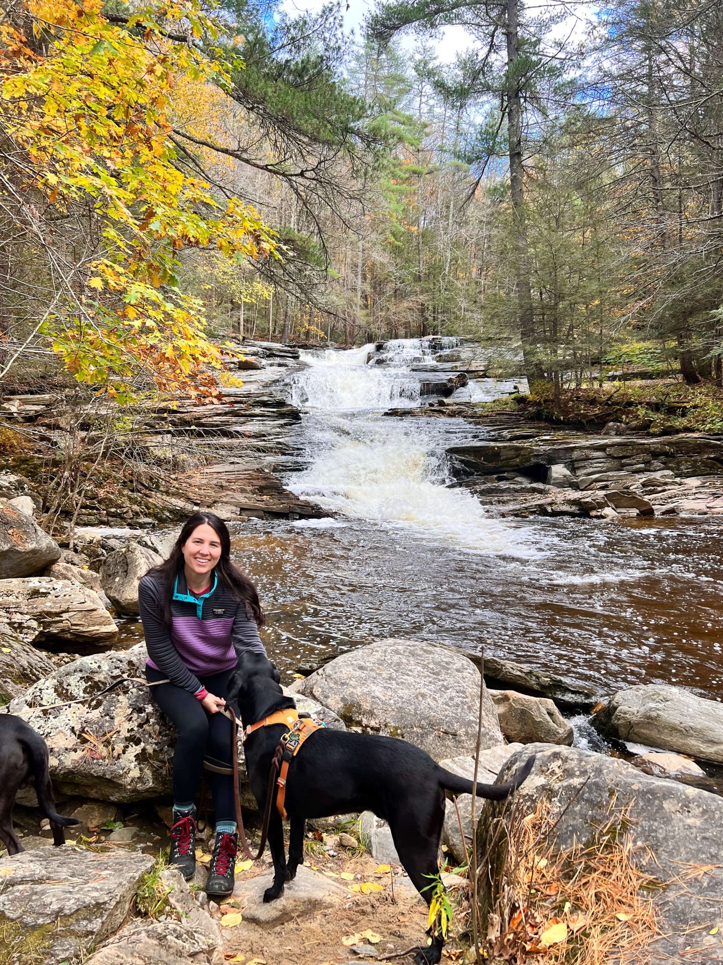
9. Burbank Trail, Richmond/Lenox line, 3 miles
- Miles: 3 miles 🥾
- Elevation Gain: 567 ft elevation gain 📈
- Level: Moderate
- Parking: Small lot along Lenox Rd (GPS coordinates: 42.35187, -73.33786), park in the lot then cross street for trail entrance. Be careful when you cross, this is a busy road!
- Special Features: Monk’s Pond (love it!), Olivia’s Overlook in parking lot, another view along trail looking west toward town of Richmond
- Where to go after: Head into Lenox and check out Haven Cafe & Bakery, Patisserie Lenox, or The Heritage Tavern (for a traditional lunch)
Across the street from Olivia’s Overlook is the entrance to the Burbank Trail.
The highlight of this trail is Monk’s Pond (pictured below) and the view overlooking the town of Richmond. You can combine this trail with Olivia’s Overlook since they’re from the same parking lot!
10. The Cheshire Cobbles Lookout via the Appalachian Trail, Cheshire, 1.7 miles

- Miles: 1.7 miles 🥾
- Elevation Gain: 700 ft elevation gain 📈
- Level: Moderate
- Parking: (GPS Coordinates 42.55613, -73.14454)
- Special Features: Spectacular views facing west and trail along the AT ⛰
- Where to go after: Check out Greylock Grounds Coffee for special locally-sourced coffee and food!
A short but challenging hike up to a beautiful lookout in the Berkshires!
I loved this view here that faces west and was surprised by how challenging this short trail was! Check out the details below to ensure that you aren’t going to miss the lookout at the top.
The Cobbles Details
Don’t miss the main lookout at the top that faces west.
As one AllTrails reviewer put it, “This map takes you to an ok Vista. The best vista is about 2 min off the trail, take a left at the top of the stone stairs. Today it was a little slippery on the way down due to the fallen leaves. Glad I had my poles.”
This hike takes you up about 700 feet of elevation in just 0.7 miles. There is nothing technical about this trail but the steep elevation in a short amount of time makes it a challenge.
For a slightly longer option click here for a 2.1-mile (round trip) hike up to the Cheshire Cobbles.
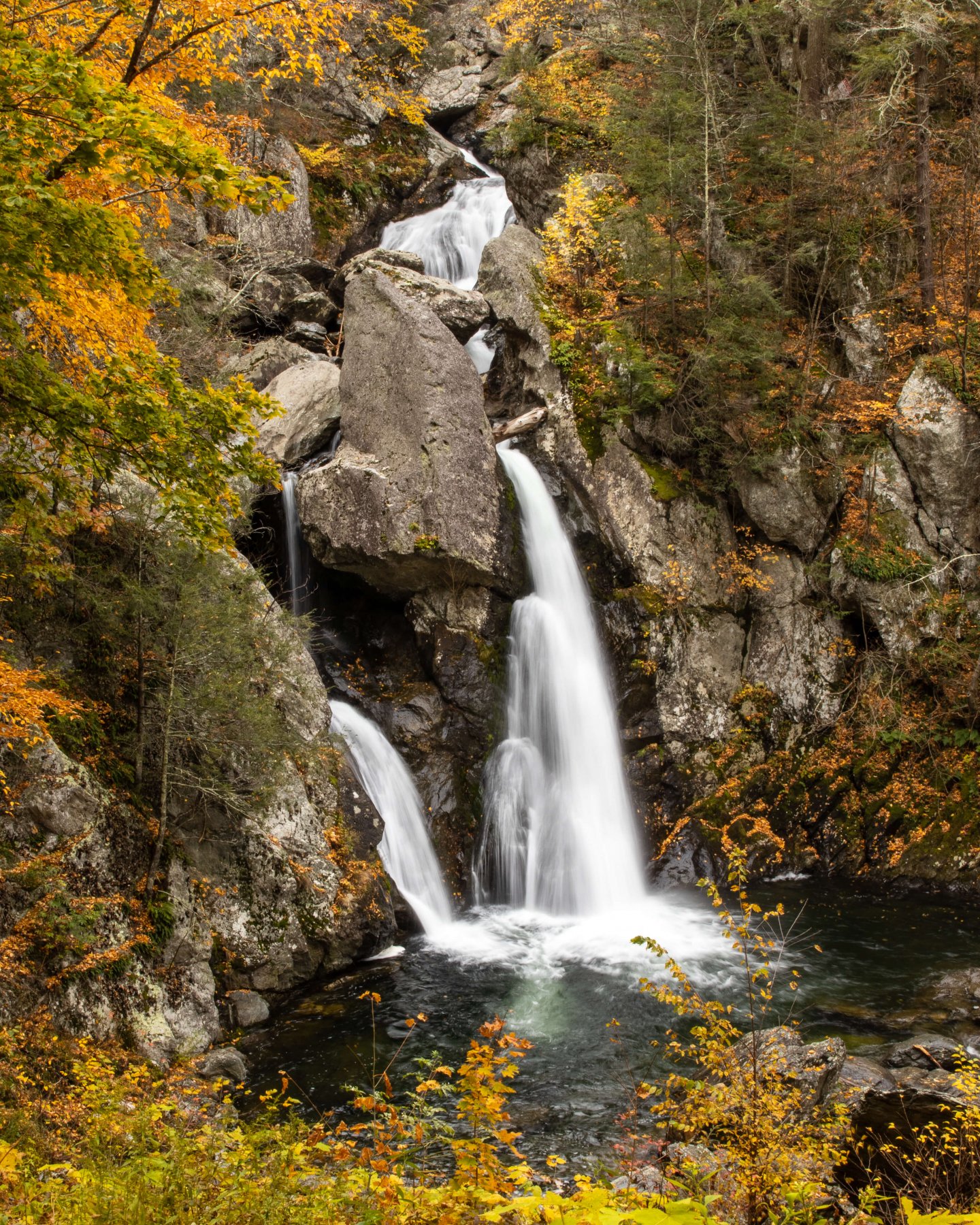
11. Bash Bish Falls, South Egremont, 2.1 miles
Update: Bash Bish Falls is closed March 2024 to July 2024! Please check here for updates on reopening.
The tallest waterfall in Massachusetts with drops totaling 200 feet!
Update: Bash Bish is closed from March -June 2024 for construction
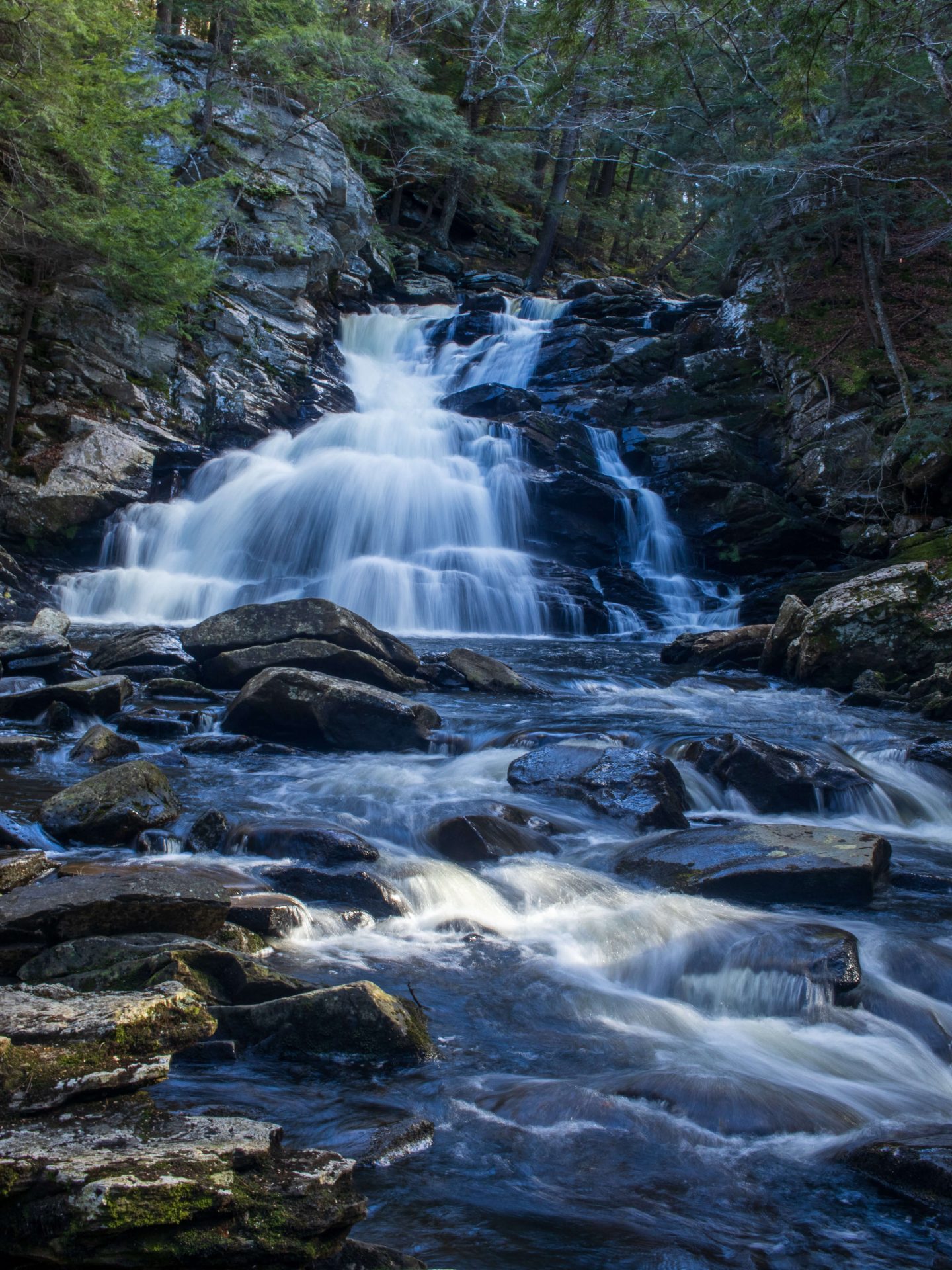
For more local waterfalls, check out my post of 10 must-see waterfalls in the Berkshires!
- Miles: 2.1 miles 🥾
- Elevation Gain: 534 ft elevation gain 📈
- Level: Moderate
- Parking: Large lot along Bash Bish Falls Rd (GPS Coordinates 42.11504, -73.49168)
- Special Features: Tallest waterfall in Massachusetts! 💦
- Where to go after: There is nothing is particularly near you here. So you can head into Sheffield after for the Marketplace Cafe! ☕️
Located in Bash Bish Falls State Park, this is the tallest waterfall in Massachusetts! So it most certainly deserves a spot on our top hikes in the Berkshires.
Though a short walk to get to this waterfall it’s one of the prettiest walks around! Just don’t go at primetime on a weekend mid-summer or fall!
I’ve hiked here in every season and my favorite time to visit was in the winter seeing it all frozen with hardly anyone there or early on a fall morning. It gets very crowded mid day.
Bash Bish Falls Hike Details
If you’re looking for a slightly shorter walk to the falls, at 1.5 miles, click here! This is one of the best waterfalls in New England and it’s beautiful all along the way!
⚠️This is a very popular trail and my favorite times to visit are fall, spring, and winter EARLY in the morning before it gets crowded. 🙂
If the main parking lot is full try the lot in the trail linked here!
⚠️In the summer and sometimes in fall, the steps leading down to the falls are closed and you can only view from above. So if you want to get down closer to the falls, plan for early spring or late fall!
This park has seen a lot of visitors so when you go please follow the 7 Leave No Trace principles to keep it beautiful and open for all! 🙏
12. Umpachene Falls, New Marlborough
- Miles: 0.3 miles 🥾
- Elevation Gain: 36 ft elevation gain 📈
- Level: Easy
- Parking: Medium lot off Umpachene Falls Road (Click here to navigate to parking GPS Coordinates 42.09458, -73.27142)
- Special Features: beautiful waterfall with multiple falls 💦
- Where to go after: Head out to Norfolk CT to the Berkshire Country Store (great breakfast and lunch sandwiches and lattes, too! ☕️
Another southern Berkshire waterfall treasure! I know it’s not the biggest waterfall but I think it’s one of the prettiest waterfalls in the Berkshires! And it’s super easy to get to, accessible for kids and folks who prefer not to walk for miles but still see a waterfall in a beautiful park setting.
Umpachene Falls History: “A Housatonic Indian Chief, Umpachene, who once fished in these waters, is commemorated here in the falls and in the stream which today bear his name. The park, comprising about 5 acres, was the gift of Mr and Mrs Robert K Wheeler and is maintained for the use of and enjoyment of the people of the town of New Marlborough.” (On sign in parking lot)
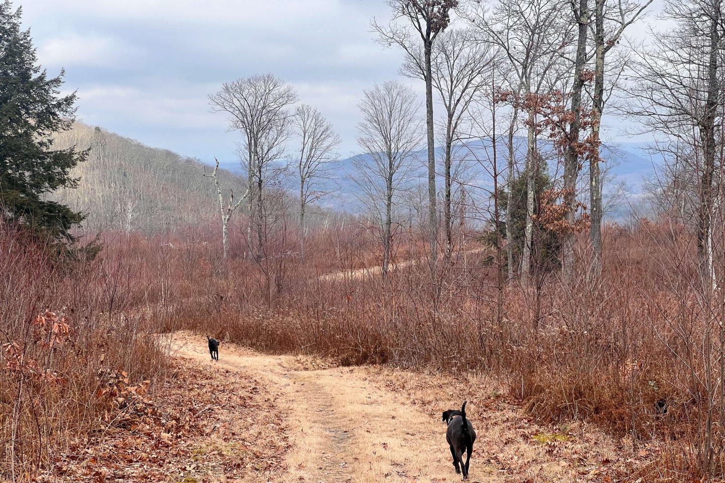
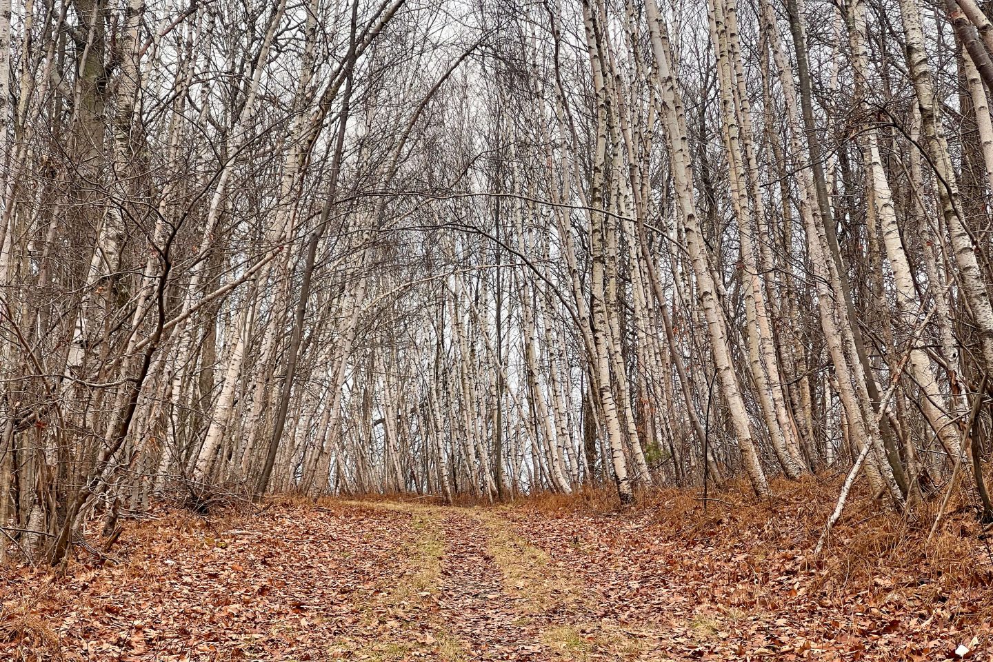
13. Alford Springs Father Loop, Alford
- Miles: 4.3 miles 🥾
- Elevation Gain: 784 ft elevation gain 📈
- Level: Moderate
- Parking: Medium lot at the end of Mountain Rd (Click here to navigate to lot 42.24836, -73.44598)
- Special Features: Loop in a pretty forest setting with views and babbling brook
- Where to go after: Head to downtown Great Barrington to the Patisserie 🥐 or Fuel Bistro ☕️
Near Great Barrington, this is scenic hike on a wide, sometimes grassy woods road. I love wlaking on these old logging roads!
There’s nothing technical about this trail which allows you to zone out and walk and enjoy a peaceful walk in the woods. Through a mesmerizing corridor of birch trees, pass several vistas with great views of the Alford Valley and Mt Greylock, and walk along the babbling Alford Springs.
You’ll enjoy this moderate and beautiful walk in the southern Berkshires!
🏆 Honorable Mention: Kennedy Park, Lenox, 2.6 miles
- Miles: 2.6 miles (or you can make it shorter) 🥾
- Elevation Gain: 406 ft elevation gain 📈
- Level: Easy
- Parking: Heading north on Pittsfield Rd in Lenox, there will be a driveway on left heading up into Kennedy Park. There is a parking lot at end of driveway. (GPS coordinates: 42.37998, -73.27735)
- Special Features: Park like setting, wide paths meandering through forest
- Where to go after: Head towards Pittsfield and check out my all-time favorite Chocolate Springs Cafe or head into Lenox and check out Haven Cafe & Bakery, Patisserie Lenox, or The Heritage Tavern (for a traditional lunch)
I hope you enjoyed this list of the best hikes in the Berkshires!
This list was a work of love as this is one of my all-time favorite areas to hike and visit so I hope you love it, too! ❤️🥾
Want another must-do Massachusetts hike that’s just east of the Berkshires?! Check out my post on Sanderson Brook Falls Loop which features a waterfall & a view! 💦
And looking for more to do in the Berkshires? Check out this post here of 33 Berkshire activities in winter (many are year-round!) 🥾

I have always wanted to go to the Berkshires! This is such an incredible list, I’m definitely going to save it for a future trip. Also, so many beautiful pictures too!
Thanks, Lita!! I love it there, too… hope you can make it there someday!! 😍🎄
Kristen,
Thanks for all your great info about the Berkshires! Your descriptions and recommendations are perfect 👌
Yay! Thanks so so much, Pamela!! Means a lot 🥰👏💚 So glad you are enjoying the Berkshires hikes post! Here for any questions….
Thank you so much for the information and te GPS coordinates!!
Happy hiking
Yay! 🙂 Glad you find the coordinates helpful! Love feeling confident on the drive to the trail knowing you’re going to find it! 👍