Trout Brook Valley in CT: Dog-Friendly Off-Leash Trails!
Scenic views from Flirt Hill, peaceful forest trails, and a dog-friendly off-leash area make Trout Brook Valley Preserve a must-do hike for dogs and people in CT!
Less than 9 miles (~15 minutes) from Fairfield and 20 miles (~30 minutes) from Stamford, Trout Brook Valley Preserve in Easton is a peaceful escape and hike in Fairfield County.
As a lifelong resident of Connecticut who always hikes with my dog, I was thrilled to discover what feels like a hidden gem: one of the few trails in Connecticut that allows dogs to be off-leash!
This post details which trails within Trout Brook Valley are designated off-leash trails. You’ll also find parking details and turn-by-turn trail directions for this 4+ mile gentle loop, which is great for people and dogs of all ages.

To make an off-leash trail successful, we need to use very good judgment. Please don’t let your dog off if they are known to be aggressive or aren’t neutered or spayed (unless well-trained).
You can make this hike shorter if you don’t want to do the whole 4.33-mile loop. You will be walking on the off-leash section for the first mile of this hike, so if you had a long drive here, now is a good time to let the dogs blow off some steam!
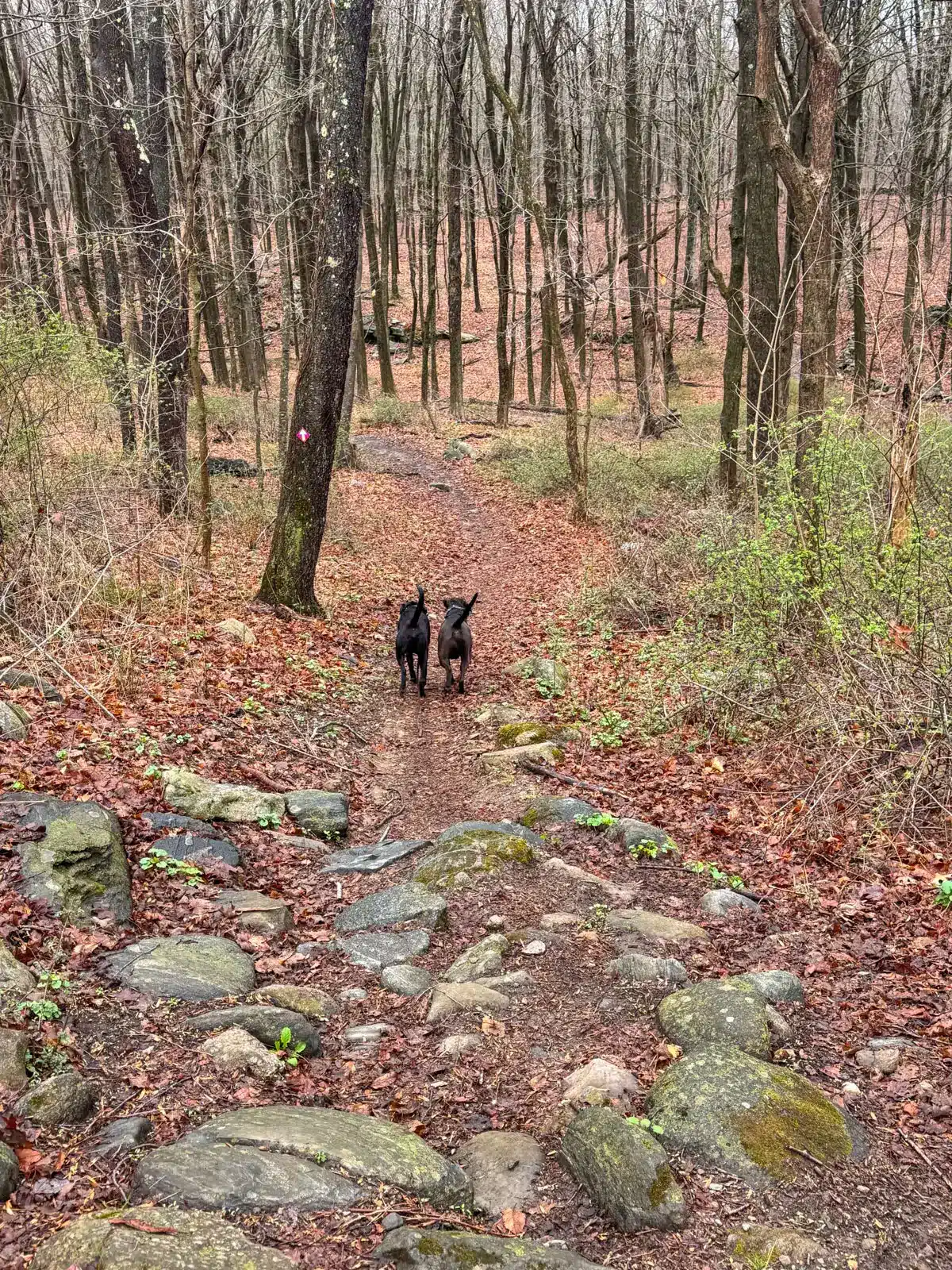
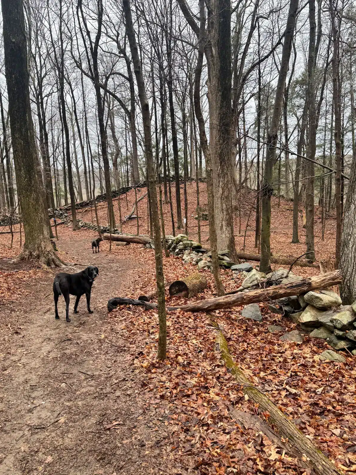
Managed by the Aspetuck Land Trust, this 1,000-acre preserve features over 20 miles of well-marked trails winding through meadows, hardwood forests, by stonewalls and quiet streams.
So let’s get to it and dive into this scenic hike in Trout Brook Valley Preserve!🌲🥾
🌲Trout Brook Valley Loop Details🌲
- 🗺️Location: Easton, CT
- 🥾Miles & Difficulty: 4.33-mile loop, Easy
- 📈Elevation Gain: 436 ft
- 🚙Parking: Click to navigate here 41.24350, -73.33153, small lot off Freeborn Rd.
- 🌲Conditions: Year-round, smooth forest and farm trails
- 🌟Highlights: Off-leash portion and farm meadow views
- 🔗 Link to custom map on AllTrails (yellow waypoints correspond to the turn-by-turn directions listed below)
- 🚗 Find the trailhead: From the Eason Public Library, turn left onto Morehouse Road and after 154 feet, turn left onto Center Road. In 1.3 miles, turn right onto Black Rock Tpke (CT-58) and after 0.1 miles turn left onto Freeborn Rd. In 0.7 miles, the parking lot will be on the right.
- Land Manager: Aspetuck Land Trust, PO Box 444, Westport, CT 06881. (203)331-1906. https://www.aspetucklandtrust.org
🩷WHY YOU’LL LOVE IT💚
- Designated off-leash portion
- Varied terrain from forest to meadow
- Streams for dogs
🔄 Trout Brook Loop Overview
You’ll begin your hike from the parking lot on Freeborn Road, finding the trailhead. The trail you start on here is the off-leash section, known as Crow Hill Preserve within Trout Brook Valley.

After 50 feet, you’ll bear left on the pink trail, starting the loop clockwise. After 1 mile on the pink trail, you’ll follow the blue trail, which leads you up through the orchard to the top of Flirt Hill.
After enjoying the view, you’ll loop back down and return to the pink-blazed trail and the Crow Hill Preserve area that takes you back to the car.
🐶Note: I spoke with a few locals who come here regularly, and they said that the lines are a bit blurred for when the off-leash section ends. Though you’ll see a sign denoting its ending, we ran into a few people who continued to have their dogs off leash yet under their control, and called the dogs back before we approached.

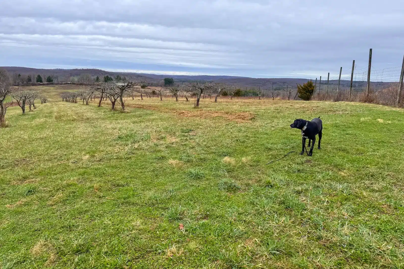
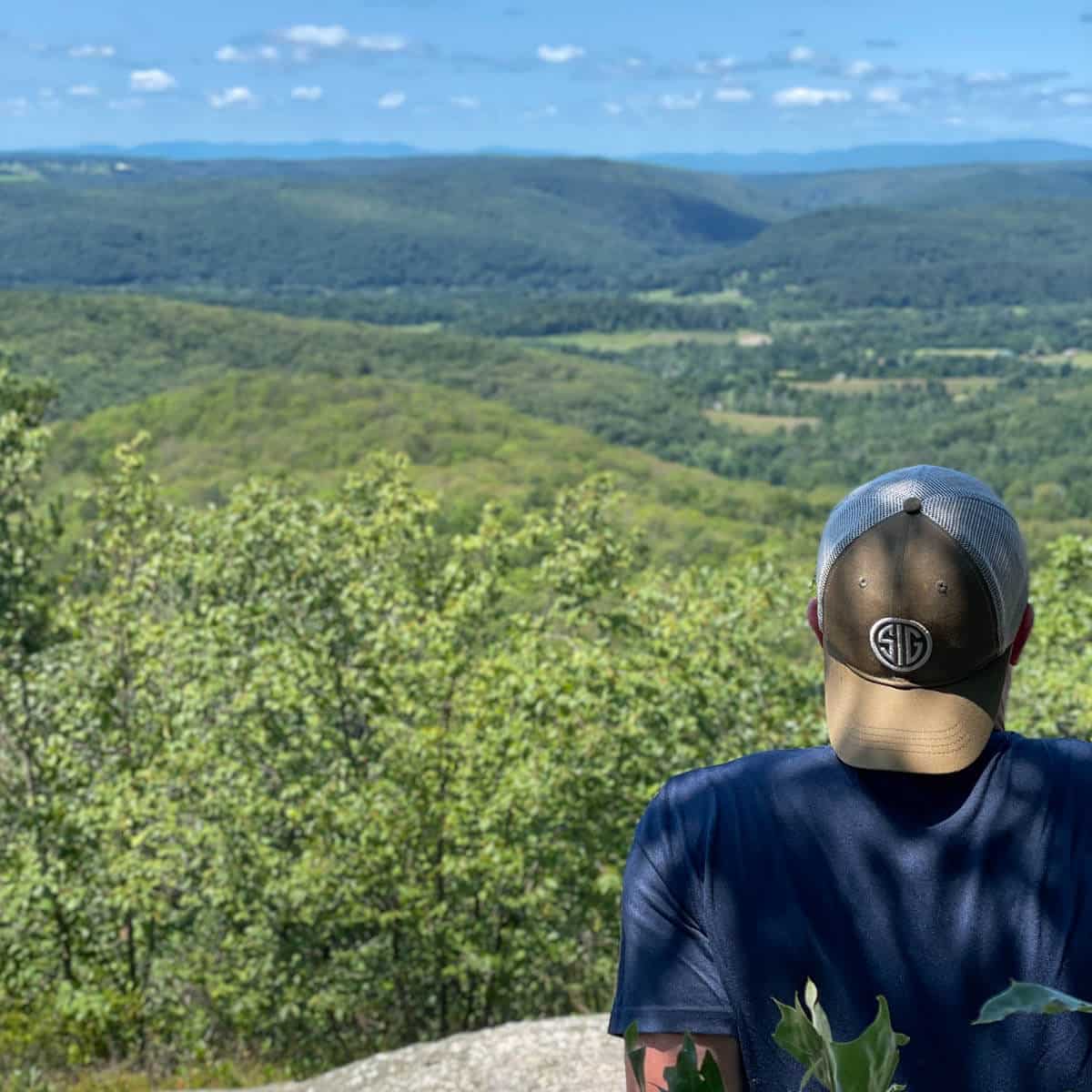
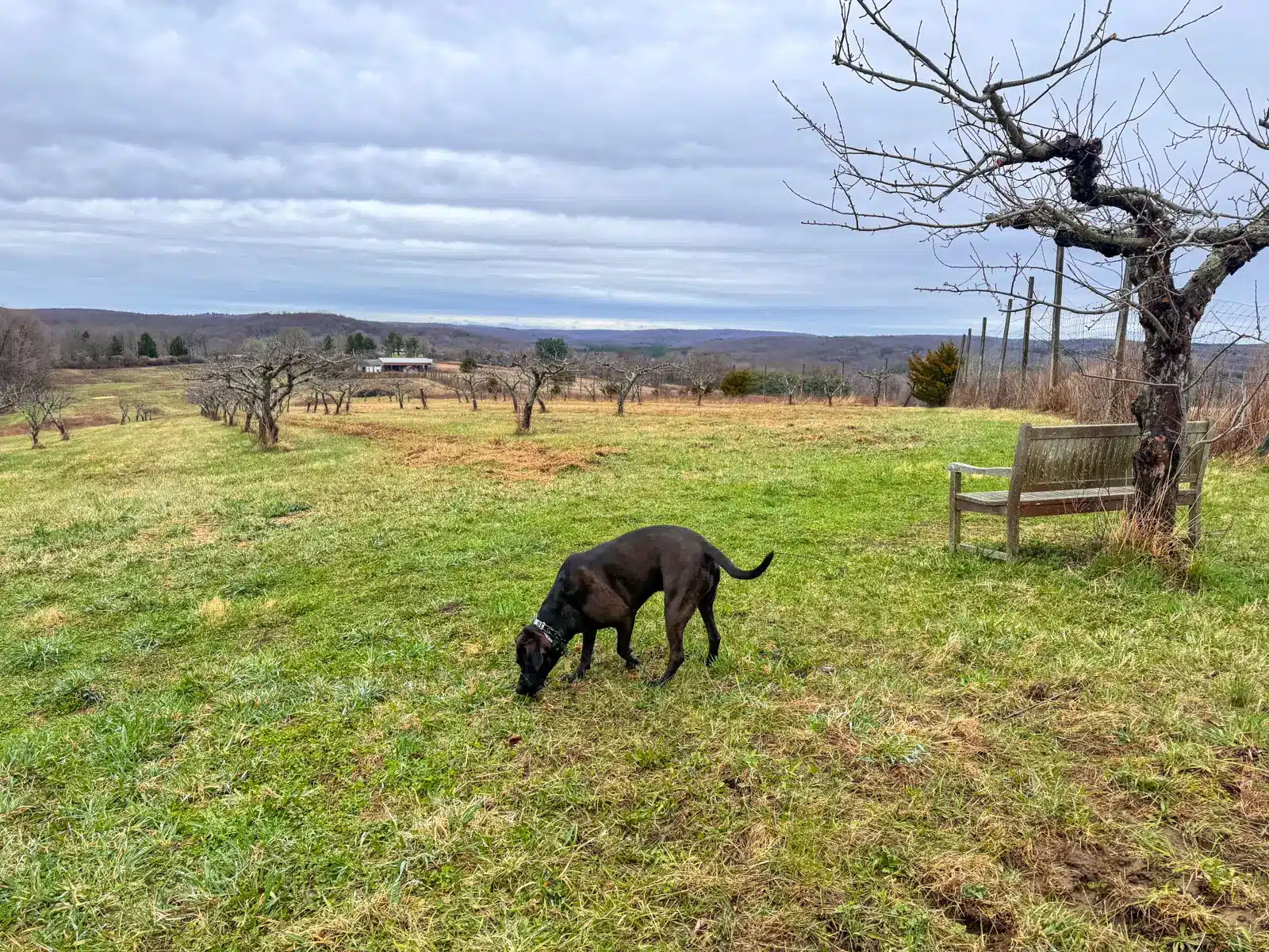
Aside from being a place you can let your pup run free, another highlight of Trout Brook Valley is the meadow and view from the top of Flirt Hill. With a bench at the top, you can sit with your dog, have a snack, and take in the views of the rolling meadow and farmland. 🌾
Though over 4 miles, there is nothing technical about this hike and there are no steep sections to navigate which is great for dogs of all ages.
TURN-BY-TURN TRAIL DIRECTIONS 🧭
- From the parking area, find the trailhead and begin the trail, bearing left after 50 feet following the pink blazes with black arrows.
- At 0.2 miles, bear right at sign ‘42’ to continue staying on the pink trail.
- At 0.5 miles, turn right at sign ‘44’.
- At 0.95 miles, come to a stream and several rock walls. Turn left onto the blue blazed trail.
- At 1 mile, reach the end of the off leash loop. Turn right onto the blue blazed trail.
- At 1.23 miles, see sign number ‘41’ and turn right to continue staying on the blue trail.
- At 1.4 miles, turn right at sign ‘W26’ and then bear left on the blue and green blazed trail.
- At 1.7 miles, at sign number ‘30, turn right to continue following the blue trail.
- At 2.05 miles, take a sharp right onto the blue trail and begin walking uphill.
- At 2.4 miles, with vernal pools on the right, turn left to go up a small hill on the purple blazed trail with white arrows.
- At 2.65 miles, come to a gate with the ‘Aspetuck Land Trust’ sign. Walk through the gate and turn right to walk to the top of the meadow with the orchard on your left.
- At 2.8 miles, reach the top of Flirt Hill where there’s a bench and view across the meadow. After taking in the view, continue walking southwest down the hill
- At 2.88 miles take a left to walk along the fence.
- At 2.95 miles, go through the gate and bear left heading back in the woods toward the pink blazes.
- At 3.25 miles, bear left and then in about 50 feet bear right to pick up the blue trail.
- At 3.42 miles, walk straight across the gravel road (Norton Road) and continue on the blue trail.
- At 3.71 miles, bear left on the pink trail where you will see an ‘Off Leash Loop” sign.
- At 4.2 miles, walk across Freeborn Street and enter trail back in the woods. Find the parking lot on your left in a couple hundred feet.
I hope you enjoyed this post all about hiking in Trout Brook Valley Preserve! It’s such a scenic property and I’d love to go back in the fall and see the views then!
Feel free to leave any comments or questions below about this trail!
Happy trails to you and your 🐶👏🩷🥾