10 of the Best Hikes in Crawford Notch, New Hampshire; All Levels!
Planning a trip to Crawford Notch State Park in New Hampshire and wondering where to hike?! In this post, I share 10 of the best hikes I’ve done in Crawford Notch (plus 5 more hikes nearby!) that have the most beautiful views. ⛰

These hikes range from just 0.6 miles (yes, you read that right!) to over 10 miles. There is a hike for everyone here in Crawford Notch State Park and here you’ll find some of the best hikes and views in all of New Hampshire!
If you are planning a trip for several nights you can alternate the short with the longer hikes like I did during our camping trip here.
Where is Crawford Notch State Park?
Crawford Notch State Park is located just above the center of New Hampshire between the towns of Bretton Woods (where Mount Washington Hotel is) and Bartlett.


At 6 miles end to end, the park spans 5,775 acres and is home to over 20 different hikes and trails in the White Mountains.
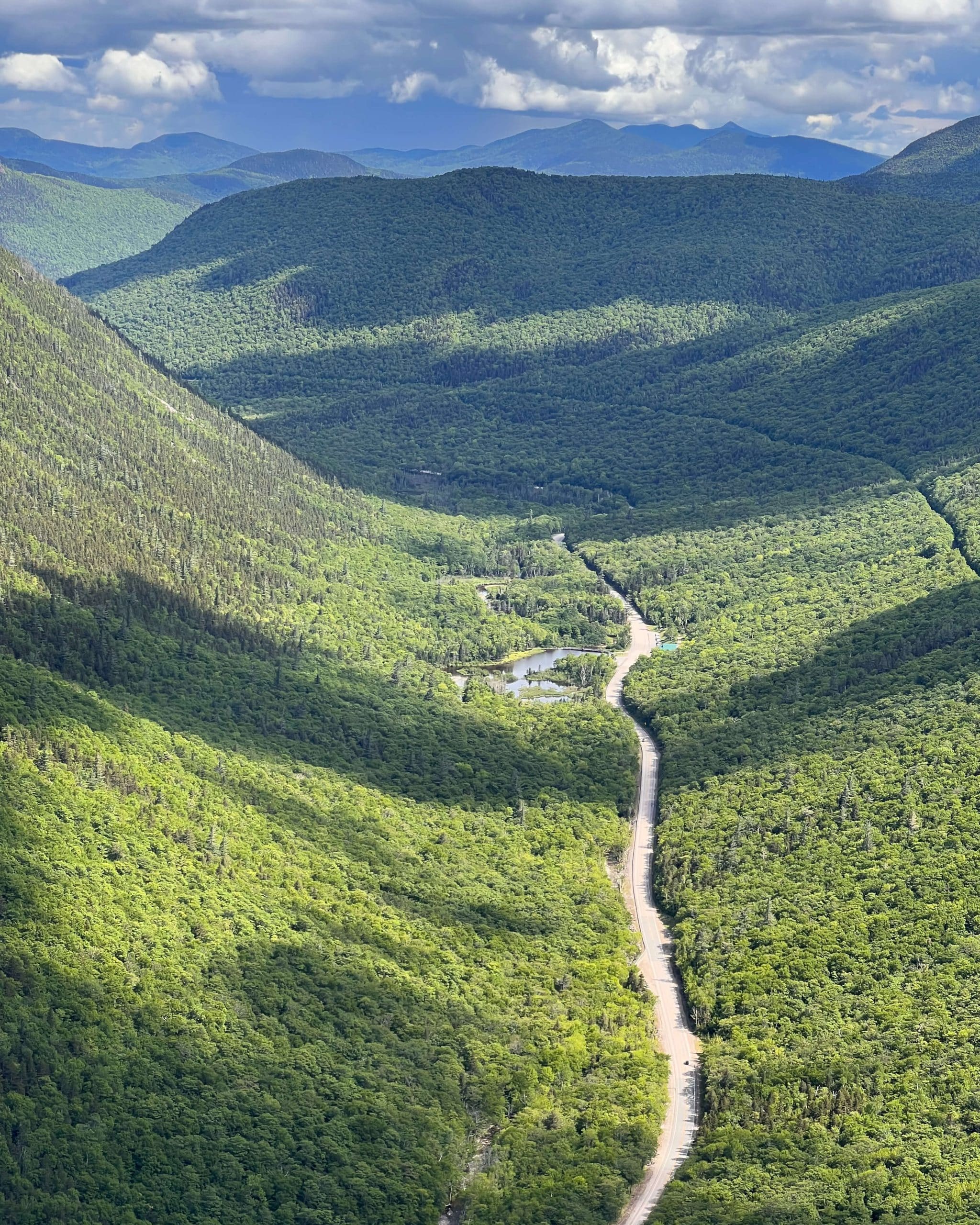
The scenic Highway 302 is the only way to access the park and runs right through the surrounding mountains.
With the White Mountains flanking either side of you, just driving on 302 through Crawford Notch is a treat in itself. Flume Gorge and Silver Cascades are just two waterfalls you can even pull off to see right from the road!

Since I included hikes with varying mileage, there is a hike here in Crawford Notch for all levels.
Where to Stay When Hiking in Crawford Notch; Camping and Accommodations
We camped at Dry River Campground which has 36 campsites (RV included), toilets, showers, and allows pets. It’s right in Crawford Notch State Park off Highway 302 in the middle of all the hiking. No far drives to hikes when staying here!
Another amazing accommodation if you don’t want to camp is the AMC Highland Center. This is a beautiful recently renovated lodge that caters to hikers. You can walk out of the lodge and across the street to numerous trailheads or they offer hiker shuttles to lots of popular destinations in the White Mountains.

The Highland Center is built to help get you outdoors so they offer complimentary activities including guided day hikes to nearby destinations, instructional talks on outdoor skills or natural history, and programs featuring guest speakers.
And the food 😱is amazing! They understand that lots of us hikers are in it for the food or just really enjoy a good meal afterward. We came here for their buffet breakfast in the morning, hot paninis for lunch, or home-cooked dinners. And to use their wifi because there was zero service at the campsite! 😊
So what are the 10 best hikes in Crawford Notch State Park?!
1. Mount Willard
This is a scene you may have seen before!! 👀 One of the more popular hikes in Crawford Notch maybe because it’s only 3.1 miles total and has this big view at the top!


To start this hike you’ll park along 302 by the train station, cross the tracks and follow the path into the forest. There will be a trail map and sign listing the hikes here. You’ll bear left at the fork to head up to Willard.
This is a pretty gradual hike with the elevation spread out. There isn’t a really tough scramble section here making it a perfect Crawford Notch hike for beginners or intermediate hikers.
At the top, you’ll see Highway 302 wind its way through the Notch here. Expansive views at the top with a long ledge to explore and get pictures from. You can see why this is a super popular hike in the fall or midday on weekends!
- Miles: 3.1 miles out & back
- Elevation Gain: 895 feet elevation gain
- Level: Moderate
- Parking: lots of spots along the street on Rt 302 right in front of the Crawford Depot (train station!) 🚂 choo choo
- Special features: Multiple stream crossing plus a little waterfall before arriving at sweeping views of Rt 302 below and views facing (mainly) south.
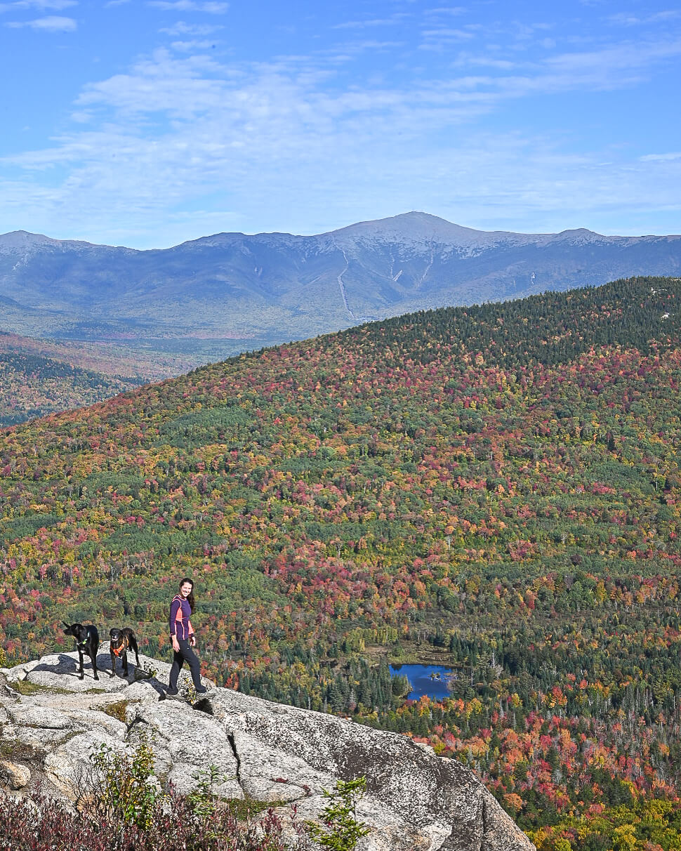
2. Mount Crawford via Davis Path Trail
This was one of my favorite hikes and views in Crawford Notch as there was no one else on the trail and it’s a hike and view I haven’t seen or heard much about before! So we were super surprised and pleased with the view from the top.

There are a couple of ‘false summits’ here where you get to a lookout and think – this must be it! And then it’s not. This happened twice to us on the way up.
It’s not well-marked at the top. There is one scramble-type section with big rock slabs and you look for the white markings on the rocks to help direct you.
Because of this, you may want to download the map on Alltrails (linked in the trail title above).
While this one has a lot of elevation gain much of it is rock steps which make the uphill much easier instead of having to find your footing. Think of it as a workout on the Stairmaster! I loved it. 😍
- Miles: 4.3 miles out & back
- Elevation Gain: 2,106 feet elevation gain
- Level: Hard 💪🏼
- Parking: Large lot off of the busy Rt 302. Heading south on 302 the lot is on the left (Saco River side) right before Notchland Rd which you’ll see on your right if you go too far & pass the lot! 🙂
- Special features: Wow, there are wide open views at the top here (facing west mainly 🌅) and you’ll also come across 2 false summits before the real one which each provide views as well!
3. Mount Pierce (multiple routes to choose from)
One of the NH 48 (48 mountains above 4,000 feet), Mount Pierce is a tough hike that lies in the middle of the southern Presidential Range.


We’ve done this hike a couple of times now and this last time (in June) we started at 5:30 pm in order to be up there for sunset.


While Mount Crawford above has more elevation per mile than Pierce, Pierce is exceptionally rugged. There are no stone steps laid out as there are on Crawford. So you have the elevation and you’re having to watch where you step as you step over rocks of all sizes on the way up. Makes for a tiring way down!
As mentioned, there are no flat paths here in Crawford Notch! 🙂
But wow, the views when you do get to the top. Mount Washington and other Presidentials in the distance and a view west for sunset. Both times I’ve been up here it’s been very very windy! Bring a jacket for the top.
This one absolutely deserves a spot on the best hikes in Crawford Notch list. If you’d like more details about this hike, I have a full post all about hiking Mount Pierce.
- Miles: 5.9 miles out & back
- Elevation Gain: 2,400 feet elevation gain
- Level: Hard
- Parking: Large lot off of Mt Clinton Rd. Coming from Rt 302 heading north, pass the Highland Center then bear right on Mt Clinton Rd. The driveway to the trailhead will be on your left after just a few hundred feet!
- Special features: One of the NH 48! Views facing west toward Mount Washington, great for sunset 🌅
4. Elephant Head Spur
I know these New Hampshire mountains (and sometimes hikers 👀) can be intimidating, but don’t let anyone tell you that a small hike isn’t a hike!


This hike saved our butts on the days we just needed to let the dogs run around and all get some energy out.
And look at the view! Gazing out onto the strip of Highway 302 and the mountains across the way, you won’t believe how pretty it is for just a third of a mile up a little hill.
- Miles: 0.6 miles out and back
- Elevation Gain: 157 feet elevation gain
- Level: Moderate (though I would consider it easy as well!)
- Parking: There are lots of spots along the road parallel to Rt 302. Heading south on 302, just after Saco Lake and the train station you will see the spots on your right. This means that you will have to cross the street to get to the start of this trail so be careful! ✋
- Special features: Stream crossing with water for the dogs and then beautiful views at the top looking northwest over Rt 302 and Mount Willard across the street! ⛰
5. Mount Jackson
Another mountain on the New Hampshire 48 list! Mount Jackson is in the southern Presidential Range on the Appalachian Trail.


There are views at the top facing north toward Mount Washington, east toward Maine, and west toward the Pemigewasset Range.
The cliffs you climb (serr vertical slabs below!) provide views over Crawford Notch.
If you are up for more mileage and want to cross 2 New Hampshire 4,000 footers off your list you can do this trail here. It’s the Mount Jackson and Mount Webster loop at 6.4 miles and 2,400 feet of elevation gain.
- Miles: 4.7 miles out & back
- Elevation Gain: 2,176 feet elevation gain
- Level: Hard
- Parking: The parking and trailhead are across the street from the entrance of this hike. Look for the lot on the right side of Rt 302 heading south just after Saco Lake and the train station.
- Special features: Sweeping views to the west where you can see Mount Washington in the distance! ⛰ This is one of the NH 48 high peaks. 🙂
6. Frankenstein Cliffs
A hiker will have to do battle with a few monstrous and spooky elements when climbing up to Frankenstein Cliffs.


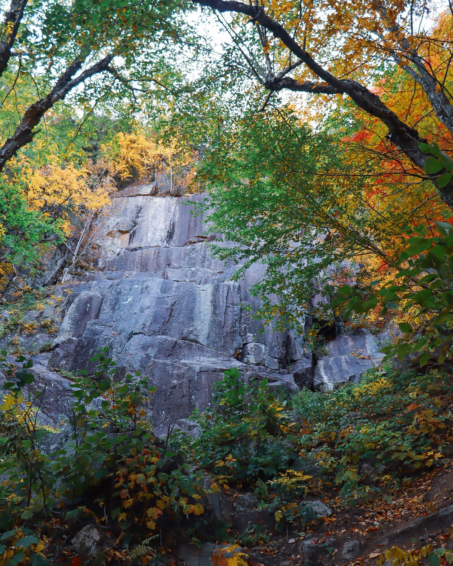
However, whether it’s ducking under the brooding rusted steel of the Cog Railway trestle, scrambling up through dark and gloomy pine hallows, or taking in the spectacular southerly views from the tragically unforgiving cliff faces, you’ll be hard pressed to not have a big smile on your face while completing this motley climb.
A stunning view to behold from the top and below. In my opinion, this is one of the most fun (in a slightly dangerous way) and most memorable hikes in Crawford Notch, particularly in the fall.
- Miles: 3.8 miles out & back
- Elevation Gain: 1,479 feet elevation gain
- Level: Hard
- Parking: Large lot on Rt 302 on the right side heading south about a mile after Dry River Campground
- Special features: Exceptional views from the cliffs, a little scrambling to get up there!
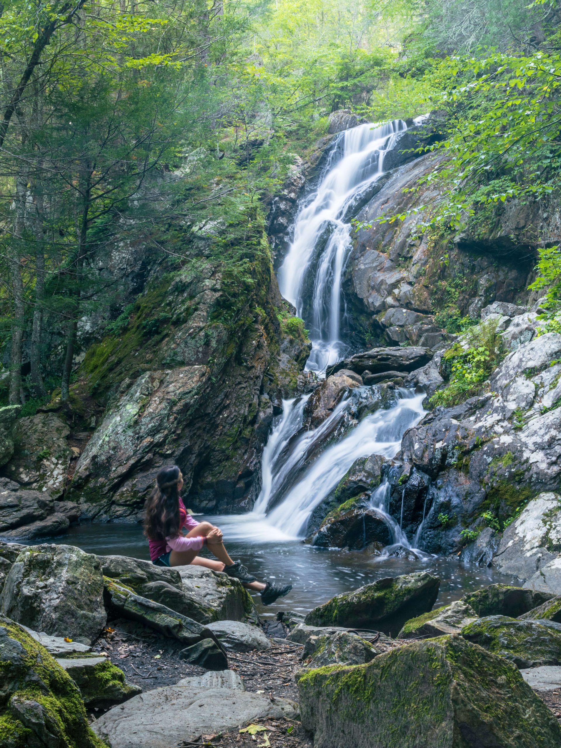
7. Arethusa Falls via Bemis Brook
The aptly named Bemis Brook trail hugs tight to Bemis Brook. Those who are faint of heart may feel a flutter or two along this gnarled and knotted footpath, with steep, precipitous drops down to roiling amber-colored water.


At approximately the half-mile mark you’ll stumble upon Bemis Brook Falls. The multi-tiered falls exhibit gentle chutes of white water, culminating with a perfectly angular cascade over a sculpted river boulder into a deep swirling pool.
Once you can peel yourself away from this initial reward it’s onward and upward to Arethusa Falls.
Upon your arrival at Arethusa Falls, you may find yourself in reverie. New Hampshire’s tallest waterfall gives an emotional impression of a Gothic church with its towering granite walls and spiritual enclave. It boasts a cacophony of even decibels of falling water and cool rushing winds, putting any visitor in awe at its feet.
- Miles: 2.8 miles out & back
- Elevation Gain: 885 ft elevation
- Level: Moderate
- Parking: Large lot on Rt 302 on the right side heading south about a mile after Dry River Campground
- Special features: Arethusa Falls (tallest in NH!) and several other cascades along the way on Bemis Brook.
8. Ripley Falls
New Hampshire’s second-tallest waterfall hike is also located within Crawford Notch State Park! The 100-foot-tall waterfall cascades down along a steep and smooth rock wall.


Flowing down from Avalanche Brook there are many cascades to admire as you get closer to the waterfall with the brook on your left.
This Crawford Notch hike is only 1 mile in total but rated moderate because it is a tad steep. There is nothing technical to the trail so beginners can do it but it will be similar to walking on an incline on a treadmill for a bit. It will get your heart pumping for sure!
But you can take a break and admire the sound and sights of this beautiful waterfall in Crawford Notch State Park.
- Miles: 1 mile out and back
- Elevation Gain: 300 ft elevation
- Level: Moderate (a little uphill, short pump!)
- Parking: Heading south on Rt 302 almost 2 miles past Wiley Pond you will see a sign on your right for Ripley Falls. Continue to drive all the way up that driveway to get to the trailhead parking at the top. There are about 10 spots up there.
- Special features: The second-tallest waterfall in New Hampshire!
9. Mount Avalon
To start this hike, cross over the railroad tracks and find the sign marking the trailhead. After a few minutes of walking on the well-worn path, you’ll see as you enter the forest, you’ll see a sign that has a map of all of the trails in the area.
For Avalan bear to the right at the fork and follow the Avalon Trail.
This hike provides views of the Presidential Mountain Range and east overlooking Crawford Notch.
A lot of the elevation here comes toward the end of the hike where there is a steeper scramble type section.
- Miles: 3.3 miles out & back
- Elevation Gain: 1,528 ft of elevation
- Level: Hard
- Parking: Located at the Crawford Notch Train Station across from Saco Lake. If full, you can park in the spots along 302.
- Special features: Grand views facing south with the road (302) winding through below.
10. Wiley Pond and Saco River Loop
Another great walk to stretch the legs or if you’re just passing through. We stopped here on our first night after a 4+ hour drive from Connecticut.
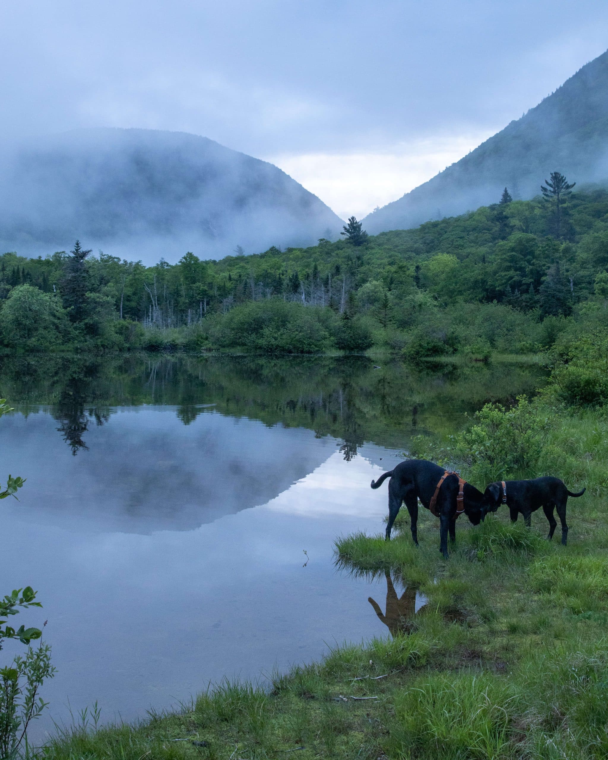

The parking lot is right along the pond so as soon as you exit the car you’re treated to beautiful views and, if you’re lucky, reflections of the mountains in the water.

As you make your way across the little bridge here (such a pretty New England scene!) you can look to your left to see the stone face of Mount Willard in the distance.
There are a few picnic tables and grills on the other side of the pond inviting people to stay and enjoy the scenery.
After you cross the bridge and enjoy the views you can head into the woods to the trail (you’ll see the path and sign straight ahead on the right after you the cross bridge).
You can actually walk as far as you want to since this short trail connects to the Saco River Trail which runs for 136 miles all the way up to the Gulf of Maine. 😱
- Miles: 1.2-mile loop
- Elevation Gain: 42 ft elevation
- Level: Easy
- Parking: About 4-5 miles past the Highland Center heading south on Rt 302 you will see the brown Wiley House on the right and the parking for Wiley Pond on the left where the big pond is.
- Special features: The beautiful pond of course! Love the reflections here.
Bonus hike: Mount Willey, Field, Avalon, Tom via Willey Range Trail (loop!)
I am adding this one as a ‘bonus’ because I haven’t done it yet. I wanted to include it in this list of the best hikes in Crawford Notch because it looks awesome for more experienced hikers looking for a significant challenge!
- Miles: 10.8-mile loop
- Elevation Gain: 5,446 ft elevation gain
- Level: Hard
- Parking: About 4-5 miles past the Highland Center heading south on Rt 302 you will see the brown Wiley House on the right which is where the parking and entrance is for this trail.
- Special features: Collect 3 NH 4,000-footers on this hike! (3 of the NH 48)
5 bonus hikes NEAR Crawford Notch with amazing views, too!⤵️
Middle Sugarloaf, 8 minutes from the AMC Highland Center


- Miles: 2.7 miles out & back
- Elevation Gain: 889 ft elevation
- Level: Moderate
- Parking: Parking lot on Zealand Rd off of Rt 302. Heading north on 302, Zealand Rd will be on your left! NOTE: Zealand Rd is closed in winter, you will not be able to drive up and park.
- Special features: Faces EAST making it a perfect sunrise hike in New Hampshire 😍🌅 with views of Franconia Notch and Mount Washington, simply amazing!
North Sugarloaf, 8 minutes from the AMC Highland Center


- Miles: 2.4 miles out & back
- Elevation Gain: 734 ft elevation
- Level: Moderate
- Parking: Parking lot on Zealand Rd off of Rt 302. Heading north on 302, Zealand Rd will be on your left! NOTE: Zealand Rd is closed in winter, you will not be able to drive up and park.
- Special features: short hike with beautiful views facing EAST for sunrise! Can see Mount Washington in the distance 😍🌅
North and Middle Sugarloaf, 8 minutes from the AMC Highland Center
You get both views above from North Sugarloaf and Middle Sugarloaf. 🙂 See photos above!
- Miles: 3.3 miles out & back
- Elevation Gain: 1,069 ft elevation
- Level: Moderate
- Parking: Parking lot on Zealand Rd off of Rt 302. Heading north on 302, Zealand Rd will be on your left! NOTE: Zealand Rd is closed in winter, you will not be able to drive up and park.
- Special features: Get views from both North and Middle Sugarloaf here! ⛰⛰
Mount Agassiz, 23 minutes from the AMC Highland Center


- Miles: 1.5 miles out & back
- Elevation Gain: 554 ft elevation
- Level: Moderate
- Parking: Spaces on Rt 142
- Special features: short hike with beautiful views facing several NH 48 mountains
Nubble Peak, 15 minutes from AMC Highland Center
- Miles: 3.5 miles out & back
- Elevation Gain: 2,053 ft elevation
- Level: Hard
- Parking: Parking on Haystack Rd off Rt 3
- Special features: Faces east for sunrise! 🌅
FAQS about the best hikes in Crawford Notch State Park:
Is Crawford Notch State Park free?
There is a $5 fee at some parking lots so bring cash!
What is the most scenic hike in Crawford Notch?
Any hike on this list of 10 hikes in Crawford Notch will offer you amazing views. If I had to pick a favorite I would choose Mount Crawford itself! 🙂 (Or Frankenstein Cliffs 👀)
❤️I hope you enjoyed this post about the best hiking in Crawford Notch State Park. I was amazed at how many trails there are to hike in this one area. If you are camping at Dry River Campground, the Highland Center, or staying someplace nearby – you’ll be happy to not have to drive far for some of the best hikes in New Hampshire!
What to bring when hiking in Crawford Notch State Park
- All seasons: Waterproof (or resistant) hiking boots with good grip! Streams, mud, rocky trails, and maybe even some scrambling. (Aka no flat paths!) Boots will help keep your ankles stable as you climb. Hiking poles may come in handy with the rocky terrain as well.
- Summer: bug spray (we really needed it in June!), sunscreen, lots of water, food/snacks, shell jacket for the top
- Fall: sunscreen, water, food/snacks, and jacket for the top
- Winter: A whole different ball game! You may need snowshoes or you may need microspikes. Check trail conditions here.
Other posts you may enjoy:
Looking for more hike ideas in New Hampshire?! Check out my post of the top 11 hikes and views in New Hampshire! (From my personal experience :))
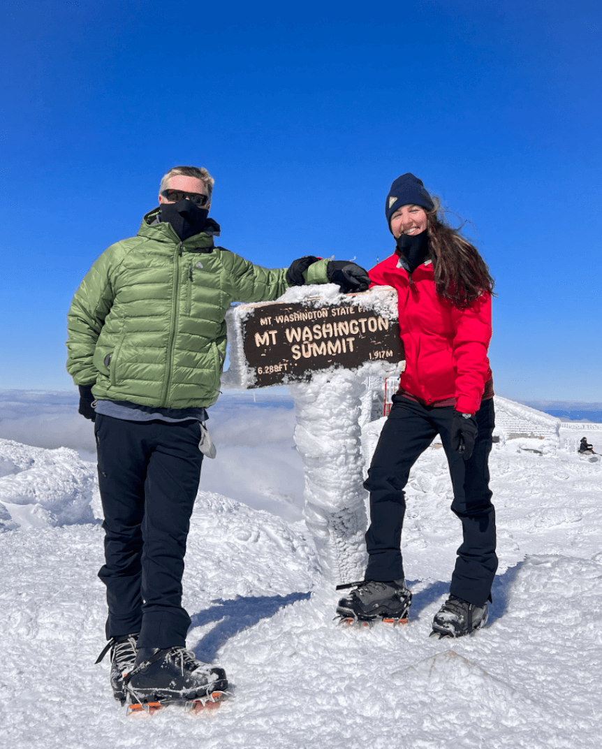
Or check out my experience hiking Mount Washington in the winter!