Hiking Mount Race, MA: Best Trails, Views & Waterfalls!
Mount Race, rising to 2,365 feet in the Taconic Mountains of southwestern Massachusetts, might get lost in between its prominent local brothers, Mounts Bear and Everett, but it’s an absolute gem that offers some of the finest views around.
Located along the Appalachian Trail and part of Mount Washington State Forest, Mount Race is known for its stunning natural features, including its exposed ridgelines and panoramic easterly views.
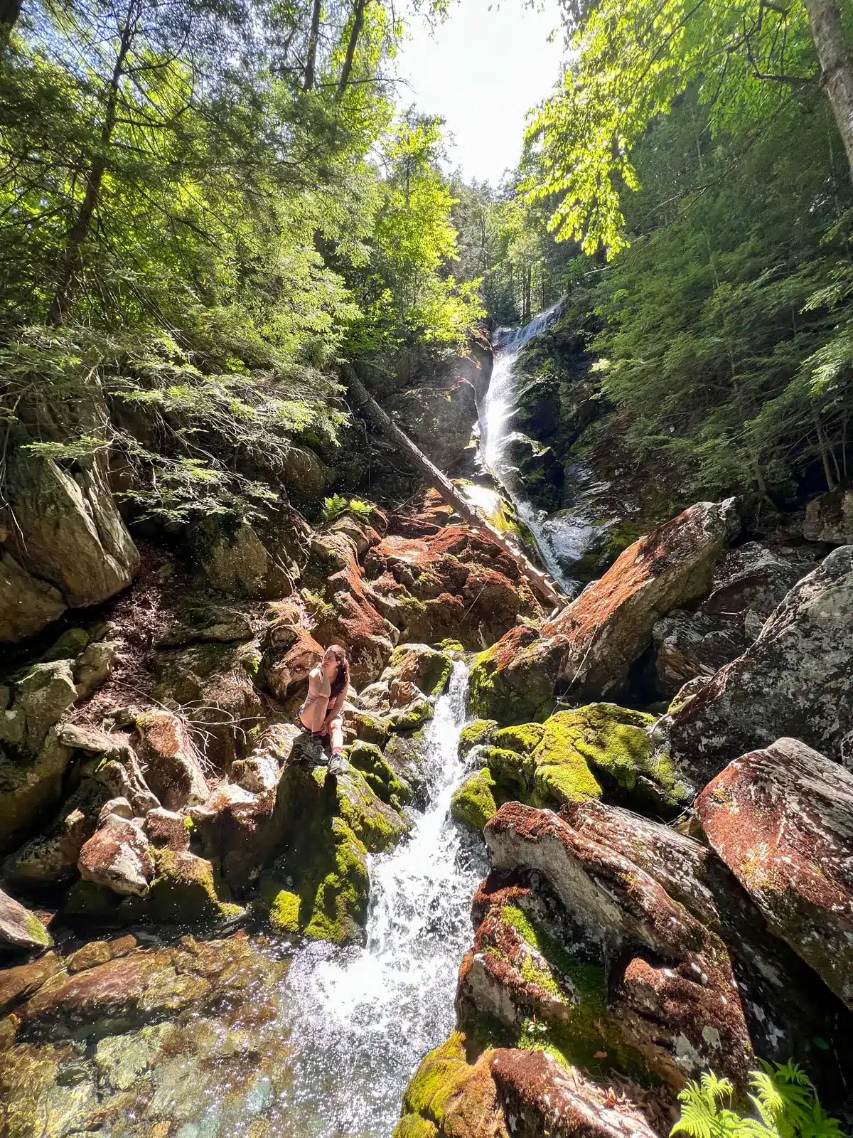
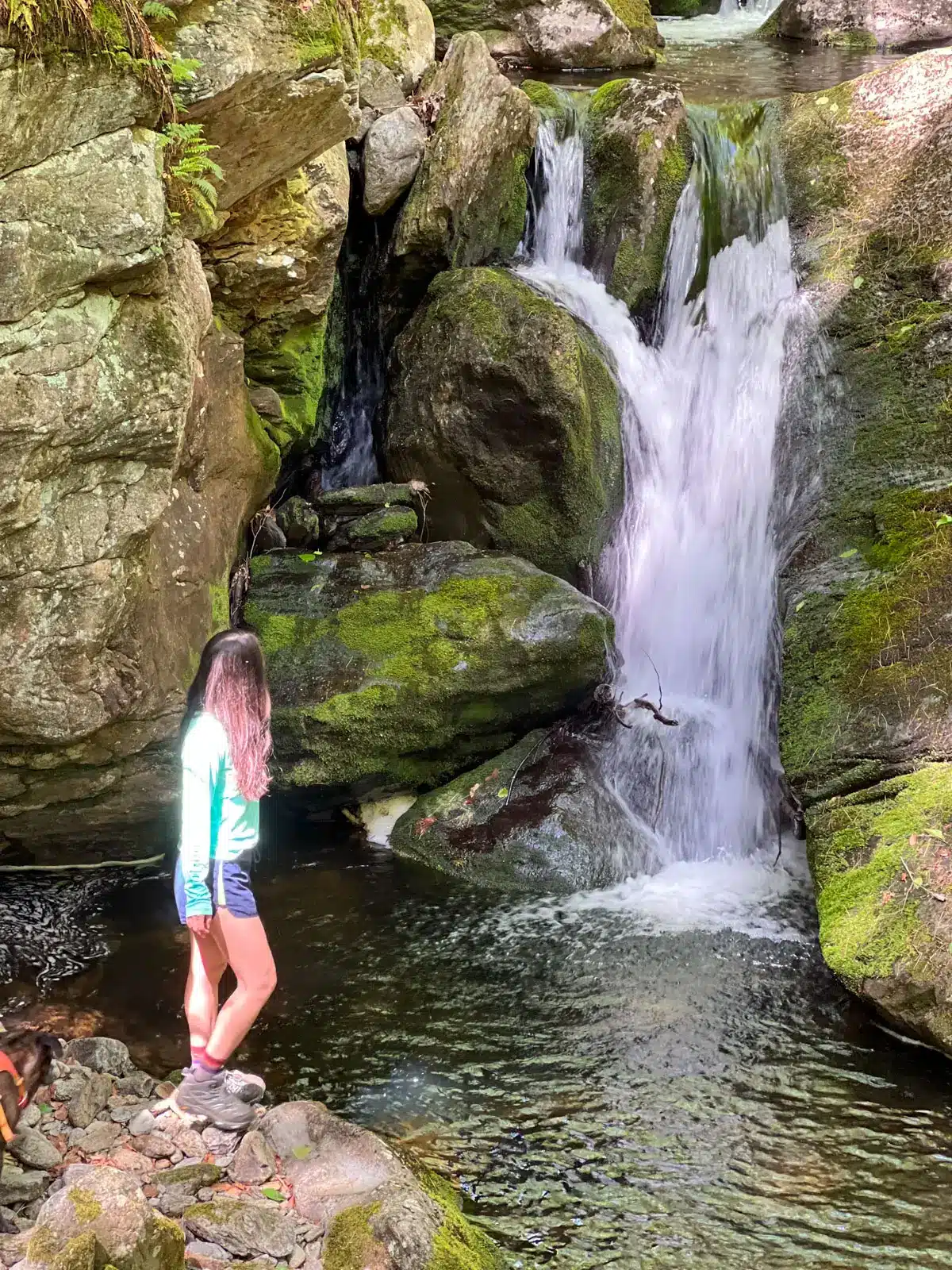
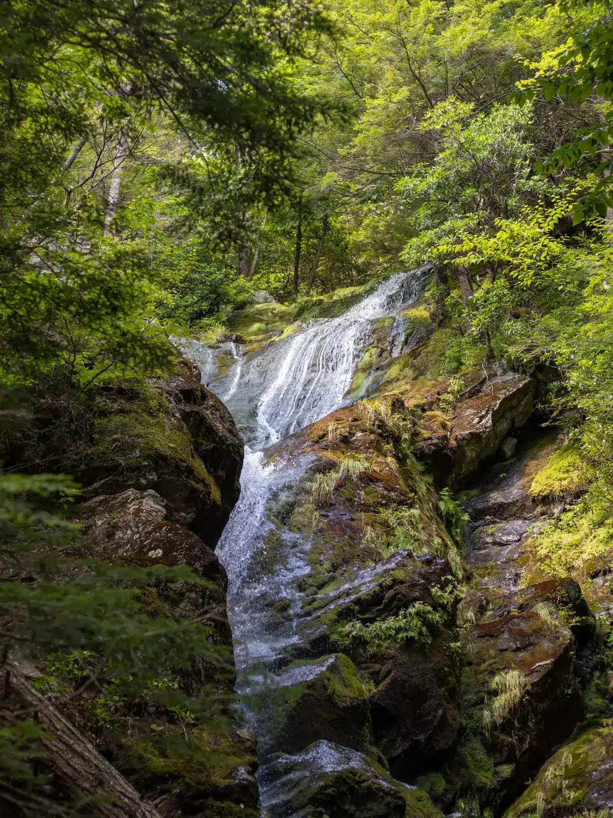
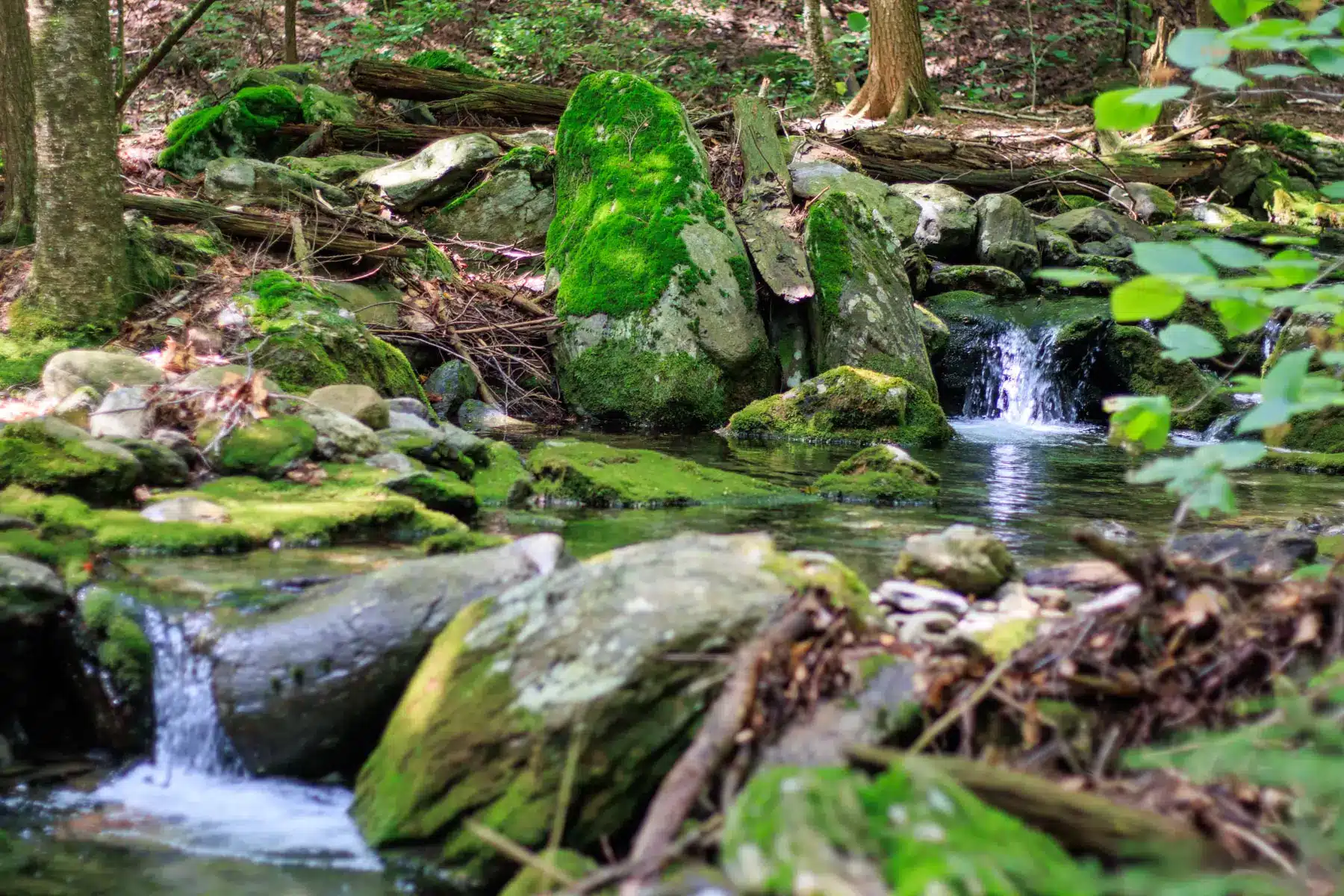
Equally notable is that the mountain’s eastern slopes are home to Race Brook Falls, a series of five tumbling cascades formed by Race Brook as it descends, crashing toward the Housatonic River Valley.
There are 4 unique routes to summit Mount Race each offering their own pros but all arriving at the view. Living next door in Connecticut, we’ve hiked all them all and in all the seasons several times, so it is fun to be able to share it with you!
Learn which hike up Mount Race is best for you depending on your time and length.
A Brief History of Mount Race⛰️
During the dusty and legally challenged mid-18th century in New England, William Race was an early settler in this hilly region. It’s said that Race, to whom the mountain honors, became unfortunately embroiled in a land dispute with agents of Livingston Manor, a powerful New York estate and in 1755, amid tensions over land ownership and tenancy, Race was killed by members of the Livingston party.
This tragic event led to the mountain bearing his name, serving as a lasting reminder of the area’s violent colonial-era conflicts.
➡️Mount Race Quick Facts:
- Location: Mount Washington State Forest, Berkshire County, Massachusetts
- Height: 2,365 feet
- Best For: Panoramic views & waterfalls
- Trails: Appalachian Trail, Race Brook Falls Trail, Guilder Pond, Plantain Pond Road
- Difficulty: Moderate to challenging
- Best Time to Hike: Late spring through fall
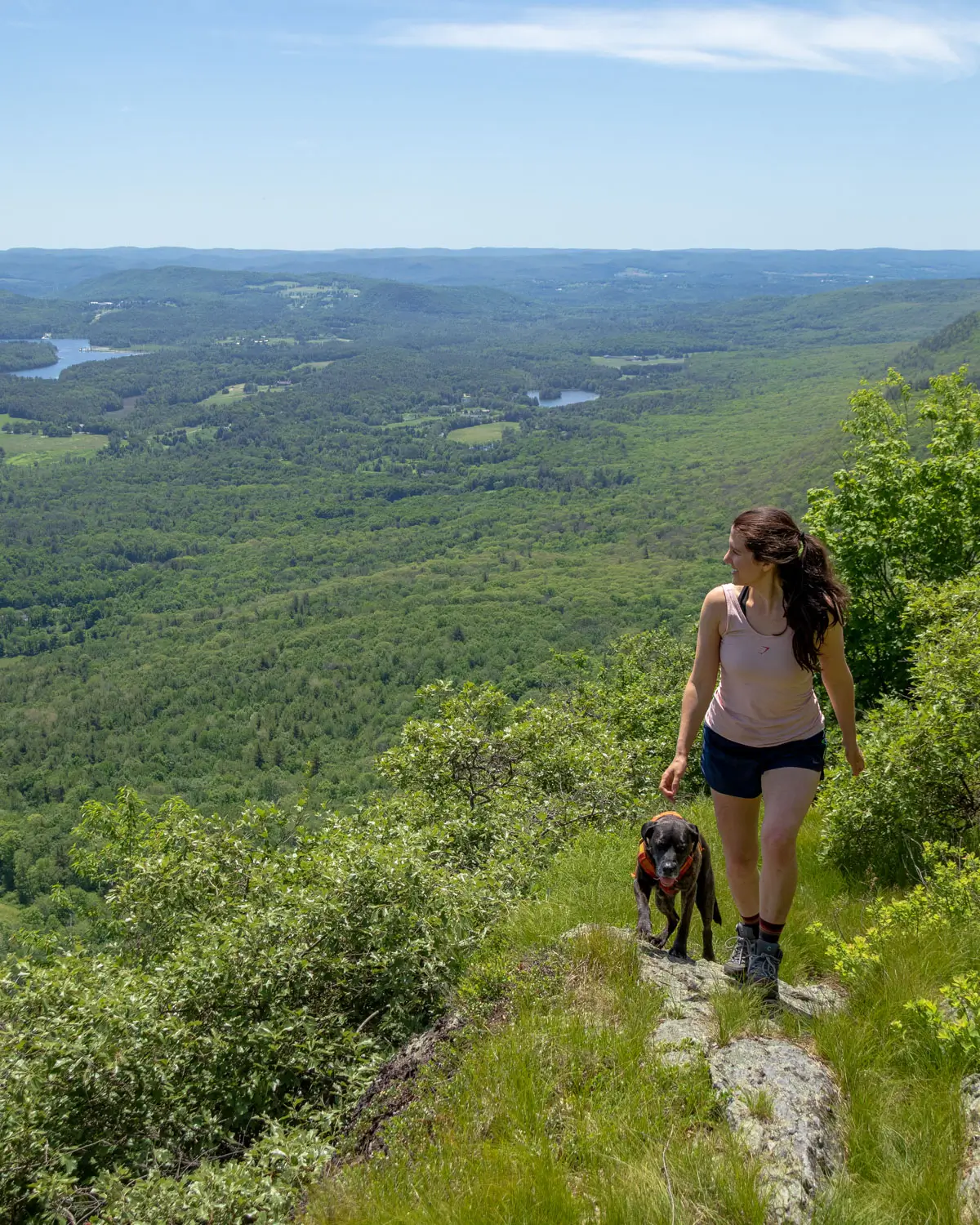
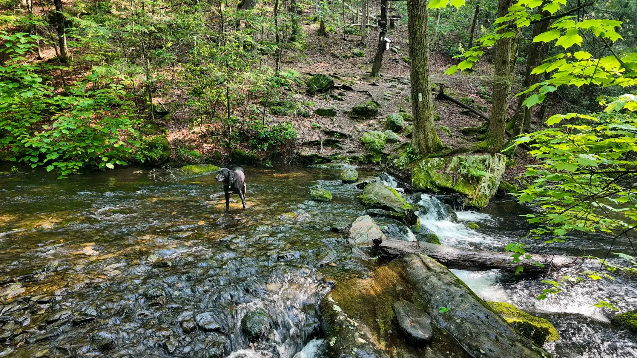
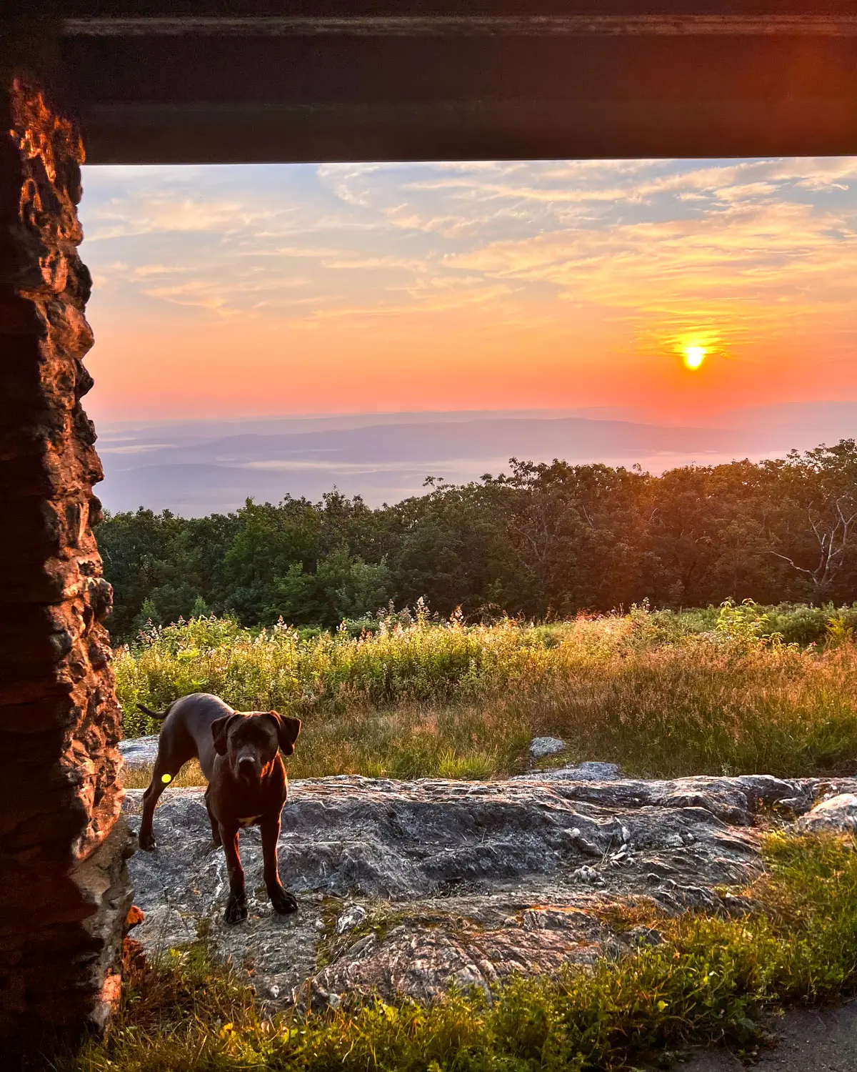
- Dog-Friendly: Yes, leashed
🥾 Hiking Mount Race, 4 Distinct Routes 🥾
1. Via Sage’s Ravine, Laurel Ridge & Race Brook Falls (7.25 miles)
- 🥾Miles & Difficulty: 7.25 miles, *point to point (Moderate – Hard)
- 📈Elevation Gain: 1,158 ft
- 🚙Parking: Drop 1st car here: 42.08962, -73.41107, this will be the end of the hike. Park 2nd car here: 42.04941, -73.46706, this is where you will start the hike.
- 🌟Highlights: Sages Ravine Falls 💦, Bear Rock Falls 💦, Mount Race views ⛰️, Race Brook Falls 💦
- 🔗 AllTrails link 🌲
*This is a point-to-point hike so you’ll need 2 cars! Parking car one at the Race Brook Falls parking area off of Route 41 in Sheffield, Massachusetts, piling into car two and then parking off of Mt. Washington Road in Salisbury, Connecticut (also called East Street). You’ll find a small pull-off that fits around 5–6 cars, marked for “AMC Northwest Cabin Parking”.
Beginning from the Mt. Washington Road parking area, you’ll walk 0.3 miles on Northwest Road fire trail, pass the AMC cabin on your right, then turn left onto an unmarked connector. About 0.7 mi later, you hit the Appalachian Trail and shortly thereafter enter the marvels of Sages Ravine.
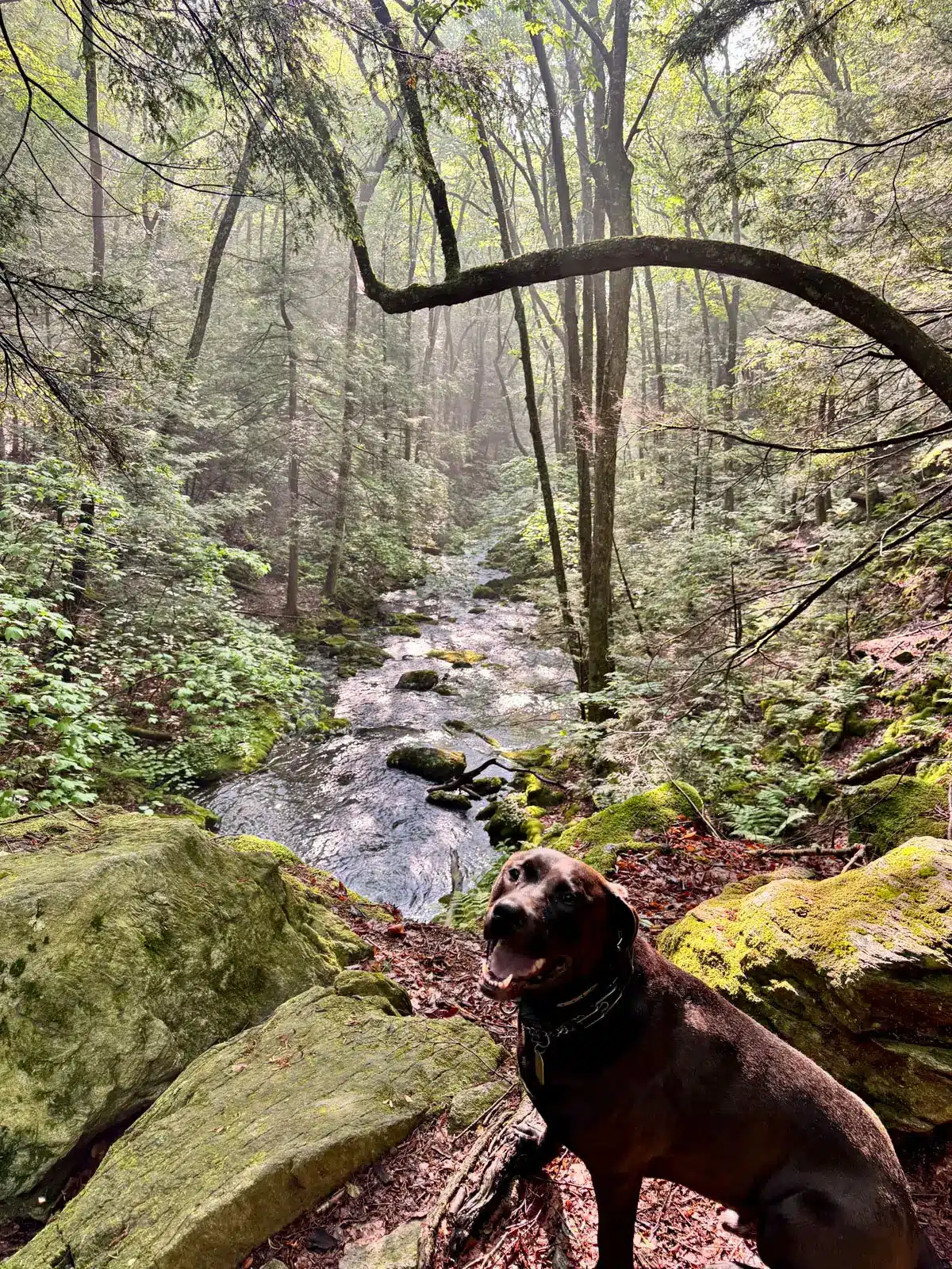
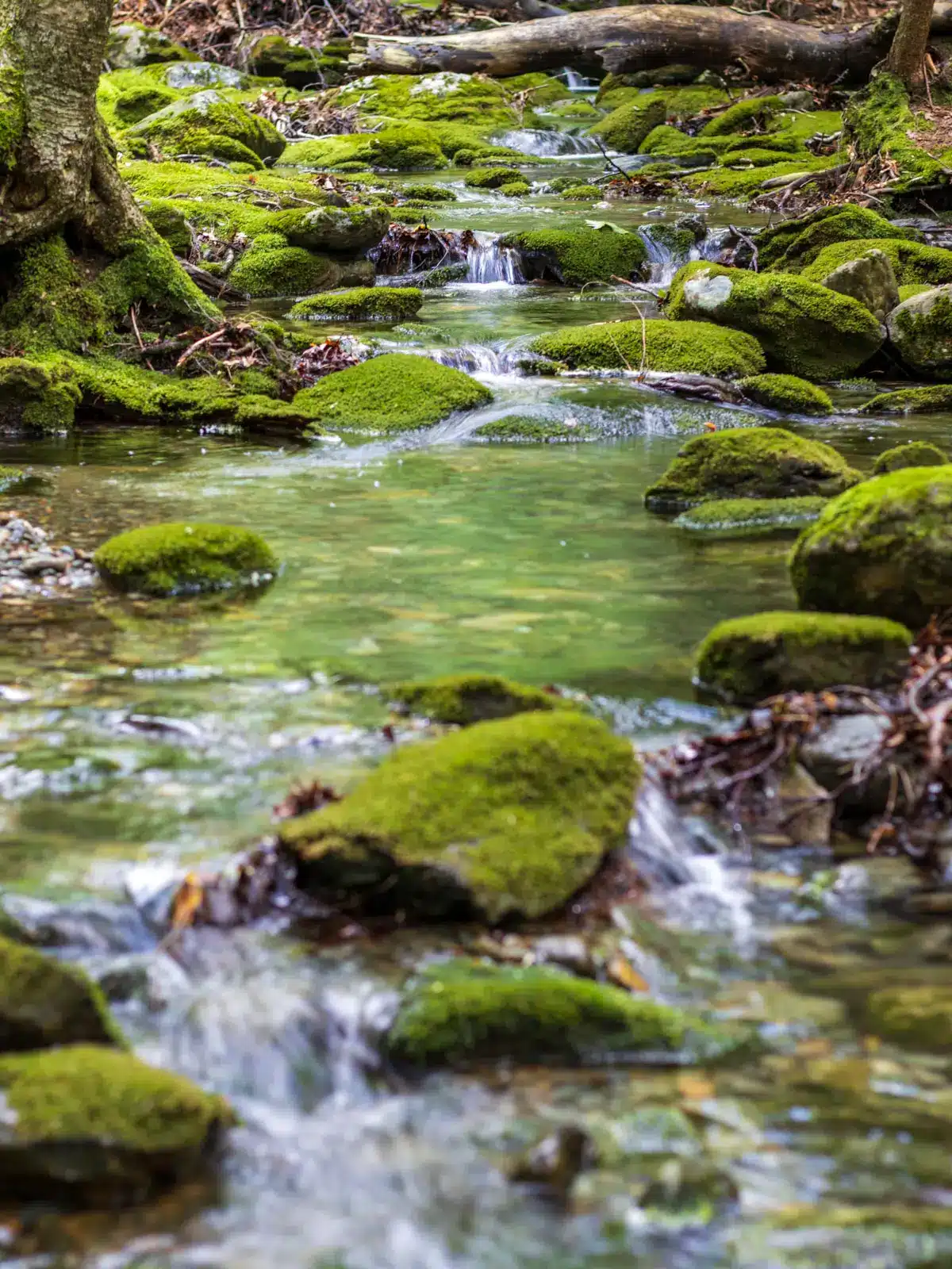
Straddling the Massachusetts–Connecticut border, is a wild, mystical gorge that awes and enchants those who wander into its depths.
Carved by glaciers and several millennia of cascading waters, the ravine is a cathedral of stone and moss, where icy streams tumble over slick boulders beneath towering hemlocks.
This rugged chasm has long drawn wanderers—from Native tribes seeking sacred balance with the natural world to early New England settlers and modern-day Appalachian Trail enthusiasts.
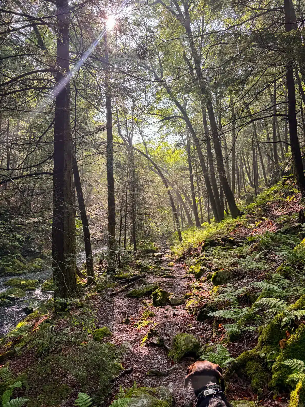
The trail through Sage’s Ravine is at times narrow, tight, and technical, demanding intentional and careful footing across some slick surfaces and root-strewn paths. Mists from an array of waterfalls cool the air, the sound of rushing water a primordial echo.
Ferns, trillium, and lichens thrive in the shaded forest floor, adding vibrant life to the ancient terrain. Hikers who enter the mile long Sage’s Ravine are promised not just a physical challenge, but a portal deep into a prehistoric world—where nature’s raw, timeless power still reigns supreme.
With the near vertical walls of the ravine behind you, enjoy some gentle ups and downs through an enchantingly lovely bit of forest for about 2.3 miles . You don’t realize how high up you actually are until you begin to catch bright glimpses of the valley far below through the trees.
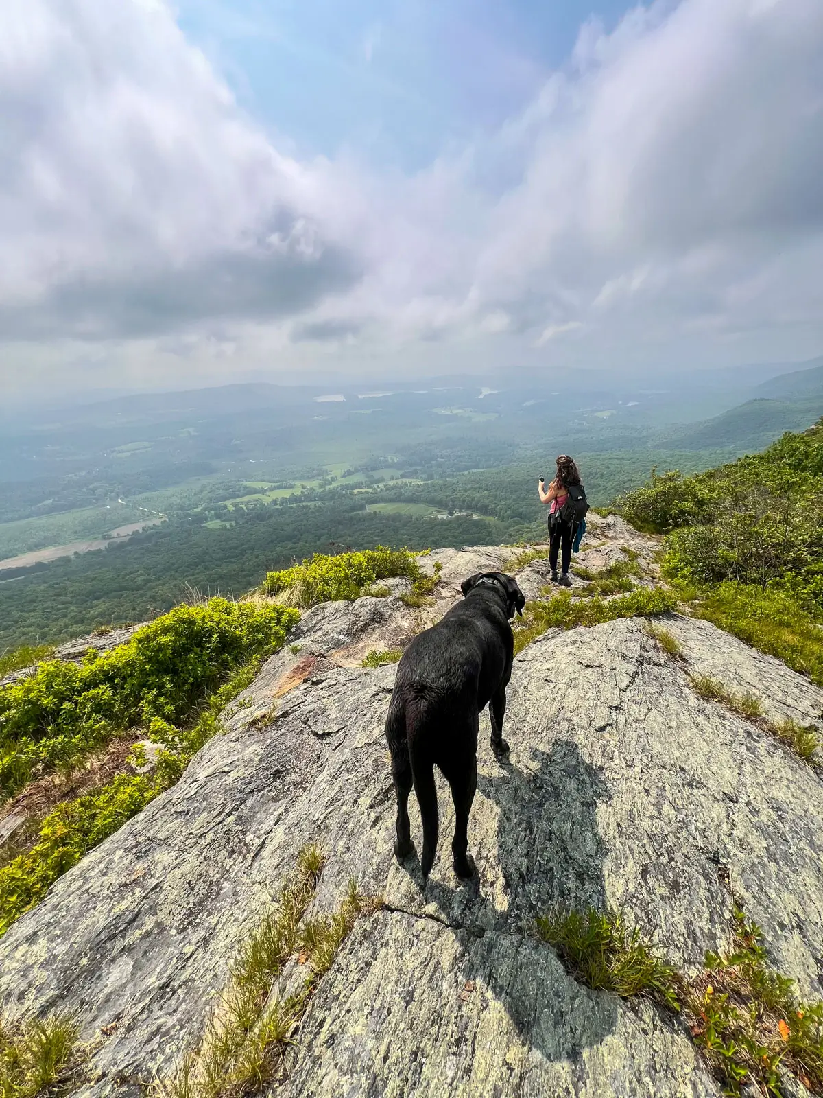
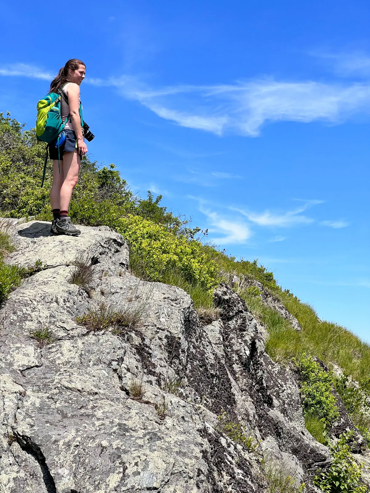
Laurel Ridge, on the southern slope of Mount Race is a breathtaking 0.6 mile stretch of the Appalachian Trail that barely clings to the mountain’s dramatically precipitous eastern escarpment.
Once used by Native peoples and early settlers as a highland path, the ridge now offers climbers an unforgettable trek through untouched wild beauty and a nice bit of history.
The trail weaves through wind-stunted pitch pines, vibrant mountain laurel thickets, and exposed granite ledges.
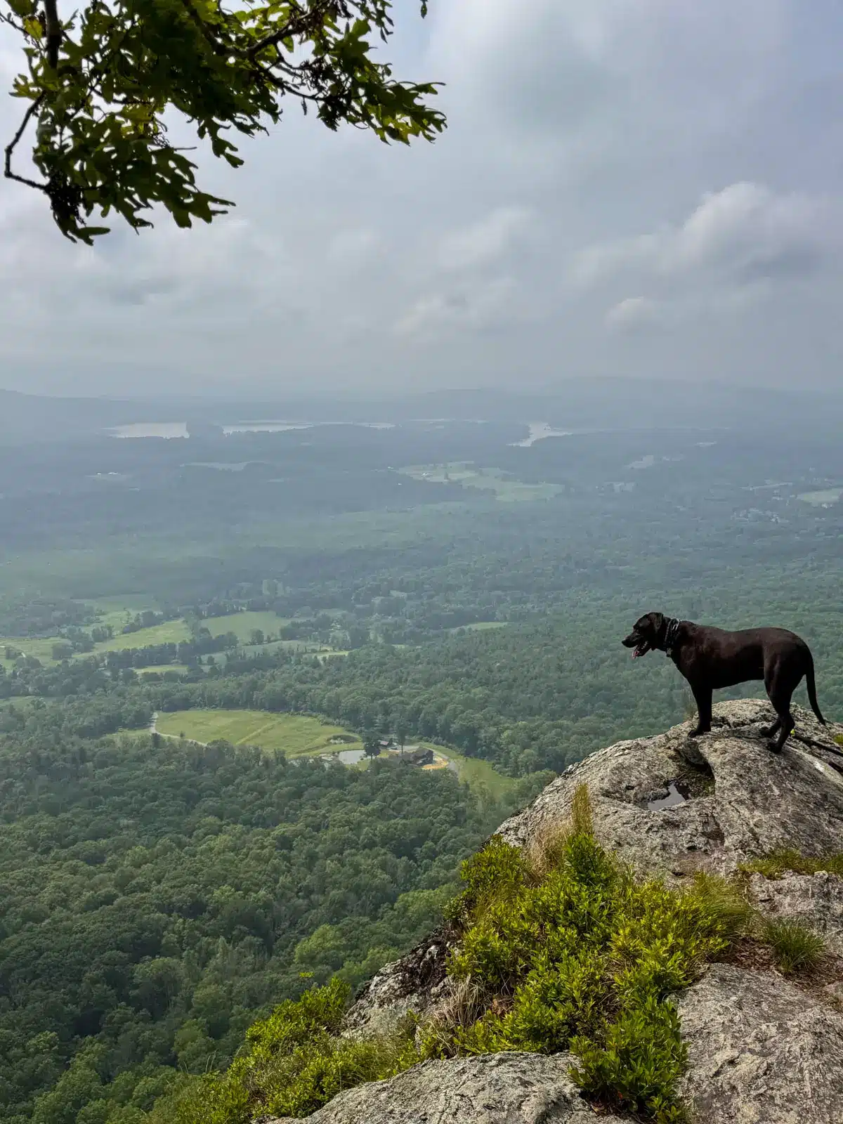
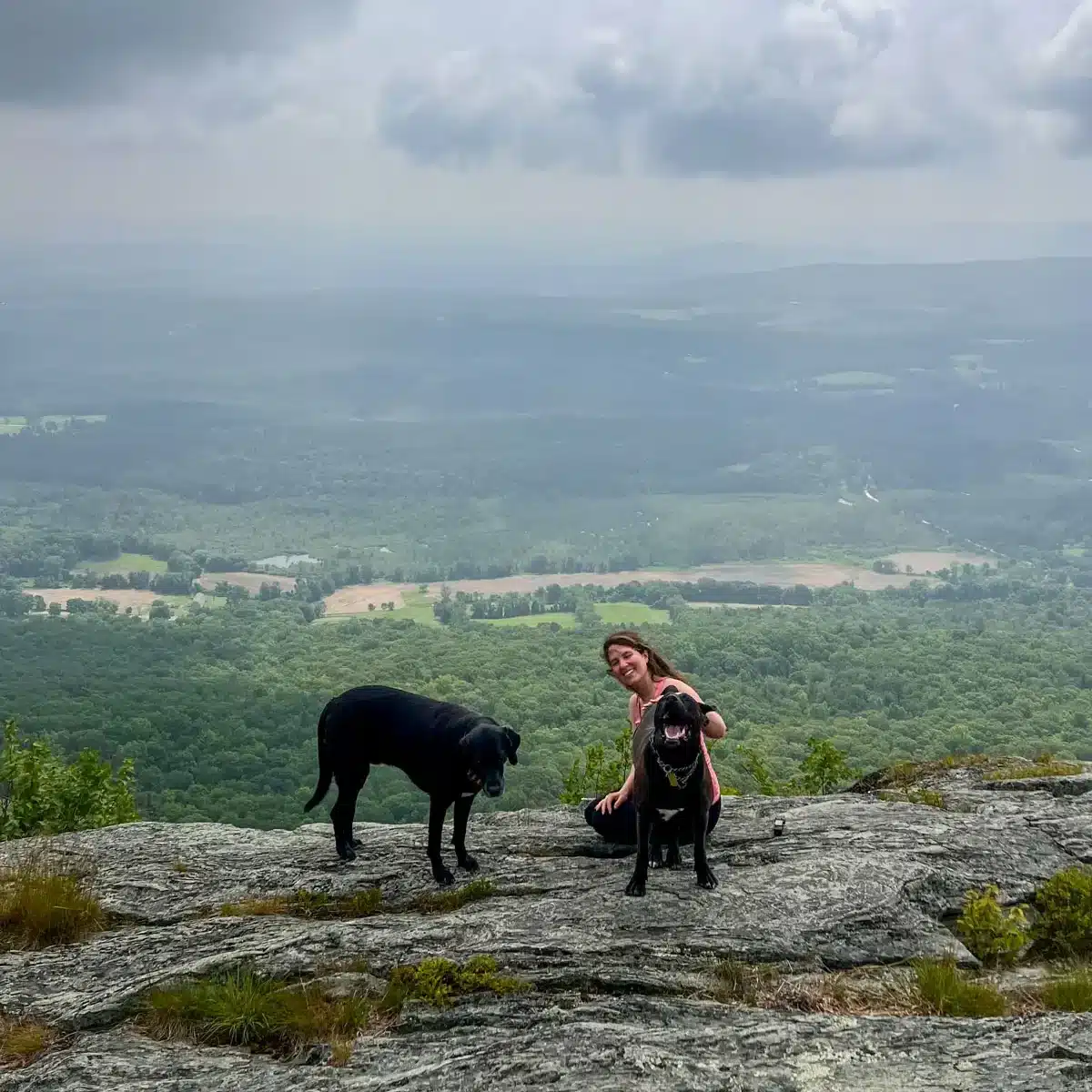
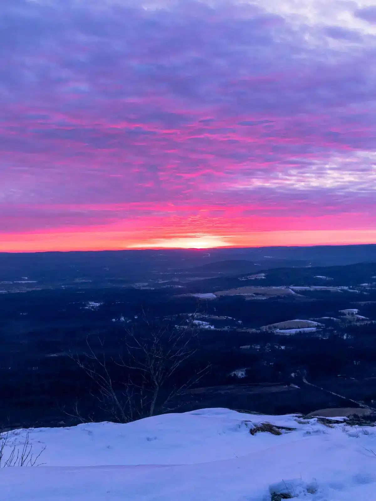
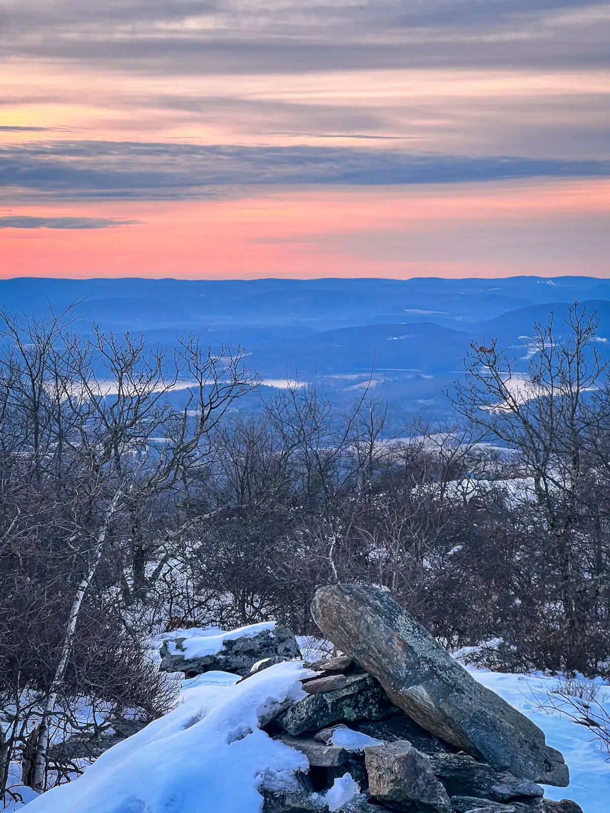
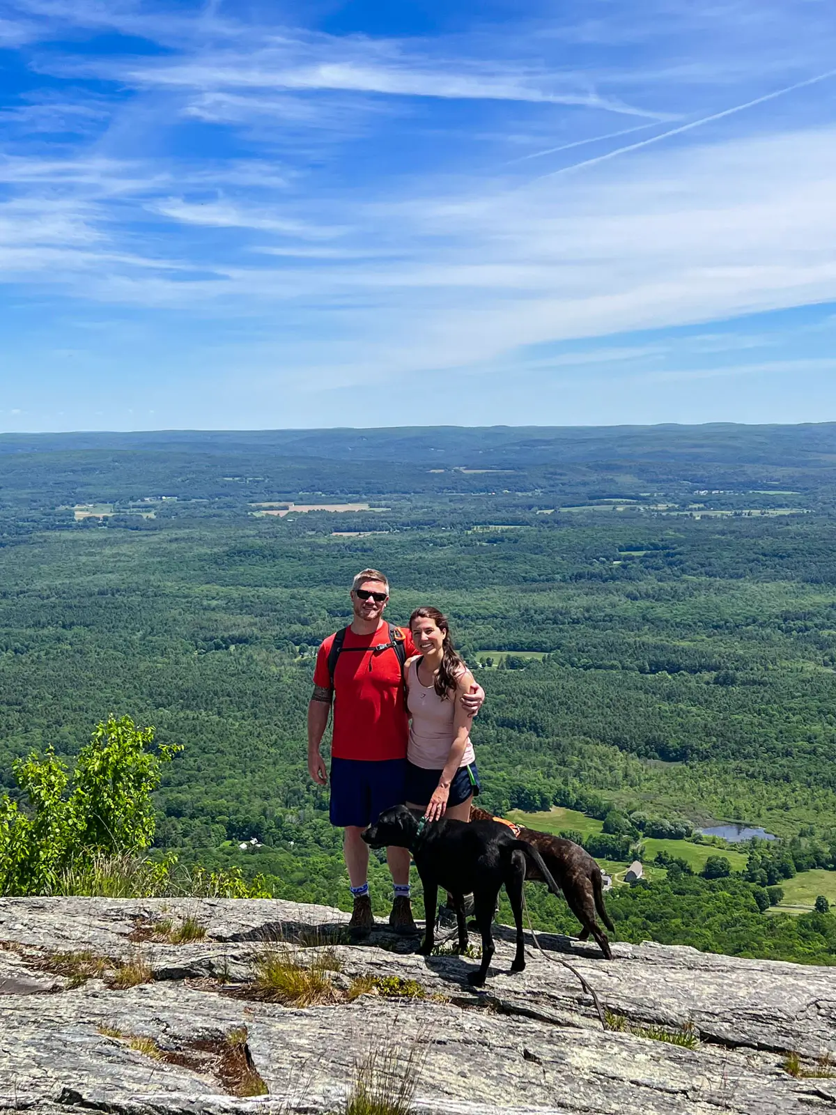
You’ll eventually reach a quarter acre pitch of grass and rock with incredible panoramic views extending fully north to south. The summit of Mount Race is just passed this final grand lookout and is marked by an ever growing and ever crumbling cairn of mountain stones.
Continue on the AT for 1.0 miles until reaching the Race Brook Falls trail and bearing right.
Remain on the Race Brook Falls Trail for 1.9 miles until reaching your second parked car.
2. Race Brook Falls Trail to Mount Race (5.8 miles)
- 🥾Miles & Difficulty: 5.8 miles, out & back (Hard, steep)
- 📈Elevation Gain: 1,669 ft
- 🚙Parking: Navigate here: 42.08937, -73.41122 Lot along Route 41.
- 🌟Highlights: Race Brook Falls 💦, Mount Race views ⛰️
- 🔗 AllTrails link 🌲
Race Brook Falls, tucked snuggly into the steep slopes of Mount Race, is a thrilling natural gem that rewards hikers with huge cascades of rushing water and beautiful rugged terrain.
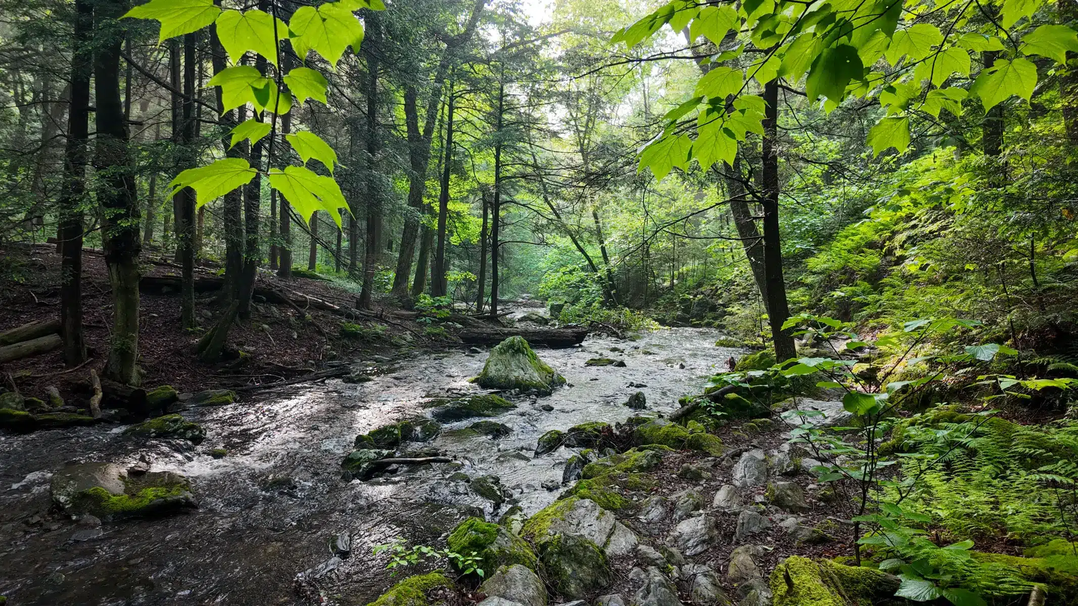
From the parking area off of Route 41 in Sheffield, the Race Brook Trail is a steep, root-laced path climbing through an old-growth forest of hemlock and maple. The roar of the brook makes its way through and around the trees, growing louder with each step through this early trail section.
As you ascend, Race Brook tumbles over a series of dramatic falls—each more breathtaking than the last—plunging down moss-covered rock faces into fern-filled glens. Cool mists and eternal winds from the raging water refreshes and invigorates as you climb and navigate.
The trail actually crosses the falls at 0.9 miles. Watch your footing as it’s a sort of sink or swim gauntlet of rugged, slick boulders and rushing water. Make it to the other side is the name of the game.
The trail to the falls is steep and slippery in places, adding a definite edge to the journey, so again, be mindful and intentional when traversing.
At the 2.0 mile mark you’ll hang a left on the Appalachian Trail. Traverse rocky ups and downs, through strong and gnarled alpine forests to the reach the pinnacle of Mount Race and the spectacular views just beyond the summit cairn. Return the 2.9 miles you came.
3. Mount Race, Mount Everett, and Guilder Pond (7.4 miles)

- 🥾Miles & Difficulty: 7.4 miles, Hard (long & steep)
- 📈Elevation Gain: 2,470 ft
- 🚙Parking: Navigate here: 42.0895, -73.41118 Lot along Route 41
- 🌟Highlights: Race Brook Falls 💦, Mount Everett view ⛰️, Mount Race views ⛰️
- 🔗 AllTrails link 🌲
The Guilder Pond and Mount Everett route to Mount Race is one that is rarely discussed, to our collective detriment.
Guilder Pond, one of the highest natural bodies of water in Massachusetts, shimmers like glass beneath a ring of evergreens, and provides a clear and magical little path around its shores.
After parking in the Mount Everett State Reservation, you set off and traverse Guilder’s peaceful banks for 0.6 miles, a steep, rocky ascent then leads to the summit of Mount Everett, the third-highest peak in Massachusetts.
You’ll reach the summit in 1.4 miles and from here you’ll stay on the AT for 1.8 miles until reaching Mount Race’s summit and the easterly facing rock clearing just beyond.
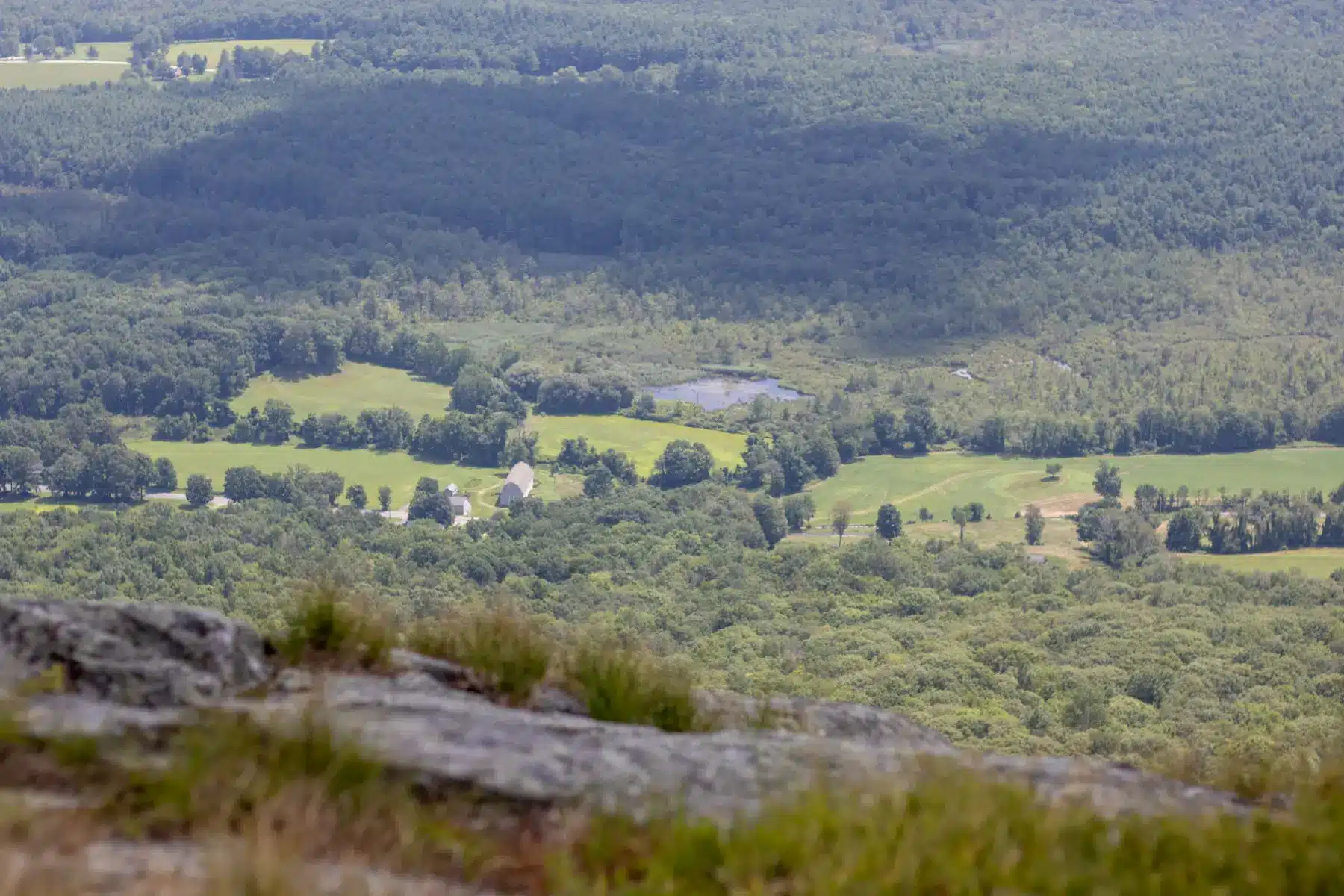
The trail is a wild mix of granite slabs, stunted pitch pines, and windswept ridgelines, with panoramic views stretching to the Berkshires, Hudson Valley, and even the distant, skyline dominating Catskills in New York. Return the 3.2 miles you came.
I love it up here, the pond, the trail, the views, the history all combine to create a deep connection to the land’s storied past and the importance of preserving its future.
4. Via Plantain Pond Road (2.43 miles)

- 🥾Miles & Difficulty: 2.43 miles, Moderate
- 📈Elevation Gain: 636 ft
- 🚙Parking: Navigate here: 42.0868, -73.44401 Pull off Plaintain Pond Rd
- 🌟Highlights: Short! Mount Race views ⛰️
- 🔗 AllTrails link 🌲
Plantain Pond Road offers an exhilarating, rugged hike up to Mount Race’s summit, starting from a remote logging road nestled in the Taconic foothills
Once a route for early loggers in the region, the old trail at the end of Plantain Road turns left at 0.3 miles and climbs steadily through dense mixed hardwood and spruce forest, the silence punctuated only by wind and the song of distant birds.
After criss-crossing a rocky brook several times, and dealing with a steepening path, all while navigating a not-so-fantastically marked trail, you’ll finally reach the junction with our good ol’ friend, the Appalachian Trail at 0.9 miles in.
From here, the climb creeps up and down over the granite crowns of the semi-exposed ridge—scrambling over open rocky ledges, and ducking under wind-twisted pitch pines for another 0.3 miles.
Along the way enjoy dramatic valley views until reaching Mount Race’s summit cairn. Continue just a touch further (0.1 miles) to feel the earth drop away beneath as you carefully traverse the dizzying cliffside.
Reaching the lookout just below the summit cairn, the reward is vast: sweeping panoramas of the Housatonic Valley and Taconic peaks beyond.
This route blends bushwhacking through thrilling alpine terrain—certainly one for our more adventurous readers but one of the proven best. Return the 1.2 miles back to your vehicle on Plantain Road.
Why Hike Mount Race
Mount Race offers some of the most dramatic scenery in Massachusetts — from misty waterfalls and wildflower-lined ridges to sweeping views over the Housatonic River Valley. Add in its colonial history and Appalachian Trail setting, and it’s a peak worth hiking again and again.
FAQ: Hiking Mount Race
Anywhere from 2–6 hours depending on route you choose here and your. pace.
Yes — the AT runs directly over its summit.
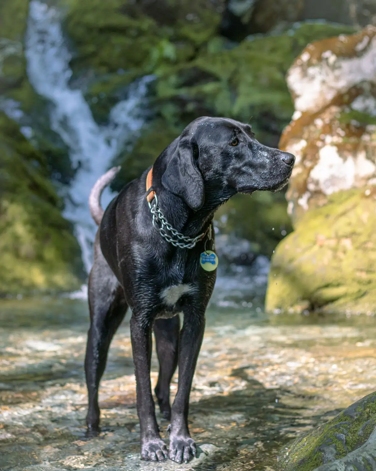
Yes, but keep them leashed for safety near cliffs and waterfalls.
Yes, if you take the Race Brook Falls Trail up to Mount Race you will see the waterfall on the way up.