Scenic Housatonic River Walk on the CT Appalachian Trail
Welcome to a beautiful stretch of the Appalachian Trail in Connecticut all along the rolling Housatonic River. Hike for as little or as long (as far as 10 miles!) as you want here, along this mainly flat section of the AT in CT.
I am so happy to share details and need-to-know info about this river walk starting in Cornwall, CT. If you’re here, I’m thinking you will have the opportunity to hike this peaceful and scenic section of the Appalachian Trail in Connecticut, and that makes me excited for you! :))
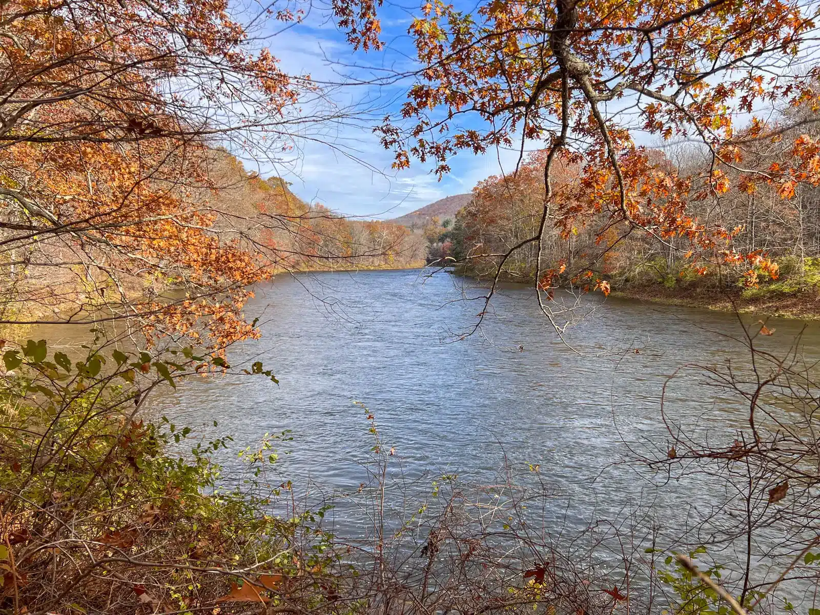
 love this narrow path along the river!
- Scenic views of the river the whole way


I’ve hiked all 50 miles of the Appalachian Trail in CT, and while there are many memorable lookouts, this river walk is a section I easily come back to hike several times a year.
This is an easy, mainly flat trail that meanders along the Housatonic River. You can hike 1 mile down and back or 5 miles down and back – whatever you’re feeling up to.
In this post, I tell you all the details about this trail, how to get here, along with turn-by-turn directions although this is a pretty easy one to follow. 🙂
So let’s get to it!

Housatonic River Walk in Cornwall, CT; Overview
Tucked away in rural Litchfield County, Cornwall is a quintessential New England town loaded with character, tons of hiking trails, charming cafes, and the longest covered bridge in Connecticut.
Though a little removed in the northwest corner of CT, this is the perfect place to take a ride with the windows down as you make your way along the winding country roads.
 Covered bridge at dusk 🌟
- Meadow view, part of this Housatonic River Trail
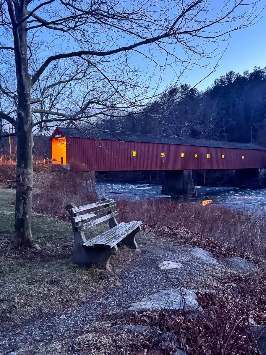

🌟While in the area, check out the covered bridge and all there is to do in Cornwall, CT! 🌟
Founded in 1740, Cornwall was shaped by its iron industry, farming roots, and rugged landscape of steep hills and deep valleys.
With the rolling hills of the Appalachian Trail on one side and the rambling Housatonic River on the other, this Housatonic River Trail provides endless scenery, water, and fun for you and your dogs.
 Trail leads into wide open meadow!


Following the white blazes of the Appalachian Trail the whole way, this hike is straightforward to follow. While our hike here has you walk for a little more than 2 miles before turning around, you can continue to walk for a total of 10.5 miles round trip if you want to.
Since it is easy to see ahead on this trail, we allow the dogs to roam off leash here and there and call them back when we encounter other people. There are many spots that allow the dogs to walk right in the river to cool off, swim, or catch a drink.
Housatonic River Walk Details
🗺️LOCATION: CORNWALL, CT
📍Find the trailhead: From the Cornwall Library head north on Pine Street and after 0.3 miles turn left on Furnace Brook Road (CT-4). After 3.3 miles, keep right to continue on Furnace Brook Road toward Sharon and after 0.3 miles keep right onto River Road (US-7). After 115 feet, turn right onto River Road and go for 1.1 miles until you see a small parking area on the left and Appalachian Trail sign.
🚘GPS Coordinates: 41.80789, -73.39167
🥾LENGTH: 4.32 miles (out & back)


⏱️TIME & MONEY: 1h 45m; free
📈ELEVATION GAIN: 95 ft
💪🏼DIFFICULTY: Easy
🌲CONDITIONS: Year-round, narrow and wide paths along the river
🌟HIGHLIGHTS: Views and access to the river plus a wide open meadow
🐶 DOG-FRIENDLY: Yes! Lots of water access for dogs, mainly flat, nothing technical
📋Land Manager: Appalachian Trail Conservancy. 799 Washington Street, PO Box 807, Harpers Ferry, WV. 25425 (304)535-6331. info@appalachiantrail.org
Parking on River Road, you’ll follow the Appalachian National Scenic Trail signs with the river on your left. At about half a mile in, the trail bends to the right away from the river where you’ll emerge onto an expansive meadow scattered with hay bales. This open meadow is a great spot to let the dogs roam and explore.

You’ll walk for 2.1 miles until you reach signs for Stony Brook Campsite and Stony Brook Falls which tumble into the Housatonic River at which point you’ll turn back walking out the way you came. A known nesting spot for bald eagles in CT, keep your eyes peeled along the hike! I’ve spotted them a couple times here.
🧭 TURN-BY-TURN DIRECTIONS 🧭
- From the parking area along River Road, walk north with the river on your left where you will find the ‘Appalachian National Scenic Trail’ sign and trailhead. Begin your hike here,
- At 0.18 miles, bear left onto the white blazed Appalachian Trail.
- At 0.42 miles, the trail curves around to the right continuing on the white blazed trail. You will shortly arrive at the open meadow with views facing west.
- At 1.51 miles, bear right continuing on the white blazed trail.
- At 2 miles, notice ‘Stony Brook Group Camping’ sign on the right, continue left on the white blazed trail.
- At 2.1 miles, walk across a little bridge with several cascading falls on your right. You can turn around here or keep going for longer if you wish.
I hope you get out there and enjoy all this part of the state and this peaceful, scenic trail has to offer.
Be sure to leave any questions below or come back to comment after you’ve hiked here to let me know how you liked it. I’d love to hear from you!
Happy Trails…🐾🩷🥾